
Building or ruin · Roman · Perth and Kinross
Carpow Roman Fort
A thirty-acre Roman fort at the meeting of the Tay and the Earn, held from the late second century into the early third.
Carpow is in the wrong place to have done the job usually attributed to it. The fortress sits on the southern bank of the Tay, a kilometre east of where the Earn joins it, and it is generally associated with the campaigns of Septimius Severus in the early third century. But a base on the south side of the estuary is badly sited for driving north, and on that ground and others it is more likely to have been built under Commodus in 185.
What is not in doubt is the scale. Thirty acres, built in stone, brick and tile rather than turf and timber, and occupied at different times by two legions — the Second Augusta and the Sixth Victrix. Permanent construction on that scale, this far north, is a statement of intent.
The likeliest function is supply by sea. The Firth of Tay lay immediately east and opened onto the North Sea, and it has been proposed that Carpow is the Horrea Classis of the Ravenna Cosmography — the granaries of the fleet, which would fit exactly.
It sits between other systems. The Gask Ridge frontier works lay north and west and were older; the Antonine Wall lay to the south and was contemporary. The people in the country around were the Caledonians of the Roman writers, later called Picts, and one of the significant Pictish sites, Clatchard Craig, is immediately to the east.
What follows is drawn from published sources, with each claim labelled by how firmly it is established.
History
Carpow was a large fortress of some thirty acres at the confluence of the Tay and the Earn, occupied at different times by two legions, Legio II Augusta and Legio VI Victrix. It was built solidly and permanently in stone, brick and tile rather than as a temporary work, which is unusual this far north. The fort was in use from the late second century into the early third. It has never been comprehensively excavated, but it is thought to have served as a naval supply depot for Roman forces in the central lowlands — the Firth of Tay lay to the east and gave access to the North Sea.
Its occupation coincided with the campaigns of Septimius Severus, and it has often been read as a base for them. The position argues against that: a fortress on the southern side of the Tay estuary is poorly placed to support offensive operations to the north. On that and other evidence it is more likely to have been built under Commodus in 185, for his campaigns rather than Severus's. It has been suggested that Carpow is the place called Horrea Classis, or Poreo Classis, in the Ravenna Cosmography — a name meaning the granaries of the fleet, which would fit a naval supply function well.
The setting places it between systems. The Gask Ridge line of frontier works lay north and west and predates the fort; the Antonine Wall lay to the south during its occupation. The people around it were called Caledonians in Roman sources, and in later decades Picts — the significant Pictish site of Clatchard Craig lies immediately east.
People
-
Septimius Severus
Emperor whose northern campaigns have often been connected with the fortress.
-
Commodus
Emperor under whom the fort may instead have been founded about 185.
Cultural influences
-
At the Tay–Earn confluence, the stone fortress probably supplied Roman forces by water between the central lowlands and the North Sea.
Connections
-
Both are Roman forts in the Tay valley, preserving the military network that controlled movement and supply across eastern Scotland.
-
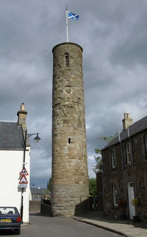
Photo: Otter / Wikimedia Commons / CC BY-SA 3.0 The Roman fort and early Christian tower represent successive phases of occupation and power in the Tay valley landscape.
-
The fort and hillfort reflect different periods of defended occupation around Abernethy and the Tay valley.
Discovery & excavation
The large fortress has never been comprehensively excavated, so its permanent stone, brick and tile construction is known more clearly than its internal layout.
What to look for
-
The Tay–Earn confluence
The fort occupied the meeting of the Tay and Earn, a position suited to a naval supply depot.
-
The fortress scale
Its enclosure covered about thirty acres, unusually large and permanent for a Roman fort this far north.
Plan your visit
- Location
- 56.3456°N · 3.2831°W
- Nearest settlement
- Carpow
- Time needed
- About 45 minutes
- What survives
- A largely unexcavated Roman fortress site at the Tay–Earn confluence, with its scale and strategic water setting more legible than standing fabric.
Nearby places
Fortified place · Medieval
Abernethy Round Tower
Perth and Kinross
One of only two Irish-style round towers in Scotland, the other at Brechin Cathedral.
- Near Abernethy
Fortified place · Prehistoric
Castle Law, Abernethy
Perth and Kinross
A contour fort above Abernethy, scheduled since 1964: older than the medieval lordship in the village below, and with no recorded connection to it.
Fortified place · Iron Age
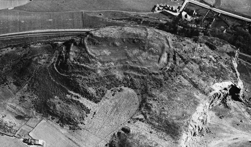
Clatchard Craig
Fife
Clatchard Craig was an important stronghold of the Picts, the people of northern and eastern Scotland from about AD 300 to 900, with evidence of el…
- Some walking

Carved stone · Pictish & early medieval
Abdie stone
Fife
The Abdie Stone is a rare Class I Pictish (of the Picts, the people of northern and eastern Scotland from about AD 300 to 900) monument in Fife who…
- Easy path
The setting
View across Mugdrum Island and the River Tay near the site of Carpow Roman Fort.
Photo: A A Lang / Wikimedia Commons / CC BY-SA 2.0
Questions people ask
- What kind of site was Carpow?
- A large fortress of some thirty acres at the confluence of the Tay and the Earn, occupied at different times by Legio II Augusta and Legio VI Victrix, and built solidly and permanently in stone, brick and tile rather than as a temporary work — unusual this far north.
- Was it a base for the Severan campaigns?
- It has often been read that way, since its occupation coincided with them, but the position argues against it. A fortress on the southern side of the Tay estuary is poorly placed to support offensive operations to the north, and it is more likely to have been a naval supply depot for forces in the central lowlands.
- Does it have a Roman name?
- It has been suggested that Carpow is the Horrea Classis of the Ravenna Cosmography, a name meaning the granaries of the fleet, which would fit a naval supply function well.
Sources
The Ancient Codex, in your pocket
Get the Pocket Codex app
Carry the directory with you — Carpow Roman Fort and thousands of ancient places across Britain and Ireland, offline, wherever you roam.