About

A codex, not a catalogue

The Ancient Codex gathers the deep-time places of Britain and Ireland into one record: what stands there now, what is known of it, what is only said, and what a visit actually involves.

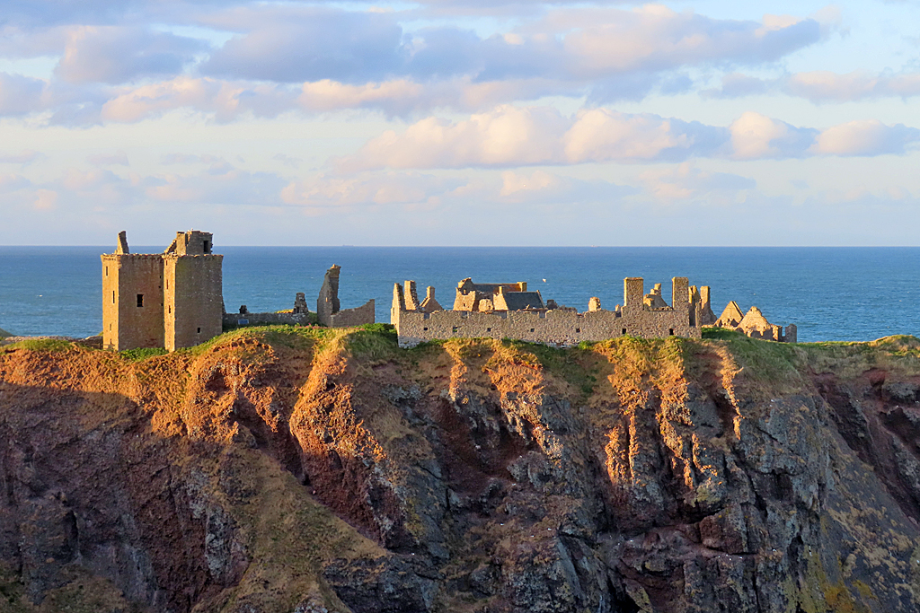
Evening light on the ruined walls of Dunnottar Castle, standing on a flat-topped headland above sea cliffs
Dunnottar Castle, Aberdeenshire Photo: Anne Burgess / Wikimedia Commons / CC BY-SA 2.0

What the Codex is

The Codex holds 4,619 places: stone circles and chambered cairns, brochs and hillforts, carved Pictish stones, abbeys and holy wells, castles, Roman forts, and a few trees older than anything built near them. Each has a page. Each page sets out to answer the same small set of questions. What is this. How old, and how confidently. What can be seen on the ground now. And what getting there asks of whoever makes the journey.

That is a narrower job than it first sounds. The national registers already hold these places, in the language of the register: scheduled monument, site number, grid reference, condition. They are indispensable, and they were never written for a free Saturday. The Codex sits on top of them and takes the question they leave alone. Is this worth the journey, and what is a person looking at once they arrive.

The answer is often quieter than a photograph suggests. A great deal of what survives is a bank in a field, a scatter of kerb stones, a wall foundation under turf. Saying so is part of the work. A place that repays the walk for its setting alone is a different proposition from one that repays it for what is carved on the stone, and the Codex tries to say which is which.

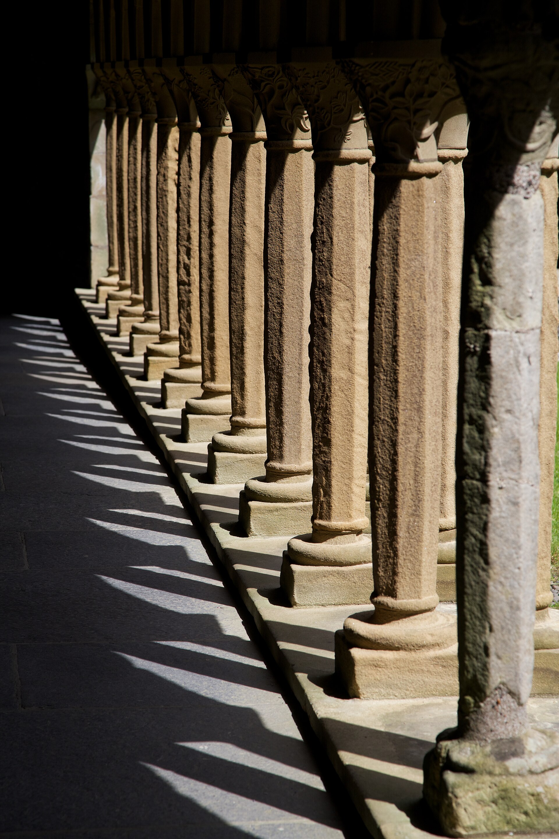
A run of carved stone columns in the cloister at Iona Abbey, throwing a long row of shadows across the paving
Iona Abbey, Argyll and Bute Photo: Tom Parnell / Wikimedia Commons / CC BY-SA 4.0

Who it is for

For anyone who has stood beside an old stone in a wet field and wished they knew what they were looking at. For people planning a day out who want more than an opening time, and for people already standing there who want to know what they are seeing. The Codex assumes curiosity and assumes no prior reading.

It is also written to be read by machines. Alongside the prose, every page carries structured data: what kind of place this is, when it was made, where it sits, what it connects to, and what the claim rests on. More and more of these questions are put to an assistant rather than typed into a search box, and an answer is only ever as good as the record behind it. The Codex is built to be that record, and to be legible as one.

Where it differs from a listings site

A listings site is complete and flat. Every entry gets the same template, the same length and the same confidence, whether the ground holds a cathedral or a mound. The Codex is neither complete nor flat, and that is deliberate.

Depth

Uneven, and shown

67 places carry a full account, 3,732 a working entry, 803 a short marker that is honest about being short. A place is given the length its evidence can carry and no more. Importance is felt in the hierarchy rather than printed as a score.

Certainty

What is said stays what is said

Folklore, ritual meaning, alignments and contested dates are recorded as tradition and labelled as tradition. Nothing is promoted to fact for want of a better line, and a genuine unknown is left standing as an unknown.

Protection

Some places are not pinned

21 records deliberately withhold an exact location, giving a general area and pointing to official access instead. Where an authoritative source obscures a site, the Codex does not reconstruct it.

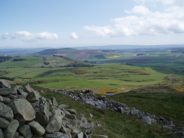
Ploughed fields and woodland falling away to the Firth of Tay, seen from the grassy ramparts of Norman's Law
Most of the corpus looks nearer to this than to a castle on a cliff: a hill, a bank under the grass, a long view. Norman's Law Hillfort, Fife Photo: Douglas Nelson / Wikimedia Commons / CC BY-SA 2.0

How the record was made

The notice at the top of every page says briefly what this section says at length. The places are ancient. The record of them is not.

These pages were assembled by software and language models reading open sources: Wikidata and Wikipedia, OpenStreetMap, the official heritage bodies of Scotland, England, Wales and Ireland where their records are open, published archaeological and antiquarian writing, and Geograph and Wikimedia Commons for photography. Every record then passes a quality gate before it can become a public page, covering scope, sensitivity, image licensing, and how much independent support a claim actually has. 4,541 pages rest on two or more independent source families. 78 rest on one, and those are the ones most likely to be wrong.

No person has read all 4,619 of these pages. Claiming otherwise would be the easiest thing on this site to write and the least true. What happens instead is regional: a region is checked, corrected, and only then opened to search engines. When this page was built, 2 of 4,619 were open. The rest can be read by anyone who finds them and are held back from search until they have been through that pass.

4,577 pages carry a photograph, every one of them licensed for reuse and credited to the person who took it. No imagery here is generated, and none is altered.

If something is wrong, please tell us. A correction is worth more than a compliment, and it is the fastest way this record improves. How places are judged, sourced and protected is set out step by step in the methodology.

Where it reaches

The Codex began in Fife and grew outward through Scotland, then into England, Wales, Ireland, Northern Ireland and the Isle of Man: 186 regions at present count. Coverage is not even, and evenness is not the point. Scotland is deepest, because that is where the work started. England is broadest by number. Wales, Ireland and the islands are thinner and are filling in.

A place earns a page by being visitable and by belonging to the deep past, which in practice means built, used or made significant before 1800. Later heritage stays out unless it preserves an older layer underneath. Nothing is added because it would round out a map, and a region is never padded to look complete.

Read further

The methodology sets out how places are chosen, how source confidence is judged, and what happens to a sensitive site. Shorter answers live in the frequently asked questions. Anything else, including corrections and concerns about a fragile place, goes to the contact page.