
Clatchard Craig was an important stronghold of the Picts, the people of northern and eastern Scotland from about AD 300 to 900, with evidence of elite craft and long occupation. Its hilltop enclosure was entirely destroyed by 20th-century quarrying.
Clatchard Craig no longer rises above the Tay coastal plain: the hill and its early fort, dating roughly AD 400–1100, were entirely quarried away for aggregate in the late 20th century. What remains is an excavated record of a hilltop stronghold occupied from the 6th century into at least the 8th, once positioned among major centres including Abernethy, Forteviot and Scone.
Rescue excavations recorded a deep sequence from Neolithic activity through Bronze Age, Iron Age and Roman-period material to a multi-rampart Pictish fortress. Vitrified defences, a high-status summit hearth, metalworking moulds and a silver ingot show why the lost site has lasting archaeological importance.
What follows is drawn from published sources, with each claim labelled by how firmly it is established.
History
Clatchard Craig stood on a 119-metre hill overlooking the Tay coastal plain, above land now occupied by Newburgh. Human activity is attested from the Neolithic, including pottery and a petrosphere, followed by a Bronze Age cist burial and Beaker pottery. Iron Age use and Roman-period finds, including Samian ware, continued the long sequence before the hill became an early medieval fortress.
From the 6th century AD until at least the 8th, Clatchard Craig was occupied as a fort with six ramparts around a summit building. The earliest two timber-laced stone ramparts were radiocarbon dated to the 6th century; later works reused Roman tiles and mortared masonry. Its walls were vitrified in a fire of unknown date, while a paved summit hearth, brooch moulds and a silver ingot point to high-status occupation and craft activity.
Quarrying began with the railway and threatened the hill’s andesite geology. Rescue excavations in 1954–55 and 1959–60 investigated the fort before destruction, after efforts to stop quarrying were overruled by the Ministry of Transport. The entire hill was later quarried away; the former site is privately owned and remains a quarry, making excavation records the primary evidence for the fort.
People
-
The 1954 to 1960 excavation teams
Recorded the fort and its prehistoric sequence before quarrying removed Clatchard Craig.
Cultural influences
-
The hilltop fort was shaped by its position above the Tay coastal plain, a setting that gave its occupants wide views and placed it near early medieval centres including Abernethy and Scone.
Connections
-
Another hillfort in the wider Fife landscape, allowing comparison with Clatchard Craig’s defended settlement.
-

Photo: Ewen Rennie / Wikimedia Commons / CC BY-SA 2.0 A Pictish monument in the surrounding landscape, connecting Clatchard Craig with the early medieval communities of Fife.
-
A Roman military site that extends the region’s history of defended settlement beyond the later prehistoric hillfort.
Discovery & excavation
Rescue excavations in 1954 to 1955 and 1959 to 1960 investigated the fort before quarrying destroyed the hill entirely.
Finds now held at: Clatchard Craig.
What to look for
-
A fort that no longer exists
Clatchard Craig was entirely destroyed in the late twentieth century by quarrying for aggregate, authorised by the Ministry of Transport. The site is now privately owned and is still a quarry. Everything known about the fort comes from work done before it was removed.
-
A Pictish stronghold among centres of power
The fort was occupied from the sixth century until at least the eighth and stood close to Abernethy, Forteviot, Scone and Moncreiffe — all centres of secular or religious authority in the early Middle Ages. Its position in that company is why it is read as an important Pictish stronghold.
-
Occupied since the Neolithic
Human presence on the hill has been identified from the Neolithic onward, so the early medieval fort was the latest use of a place people had been returning to for thousands of years.
-
Mare's Craig, also quarried away
The eastern side of the same valley mouth was occupied by Mare's Craig, which produced several ancient artefacts but was never excavated, and which twentieth-century quarrying also destroyed. Two sites went; only one had been recorded first.
-
Black Cairn Hill survives
A single-walled fort of that name lies to the south-west of where Clatchard Craig stood and is still largely intact — the nearest surviving comparison for what has been lost.
-
The Tay plain below
The former hillfort’s position in relation to the Tay plain.
-
The quarry that ate it
The quarry that replaced Clatchard Craig.
-
Towards Newburgh
The wider landscape towards Newburgh and central Fife.
-
Black Cairn Hill
The still-intact Black Cairn Hill fort to the south-west, without treating it as part of Clatchard itself.
Plan your visit
- Location
- 56.3463°N · 3.2252°W
- Access
- Open access
- Terrain
- Moderate walking
- Time needed
- About 60 minutes
Nearby places

Carved stone · Pictish & early medieval
Abdie stone
Fife
The Abdie Stone is a rare Class I Pictish (of the Picts, the people of northern and eastern Scotland from about AD 300 to 900) monument in Fife who…
- Easy path
Building or ruin · Roman
Carpow Roman Fort
Perth and Kinross
A thirty-acre Roman fort at the meeting of the Tay and the Earn, held from the late second century into the early third.
- Near Carpow
Fortified place · Medieval
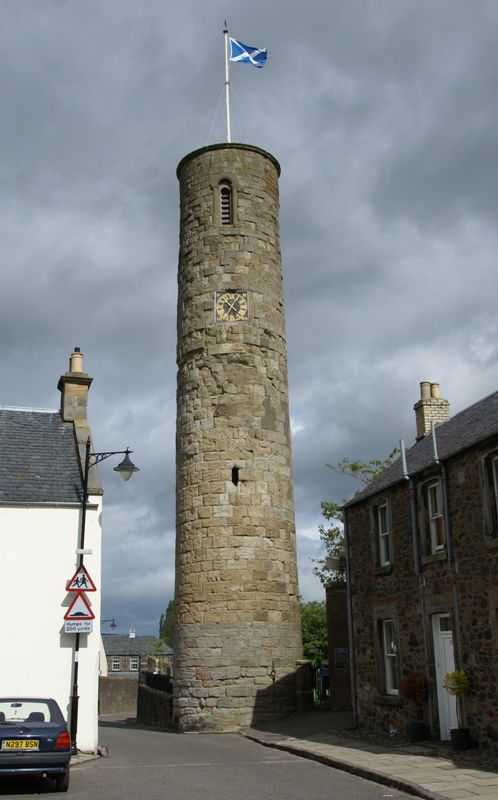
Abernethy Round Tower
Perth and Kinross
One of only two Irish-style round towers in Scotland, the other at Brechin Cathedral.
- Near Abernethy
Fortified place · Prehistoric
Castle Law, Abernethy
Perth and Kinross
A contour fort above Abernethy, scheduled since 1964: older than the medieval lordship in the village below, and with no recorded connection to it.
Questions people ask
- What was Clatchard Craig?
- It was an early medieval hillfort, occupied from the 6th century until at least the 8th century AD, with earlier prehistoric use.
- What did excavations reveal?
- They found six ramparts, evidence of high-status occupation, brooch casting moulds and a silver ingot, alongside much older archaeological material.
- Does the fort survive?
- No. The hill and fort were entirely destroyed by quarrying for aggregate in the late 20th century.
Sources
The Ancient Codex, in your pocket
Get the Pocket Codex app
Carry the directory with you — Clatchard Craig and thousands of ancient places across Britain and Ireland, offline, wherever you roam.