
Roman pottery, glass and a coin found packed inside its walls turn this collapsed tower into rare physical evidence of contact — hostile or looted — between Borderers and the Roman army.
A low ring of tumbled stone crowns a ridge shoulder above Galashiels, all that remains of a drystone tower with staircases and guard chambers within its walls. The tower stands inside the earthworks of an older defended settlement, built directly on part of its defences.
What makes the site more than another ruined tower is what excavators pulled out of it. Roman pottery, fragments of glass vessels and a coin from the first century AD were found packed into the rubble, evidence that has been read as loot carried home from a nearby legionary base rather than trade goods bought in peace. The broch’s short life — apparently built soon after the Roman army withdrew from Scotland and pulled down again within a few decades — reads as a direct response to the shifting Roman frontier passing right through this stretch of the Borders.
Torwoodlee is not an isolated structure but one node in a chain of similar towers along the valley, part of a landscape where communities built to watch the ground below and, it seems, to profit from the disruption a retreating empire left behind.
What follows is drawn from published sources, with each claim labelled by how firmly it is established.
The name
No name from the Iron Age itself survives for the broch; the structure is known only by the later name of the estate and landscape around it. The first part, tor, comes from the Brittonic languages spoken in early Britain and describes a rocky hill or prominent outcrop, a fitting description for the raised ridge the broch and its earlier hillfort occupy. The remaining elements are Old English: wudu, meaning wood or forest, and lēah, a clearing or open ground within woodland, giving a combined sense of 'the woodland clearing beside the rocky hill'. The word broch itself comes from the Scots brough, meaning a fortified place, and was adopted by archaeologists to describe the distinctive double-walled stone towers built across northern Scotland during the Iron Age.
History
Long before the broch was built, an irregular oval hillfort measuring roughly 137 by 136 metres already enclosed the ridge shoulder above Galashiels, its earthwork defences marking out a substantial hilltop settlement. The broch builders later chose the strongest, most defensible corner of this older fort for their own tower, cutting across its earlier ramparts rather than starting from open ground.
Around 100 AD, in the years soon after the Roman army withdrew from Scotland, a circular drystone tower with a diameter of about 23.2 metres and outer walls some 5.2 metres thick was raised on the southwest side of the hillfort. Its double-wall construction created a hollow cavity within the stonework itself, providing space for internal stairs and guard chambers while giving the tower unusual stability for its height.
The tower's stone-lined entrance passage ran through the full thickness of the wall, narrow enough to be tightly controlled and roofed with heavy stone lintels, a design echoed in better-preserved broch towers such as the Broch of Mousa in Shetland. Such passages let defenders restrict access to a single, easily watched point rather than an open doorway.
Within a few decades of its construction the broch was deliberately thrown down, an event that has been connected to a Roman military expedition preparing the ground for the reoccupation of southern Scotland around 140 AD. Roman pottery and glass recovered from beneath the broch's own wall show that Roman material was already present at the site before the structure was even destroyed.
In 1891 the antiquarian James Curle cleared out the broch's interior and recovered a substantial quantity of Roman pottery and glass together with a coin dating to the 1st century AD, material he later described in a paper comparing Torwoodlee to a second broch discovered at Bow in Midlothian.
Stuart Piggott returned to the site in 1950 to carry out a systematic excavation, uncovering further Roman pottery and glass sealed beneath the broch wall itself. His findings, published in 1953, helped establish the sequence of construction soon after the Roman withdrawal and destruction ahead of the later reoccupation, with the Roman finds most plausibly explained as material looted from the legionary fort at Newstead, known to the Romans as Trimontium.
People
-
James Curle
Antiquarian who cleared out the broch's interior in 1891, recovering Roman pottery, glass and a 1st-century coin, and later published a comparative study of the Torwoodlee and Bow brochs.
-
Stuart Piggott
Archaeologist who carried out the systematic 1950 excavation of the broch and hillfort, publishing the results in 1953.
Connections
-
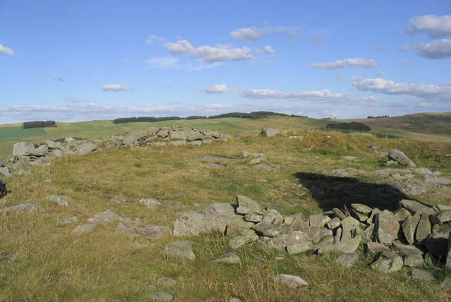
Photo: Walter Baxter / Wikimedia Commons / CC BY-SA 2.0 Lies about 3.2 km north of Torwoodlee, part of the same regional network of broch towers positioned to watch over movement through the surrounding valleys; Curle's 1892 paper discussed the two brochs together after their discovery.
-
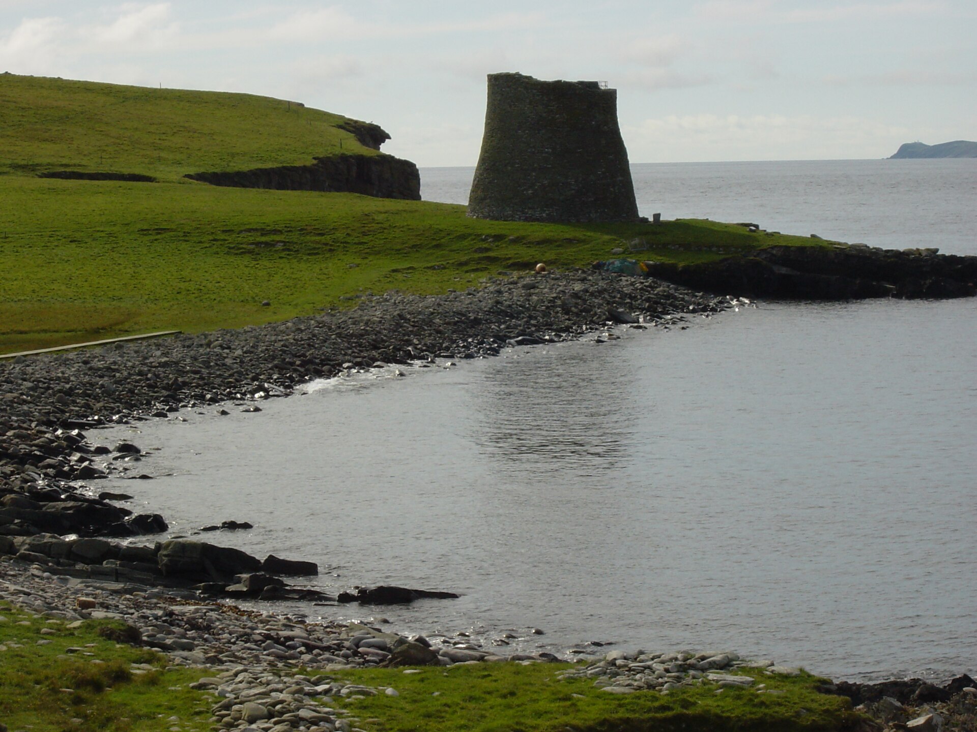
Photo: Langus (talk) / Wikimedia Commons / Public domain A far better-preserved broch tower whose surviving stone-lined entrance passage and lintelled roof illustrate the same defensive design used at Torwoodlee, where only the footprint of the entrance survives.
-
Newstead (Trimontium)
The nearby Roman legionary fort that most plausibly supplied the Roman pottery, glass and coin found inside the broch, likely carried there as looted material.
-
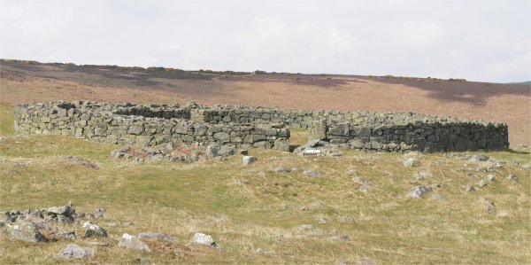
Photo: Oehoe at Dutch Wikipedia (Original text: Van de Beek) / Wikimedia Commons / CC BY-SA 3.0 Edin’s Hall is another lowland Borders broch whose form and frontier setting make it a useful comparison with Torwoodlee. Excavation at Torwoodlee is used to frame Edin’s Hall within the same early Roman-period construction phase.
Discovery & excavation
The broch was first opened up by James Curle in 1891, whose clearance recovered Roman pottery, glass and a 1st-century coin from within the structure. It was excavated to modern standards by Stuart Piggott in 1950, whose work found further Roman material sealed beneath the broch's own wall, fixing the tower's construction after the Roman finds had already reached the site and supporting a build date soon after the Roman withdrawal from Scotland around 100 AD.
What to look for
-
The collapsed broch mound
A low circular mound of tumbled masonry marks the footprint of the tower, roughly 23 metres across, sitting within the wider earthworks of the older hillfort.
-
The earlier hillfort earthworks
The irregular oval outline of the hillfort, about 137 by 136 metres, can still be traced in the earthworks surrounding the broch, showing that the tower was a later addition to an already-defended hilltop.
-
The entrance passage footprint
The line of the original stone-lined entrance passage survives at ground level, showing where a narrow, lintel-roofed corridor once controlled access through the thickness of the broch wall.
Plan your visit
- Location
- 55.6369°N · 2.8505°W
- Access
- Permission required
- Terrain
- Rough ground — reasonable boots advised
- Time needed
- About 90 minutes
Opening & admission
- Ridge and farmland setting near Galashiels; confirm local access before visiting.
Nearby places

Fortified place · Iron Age
Bow Castle Broch
Scottish Borders
One of only three brochs surviving in the Scottish Borders, and the only one to have yielded a Roman cockerel-shaped brooch alongside 2nd-century a…
- Rough ground

Fortified place · Medieval
Elibank Castle
Scottish Borders
A 1511 royal charter tied one family's right to farmland to a promise to build in stone, and the Italianate terraced gardens later raised here rank…

Building or ruin · Medieval
Melrose Abbey
Scottish Borders
St Mary's Abbey, Melrose was founded in 1136 by Cistercian monks at the request of King David I of Scotland: the first Cistercian abbey in Scotland…
- Near Melrose
- 2 min walk from car park

Minor monument · Medieval
Market Cross, Market Square, Melrose
Scottish Borders
Melrose’s 1645 market cross combines a restored seventeenth-century shaft with a nineteenth-century base and a weathered unicorn finial carrying th…
- Easy path
Questions people ask
- What is a broch?
- A broch is a drystone tower built in Iron Age northern Scotland, with double walls enclosing a hollow cavity used for internal stairs and chambers.
- How old is Torwoodlee Broch?
- It was built around 100 AD, soon after the Roman army withdrew from Scotland, on top of part of an earlier hillfort's defences.
- Why was Roman material found inside the broch?
- Roman pottery, glass and a coin were found inside and beneath the walls, likely looted from the nearby Roman fort at Newstead (Trimontium).
- Who excavated the site?
- James Curle cleared it in 1891, and Stuart Piggott carried out a systematic excavation in 1950, publishing his results in 1953.
- What happened to the broch after it was built?
- It was thrown down within a few decades, possibly by a Roman expedition preparing for the reoccupation of southern Scotland around 140 AD.
Sources
- Wikipedia: Torwoodlee Broch
- Piggott, Excavations in the broch and hill-fort of Torwoodlee, 1953
- Curle, Notes on two brochs recently discovered at Bow and Torwoodlee, 1892
Explore more: Fortified places · Iron Age · Scottish Borders
The Ancient Codex, in your pocket
Get the Pocket Codex app
Carry the directory with you — Torwoodlee Broch and thousands of ancient places across Britain and Ireland, offline, wherever you roam.