
The only broch - a drystone tower, round and hollow-walled, built in the Iron Age, from about 800 BC until the Romans came - still standing nearly to its full height with its original stair intact - and storm petrels nest in its walls.
Nothing else like it is left. Of more than 500 brochs built in Scotland - dry-stone round towers of the Iron Age - this is the only one standing nearly to its full height with its original stair still running up inside the wall. It reaches 13.3 metres, was raised around 300 BC, and was built without a scrap of mortar.
The reason it survived is partly that it was overbuilt. Mousa has one of the smallest diameters of any broch, one of the thickest wall bases, and one of the smallest interiors; a great deal of stone surrounds not much room. Being on a small island 23 kilometres south of Lerwick, reached only by boat from Sandwick, cannot have hurt either.
The tower sits on flat rock at the end of a low promontory, beside a sheltered tidal basin that gave small boats somewhere to land, and looks out across Mousa Sound to the South Mainland. In a place where travel between settlements was usually easier by water than over ground, that view mattered - from the upper levels most of the sound and the nearby coast can be seen, and anyone approaching would have been visible a long way off. The tower would have been just as visible in return.
Inside, a single entrance passage 5 metres long still carries the original bar-hole for the beam that held the door. The central space has a hearth and a stone floor tank, with a low bench round the wall added early on, and three cells built into the wall thickness, each entered over a raised threshold and lit through an opening above its lintel. Ledges set into the inner wall at 2.1 and 3.7 metres either carried a timber roundhouse standing on posts, or - as has recently been argued - scaffolding in a tower that was never roofed at all. If the timber building existed, it was later pulled out and replaced by a small wheelhouse, with three stone piers projecting inward.
Because it never fell down, there is less to dig here than at a ruined broch, and what had gathered inside was taken out in 1861, more than two thousand years after it was built. That clearance produced quantities of otter bone, pottery, stone pot lids, and a carved fir model of a Norwegian boat about three feet long. Work since 1967 has been stabilisation and recording rather than excavation, including a 3D laser scan in 2005.
The Norse knew the place. Egil’s Saga has a couple eloping from Norway to Iceland shipwrecked and sheltering here; the Orkneyinga Saga has Earl Harald Maddadsson besieging the broch in 1153 after his mother was abducted and held inside it. George Low drew it in 1774, Walter Scott saw it in 1814 and called it the most entire Pictish fortress probably in the world, and Henry Dryden surveyed it properly in the 1850s and 1860s.
It is also, now, a seabird colony. Mousa holds around 6,800 breeding pairs of European storm petrels, roughly 8 per cent of the British population, and some of them nest in burrows in the broch’s own walls - best seen after dark, on an overcast summer night.
What follows is drawn from published sources, with each claim labelled by how firmly it is established.
The name
The Norse saga form Morseyarborg preserves the name as ‘Mousa broch’, joining the island name to the Old Norse word borg for a fortified stone structure.
History
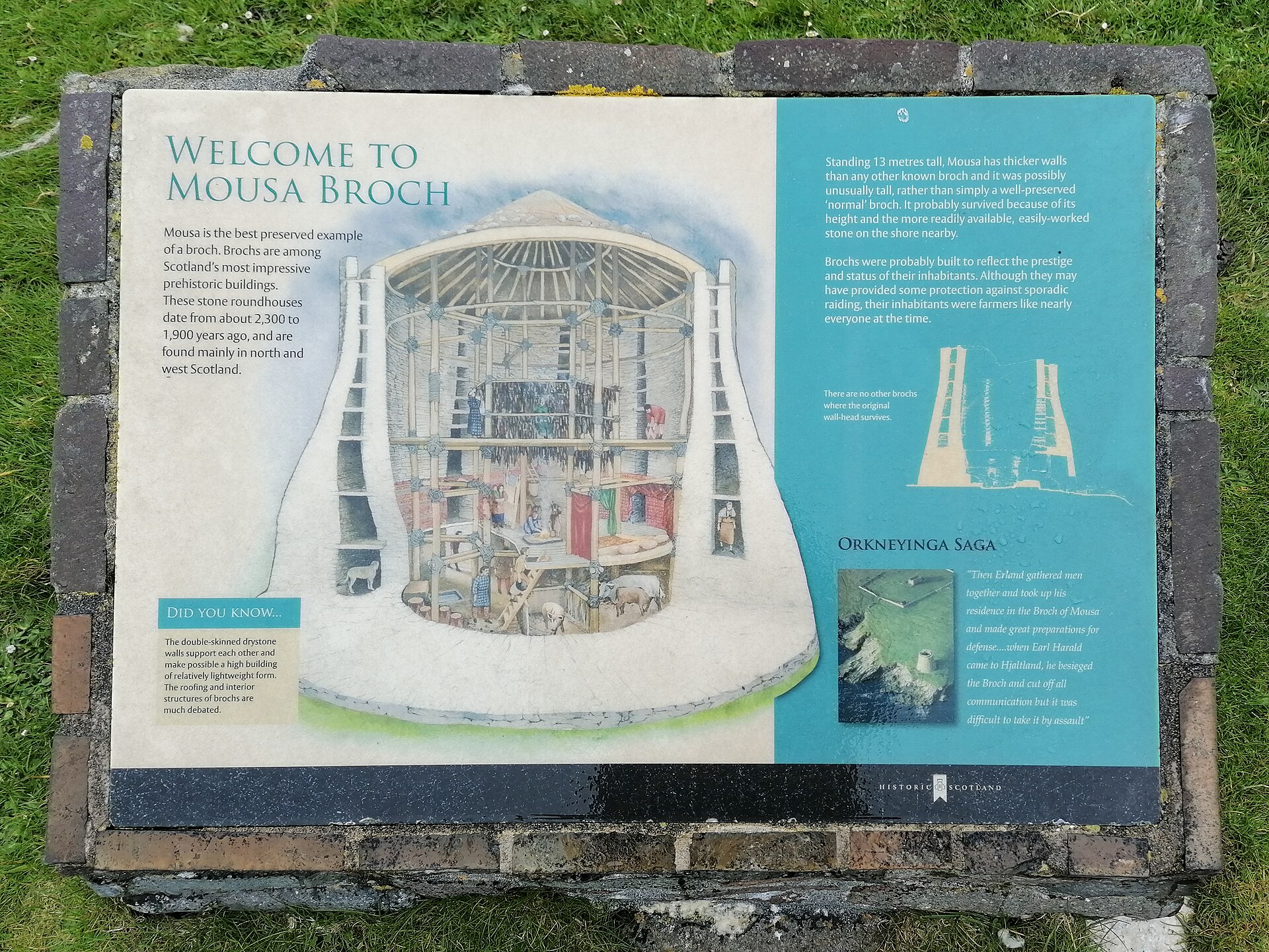
The broch, a dry-stone round tower of the Scottish Iron Age, was built around 300 BC on the western shore of the island of Mousa in Shetland, one of more than 500 raised across Scotland. It stands 13.3 metres high, the tallest still standing, and is among the best-preserved prehistoric buildings in Europe.
It has one of the smallest overall diameters of any broch, one of the thickest wall bases and one of the smallest interiors. That massive construction, along with its remote position, is likely the main reason it has survived so well. It is built of dry stone with no mortar, and it is the only broch complete nearly to the top, including the original stair running within the thickness of the wall.
The single ground-level entrance is on the west side, altered at various times from its original form. The entrance passage runs 5 metres and still has its original bar-hole, cut to take the beam that barred the door. Inside, the central space holds a hearth and a stone floor tank, with a low stone bench around the base of the inner wall that belongs to an early alteration.
The broch went through at least two phases of occupation. In its original condition it may have contained a wooden roundhouse - a circular timber dwelling - resting on the scarcement ledges, the internal wall shelves at heights of 2.1 and 3.7 metres, and presumably on a ring of posts set into the primary floor. It has recently been argued instead that those ledges carried scaffolding in a building that was never roofed.
At a later date, if the timber building existed, it was demolished to make way for a small wheelhouse in the interior, a form in which stone piers project inward from the wall like the spokes of a wheel; this one has three. Three large cells are built into the thickness of the ground-floor wall, entered over thresholds 0.7 metres above floor level, with openings above each lintel that seem designed to let light and air into the chamber behind. All three have recesses set into the wall.
Above the solid base are six galleries, formed by the space between the two concentric walls of the upper tower and partly lit by voids. Most can be walked along. They were probably an aid to the builders in raising the structure rather than accommodation or storage. The stair begins at the second level, reached through a doorway in the inner wall face with a cell beside it, and there is a further cell above the entrance passage.
The broch went on being used for centuries and appears in two Norse sagas. Egil's Saga tells of a couple eloping from Norway to Iceland who were shipwrecked and sheltered in it. The Orkneyinga Saga records a siege of the broch by Earl Harald Maddadsson in 1153, after the abduction of his mother, who was held inside.
The antiquarian George Low visited on his tour of 1774 and made the first drawings. Sir Walter Scott came in 1814 and called it a Pictish fortress, the most entire probably in the world. The geologist and antiquarian Samuel Hibbert gave a detailed account after visiting in 1818, and Sir Henry Dryden made the first accurate survey in 1852 and 1866.
The interior was first cleared of accumulated rubble in 1861, more than two thousand years after the tower was built. The clearing produced large quantities of animal bone, particularly otter, the animals having probably lived in the abandoned structure, along with pottery fragments, stone pot lids and a slaty object described as resembling a triangular file. The most unusual find was a carved wooden model of a Norwegian boat, about 0.9 metres long and made of fir.
Further clearing by the Office of Works in 1919 recovered relatively little. Some pottery sherds, including part of a Black-burnished ware vessel, are now in the National Museum of Scotland. Because the tower never collapsed, and because later reuse and nineteenth-century clearing removed what had gathered inside, the archaeology here is thin and the architecture itself carries most of the evidence.
Modern work has concentrated on recording and conservation rather than excavation. Major stabilisation was carried out between 1967 and the 1980s, and in 2005 archaeologists used 3D laser scanning to document the structure and support conservation planning. The site is managed by Historic Environment Scotland as a scheduled monument.
Mousa is well known among birdwatchers for its breeding European storm petrels, best seen after dark on partly or wholly overcast summer nights. The island holds around 6,800 breeding pairs, about 8 per cent of the British population and about 2.6 per cent of the world population, and some of them nest in burrows within the broch itself.
People
-
Earl Harald Maddadsson
Besieged the broch in 1153, according to the Orkneyinga Saga, after the abduction of his mother, who was held inside it.
-
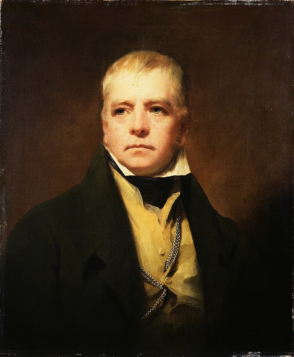
Portrait: Henry Raeburn / Wikimedia Commons / Public domain Sir Walter Scott
Visited in 1814 and described the tower as a Pictish fortress, the most entire probably in the world.
-
Sir Henry Dryden
Made the first accurate survey of the broch, in 1852 and 1866.
-
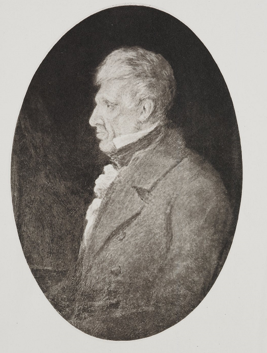
Portrait: Mrs Mary Clementina Hibbert Ware / Wikimedia Commons / Public domain Samuel Hibbert
The geologist and antiquarian visited the Broch of Mousa in 1818 and published a detailed account in 1822. His interpretation of the tower’s structure records the monument before its nineteenth-century clearance.
Cultural influences
-
A landmark in Norse-era sea travel
Mousa’s tall tower was already a recognised refuge in Norse saga tradition. The stories of shipwrecked travellers and the 1153 siege show how its position beside sheltered water gave the prehistoric building a continuing role in later maritime life.
Connections
-
Mousa Sound
The narrow water between the island and the South Mainland, part of the network of sheltered routes that connected Shetland communities when sea travel was easier than overland.
-
Loch of Mousa
The sheltered tidal basin immediately beside the broch, joined to the sea by a narrow channel and offering a landing place for small boats.
Discovery & excavation
Sir Henry Dryden made the first accurate surveys of Mousa in 1852 and 1866. Later recording, including 3D laser scanning in 2005, has documented the unusually complete tower for conservation.
In culture
-
Egil's Saga
Tells of a couple eloping from Norway to Iceland who were shipwrecked and used the broch as a temporary refuge.
-
Orkneyinga Saga
Gives an account of Earl Harald Maddadsson's siege of the broch in 1153.
What to look for
-
The intramural stair
Beginning at the second level and running within the wall to the top - the only original broch stair to survive complete.
-
The bar-hole
In the 5-metre entrance passage, cut to take the beam that barred the door.
-
The scarcement ledges
Shelves set into the inner wall at 2.1 and 3.7 metres, which either carried a timber roundhouse or, on a recent reading, scaffolding in a roofless tower.
-
The wall cells
Three chambers in the thickness of the ground-floor wall, entered over raised thresholds, each with openings above the lintel for light and air and recesses cut into the stone.
-
The storm petrels
Around 6,800 breeding pairs on the island, some nesting in the broch walls, best seen after dark on overcast summer nights.
Standing there
- Reached only by boat across Mousa Sound to a small, flat, treeless island of grass and heath, the broch rises 13.3 metres straight off a low rock shore — the tallest broch still standing — so the first impression is of sheer intact height against open sky, sea-wind and the wash of the sound.
- The way in is a single low west-facing doorway and a 5-metre passage that still holds its original bar-hole, opening into a circular court under the sky, where a hearth, a stone floor-tank and a low stone bench around the inner wall mark where people actually lived inside the tower.
- From the court the original intramural stone stair climbs on, curving up between the broch's two concentric drystone walls past dim galleries lit only by narrow voids, until the stair emerges at the top, with much of Mousa Sound and the South Mainland coast laid out below — the same commanding sea-view its Iron Age builders had.
- On dark, overcast summer nights the broch becomes an extraordinary soundscape: thousands of European storm petrels — Mousa holds around 6,800 breeding pairs — return after dark to nest in the island's burrows and in the broch's own drystone walls, filling the night with their churring calls.
- Sheltering inside in the Iron Age would have been close and dim — a fire on the central hearth, the smell of smoke and damp stone, small wall-cells reached over raised thresholds for storage — a refuge whose strength still read in the Norse age, when sagas record a shipwrecked eloping couple sheltering here and a 1153 siege of the tower.
Plan your visit
- Location
- 59.9953°N · 1.1821°W
- Nearest settlement
- Sandwick
- Access
- Reached on a public path
- Terrain
- Moderate walking
- Time needed
- About 45 minutes
- Best time
- Visit between April and September, when Historic Environment Scotland lists the broch as open. Boat crossings and the exposed island conditions are weather-dependent.
- What survives
- Mousa is Scotland’s tallest and best-preserved Iron Age broch, standing about 13 metres high. Its thick drystone walls, internal galleries and stair survive exceptionally well, though the stair to the top is steep and uneven.
- Start point
- Sandsayre Pier, Leebitton (Sandwick) — Mousa ferry departure — Mousa cannot be reached on foot. The Mousa Boat ferry departs the historic Sandsayre Pier at Leebitton, Sandwick, on the Shetland Mainland (small visitor centre at the pier). Ferry is seasonal and weather-dependent; the figure shown is the straight-line sea distance from the pier to the broch, NOT a walk. There is a car park at the pier.
Nearby places
Tomb or burial place · Prehistoric
Catpund
Shetland Islands
Along the bank of a burn on Shetland Mainland, the rock face at Catpund still carries the scars of centuries of quarrying, row upon row of hollows…
- Easy path

Fortified place · Iron Age
Clumlie Broch
Shetland Islands
Clumlie Broch stands on a low rise amid flat arable ground in Dunrossness, on southern Shetland Mainland, roughly eight kilometres north of Sumburg…
- Some walking

Sacred place · Prehistoric
St Ninian's Isle
Shetland Islands
St Ninian's Isle sits off the south-western coast of Shetland Mainland, joined to it by a 500-metre tombolo, the largest in the United Kingdom. Loc…
- Easy path

Carved stone · Pictish & early medieval
Papil Stone
Shetland Islands
Carved on a single face of stone left otherwise plain, the Papil Stone rises to a large, long-stemmed cross shaped like a fan, its shaft crowded be…
- Easy path
Questions people ask
- How tall is Mousa Broch?
- 13.3 metres, making it the tallest broch still standing and the only one complete nearly to the top, including its original stair within the wall.
- Why has it survived so well?
- Its construction and its position. It has one of the smallest diameters and thickest wall bases of any broch, and the island is remote.
- Does it appear in the sagas?
- Twice. Egil's Saga has a shipwrecked eloping couple sheltering in it, and the Orkneyinga Saga records Earl Harald Maddadsson besieging it in 1153 after his mother was abducted and held inside.
- What was found inside?
- The 1861 clearance produced animal bone, much of it otter, pottery, stone pot lids, a slaty object like a triangular file, and a carved fir model of a Norwegian boat about 0.9 metres long.
- What are the birds?
- European storm petrels. The island holds around 6,800 breeding pairs, about 8 per cent of the British population, and some nest in burrows in the broch walls.
Sources
- Canmore site 944
- Wikipedia: Broch of Mousa
- Wikidata: Q923376
- Historic Environment Scotland scheduled monument SM90223 — Mousa, broch (accessed 2026-08-03)
- Historic Environment Scotland — Mousa Broch visitor information (accessed 2026-08-22)
Explore more: Fortified places · Iron Age · Shetland Islands
The Ancient Codex, in your pocket
Get the Pocket Codex app
Carry the directory with you — Broch of Mousa and thousands of ancient places across Britain and Ireland, offline, wherever you roam.