
Six weathered boulders share a wooded hill with a much larger, older stronghold, one refortified deep into the Pictish (of the Picts, the people of northern and eastern Scotland from about AD 300 to 900) era, whose triple ring of walls still traces the summit beneath later monuments.
Six boulders, the tallest of them well over a metre high, stand in a loose ring on the wooded south flank of a hill outside Elgin. Walkers who climb past them to the summit find something stranger still: an octagonal tower and a Victorian burial vault sharing the crown of a hill that was, long before either was built, the site of a substantial fort.
The hill itself, known as the Knock of Alves, rises only a little over three hundred feet above the surrounding farmland of Moray, but its slopes carry the ditches, banks and tumbled facing-stones of a fort whose builders reshaped the whole summit and much of the ground below it. The stone circle sits apart from this, on the lower southern slope, its purpose and age never recorded in any survey that reached a firm conclusion — a quieter, older neighbour to the fortifications above it.
What makes the hill unusual is the sheer stacking of periods on one small summit: prehistoric ramparts overlaid by a persistent but unproven tradition of an early church, then, many centuries later, a commemorative folly and a family tomb built directly into the old defences. Each addition damaged what came before it, so that today the fort survives only as scars and low walls half-hidden under later stonework and the roots of the wood that now covers the whole hill.
What follows is drawn from published sources, with each claim labelled by how firmly it is established.
History
The earliest confirmed activity on the hill belongs to the Iron Age. Postholes excavated within the upper citadel in 2016 produced radiocarbon dates spanning 400 to 200 BC and 520 to 370 BC, showing that a defended enclosure crowned the summit for centuries before the stone circle on its southern slope drew any attention from later antiquarians and surveyors.
Deposits recovered from the lower ramparts around the base of the hill returned dates of 330 to 540 AD, indicating that after a period of abandonment the fort was reoccupied and substantially refortified between the later 4th and early 6th centuries, a phase that coincides with the wider early medieval reworking of hillforts across northern Pictland.
Local tradition holds that an early Christian church, possibly linked to the Culdees (a community of Celtic monks), once stood on the summit, though no structural traces of any such building have ever been identified during survey or excavation, and the claim survives only as an unverified strand of local memory attached to the hill.
In 1827 the octagonal, three-storey York Tower was raised on the summit to commemorate Prince Frederick, Duke of York. Its construction cut directly through the earlier fort ramparts, beginning a long process of damage to the prehistoric remains that later access roads, root disturbance and animal burrowing would continue. The Forteath Mausoleum was built beside the tower in 1850 as the burial place of seven members of the Forteath family of nearby Newton House, adding a second post-medieval structure to the summit and further compounding the erosion and disturbance already affecting the underlying hill fort earthworks.
In 1957 the Royal Commission on the Ancient and Historical Monuments of Scotland surveyed the fort in detail, recording an inner enclosure some 125 feet by 75 feet, a larger second enclosure of 415 by 75 feet with its entrance to the east, a third surrounding wall, and two further earthen ramparts on the lower slopes, establishing the multi-phase layout still referenced today.
People
-

Portrait: Unidentified painter / Wikimedia Commons / Public domain Prince Frederick, Duke of York
Commemorated by the octagonal York Tower built on the hill's summit in 1827.
-
The Forteath family of Newton
Seven family members were buried in the mausoleum built on the summit in 1850.
Cultural influences
-
A Victorian folly and family burial vault were built into the prehistoric defences, substantially changing the hilltop’s later appearance.
Connections
-
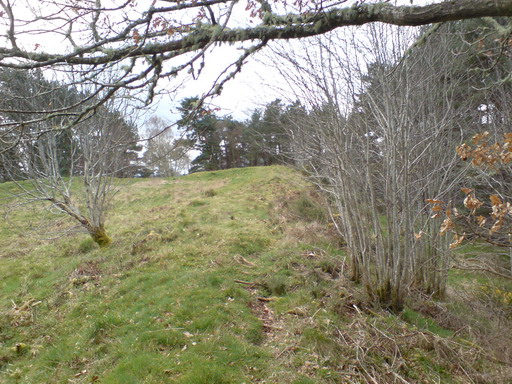
Photo: david johnston / Wikimedia Commons / CC BY-SA 2.0 Classed alongside Knock of Alves as one of a group of massively constructed oblong hillforts to the west, several showing evidence of vitrification.
-
Knock Farril
Grouped with Knock of Alves and Craig Phadrig among the western hillforts sharing this oblong, vitrified construction style.
-
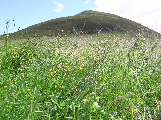
Photo: Steve Reid / Wikimedia Commons / CC BY-SA 2.0 Classed with Knock of Alves in the same regional group of massive oblong hillforts, this one lying to the south-east.
-

Photo: Colin Smith / Wikimedia Commons / CC BY-SA 2.0 Dunnideer
Grouped with Knock of Alves, Tap o' Noth and the western forts as part of the same distinctive class of oblong, vitrified hillforts.
Discovery & excavation
A 1957 survey by the Royal Commission on the Ancient and Historical Monuments of Scotland first documented the fort's surviving walls and enclosures in detail. Excavation in 2016 went further, recovering radiocarbon-dated deposits from both the upper citadel and the lower ramparts and establishing that the site was used across two widely separated periods, the Iron Age and the early medieval centuries, rather than in a single continuous occupation.
What to look for
-
The stone circle
Six boulders, the largest up to 1.3 metres high, stand in a ring some 10 metres across on the hill's south side, about 200 metres from the summit.
-
York Tower
An octagonal, three-storey folly built in 1827 on the summit, commemorating Prince Frederick, Duke of York, and standing directly over part of the old fort.
-
The Forteath Mausoleum
A Victorian burial vault of 1850 beside the tower, built for members of the Forteath family of Newton House.
-
The fort's ramparts
Multiple lines of walling and earthwork survive around the summit and lower slopes, including crestlines, facing-stones and two outer ramparts, though much is now mutilated by later building and erosion.
What is said
Folklore and tradition, recorded as what is said — not as established fact.
-
The lost hilltop church
Local tradition holds that an early Christian church, possibly Culdean (linked to a community of Celtic monks), once stood on the summit of the Knock of Alves, though no trace of any such building has been found.
Plan your visit
- Location
- 57.6480°N · 3.4040°W
- Nearest settlement
- Elgin
- Access
- Open access
- Terrain
- Moderate walking
- Time needed
- About 45 minutes
Opening & admission
- The wooded hill has summit monuments, hillfort remains and a stone circle.
- A managed visitor route to the prehistoric features is not confirmed; check local access before visiting.
Nearby places

Fortified place · Medieval
Duffus Castle
Moray
Its stone tower still leans bodily off the earthen motte it was built on, frozen mid-collapse: a rare, visible lesson in why timber-age mounds made…
- Near Elgin

Sacred place · Prehistoric
Elgin Cathedral
Moray
Known as the Lantern of the North, it was Scotland's second-largest medieval cathedral and uniquely combined an English-style octagonal chapter hou…
- Near Elgin
- Easy path

Carved stone · Pictish & early medieval
Elgin Pillar
Moray
A tall granite Pictish (of the Picts, the people of northern and eastern Scotland from about AD 300 to 900) stone found buried beneath Elgin's old…
- Near Elgin
- Easy path

Carved stone · Pictish & early medieval
Birnie Symbol Stone
Moray
The Birnie Symbol Stone preserves a compact seventh-century Pictish (of the Picts, the people of northern and eastern Scotland from about AD 300 to…
- Near Elgin
- Easy path
Questions people ask
- What is the stone circle at the Knock of Alves made up of?
- Six boulders, the tallest around 1.3 metres high, arranged in a ring about 10 metres in diameter on the hill's south side, roughly 200 metres from the summit.
- Is the stone circle connected to the hill fort above it?
- They share the same hill but are recorded separately; the fort's dated occupation is Iron Age and early medieval, while the stone circle's age is not established.
- When was the Knock of Alves hill fort in use?
- Excavated deposits date to 400-200 BC and 520-370 BC in the citadel, and 330-540 AD in the lower ramparts, showing Iron Age use followed by early medieval reoccupation.
- What are York Tower and the Forteath Mausoleum?
- An 1827 octagonal folly commemorating the Duke of York, and an 1850 burial vault for the Forteath family of Newton, both built on the fort's summit.
- Was there ever a church on the hill?
- Local tradition holds that an early Christian, possibly Culdean, church once stood on the summit, but no physical evidence of it has ever been found.
Sources
- Wikipedia: Knock of Alves
- Historic Environment Scotland — Canmore
- Wikidata: Knock of Alves
Explore more: Sacred places · Prehistoric · Moray
The Ancient Codex, in your pocket
Get the Pocket Codex app
Carry the directory with you — Knock of Alves and thousands of ancient places across Britain and Ireland, offline, wherever you roam.