
A Neolithic chambered cairn shares this remote headland with an Iron Age dun and a rare medieval boat harbour — one of Skye's most densely layered archaeological landscapes.
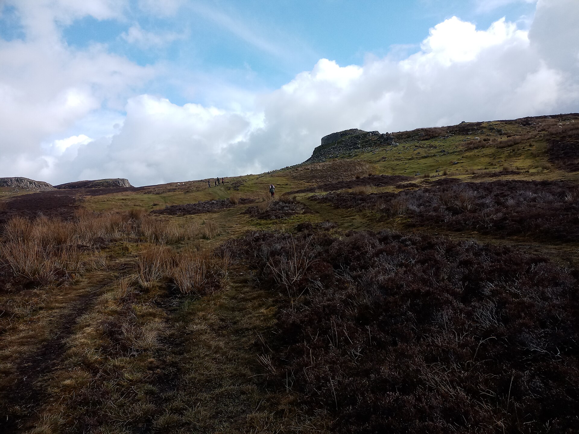
On a windswept headland south of the Cuillin hills on Skye, a low mound of stones has kept watch over the sea for some four thousand years. This is the chambered cairn of Rubha an Dùnain, a communal burial monument built in the second or third millennium BC, and it stands as only one part of an unusually crowded archaeological landscape — Mesolithic (the middle Stone Age, roughly 9000–4000 BC) hunters, Iron Age fort-builders, and Viking-age sailors have all left their mark on the same small stretch of ground.
Close by, on the shore of Loch na h-Àirde, lie the remains of what archaeologists now regard as one of Scotland’s most remarkable medieval harbours: stone quays, boat shelters and a hand-cut canal that once let birlinns and other vessels reach open water at high tide. A boat timber recovered from the loch was carbon dated to around AD 1100, tying the harbour firmly to the Norse and clan periods that followed the cairn’s construction by well over two thousand years.
Long after the last boats put out from the loch, the peninsula supported a farming community under Clan MacAskill, coast-watchers to the MacLeods, whose tacksman’s house still stands in ruin near the shore. No one has lived here since the middle of the 19th century, leaving the cairn, the dun and the harbour to be read together as layers of the same uninhabited ground.
What follows is drawn from published sources, with each claim labelled by how firmly it is established.
The name
The name Rubha an Dùnain means 'point of the little fort', a reference to the Iron Age dun standing south of Loch na h-Àirde rather than to the chambered cairn itself.
History
During the Mesolithic period, hunter-gatherers used a small rock shelter on the headland north of the loch, the earliest known trace of human presence on the peninsula. Sometime in the second or third millennium BC, a chambered cairn — a communal stone burial mound — was raised nearby, followed in time by a separate passage grave, adding a further layer of prehistoric burial to the same stretch of ground.
South of the loch stands a dun, a small drystone fortified tower, thought on the basis of its form to belong to the Iron Age. Its presence gave the peninsula its Gaelic name, Rubha an Dùnain, meaning 'point of the little fort', a name that has outlasted the people who built and used the structure by well over a thousand years.
Along the stream linking the loch to the sea, an artificial canal was cut at some point in the past, long attributed by local tradition to Viking builders. In 2000 a local archaeologist recovered a timber from the loch belonging to a Norse-style clinker-built faering, a light open boat, which was later carbon dated to around AD 1100, giving the first hard evidence for the harbour's medieval use.
In May 2009 an archaeological survey sponsored by Historic Scotland identified stone-built quays around the loch together with a system for maintaining a constant water level, allowing boats such as birlinns to be floated out to sea at high tide. Historic Environment Scotland later described the result as a rare medieval harbour complex with no close parallel identified anywhere else for its combination of age and complexity.
In 2011 the Royal Commission on the Ancient and Historical Monuments of Scotland carried out aerial surveys of the peninsula in the hope of locating further remains. The marine archaeologist Dr Colin Martin, who summarised the findings in a report titled 'A Highway into History', judged that the site held enormous potential to reveal how boats were built, serviced and sailed on Scotland's western seaboard across the medieval and possibly earlier periods.
In the centuries after the Viking era, Rubha an Dùnain became the hereditary home of Clan MacAskill, a sept of Clan MacLeod who served as coast-watchers and bodyguards. A farming community grew up on the peninsula, including an 18th-century tacksman's house, and by the early 19th century the associated farm had grown to some 37,500 acres, directly supporting around 70 men and their families.
The community did not survive the Highland Clearances. Many of the clan's leaders emigrated to the United States, New Zealand and Cape Breton in Nova Scotia as the farm broke up, and no record of any occupants on the peninsula survives after the census of 1861, after which Rubha an Dùnain has remained uninhabited.
People
-
Colin Martin
Marine archaeologist who assessed the Loch na h-Àirde harbour complex during the 2011 aerial survey and authored the summary report 'A Highway into History'.
Cultural influences
-
The promontory setting reflects the coastal settlement patterns that shaped Iron Age brochs in northern Scotland.
Connections
-
Clan MacLeod
Clan MacAskill, hereditary occupants of the peninsula after the Viking era, were a sept (branch) of Clan MacLeod, serving as their coast-watchers and bodyguards.
-
Royal Commission on the Ancient and Historical Monuments of Scotland (RCAHMS)
RCAHMS carried out aerial surveys of the peninsula in 2011 before merging with Historic Scotland to form Historic Environment Scotland.
-
Skye's Hidden Heritage
This independent website hosts Dr Colin Martin's report on the Loch na h-Àirde harbour findings, 'A Highway into History'.
Discovery & excavation
In 2000 a local archaeologist recovered a Norse-style boat timber from Loch na h-Àirde, later carbon dated to about AD 1100. A further archaeological study followed in May 2009, sponsored by Historic Scotland, identifying stone-built quays and a water-level control system around the loch shore.
What to look for
-
The chambered cairn
A stone burial mound dating from the second or third millennium BC, standing among Mesolithic and Iron Age remains on the northern part of the peninsula.
-
Loch na h-Àirde and its canal
An artificial channel connecting the loch to the sea, with stone-built quays and boat noosts still traceable around its shore.
-
The dun
A small Iron Age fortified structure south of the loch, from which the peninsula takes its Gaelic name.
-
The tacksman's house
The ruined 18th-century house of the farming community that once supported around 70 men and their families before the Clearances.
What is said
Folklore and tradition, recorded as what is said — not as established fact.
-
The Viking canal
The artificial canal linking Loch na h-Àirde to the sea is reputed to be of Viking origin, according to long-standing local tradition, though carbon dating of a recovered boat timber has since lent some support to a medieval, Norse-era use of the site.
Plan your visit
- Location
- 57.1610°N · 6.3160°W
- Access
- Open access
- Terrain
- Rough ground — reasonable boots advised
- Time needed
- About 60 minutes
Opening & admission
- Uninhabited headland with archaeology spread across the peninsula; record gives no visitor route detail.
Nearby places

Fortified place · Iron Age
Dun Ringill
Highland
A stone roundhouse dating from the centuries before Rome arrived that Clan MacKinnon later refitted as its own stronghold, so the ruin carries two…
- Near Inverness
- Some walking

Fortified place · Iron Age
Dun Ardtreck
Highland
A cliff-edge Skye fort twice built and twice destroyed by fire: one of the clearest examples anywhere of the transitional "semi-broch (a tall circu…
- Near Tokavaig
- Rough ground

Building or ruin · Medieval
Dunscaith Castle
Highland
Its name comes not from a clan or a king but from Scáthach, the legendary warrior-woman said to have trained the Irish hero Cú Chulainn in the arts…
- Near Inverness
Fortified place · Iron Age
Dun Beag
Highland
A countess spent six years hand-sifting its spoil heaps, and coins running from Henry II to George III show this Skye tower stayed in use long afte…
- Near Inverness
- Some walking
Questions people ask
- What does the name Rubha an Dùnain mean?
- It means 'point of the little fort', referring to an Iron Age dun standing south of Loch na h-Àirde.
- Why is Loch na h-Àirde archaeologically important?
- It contains a rare medieval harbour complex — quays, boat noosts and an artificial canal — with no close parallel found elsewhere in Scotland.
- When was the site recognised as nationally important?
- Historic Environment Scotland designated Rubha an Dùnain a historic monument of national importance in 2017.
- Who lived at Rubha an Dùnain historically?
- Clan MacAskill, a sept of Clan MacLeod, held it as hereditary coast-watchers, farming the peninsula until the Highland Clearances.
- Is Rubha an Dùnain inhabited today?
- No — it has been uninhabited since at least the 1861 census, after which no occupants are recorded.
Sources
- Wikipedia: Rubha an Dùnain
- Historic Environment Scotland — Canmore
- Skye's Hidden Heritage — 'A Highway into History' report by Dr Colin Martin
Explore more: Tomb or burial places · Prehistoric · Highland
The Ancient Codex, in your pocket
Get the Pocket Codex app
Carry the directory with you — Rubha an Dùnain and thousands of ancient places across Britain and Ireland, offline, wherever you roam.