
A countess spent six years hand-sifting its spoil heaps, and coins running from Henry II to George III show this Skye tower stayed in use long after prehistory.
A drystone tower rises on a low rocky knoll above the moorland north-west of Struan, its entrance facing east across the ground that slopes away toward the sea. The wall still stands to about two metres in places, thick enough at its base — some four metres — that three separate openings run through its mass: one into a small chamber, one into a long gallery threaded within the wall itself, and one onto a stone stair whose lower twenty-odd steps still climb inside the stonework.
What is seen today is a remnant. Thomas Pennant, touring the Hebrides in 1772, found a much taller structure, and early travellers who followed him described the broch as a landmark rather than a ruin. Half its height has gone since, worn away or carried off stone by stone, leaving the surviving drystone walling to tell only part of the story it once told whole.
The rest of that story came out of the ground itself, when an early twentieth-century excavation turned over the broch’s interior almost bucket by bucket. What emerged was not a single tidy Iron Age assemblage but a scatter of objects reaching from prehistory into the eighteenth century, an accumulation of use and reuse that the walls alone could never have shown.
What follows is drawn from published sources, with each claim labelled by how firmly it is established.
The name
Dùn Beag is Gaelic for small fort, a descriptive name for the broch tower on Skye.
History
In 1772 the antiquarian Thomas Pennant visited Dun Beag and described a broch that was still substantially intact, its drystone walls reputedly standing to a height of about four metres — roughly twice what survives today. Pennant's account is the earliest detailed record of the tower, capturing it before further centuries of stone-robbing and weathering reduced its upper courses to their present state.
The following year, in 1773, Samuel Johnson and James Boswell passed close by during their celebrated tour of the Hebrides, and the broch they described near Ullinish is thought by later writers to have been Dun Beag itself. Their brief mention places the monument within one of the best-known travel narratives of eighteenth-century Scotland, linking a remote Skye tower to a much wider literary journey.
Between Pennant's visit and the twentieth century, roughly half of the broch's original wall height was lost, most likely to stone-robbing for local building as well as ordinary collapse. What had stood some four metres tall in 1772 had been reduced, by the time of formal investigation, to a stump a little over two metres high — a reminder of how quickly an unprotected monument can erode once attention moves elsewhere.
Between 1914 and 1920 the Countess Vincent Baillet de Latour excavated Dun Beag, removing an estimated 200 tons of earth and stone from within and around the tower. Every barrowload of spoil was sifted by hand through the excavators' fingers in search of small finds, an intensive method that recovered material a cruder dig would have missed, even though the standard of recording and publication fell well short of later archaeological norms.
The excavation produced a large assemblage of everyday and unusual objects: numerous stone implements and utensils, a gold ring, bronze fittings, a folded piece of sheet lead, iron and glass objects, a bone borer, an antler pick, quantities of pottery, and a stone cup. Several hundred glass beads also came to light, though these are not believed to be prehistoric in date, hinting at activity on the site well after the broch's original use.
Among the finds were coins of Henry II, Edward I, James VI, George II and George III, a spread running from the twelfth century into the eighteenth. Their presence suggests the broch, or the ground around it, remained in use or was regularly visited long after its Iron Age origins, rather than being abandoned and forgotten once prehistory ended.
People
-
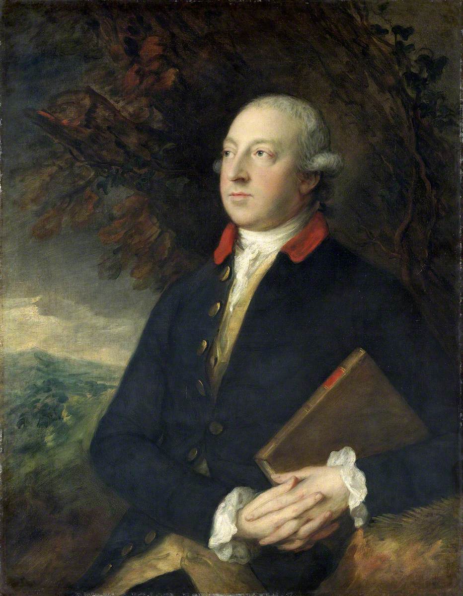
Portrait: Thomas Gainsborough / Wikimedia Commons / Public domain Thomas Pennant
Antiquarian traveller who recorded and described the broch in 1772, while it still stood far taller than it does today.
-
Samuel Johnson and James Boswell
Travellers whose 1773 Tour to the Hebrides describes a broch near Ullinish thought by later scholars to have been Dun Beag.
-
Countess Vincent Baillet de Latour
Excavated Dun Beag between 1914 and 1920, removing some 200 tons of material and hand-sifting the spoil for finds.
Cultural influences
-
Atlantic Scottish broch tradition
The thick drystone walls, internal stair and wall galleries show the characteristic construction of an Atlantic Scottish broch, later reused and visited over many centuries.
Connections
-

Photo: John Allan / Wikimedia Commons / CC BY-SA 2.0 Another Skye broch excavated by Countess Vincent Baillet de Latour: she worked there in 1892, before her 1914–1920 excavation at Dun Beag.
Discovery & excavation
The countess's 1914-1920 excavation cleared some 200 tons of material from the broch's interior and immediate surroundings, with all of the spoil sifted by hand. The standard of recording fell short of what later archaeologists would apply, so some detail about exactly where individual finds lay has been lost, even though the objects themselves survived to be catalogued.
In culture
-
Tour to the Hebrides
Samuel Johnson and James Boswell, on their 1773 tour of the Hebrides, described a broch near Ullinish that is thought to have been Dun Beag, placing the monument within one of the era's most famous travel accounts of Scotland.
What to look for
-
The east-facing entrance
The single original entrance into the broch faces east, the direction from which most visitors still approach the knoll.
-
Three internal openings
Within the thickness of the wall, three separate openings survive: one to a small chamber, one to a long narrow gallery, and one to the internal stair.
-
The surviving stair
Around twenty steps of the original stone stair remain intact, climbing within the wall toward what would once have been an upper level.
-
The scale of the walls
The tower's base walls run about four metres thick, enclosing an interior some eleven metres across within an overall diameter of roughly 18.6 metres.
Plan your visit
- Location
- 57.3604°N · 6.4258°W
- Nearest settlement
- Inverness
- Access
- Open access
- Terrain
- Moderate walking
- Time needed
- About 45 minutes
- Best time
- Visit in daylight and dry conditions, when the broch remains and surrounding landscape can be viewed safely.
- What survives
- The broch survives as a low drystone tower on a rocky knoll, with its entrance, internal cells, wall gallery and part of the intramural stair still visible.
- Facilities
- No dedicated visitor facilities are documented at the broch; plan to use facilities in nearby settlements.
Opening & admission
Free entry; Historic Environment Scotland lists Dun Beag as open year-round.
- Grounds or exterior access only; the approach includes steep sections through sheep-grazed land.
Nearby places

Fortified place · Iron Age
Dun Ardtreck
Highland
A cliff-edge Skye fort twice built and twice destroyed by fire: one of the clearest examples anywhere of the transitional "semi-broch (a tall circu…
- Near Tokavaig
- Rough ground

Fortified place · Iron Age
Dun Cruinn
Highland
A smaller broch or dun was built inside the ruins of an earlier hillfort on the same rocky knoll: two separate strongholds, one after the other, on…
- Near Dunvegan
- Rough ground

Fortified place · Iron Age
Dun Fiadhairt
Highland
A double-walled stone tower dating the period from roughly 800 BC to the Roman conquest stands on a loch-side knoll near Dunvegan, excavated in 189…
- Near Dunvegan
- Rough ground
Fortified place · Iron Age
Dun Hallin
Highland
Its walls still rise close to four metres, with an intact mural gallery and lintel in place: one of Skye's better-preserved brochs, and one never d…
- Near Hallin
- Some walking
Questions people ask
- What is Dun Beag?
- Dun Beag is an Iron Age broch, a drystone defensive tower, standing on a rocky knoll near Struan on Skye's west coast.
- How big is the broch?
- The tower is about 18.6 metres across, with base walls roughly 4 metres thick and an interior around 11 metres in diameter.
- Who excavated Dun Beag?
- The Countess Vincent Baillet de Latour excavated the site between 1914 and 1920, removing about 200 tons of earth and stone by hand.
- What was found inside the broch?
- Finds included stone tools, a gold ring, bronze objects, pottery, a stone cup, glass beads, and coins spanning Henry II to George III.
- Can visitors still see the internal stair?
- Yes — around twenty steps of the original stone stair survive within the broch's wall, alongside a chamber and a wall gallery.
Sources
- Wikipedia: Dun Beag
- Historic Environment Scotland — Dun Beag
- Wikidata: Q601058
Explore more: Fortified places · Iron Age · Highland
The Ancient Codex, in your pocket
Get the Pocket Codex app
Carry the directory with you — Dun Beag and thousands of ancient places across Britain and Ireland, offline, wherever you roam.