
A smaller broch or dun was built inside the ruins of an earlier hillfort on the same rocky knoll — two separate strongholds, one after the other, on one small summit.
A band of tumbled rubble, in places nearly three metres thick, traces an irregular oval around the top of a rocky knoll on the Skerinish Peninsula on Skye. This is what remains of a hillfort wall, still clearest along its northern stretch, enclosing a long, narrow summit roughly 95 metres from end to end but only 25 metres across at its widest — barely a fifth of a hectare of usable ground, perched for defence rather than comfort.
Partway along its length the wall is cut by a rampart and ditch, splitting the enclosed area into two. At the southern end, built later and into the older fort’s remains, stands a separate structure: a dun, or possibly a broch (a drystone roundhouse tower), about 20 metres across and still standing as high as 1.5 metres in places. Whoever built it was reusing a defended summit that earlier occupants had already fortified and, it seems, abandoned.
The knoll sits between two sea lochs, Loch Snizort Beag and Loch Eyre, on a peninsula about ten kilometres north-west of Portree — a position with clear views over water on more than one side, in country that was clearly worth defending more than once.
What follows is drawn from published sources, with each claim labelled by how firmly it is established.
History
The first structure on the knoll was a hillfort, its wall enclosing an irregular oval summit about 95 metres long and 25 metres wide. Built for defence, the wall was substantial — close to three metres thick where it survives best, along the north side — and the fort's builders further divided the enclosed ground with a rampart and ditch cut across its middle, separating the summit into two distinct spaces.
At some later point, after the hillfort had gone out of use in its original form, a second and quite different structure was raised within the ruins of its southern end: a dun, or possibly a broch, a drystone roundhouse roughly 20 metres in diameter. Parts of its wall still stand to a height of about 1.5 metres, built directly into the remains of the earlier fortification rather than on a fresh site.
Cultural influences
-
Reuse of an earlier hillfort
A later dun or broch was built into the ruined southern end of the earlier hillfort, reusing its defended knoll rather than starting a new enclosure.
Connections
-
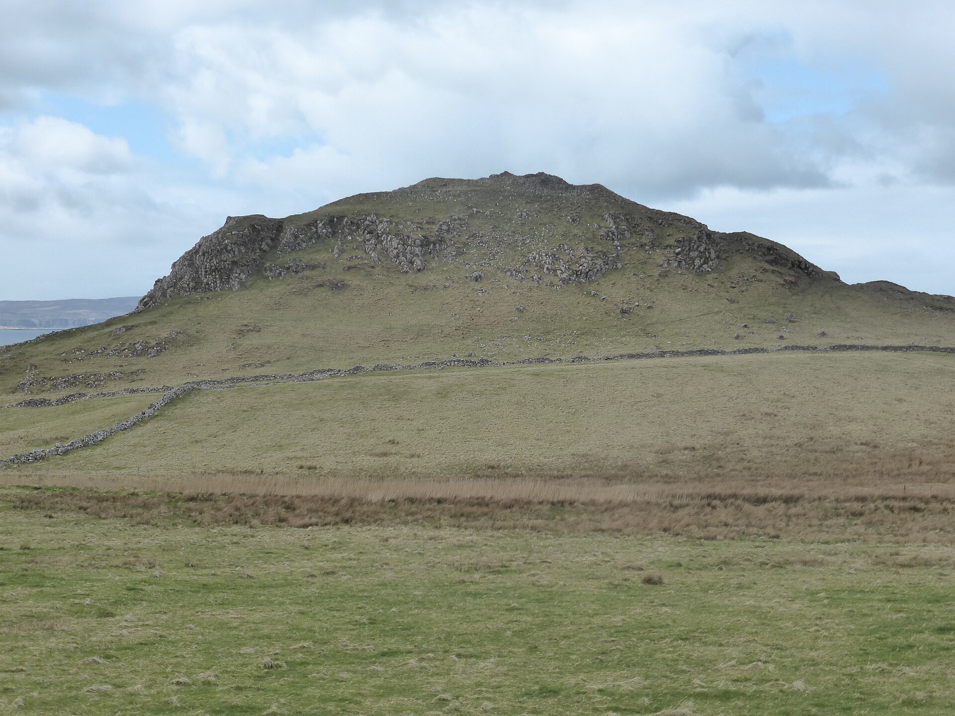
Photo: IBM Ralston / Wikimedia Commons / CC BY-SA 4.0 Both are Iron Age hillforts on Skye, preserving defended enclosures in the island’s prehistoric landscape.
-
Photo: Victuallers / Wikimedia Commons / CC BY-SA 4.0 Both are prehistoric defended sites in Skye’s archaeological landscape, but Dun Cruinn is a hillfort while Dun Beag is a broch; their relationship is comparative rather than institutional.
-
Both are Iron Age monuments on Skye, linking a hillfort with a broch and showing the variety of defended sites in the island’s settlement landscape.
Discovery & excavation
The visible earthworks preserve two construction phases: an earlier hillfort and a later dun or broch built into the ruined southern end of its enclosure.
What to look for
-
The rubble wall band
A thick band of tumbled stone, up to three metres wide, marks the line of the hillfort's original wall and is best preserved along the north side of the knoll.
-
The dividing rampart and ditch
Roughly midway along the fort's length, a rampart and ditch cut across the enclosure, splitting the defended summit into two separate areas.
-
The dun or broch remains
In the southern part of the fort, a later roundhouse structure about 20 metres across survives up to 1.5 metres high, built into the earlier fort's ruins.
Plan your visit
- Location
- 57.4828°N · 6.3214°W
- Nearest settlement
- Dunvegan
- Access
- Open access
- Terrain
- Rough ground — reasonable boots advised
- Time needed
- About 45 minutes
- Best time
- Daylight, for the wall band, dividing ditch and later roundhouse remains.
- What survives
- The hillfort survives as a broad rubble wall band and ditch, with the later roundhouse remaining to about 1.5 metres high.
Opening & admission
- Rocky knoll fort; access not established.
Nearby places
Fortified place · Iron Age
Dun Skudiburgh
Highland
A vitrified (burnt so fiercely that the stone melted and set again) Iron Age (from about 800 BC until the Romans came) fort with a later dun built…
- Near Uig
- Rough ground
Fortified place · Iron Age
Dun Beag
Highland
A countess spent six years hand-sifting its spoil heaps, and coins running from Henry II to George III show this Skye tower stayed in use long afte…
- Near Inverness
- Some walking
Fortified place · Iron Age
Dun Hallin
Highland
Its walls still rise close to four metres, with an intact mural gallery and lintel in place: one of Skye's better-preserved brochs, and one never d…
- Near Hallin
- Some walking

Fortified place · Iron Age
Dun Ardtreck
Highland
A cliff-edge Skye fort twice built and twice destroyed by fire: one of the clearest examples anywhere of the transitional "semi-broch (a tall circu…
- Near Tokavaig
- Rough ground
The setting
Near Dun Cruinn, about 494 metres away.
Photo: John Allan / Wikimedia Commons / CC BY-SA 2.0
Questions people ask
- What is Dun Cruinn?
- A prehistoric fortified site on a rocky knoll on Skye's Skerinish Peninsula, combining an early hillfort with a later dun or broch built within its remains.
- Where is Dun Cruinn?
- On the Skerinish Peninsula on the Isle of Skye, between Loch Snizort Beag and Loch Eyre, about ten kilometres north-west of Portree.
- How big is the fort?
- The enclosure is an irregular oval about 95 metres long and 25 metres wide, covering roughly 0.19 hectares.
- Is the dun the same age as the fort?
- No. The dun, or possible broch, in the fort's southern end was built later, reusing the earlier hillfort's remains rather than a fresh site.
- What can still be seen on site?
- A rubble wall band up to three metres thick, a rampart and ditch dividing the enclosure, and dun remains standing up to 1.5 metres high.
Sources
Explore more: Fortified places · Iron Age · Highland
The Ancient Codex, in your pocket
Get the Pocket Codex app
Carry the directory with you — Dun Cruinn and thousands of ancient places across Britain and Ireland, offline, wherever you roam.