
Fortified place · Iron Age · Highland
Dun Hallin
Its walls still rise close to four metres, with an intact mural gallery and lintel in place — one of Skye's better-preserved brochs, and one never dug into.
On a rocky knoll above a green valley on the Waternish peninsula, a ring of drystone walling still stands almost to head height on two sides. The stone was raised without mortar, course upon course, by people who understood how to make a wall lean inward on itself and hold. Close to the entrance a low stone-roofed passage survives inside the thickness of the wall, and above the ruined doorway a single long lintel stone still spans the gap it was set to bridge, roughly two thousand years after it was lifted into place.
This is a broch, a tall drystone tower unique to Iron Age Scotland, and Dun Hallin is among the better-preserved examples on Skye. Its outer wall measures around 17.4 metres across, enclosing an inner chamber some 10.5 metres in diameter, and a second defensive wall was built around the edge of the knoll itself, still standing to about 6 metres in one stretch. The choice of ground was deliberate: the tower looks out over a fertile valley on one side and the sea on the other, commanding both at once.
No excavation has ever been carried out here. What is known comes from what can still be seen above ground — walls, a gallery, a doorway, a scatter of rubble where the interior once stood open. That absence of digging means the broch’s interior, and whatever it might still hold, remains untouched.
What follows is drawn from published sources, with each claim labelled by how firmly it is established.
History
In the Iron Age, at a date probably not far either side of the year AD 1, a community on Waternish raised a drystone tower on a defensible rocky knoll above the shore, choosing a position that let its builders watch both the fertile valley inland and the sea approach below. The tower's twin walls, tapering inward, and its internal gallery reflect the sophisticated dry-stone engineering shared by broch builders across northern and western Scotland in this period.
At some point after its main occupation the broch was reinforced or supplemented by an additional outer stone wall built around the rim of the knoll itself, a defensive circuit distinct from the tower's own double wall and still standing to around 6 metres in height on its southern stretch, suggesting the site's defensive importance, or the threats it faced, continued or changed over time.
In 1921 the site was examined and six steps of an intra-mural stairway, built within the thickness of the broch wall, were recorded — a rare surviving trace of how people once moved up through the tower's walls. No formal excavation followed, and today those steps are no longer apparent, buried again beneath rubble and turf, leaving the 1921 record as the only account of a feature that has since gone back underground.
Cultural influences
-
Broch defences on a rocky knoll
The double wall, mural gallery and entrance guard cells use broch engineering alongside a separate outer defensive circuit around the knoll.
Connections
-

Photo: Richard Dorrell / Wikimedia Commons / CC BY-SA 2.0 Both are Iron Age brochs on Skye, preserving the regional tradition of stone-built round towers and their associated settlement landscapes.
-

Photo: John Allan / Wikimedia Commons / CC BY-SA 2.0 Both are prehistoric broch sites on Skye, useful as separate examples of the island’s Iron Age tower tradition rather than one shared structure.
-
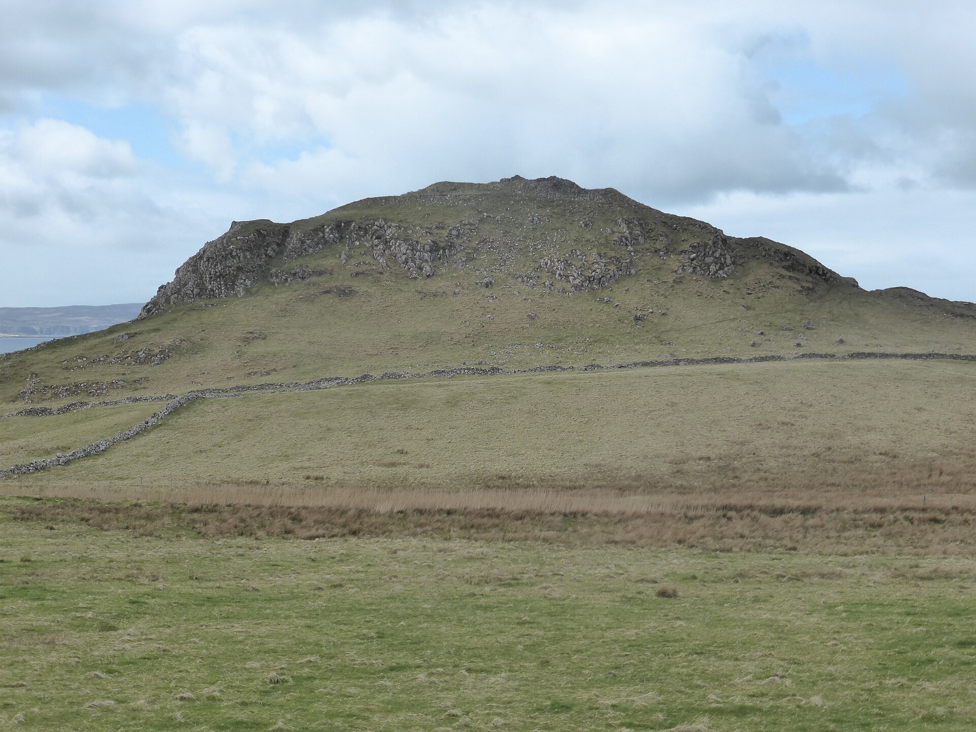
Photo: IBM Ralston / Wikimedia Commons / CC BY-SA 4.0 Both are defended prehistoric sites on Skye, but Dun Hallin is a broch while Dun Skudiburgh is a hillfort; their relationship is comparative rather than institutional.
Discovery & excavation
Dun Hallin has never been formally excavated. The only recorded investigation took place in 1921, when six steps of an intra-mural stairway were noted within the broch wall; that stairway is no longer visible today. Because the interior has not been dug, whatever floor deposits, hearths, or artefacts the broch may still contain remain unexamined.
What to look for
-
The mural gallery and lintel
On the southwest side of the broch a mural gallery, a passage built within the thickness of the double wall, is still visible, and a lintel stone remains in position over a doorway there, spanning the opening much as it did when first set.
-
The guard cells at the entrance
The ruined entrance passage on the southeast side is flanked by oval guard cells built into the wall thickness; only the northern, right-hand cell can easily be made out today.
-
The outer defensive wall
A second stone wall runs around the edge of the rocky knoll the broch stands on, still standing to about 6 metres in height on its southern side, an outer line of defence separate from the broch's own walls.
-
The standing wall height
On its north and west sides the broch wall still reaches a maximum height of 3.8 metres, giving a clear sense of the scale of the original tower even in its ruined state.
Plan your visit
- Location
- 57.5401°N · 6.5862°W
- Nearest settlement
- Hallin
- Access
- Open access
- Terrain
- Moderate walking
- Time needed
- About 45 minutes
- Best time
- Daylight, for the outer wall, gallery and entrance cells.
- What survives
- The broch stands to 3.8 metres in places, and its separate outer wall reaches about six metres on the south; the 1921-recorded stair is no longer visible.
Opening & admission
- Steep-sided rocky plateau near Hallin; source does not state managed access.
Nearby places

Fortified place · Iron Age
Dun Borrafiach
Highland
A drystone tower on Skye's Waternish coast still stands over two and a half metres high, with its internal gallery wall exposed to view along the e…
- Near Halistra
- Rough ground

Fortified place · Iron Age
Dun Fiadhairt
Highland
A double-walled stone tower dating the period from roughly 800 BC to the Roman conquest stands on a loch-side knoll near Dunvegan, excavated in 189…
- Near Dunvegan
- Rough ground
Fortified place · Iron Age
Dun Skudiburgh
Highland
A vitrified (burnt so fiercely that the stone melted and set again) Iron Age (from about 800 BC until the Romans came) fort with a later dun built…
- Near Uig
- Rough ground

Fortified place · Iron Age
Dun Cruinn
Highland
A smaller broch or dun was built inside the ruins of an earlier hillfort on the same rocky knoll: two separate strongholds, one after the other, on…
- Near Dunvegan
- Rough ground
The setting
Road towards Hallin near Dun Hallin; retained as a contextual approach view.
Photo: Richard Dorrell / Wikimedia Commons / CC BY-SA 2.0
Questions people ask
- What is Dun Hallin?
- An Iron Age broch, a tall drystone tower, on the Waternish peninsula of Skye, overlooking a fertile valley and the sea.
- How tall are the walls today?
- The broch wall stands to a maximum height of about 3.8 metres on its north and west sides.
- Has the broch been excavated?
- No. It has never been formally excavated; the only recorded investigation was in 1921, when stairway steps were noted but not fully explored.
- How big is Dun Hallin?
- It has an external diameter of around 17.4 metres and an internal diameter of around 10.5 metres.
- Is there a second wall around the broch?
- Yes, an outer stone wall runs around the rocky knoll's edge and still stands about 6 metres high on its southern side.
Sources
Explore more: Fortified places · Iron Age · Highland
The Ancient Codex, in your pocket
Get the Pocket Codex app
Carry the directory with you — Dun Hallin and thousands of ancient places across Britain and Ireland, offline, wherever you roam.