
A double ring of vitrified (burnt so fiercely that the stone melted and set again) and rebuilt walls crowns a rock between two river valleys, with sightlines reaching all the way to the Moray Firth.
A rocky summit rises sharply between the River Nairn and its tributary the Allt Dearg, and from its top the ground falls away in every direction, opening a view that runs seven miles north-east to where the Nairn meets the sea at the Moray Firth. Whoever chose this hill to fortify was thinking about sightlines as much as slopes: nothing approaches from any quarter without being seen long before it arrives.
The summit itself is ringed by a ruined wall enclosing a space about the length and width of a football pitch, and inside that ring is a second, smaller wall built later from stones lifted out of the first. Down the flanks of the rock, further arcs of walling and earthworks step outward in layers, as if the defences were built up gradually rather than in one campaign. A shallow circular hollow near the summit, likely a well or cistern, hints at how a garrison here might have coped with a siege.
Closer inspection of the stonework in the twentieth century turned up traces of vitrification — walls whose stones had been fused together by intense heat, a phenomenon found at hillforts across Scotland and still not fully explained. Today Historic Environment Scotland lists Dun Evan among sites of national importance, a small hill above Cawdor carrying defences layered thickly enough to reward a careful walk around its ramparts.
What follows is drawn from published sources, with each claim labelled by how firmly it is established.
History
The earliest defences at Dun Evan took the form of a single wall carried right around the summit of the hill, enclosing a space some 58 metres long by 25 metres wide. The stones used in its inner faces were comparatively small, a detail that has led investigators to conclude the wall was originally timber-laced, its rubble core bound together with internal wooden beams in a technique recorded at other early hillforts across Scotland.
At some later point the defenders reduced the size of the fortified summit, building a second wall inside the line of the first and enclosing a smaller area. The builders of this inner phase appear to have quarried much of their stone from the earlier, outer wall rather than sourcing fresh material, effectively cannibalising the first fort to raise the second — a practical shortcut that also shows the site remained in active use across more than one building phase.
Beyond the summit, builders added a further tier of defences reaching down the flanks of the rock: an arc of ruined walling and earthworks about 55 metres long to the south-west, and a similar arc of about 40 metres to the north-east. Within the north-east arc a separate defensive wall was raised, running roughly 18 metres back toward the southern point of the rock and linked to the outer arc by two parallel stretches of walling spaced several metres apart, together forming a rectilinear plan that may mark the footprint of a building or a set of reinforcing cross-walls built on a heavier scale than the rest of the fort.
In 1957 a survey of the outer defences measured the surviving height of the wall within the north-east arc at up to 4.3 metres, an unusually tall remnant for an Iron Age hillfort and a sign of how substantial the original construction must have been before centuries of collapse and stone-robbing reduced most of the site to low banks and rubble spreads.
A further examination in 1963 recorded facing stones still in position along the summit wall and identified traces of vitrification in its structure, along with a dip in the wall's north-eastern circuit interpreted as the position of the original entrance. These findings, combined with the extent and complexity of the surviving earthworks, underpin Dun Evan's current status as a hillfort scheduled by Historic Environment Scotland as a monument of national importance.
Cultural influences
-
Timber-laced hillfort construction
The small facing stones and vitrification traces point to a timber-laced rampart, a construction method shared with other early Scottish hillforts.
Connections
-

Photo: neil / Wikimedia Commons / CC BY-SA 2.0 Both are prehistoric hillforts in the Highland landscape, preserving defended enclosures on elevated ground.
-
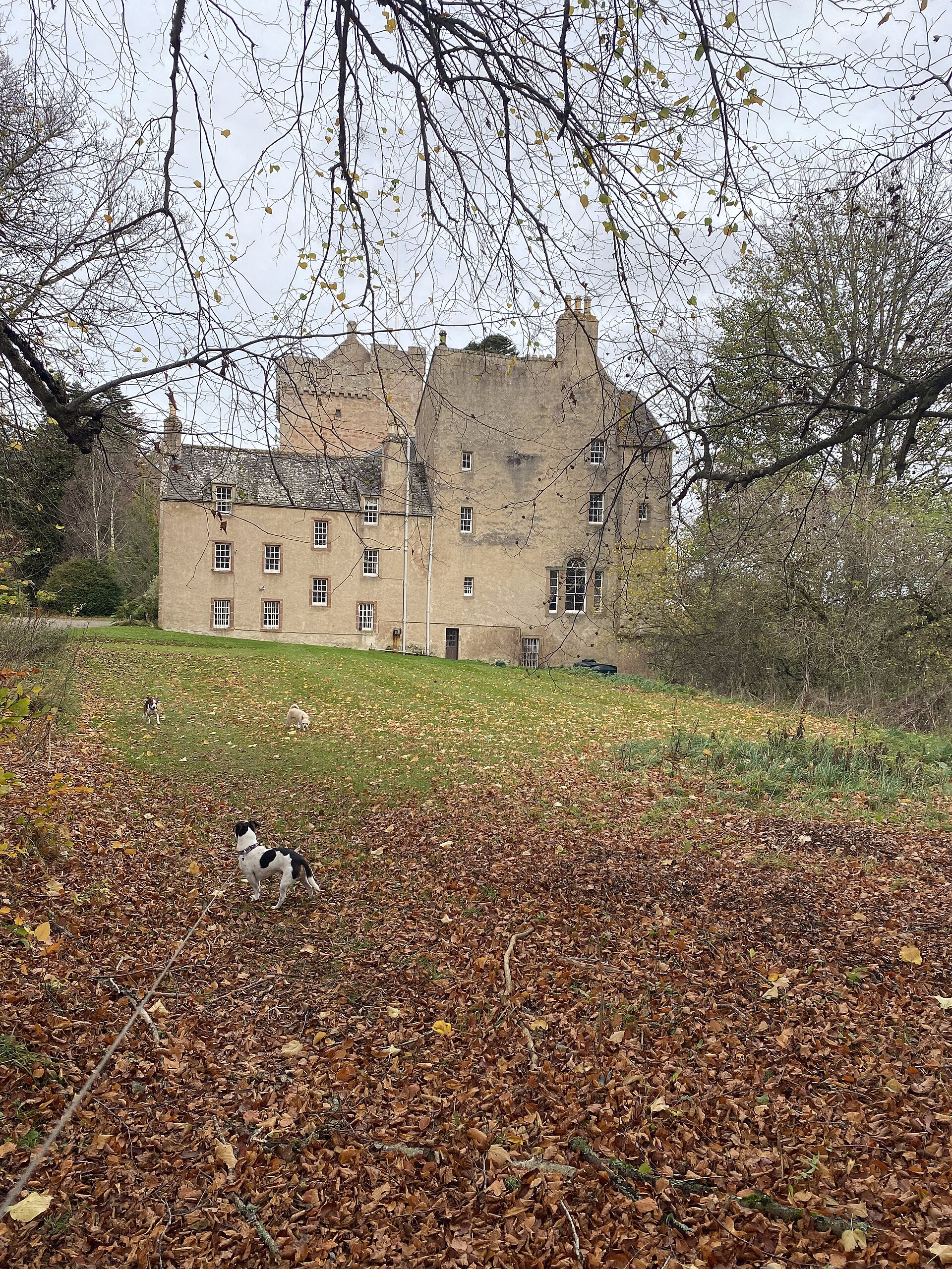
Photo: thejackrustles / Wikimedia Commons / CC BY-SA 2.0 Both are historic landmarks in the Nairn and Cawdor landscape, but Dun Evan is a prehistoric hillfort while the Kilravock dovecote belongs to a later estate.
-

Photo: Lesbardd / Wikimedia Commons / CC BY-SA 4.0 Both are defended or fortified sites in the Cawdor area, linking Dun Evan’s prehistoric enclosure with the later tower-house tradition at Cawdor Castle.
Discovery & excavation
Investigations in 1957 and 1963 documented the surviving structure in detail: the 1957 survey measured the outer defensive wall's height, while the 1963 examination recorded facing stones and vitrification traces in the summit wall and identified the likely entrance from a dip in its north-eastern circuit.
What to look for
-
The summit wall and entrance
A ruined wall rings the hilltop, enclosing an area roughly 58 by 25 metres; a dip along its north-eastern stretch marks where the original entrance is thought to have stood.
-
The inner, second-phase wall
A smaller wall sits inside the line of the first, built largely from stone taken from the outer fortification during a later phase of use.
-
The well or cistern
A circular depression about 3.5 metres across and 0.6 metres deep within the fort is interpreted as a well or cistern for water storage.
-
The outer arcs and tall wall section
Lower down the flanks of the rock, two arcs of ruined walling and earthworks survive, including a wall section within the north-east arc whose height was measured at up to 4.3 metres in 1957.
-
The panoramic outlook
From the summit the view extends across the valleys of the Nairn and the Allt Dearg and as far as the Moray Firth near Nairn, seven miles to the north-east.
Plan your visit
- Location
- 57.5030°N · 3.9581°W
- Nearest settlement
- Cawdor
- Access
- Open access
- Terrain
- Moderate walking
- Time needed
- About 60 minutes
- Best time
- Daylight, for the summit defences and the valley outlook.
- What survives
- The summit and lower defensive arcs survive as ruined walls and earthworks, including a north-east section measured at 4.3 metres high.
Opening & admission
- Rocky hillfort south-west of Cawdor; source confirms setting but not access rights.
Nearby places
Minor monument · Medieval
Dovecot, Kilravock Castle
Highland
Kilravock’s pigeon house, built to keep birds for winter meat, makes the estate’s long-running economy tangible within a building altered from medi…
- Near Cawdor

Fortified place · Medieval
Cawdor Castle
Highland
A tower house said to have been built around a living holly tree, its site chosen by tradition after a gold-laden donkey lay down to rest beneath it.

Tomb or burial place · Prehistoric
Clava cairn
Highland
A burial mound of piled stones at Balnuaran of Clava, whose kerb stones were sorted by colour before they were laid.
- Near Inverness
- Some walking
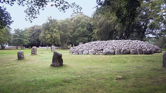
Tomb or burial place · Prehistoric
Clava Cairns
Highland
Clava’s planned arrangement of cairns and standing stones offers rare evidence of a single communal decision about burial and remembrance, rather t…
- Near Inverness
- 149 metres from car park
- Easy path
The setting
Near Dun Evan, about 51 metres away.
Photo: valenta / Wikimedia Commons / CC BY-SA 2.0
Near Dun Evan, about 408 metres away.
Photo: Steven Brown / Wikimedia Commons / CC BY-SA 2.0
Questions people ask
- What is Dun Evan?
- Dun Evan, also known as the Doune of Cawdor, is a hillfort on a rocky summit southwest of Cawdor in Highland, Scotland, scheduled as a nationally important monument.
- How big is the fort at Dun Evan?
- The main summit wall encloses an area about 58 metres by 25 metres, with further outer defensive arcs extending down the flanks of the hill.
- Was Dun Evan built in more than one phase?
- Yes. A later, smaller inner wall was built partly from stone taken from the earlier outer wall, showing at least two phases of construction.
- What is vitrification and was it found at Dun Evan?
- Vitrification is fusing of stone by intense heat, sometimes seen in ancient hillfort walls. A 1963 survey recorded traces of it in the summit wall at Dun Evan.
- What can visitors see inside the fort today?
- The summit wall, its inner second-phase wall, a circular depression thought to be a well or cistern, and outer defensive arcs on the hill's flanks.
Sources
- Wikipedia: Dun Evan
- Historic Environment Scotland
Explore more: Fortified places · Iron Age · Highland
The Ancient Codex, in your pocket
Get the Pocket Codex app
Carry the directory with you — Dun Evan and thousands of ancient places across Britain and Ireland, offline, wherever you roam.