
Its summit fort at Mither Tap has stone ramparts with none of the vitrification seen at other Aberdeenshire hillforts, and the hill has been floated as a possible site of the Battle of Mons Graupius.
Mither Tap crowns Bennachie with a rough granite knob visible across Aberdeenshire. Its summit walls enclose an Iron Age hillfort, a defended hilltop settlement dating from the centuries before Rome arrived, from about 800 BC; the peak is modest by Scottish standards, yet its isolation above the flatter landscape makes it visible from towns and low hills far to the north and east.
The fort’s builders raised their rampart without turning to the fire-fused stonework, called vitrification, that scars the walls of many neighbouring hillforts, leaving Mither Tap’s defences built by a different method than its regional counterparts. Centuries later, antiquarian and academic excavators have returned to the summit more than once, drawn by the fort’s scale and by the possibility, still unproven, that the surrounding landscape once hosted the Roman army’s clash with northern tribes at the Battle of Mons Graupius.
Below the fort, the hill’s lower slopes carry a different kind of history. In the early nineteenth century, squatter families built a crofting community known as the Colony on Bennachie’s common land, clearing and working smallholdings alongside quarrying and dyking for the estates around them; their traces, along with a name whose own meaning has never been settled, are ones the hill still keeps.
What follows is drawn from published sources, with each claim labelled by how firmly it is established.
The name
The origin of the name Bennachie is uncertain. One suggestion derives it from the Gaelic Beinn a Cioch, the hill of the nipple or pap, describing the shape of its profile. Another reading translates it as the Mountain of Ce, after Ce, a king named in the list of legendary kings of Pictland.
History
.jpg?width=1000)
During the Iron Age, hillfort builders chose the granite tor of Mither Tap for a defensive summit enclosure, ringing its rocky crown with a stone rampart. Unlike many other hilltop forts in the surrounding country, the walls at Mither Tap show no trace of vitrification, the intense heat-fusing of stone seen at nearby forts, leaving its construction technique distinct from its neighbours in the region.
From 1800 until 1859, a community of squatters known as the Colony settled the common land on the eastern side of Bennachie. Families led a crofting life, combining smallholdings with skilled trades such as dyking and quarrying carried out for local landowners. After 1859 the common land was broken up and divided among neighbouring estates, and the Colony gradually dwindled as families dispersed to other parts of the parish.
In the 1870s the early Scottish archaeologist Christian Maclagan turned her attention to Mither Tap, surveying the hillfort and conducting excavations there in 1876 and 1881. Her work was among the first systematic investigations of the site, recording the fort's defences at a time when few Scottish hillforts had been studied in comparable detail by any researcher, let alone a woman working in the field.
George Esson, the last of the original Colony settlers, remained living on the hill long after the community around him had broken up, dying only in the 1930s. His long tenure preserved a direct, lived link to the crofting settlement for more than seventy years after its common land was first divided among the surrounding estates and the rest of the Colony had dispersed.
In 1973 a group of local volunteers founded the Bailies of Bennachie, a conservation charity dedicated to looking after the hill's paths, environment and archaeological remains. The organisation has since worked alongside Forestry and Land Scotland, which owns and manages most of the range, to maintain the network of trails, car parks and the visitor centre at its eastern foot.
In 2019 the University of Aberdeen's Northern Picts Project returned to Mither Tap to carry out a fresh excavation, more than a century after Maclagan's original digs there. The renewed investigation reflected continuing academic interest in the fort's origins and its possible place within the wider story of Pictish-period settlement in northern Scotland.
In 2023 the Bailies of Bennachie were recognised for their decades of work when they received the Community Initiative Award at RSPB Scotland's Nature of Scotland Awards. The award marked fifty years of volunteer effort maintaining the hill's paths and safeguarding its archaeological and natural heritage for the many walkers who visit each year.
People
-
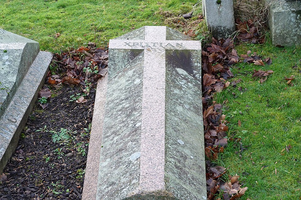
Portrait: Stirlingdigger / Wikimedia Commons / CC BY-SA 4.0 Christian Maclagan
An early Scottish archaeologist who surveyed Mither Tap and excavated the hillfort there in 1876 and 1881.
-
George Esson
The last of the original Colony settlers, who continued living on Bennachie until his death in the 1930s.
Connections
-
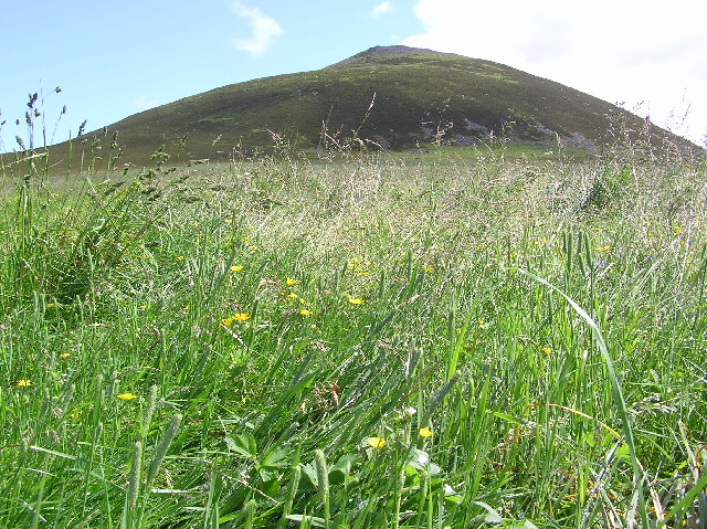
Photo: Steve Reid / Wikimedia Commons / CC BY-SA 2.0 A nearby Pictish-era hillfort in Aberdeenshire, grouped alongside Mither Tap among the region's notable hilltop forts.
-
University of Aberdeen Northern Picts Project
Carried out an excavation at Mither Tap in 2019 as part of its wider research into Pictish-period sites in northern Scotland.
-
Battle of Mons Graupius
Mither Tap has been proposed as a possible location for this Roman-era battle, though the true site of the battle remains unidentified.
Discovery & excavation
The hillfort at Mither Tap was first investigated by the pioneering Scottish archaeologist Christian Maclagan, who surveyed and excavated the site in 1876 and 1881. Renewed excavation followed in 2019, when the University of Aberdeen's Northern Picts Project examined the fort as part of its research into Pictish-period Scotland.
In culture
-
The Goddess in the Landscape of Scotland
The writer Stuart McHardy discusses Bennachie's breast-shaped profile and its associated place-name lore in this study of goddess symbolism in the Scottish landscape.
What to look for
-
Mither Tap hillfort ramparts
The Iron Age stone ramparts encircling the granite tor of Mither Tap remain visible at the summit, notable for showing no vitrification, the fused stonework typical of many other regional forts.
-
The Colony remains
Scattered foundations and field boundaries on the hill's eastern common land mark the site of the Colony, the crofting settlement occupied between 1800 and 1859.
-
Oxen Craig summit
At 528 metres, Oxen Craig is the highest point on the Bennachie ridge, reached by marked paths from the visitor centre at the range's eastern foot.
-
The Gordon Way
This waymarked trail runs along Bennachie's southern flank between the visitor centre and Suie Car Park to the west, one of several paths maintained across the range.
What is said
Folklore and tradition, recorded as what is said — not as established fact.
-
The Mountain of Ce
Place-name scholarship has suggested that Bennachie's name may commemorate Ce, a king listed among the legendary kings of Pictland, making the hill, on this reading, a mountain named for a ruler of old.
Plan your visit
- Location
- 57.2927°N · 2.5624°W
- Access
- Reached on a public path
- Terrain
- Moderate walking
- Time needed
- About 180 minutes
Opening & admission
Free to visit; check the managing body's site for current path and parking details.
- Marked paths from the visitor centre offer a fairly easy ascent to Mither Tap and Oxen Craig
- Several car parks and a visitor centre at the eastern foot of the range
Nearby places
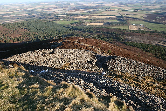
Fortified place · Iron Age
Mither Tap hillfort
Aberdeenshire
Excavation found an intact crucible and iron slag inside the ramparts: proof this granite summit was a working metalworking centre, not just a look…
- Rough ground
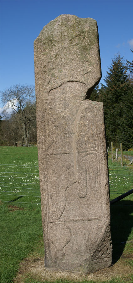
Carved stone · Pictish & early medieval
Maiden Stone
Aberdeenshire
A slab of red granite standing some three metres high, carved on every face with Christian crosses, Pictish beasts and a legend of the Devil's forf…
- Near Inverurie
- Easy path
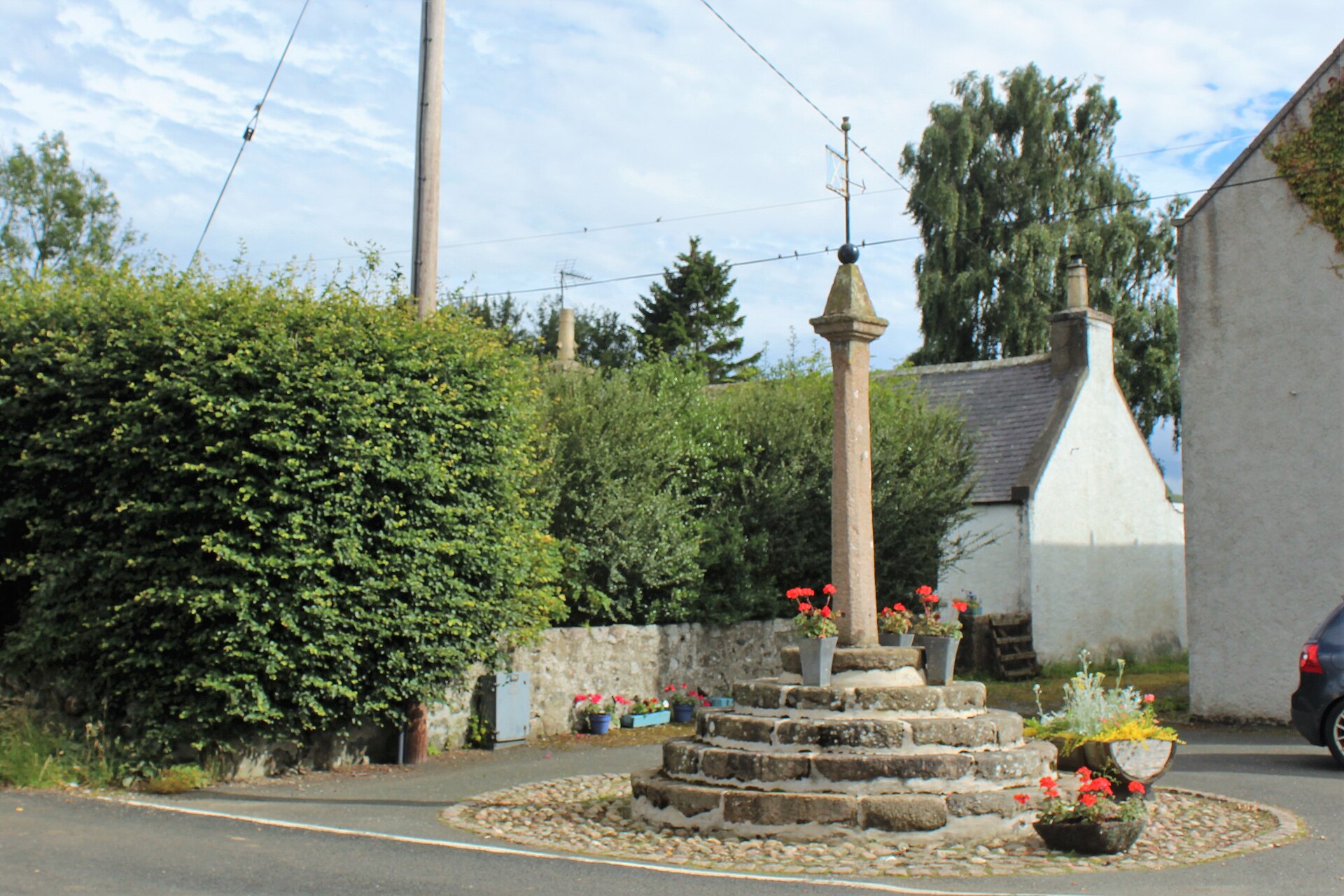
Minor monument · Medieval
Market Cross, Old Rayne
Aberdeenshire
A granite market cross on five circular steps preserves Old Rayne’s status as a burgh of barony created in 1492.
- Easy path
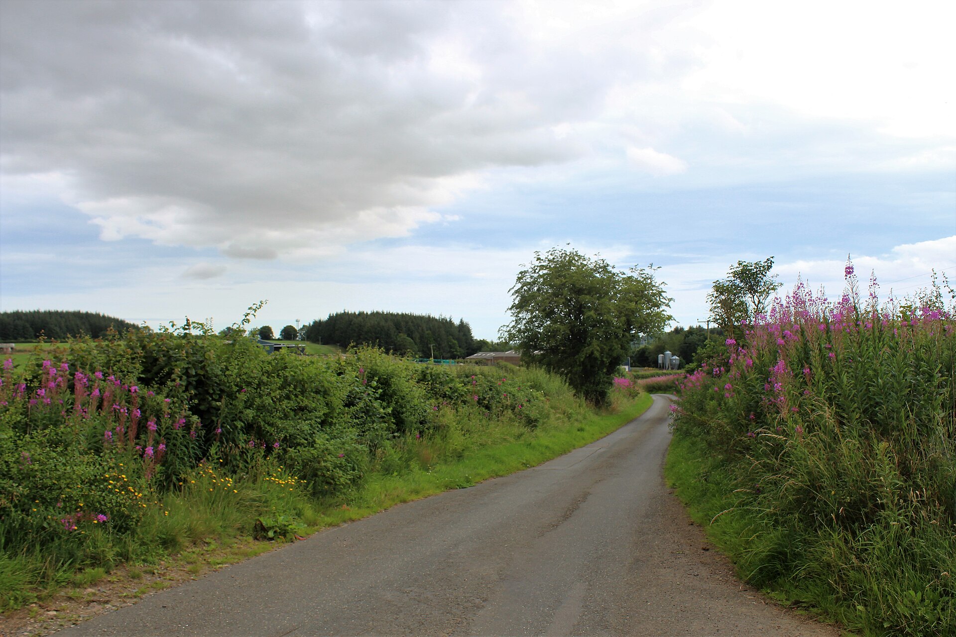
Fortified place · Roman
Durno
Aberdeenshire
The largest Roman marching camp yet found north of the Antonine Wall, revealed only by a chance aerial photograph after two millennia buried beneat…
- Near Inverurie
- Easy path
Questions people ask
- What is Mither Tap?
- Mither Tap is the most visually striking peak of the Bennachie range, topped by an Iron Age hillfort whose stone ramparts show no sign of vitrification.
- What does the name Bennachie mean?
- The origin is uncertain; suggestions include "hill of the nipple" from Gaelic Beinn a Cioch, or a name honouring Ce, a legendary Pictish king.
- What was the Colony at Bennachie?
- The Colony was a community of squatter-crofters who settled Bennachie's common land between 1800 and 1859, doing skilled work such as dyking and quarrying for local landowners.
- Who has excavated Mither Tap?
- Christian Maclagan excavated the hillfort in 1876 and 1881; the University of Aberdeen's Northern Picts Project carried out further excavation in 2019.
- Who looks after Bennachie today?
- Forestry and Land Scotland manages most of the range's paths and visitor facilities, supported by the volunteer Bailies of Bennachie, founded in 1973.
Sources
- Wikipedia: Bennachie
- Wikidata: Bennachie
- Bailies of Bennachie
- Stuart McHardy — The Goddess in the Landscape of Scotland
Explore more: Fortified places · Iron Age · Aberdeenshire
The Ancient Codex, in your pocket
Get the Pocket Codex app
Carry the directory with you — Bennachie and thousands of ancient places across Britain and Ireland, offline, wherever you roam.