
Excavation found an intact crucible and iron slag inside the ramparts — proof this granite summit was a working metalworking centre, not just a lookout.
From the valley floor, the granite tor of Mither Tap looks almost too steep to build on, its bare rock crown rising above the wooded slopes of the Bennachie range. Yet a stone rampart (an encircling bank built for defence) still runs around that summit, and a second, larger wall loops the slope below it, enclosing terraced platforms where roundhouses once stood. Much of the stonework has slumped and spread downhill over the centuries, but the two rampart lines remain easy to trace on foot, wrapping the hill like a pair of contour rings.
What excavation has shown is that this was never a simple lookout post. Inside the walls, archaeologists have found the base of a stone-lined well with steps built into the rampart itself, a cobbled floor surface, and — more strikingly — a crucible, fragments of iron, and slag, the debris of metal being worked on the spot. Animal bone, fish bone and even a gaming piece turned up alongside them, the ordinary residue of people living, eating and passing time inside the fort.
Radiocarbon dates place that occupation squarely in the Pictish period, between the 4th and 8th centuries AD, when this corner of Aberdeenshire lay within the territory later sources call Cé. Combined with the scale of the defences and the evidence of craft production, the fort looks less like a refuge and more like a seat of local power — a place from which someone controlled the surrounding land.
What follows is drawn from published sources, with each claim labelled by how firmly it is established.
The name
Some scholars derive the hill-range name 'Bennachie' from Benne Cé, meaning 'mountain of Cé', linking it to the Pictish territory of Cé thought to have covered this part of Aberdeenshire. Others instead trace it to the Gaelic Beinn na Cìche, 'hill of the breast', a description of the summit's distinctive rounded shape as seen from a distance.
History
The ramparts on Mither Tap most likely began in prehistory, long before the fort took the form visible today, but radiocarbon dating shows the site was intensively used during the early medieval Pictish period. Charcoal recovered from an internal building deposit near the entrance produced dates of AD 340–540 and AD 640–780, confirming occupation across several centuries in which this part of Aberdeenshire lay within Pictish territory.
In the 1870s the archaeologist Christian Maclagan carried out one of the earliest formal investigations of the fort, walking and recording its ramparts and internal features by eye. She published a detailed plan in 1881 that mapped the upper and lower ramparts together with possible round structures in both citadels, and marked the position of a well in the lower enclosure — a record that would guide excavators working on the site more than a century later.
In 2007 a watching brief accompanied the construction of a new path near the fort's entrance, funded by Forestry Commission Scotland and carried out by the archaeologist Dan Atkinson. Two stone blocks were found crossing the line of the new path, sitting above a compact spread of cobbles; beneath these a small excavated sondage reached a gravelly-silt surface directly on bedrock, interpreted as the floor of a building, possibly one of the roundhouses Maclagan had earlier suggested.
Oak charcoal recovered from that floor deposit during the 2007 work was radiocarbon-dated to AD 340–540 and AD 640–780, the first scientific confirmation that people were living inside the fort during the Pictish period. A loose concentration of heat-affected but unvitrified stones found nearby was read as collapsed rubble from a hearth or structure rather than evidence of the fort itself having been burned.
In June 2019 the Northern Picts project, based at the University of Aberdeen, opened seven trenches across the fort in its first large-scale scientific excavation. On the outer rampart, a raised building platform built from granite slabs on rubble mounds was uncovered alongside a midden containing cattle, sheep and fish bone, while a separate trench confirmed Maclagan's well as a stone-lined shaft with steps keyed into the rampart and traces of a clay waterproof lining.
A trench on the south-east side, previously assumed to sit over part of the outer defensive bank, instead produced stonework that the excavators suspected belonged to a sub-rectangular building rather than a rampart, though they judged that larger trenches would be needed to settle the question. From within the same area came fragments of iron, an intact crucible and slag, together with handmade pottery — direct evidence of metalworking carried out inside the fort.
Further trenches in the upper citadel and on the central tor recovered animal bone, teeth, charcoal and a gaming piece from occupation layers, alongside repeated pockets of heat-affected soil marking where fires had been lit again and again in the same spots. Taken with the metalworking debris, these finds have led archaeologists to see Mither Tap as a regional centre of the Pictish territory of Cé, and possibly a hub for elite or ceremonial activity rather than a purely defensive stronghold.
People
-
Christian Maclagan
19th-century archaeologist who surveyed the fort in the 1870s and published a detailed plan of its ramparts and internal features in 1881.
-
Dan Atkinson
Archaeologist who carried out the 2007 watching brief during path construction near the fort's entrance, funded by Forestry Commission Scotland.
Connections
-
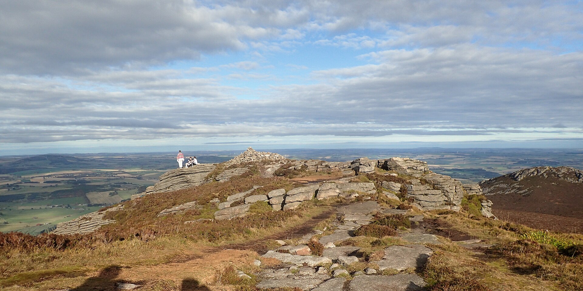
Photo: Andy Waddington / Wikimedia Commons / CC BY-SA 2.0 Mither Tap is the second-highest summit of the Bennachie range and takes its hillfort's setting, and possibly part of its name, from the wider hill range.
-
Northern Picts project, University of Aberdeen
This university research project carried out the first large-scale scientific excavation of the fort in 2019, opening seven trenches across the site.
-
Picts
Occupation of the fort during the 4th to 8th centuries AD falls within the Pictish period, and the site is interpreted as a possible regional centre of the Pictish territory of Cé.
Discovery & excavation
The fort's first detailed archaeological record was made in the 1870s by Christian Maclagan, whose 1881 published plan mapped the ramparts and citadels. Scientific excavation followed much later: a 2007 watching brief during path building produced the first radiocarbon dates for the site, and in 2019 the Northern Picts project opened seven trenches, recovering evidence of buildings, a well, and on-site metalworking.
What to look for
-
Inner and outer ramparts
Two stone rampart lines are still traceable around the hill: an inner wall hugging the summit outcrop, and a larger outer wall lower on the slope, its collapsed stonework spread downhill but its course still clear underfoot.
-
The northeast entrance passage
A long, stone-lined entrance passage on the northeast side marks the fort's main approach, thought to have been reinforced with additional outer defences.
-
Terraced building platforms
Levelled platforms cut into the hillside show where circular and rectangular structures, likely roundhouses, once stood inside the ramparts.
-
The lower citadel well
A stone-lined well with steps built into the rampart survives in the lower citadel, first recorded by Christian Maclagan in the 19th century and confirmed by excavation in 2019.
Plan your visit
- Location
- 57.2910°N · 2.5287°W
- Access
- Reached on a public path
- Terrain
- Rough ground — reasonable boots advised
- Time needed
- About 120 minutes
Opening & admission
No admission is charged; check current path and access conditions with the local land manager before visiting.
- Reached via a hillside path to the summit outcrop of Mither Tap in the Bennachie range
- Terrain is steep and rocky, crossing granite outcrops and uneven rampart lines
- No visitor facilities are recorded at the site itself
Nearby places
Fortified place · Iron Age
Bennachie
Aberdeenshire
Its summit fort at Mither Tap has stone ramparts with none of the vitrification seen at other Aberdeenshire hillforts, and the hill has been floate…
- Some walking
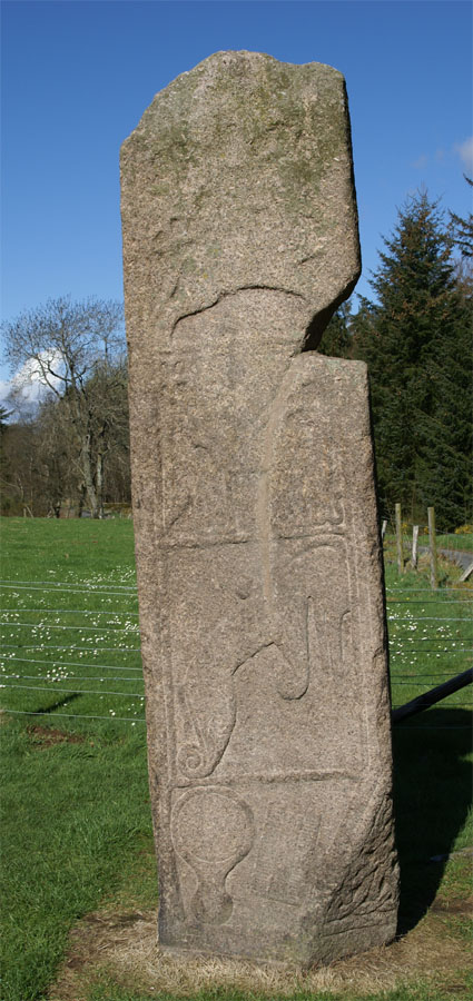
Carved stone · Pictish & early medieval
Maiden Stone
Aberdeenshire
A slab of red granite standing some three metres high, carved on every face with Christian crosses, Pictish beasts and a legend of the Devil's forf…
- Near Inverurie
- Easy path
Fortified place · Roman
Durno
Aberdeenshire
The largest Roman marching camp yet found north of the Antonine Wall, revealed only by a chance aerial photograph after two millennia buried beneat…
- Near Inverurie
- Easy path

Sacred place · Prehistoric
Easter Aquhorthies stone circle
Aberdeenshire
One of Scotland's best-preserved recumbent stone circles, and the only one where every stone still stands exactly where its Bronze Age (roughly 250…
- Easy path
Questions people ask
- What is Mither Tap hillfort?
- A prehistoric stone-walled fort on the summit of Mither Tap, a granite outcrop on the Bennachie range in Aberdeenshire, later occupied during the Pictish period.
- When was the fort occupied?
- Radiocarbon dating shows occupation between the 4th and 8th centuries AD, during the early medieval Pictish period, though the ramparts may originate earlier in prehistory.
- What have excavations found inside the fort?
- A stone-lined well, building platforms, animal and fish bone, a gaming piece, and metalworking debris including an intact crucible, iron fragments and slag.
- Who first surveyed the fort?
- Christian Maclagan surveyed the site in the 1870s and published a detailed plan of its ramparts and citadels in 1881.
- Why is Mither Tap considered significant?
- Its scale, defences and metalworking evidence suggest it was a regional power centre in the Pictish territory of Cé, not just a defensive site.
Sources
The Ancient Codex, in your pocket
Get the Pocket Codex app
Carry the directory with you — Mither Tap hillfort and thousands of ancient places across Britain and Ireland, offline, wherever you roam.