
Snabrough Broch sits on a short, low promontory on the shore of Snabrough Loch, on the island of Unst in Shetland, its ruined wall now measuring around 18 metres across at the outside face. The site lies south of Burragarth and about half a kilometre east of Bluemull Sound, with rolling cultivable land closing in around it to the north. Little of the tower now stands proud of the ground, but on the southeast side traces of both the inner and outer faces of the broch wall can still be made out, giving a sense of the thickness of the original structure.
Snabrough Broch sits on a short, low promontory on the shore of Snabrough Loch, on the island of Unst in Shetland, its ruined wall now measuring around 18 metres across at the outside face. The site lies south of Burragarth and about half a kilometre east of Bluemull Sound, with rolling cultivable land closing in around it to the north. Little of the tower now stands proud of the ground, but on the southeast side traces of both the inner and outer faces of the broch wall can still be made out, giving a sense of the thickness of the original structure.
The entrance, on the northwest side of the broch, is now choked with debris and cannot be entered. On the landward side, facing away from the loch, an outer wall or rampart with an accompanying ditch once curved across the neck of the promontory, cutting the broch off from the surrounding land and adding a further line of defence to the site. Between this outer wall and the broch itself there may once have been a scatter of associated out-buildings, though little of them is now visible above ground.
What follows is drawn from published sources, with each claim labelled by how firmly it is established.
History
In the 18th century the antiquarian George Low visited Snabrough Broch and recorded seeing "large hollow apartments ... following the curve of the wall" within the structure, a description of intramural galleries or chambers that are no longer visible today, having since collapsed or become buried in rubble.
People
-
George Low
18th-century antiquarian who visited the broch and recorded a description of internal hollow apartments following the curve of the wall, features no longer visible at the site.
Connections
-

Photo: Van de Beek / Wikimedia Commons / CC BY-SA 3.0 Another broch recorded by George Low, whose observations at both sites help document Shetland’s broch tradition.
-
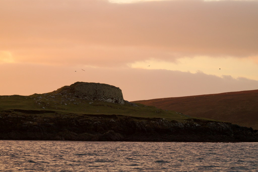
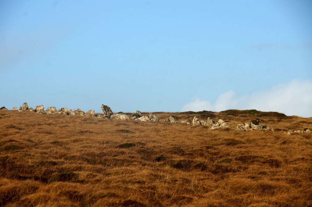
Photo: Mike Pennington / Wikimedia Commons / CC BY-SA 2.0 Another Iron Age broch on Shetland, useful for comparison with Snabrough’s promontory setting.
-

Photo: Van de Beek / Wikimedia Commons / CC BY-SA 3.0 A later Shetland tower house, representing a later phase of fortified settlement than the broch.
Discovery & excavation
The fullest early account of Snabrough Broch's interior comes from the 18th-century antiquarian George Low, who described "large hollow apartments ... following the curve of the wall" during his visit. These intramural features, likely galleries built within the thickness of the broch wall, have since disappeared from view, making Low's record the only surviving description of that part of the structure.
What to look for
-
Inner and outer wall faces
On the southeast side of the ruin, traces of both the inner and outer faces of the broch wall remain visible, giving an impression of the original wall's thickness.
-
Debris-choked entrance
The broch's entrance, on the northwest side, survives but is filled with debris, so its full form cannot be traced at ground level.
-
Outer rampart and ditch
On the landward side, an outer wall or rampart accompanied by a ditch curves across the neck of the promontory, forming an outer line of defence separate from the broch wall itself.
-
Possible out-buildings
The space between the outer rampart and the broch may once have held subsidiary out-buildings, though these are now only faintly traceable.
Plan your visit
- Location
- 60.7034°N · 0.9613°W
- Access
- Open access
- Terrain
- Moderate walking
- Time needed
- About 45 minutes
Nearby places

Fortified place · Medieval
Muness Castle
Shetland Islands
The most northerly fortified house in the British Isles: burnt by privateers in 1627 after less than thirty years of use, and its top floor later b…
Fortified place · Iron Age
Burra Ness Broch
Shetland Islands
On the tip of the headland of Burra Ness, on the east coast of Yell in Shetland, the drystone wall of a round tower still rises over four metres on…
- Some walking
Fortified place · Prehistoric
Funzie Girt
Shetland Islands
A stone wall over four kilometres long once ran the full north-south length of Fetlar, splitting the Shetland island into two almost equal halves.…
- Easy path
Sacred place · Prehistoric
Haltadans
Shetland Islands
Thirty-eight stones once ringed this patch of ground on Fetlar, Shetland; twenty-two of them still stand fixed in the soil, describing a circle ele…
- Easy path
The setting
Ruined crofthouse beside the Loch of Snabrough, near the broch on Unst.
Photo: Mike Pennington / Wikimedia Commons / CC BY-SA 2.0
Rocky coastline at Snabrough on Unst, near the broch’s lochside promontory.
Photo: Mike Pennington / Wikimedia Commons / CC BY-SA 2.0
Coast north of Brei Geo at Snabrough, the wider setting of the broch on Unst.
Photo: Mike Pennington / Wikimedia Commons / CC BY-SA 2.0
Questions people ask
- Where is Snabrough Broch?
- Snabrough Broch stands on Unst, Shetland, on a low promontory overlooking Snabrough Loch, south of Burragarth and about 0.5 kilometres east of Bluemull Sound.
- How big is Snabrough Broch?
- The broch has an external diameter of around 18 metres (60 feet), though little of its structure now stands above ground.
- Can visitors go inside Snabrough Broch?
- No. The entrance, on the northwest side of the broch, is filled with debris and cannot be entered.
- What did George Low record about the broch?
- Visiting in the 18th century, the antiquarian George Low noted "large hollow apartments ... following the curve of the wall" inside the broch, features that are no longer visible today.
- Are there other structures around the broch?
- On the landward side there was an outer wall or rampart with a ditch curving across the neck of the promontory, and there may have been out-buildings between this outer wall and the broch itself.
Sources
- Snabrough Broch — Wikipedia
- Snabrough Broch — Wikidata
- Media related to Snabrough Broch at Wikimedia Commons
Explore more: Fortified places · Iron Age · Shetland Islands
The Ancient Codex, in your pocket
Get the Pocket Codex app
Carry the directory with you — Snabrough broch and thousands of ancient places across Britain and Ireland, offline, wherever you roam.