
A stone wall over four kilometres long once ran the full north-south length of Fetlar, splitting the Shetland island into two almost equal halves. Known as Funzie Girt — in Scots, Funyie Girt, "Finns' dyke" — the line begins at the cliffs of Muckle Funziegord Geo on the north shore, and where it survives it remains a conspicuous feature of the uninhabited northern half of the island, though the southern stretches have largely vanished. Originally about a metre wide, it was built from local stone, with the largest slabs and boulders set on end or on edge to form its base.
A stone wall over four kilometres long once ran the full north-south length of Fetlar, splitting the Shetland island into two almost equal halves. Known as Funzie Girt — in Scots, Funyie Girt, “Finns’ dyke” — the line begins at the cliffs of Muckle Funziegord Geo on the north shore, and where it survives it remains a conspicuous feature of the uninhabited northern half of the island, though the southern stretches have largely vanished. Originally about a metre wide, it was built from local stone, with the largest slabs and boulders set on end or on edge to form its base.
No one knows for certain when it was raised. Some authoritative sources place it in the Neolithic, though a Bronze Age date has also been suggested, and one writer has speculated it could even be Mesolithic; because Shetland’s Neolithic and Bronze Age are hard to distinguish archaeologically, a date before the 1st millennium BC is considered likely. Its purpose is equally uncertain — most probably a territorial boundary of some kind, though its scale seems out of proportion to the population Shetland could plausibly have supported at the time, prompting one description of it as a “Bronze Age Berlin Wall” that may have separated two competing tribes.
The dyke has left its mark beyond archaeology. It gave rise to local legends about troll builders and disputed land, and to at least two pieces of Shetland fiddle music, while its northern section has stood under legal protection as a scheduled monument since December 1957.
What follows is drawn from published sources, with each claim labelled by how firmly it is established.
The name
"Funzie Girt" translates as "Finns' dyke": the Finns were the legendary pre-Norse inhabitants of Shetland, said to have possessed magical powers, though the Iron Age population was in fact Pictish (the historical record for this period is fairly sparse). The spelling shift from "Finn" to "Funzie" reflects a widespread confusion between the old letter ȝ (yogh) and the cursive form of z. An earlier form of the name was simply "Finnigord"; since "gord" already means "dyke", the commonly used variant "Finnigirt dyke" is strictly tautologous. The dyke may also have shaped the name of Fetlar itself. Its division of the island was so pronounced that Norse settlers treated Fetlar as two separate islands, calling them "Est Isle" and "Wast Isle". Haswell-Smith (2004) proposed that "Fetlar" derives from the Old Norse fetill, "strap" or "tie", meaning "two islands tied together" by the dyke. Gammeltoft (2010) disputed this, arguing that fetlar instead means "shoulder-straps" — an unlikely basis for an island name — and that Fetlar is more probably a Norse adaptation of an earlier, probably Pictish, place name, though no firm evidence survives to confirm this.
History
Funzie Girt was most likely raised before the 1st millennium BC, when the boundary between Shetland's Neolithic and Bronze Age is difficult to draw archaeologically. Whichever period built it, the effort required was considerable: local stone was quarried and set with its largest slabs and boulders placed on end or on edge to form the base, work that implies a relatively high Neolithic population for Shetland, perhaps as much as 10,000 people. The dyke both divided the island from west to east and marked an upland-lowland boundary, with the higher ground of Vord Hill lying to its east. Its true purpose was most probably territorial, though the scale of the undertaking sits uneasily with the population the island could plausibly have supported, and it has been described as a "Bronze Age Berlin Wall" that may have separated two competing tribes.
Around the same broad prehistoric era, other monuments were raised near the dyke's line. The Bronze Age Hjaltadans stone circle stands only 6 metres from the dyke north of Skutes Water, and the three stone circles of Fiddler's Crus lie to the north-west, while two Neolithic heel-shaped cairns — a chambered-cairn style found only in Shetland — sit near the summit of Vord Hill. Whilsa Pund, a large oblong stone-built enclosure near where the dyke's course vanishes, was built using a similar technique and was probably constructed around the same time.
In the centuries that followed, Funzie Girt continued to function as a working boundary marker, known locally as a hagri. It differed in construction from the turf-built "fealie dykes" of the same landscape, such as the example at Burn of Feal, less than half a kilometre east of the dyke's line south of Skutes Water; even where fealie dykes had stone bases, they needed regular maintenance and in historic times were often mounted with fences to keep them stock-proof.
By 1850, when Fetlar was formally surveyed, part of Funzie Girt still formed the eastern end of an important "march", or property boundary, for Russeter, west of Colbinstoft on north Fetlar. The oldest man on the island at that time, Andrew Johnson, recalled taking part in the last formal "riding of the bounds" along the dyke's line in 1820.
In December 1957 the northern and most complete section of Funzie Girt was protected as a scheduled monument, with notification sent to Sir Harold Stanley Nicolson of Brough Lodge, Fetlar. The protected strip was described as "2000 yards or thereby" — about 1,828 metres — with no land on either side of the wall included in the scheduling. In 1998 this protection was extended, with an "irregular polygon" around the nearby Whilsa Pund scheduled contiguously with the dyke's protected area.
The dyke's memory has also been carried in music. In 1985 Papa Stour fiddler Debbie Scott recorded "Da Hill o' Finnigirt – Da Burn o' Finnigirt" on her album The Selkie's Song, featuring guitarist Peerie Willie Johnson, one of several pieces of Shetland music built around the dyke, alongside the "Muckle Reel O' Finnigirt", a tune traditionally played as a break from more strenuous reels whose original dance steps have since been lost.
People
-
Andrew Johnson
Oldest man on Fetlar at the time of the 1850 survey, who said he had taken part in the last formal "riding of the bounds" along the dyke in 1820.
-
Sir Harold Stanley Nicolson
Owner of Brough Lodge, Fetlar, to whom the December 1957 scheduling notification for the northern section of Funzie Girt was addressed.
-
Haswell-Smith (2004)
Writer who speculated a possible Mesolithic date for the dyke and proposed that "Fetlar" derives from the Old Norse fetill, "strap" or "tie".
-
Gammeltoft (2010)
Scholar who disputed the fetill derivation of "Fetlar", arguing the name more likely descends from an earlier, probably Pictish, place name.
-
Debbie Scott
Fiddle player from Papa Stour who recorded "Da Hill o' Finnigirt – Da Burn o' Finnigirt" on her 1985 album The Selkie's Song.
-
Peerie Willie Johnson
Guitarist featured on Debbie Scott's 1985 recording referencing the dyke.
Connections
-
Whilsa Pund
Stone-built oblong enclosure near the dyke's course, built using a similar technique and probably around the same time; its scheduled area is contiguous with that of the dyke.
-
Haltadans stone circle
Bronze Age stone circle standing only 6 metres from the dyke as it heads toward the northern shore of Skutes Water.
-
Fiddler's Crus
Group of three stone circles lying to the north-west of the dyke's line.
-
Burn of Feal
Site of a nearby turf-built "fealie dyke", a different and less durable construction technique from the stone-based Funzie Girt.
-
Skutes Water
Loch that the dyke's line meets and reappears from on the opposite shore, suggesting the water itself may once have been used as part of the boundary.
In culture
-
Da Hill o' Finnigirt – Da Burn o' Finnigirt
Song recorded by Papa Stour fiddler Debbie Scott on her 1985 album The Selkie's Song, featuring guitarist Peerie Willie Johnson.
-
Muckle Reel O' Finnigirt
A fiddle tune associated with the dyke, said to have accompanied a dance whose steps have since been lost; it was traditionally played as a break from more strenuous reels.
What to look for
-
Muckle Funziegord Geo
The dyke's dramatic starting point at the cliffs on Fetlar's north shore, its name meaning "big Finns' dyke gully".
-
The best-preserved stretch
The section between Riggin of Setter and Rivs Dale, where the dyke survives particularly well.
-
Stones near Hubie
Several large stones visible in a field on the south side of the road west of Hubie, marking the dyke's course as it nears the south coast.
-
Whilsa Pund
An oblong stone-built enclosure roughly 293 by 128 metres, close to where the dyke's line vanishes, built using a similar technique and probably around the same period.
-
Haltadans stone circle
A Bronze Age stone circle standing only 6 metres from the dyke as it passes toward Skutes Water.
What is said
Folklore and tradition, recorded as what is said — not as established fact.
-
The Haljer o' Fivlagord
Local tradition holds that a large rock near the south end of the dyke, whose name derives from fivl, "troll" (or "trow" in Shetland dialect), reflects a belief that the dyke was built by trolls, which were also said to inhabit a nearby coastal cave.
-
The Colbinstoft bargain
A local story tells of a farmer at Colbinstoft who wanted a boundary fence and promised his best cow to the Finns if one appeared overnight; the next morning the dyke had appeared, but the cow was gone.
-
A landowners' dispute
Another tradition holds that the dyke was built as the result of a disagreement between two landowners.
-
The Haltadans dancers
Local folklore holds that the nearby Haltadans stone circle marks where a fiddler and his wife, dancing at night with trolls, failed to notice the dawn and were turned to stone; the trolls are said to have become the standing stones, and the two recumbent stones at the centre are said to be the resting place of the couple.
Plan your visit
- Location
- 60.6230°N · 0.8680°W
- Access
- Open access
- Terrain
- Easy going
- Time needed
- About 45 minutes
Nearby places
Sacred place · Prehistoric
Haltadans
Shetland Islands
Thirty-eight stones once ringed this patch of ground on Fetlar, Shetland; twenty-two of them still stand fixed in the soil, describing a circle ele…
- Easy path
Fortified place · Iron Age
Burra Ness Broch
Shetland Islands
On the tip of the headland of Burra Ness, on the east coast of Yell in Shetland, the drystone wall of a round tower still rises over four metres on…
- Some walking

Fortified place · Medieval
Muness Castle
Shetland Islands
The most northerly fortified house in the British Isles: burnt by privateers in 1627 after less than thirty years of use, and its top floor later b…

Fortified place · Iron Age
Snabrough broch
Shetland Islands
Snabrough Broch sits on a short, low promontory on the shore of Snabrough Loch, on the island of Unst in Shetland, its ruined wall now measuring ar…
- Some walking
The setting
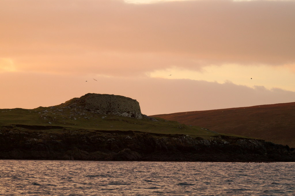
Coastline east of Hamars Ness on Fetlar, crossed by the line of Funzie Girt.
Photo: Mike Pennington / Wikimedia Commons / CC BY-SA 2.0
Questions people ask
- How old is Funzie Girt?
- Its date of construction is not certainly known. Some authoritative sources describe it as Neolithic, a Bronze Age date has also been suggested, and one writer has speculated it could be Mesolithic. Because the distinction between the Neolithic and Bronze Age is not especially marked in Shetland, a date before the 1st millennium BC is considered likely.
- What does the name "Funzie Girt" mean?
- It means "Finns' dyke" — the Finns being the legendary pre-Norse inhabitants of Shetland said to possess magical powers. The spelling reflects historical confusion between the old letter ȝ (yogh) and the cursive form of z; an earlier form of the name was simply "Finnigord".
- How long and how wide was the dyke?
- It ran for over 4 kilometres (2.5 miles), dividing Fetlar into two almost equal sections, and was originally about 1 metre wide, built from local stone with the largest slabs and boulders placed on end or on edge to form the base.
- Is Funzie Girt a protected monument?
- The northern, most complete section has been a scheduled monument since December 1957, protecting a strip of land described as "2000 yards or thereby" (about 1,828 metres) with no land on either side included. In 1998 the scheduling was extended contiguously to cover the nearby Whilsa Pund enclosure.
- Why was the dyke built?
- Its original purpose is not known for certain. It was most likely a territorial boundary of some kind and later served as a boundary marker, or hagri, but its scale is difficult to reconcile with the population Shetland could plausibly have supported, leading to its description as a "Bronze Age Berlin Wall" that may have separated two competing tribes.
Sources
- Funzie Girt - Wikipedia
- Funzie Girt - Wikidata
- Haswell-Smith, H. (2004)
- Gammeltoft, P. (2010)
Explore more: Fortified places · Prehistoric · Shetland Islands
The Ancient Codex, in your pocket
Get the Pocket Codex app
Carry the directory with you — Funzie Girt and thousands of ancient places across Britain and Ireland, offline, wherever you roam.