
On the tip of the headland of Burra Ness, on the east coast of Yell in Shetland, the drystone wall of a round tower still rises over four metres on its eastern side.
On the tip of the headland of Burra Ness, on the east coast of Yell in Shetland, the drystone wall of a round tower still rises over four metres on its eastern side. The wall is about 4.5 metres thick and encloses a structure with an external diameter of roughly 18 metres. It stands 2.6 kilometres south of Gutcher and is reached by a path from North Sandwick.
Internally, a scarcement ledge for supporting an upper floor is visible about 4 metres above the ground, and there are signs of an upper intramural gallery along with traces of an intramural guard cell on the southeast side. No remains of the entrance can now be seen. Traces of outbuildings lie to the north, south and southeast of the broch, with slight indications of surrounding ramparts, and the ruins of a later farm stand about 100 metres to the south.
An early survey, made around two centuries ago, recorded the broch standing to a height of 20 feet (6.1 metres), with the beginning of a bell-shaped profile clearly visible — a taller, more intact structure than survives today.
What follows is drawn from published sources, with each claim labelled by how firmly it is established.
History
During the Iron Age, a broch was built on the tip of the headland of Burra Ness, on the east coast of Yell. Its outer wall, around 4.5 metres thick, encloses an interior with an external diameter of about 18 metres, and traces of outbuildings survive to the north, south and southeast, together with slight indications of surrounding ramparts.
At some later date, a farm was established about 100 metres to the south of the broch; its ruins survive on the site today, marking a further phase of use of the headland after the broch itself had gone out of use. Historic Environment Scotland lists the broch under the reference SM2063, and it is catalogued today on Wikipedia and Wikidata as Burra Ness Broch.
Cultural influences
-
Later use of the headland
After the broch fell out of use, a farm was established about 100 metres to its south. Its surviving ruins show that the coastal headland continued to be used long after the Iron Age tower ceased to function.
Connections
-

Photo: Mike Pennington / Wikimedia Commons / CC BY-SA 2.0 Another Iron Age broch on Shetland, allowing comparison with Burra Ness’s surviving tower walls.
-
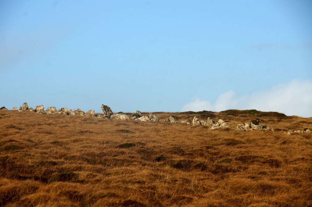
Photo: Mike Pennington / Wikimedia Commons / CC BY-SA 2.0 A prehistoric dyke on Shetland, part of the wider island landscape of ancient boundaries and monuments.
-
A prehistoric stone circle on Fetlar, another monument in Shetland’s surviving archaeological landscape.
Discovery & excavation
An early survey of the broch, made around two centuries before the present record, described it standing to a height of 20 feet (6.1 metres), with the beginning of a bell-shaped profile clearly visible. This is a taller and more distinct profile than survives today, when the outer wall stands just over 4 metres high on its east side.
What to look for
-
The outer wall
The broch's outer wall is around 4.5 metres thick and stands over 4 metres high on the east side, with an external diameter of about 18 metres.
-
The scarcement ledge
Internally, a scarcement ledge for supporting an upper floor is visible some 4 metres above the ground.
-
Signs of the intramural gallery and guard cell
There are signs of an upper intramural gallery, and traces of an intramural guard cell survive on the southeast side, though no remains of the entrance can now be seen.
-
Outbuildings and ramparts
Traces of outbuildings lie to the north, south and southeast of the broch, with slight indications of surrounding ramparts.
-
The later farm ruins
The ruins of a later farm can be seen about 100 metres to the south of the broch.
Plan your visit
- Location
- 60.6409°N · 0.9830°W
- Access
- Open access
- Terrain
- Moderate walking
- Time needed
- About 90 minutes
Nearby places
Fortified place · Prehistoric
Funzie Girt
Shetland Islands
A stone wall over four kilometres long once ran the full north-south length of Fetlar, splitting the Shetland island into two almost equal halves.…
- Easy path

Fortified place · Iron Age
Snabrough broch
Shetland Islands
Snabrough Broch sits on a short, low promontory on the shore of Snabrough Loch, on the island of Unst in Shetland, its ruined wall now measuring ar…
- Some walking
Sacred place · Prehistoric
Haltadans
Shetland Islands
Thirty-eight stones once ringed this patch of ground on Fetlar, Shetland; twenty-two of them still stand fixed in the soil, describing a circle ele…
- Easy path

Fortified place · Medieval
Muness Castle
Shetland Islands
The most northerly fortified house in the British Isles: burnt by privateers in 1627 after less than thirty years of use, and its top floor later b…
Questions people ask
- What is Burra Ness Broch?
- It is an Iron Age broch on the east coast of the island of Yell, Shetland, standing on the tip of the headland of Burra Ness.
- How big is Burra Ness Broch?
- The broch has an external diameter of about 18 metres. Its outer wall is around 4.5 metres thick and stands over 4 metres high on the east side.
- Was the broch ever taller than it is now?
- Yes. An early survey made around two centuries ago recorded it standing to a height of 20 feet (6.1 metres), with the beginning of a bell-shaped profile clearly visible.
- Where is Burra Ness Broch and how is it reached?
- It lies at grid reference HU55729572, 2.6 kilometres south of the village of Gutcher, and is reached by a path running south from the settlement of North Sandwick.
- Are there other remains near the broch?
- Yes. The ruins of a later farm can be seen about 100 metres to the south of the broch, along with traces of outbuildings and slight indications of surrounding ramparts.
Sources
- Burra Ness Broch – Wikipedia
- Burra Ness Broch – Wikidata
- Historic Environment Scotland, "Burra Ness, broch, Yell (SM2063)"
Explore more: Fortified places · Iron Age · Shetland Islands
The Ancient Codex, in your pocket
Get the Pocket Codex app
Carry the directory with you — Burra Ness Broch and thousands of ancient places across Britain and Ireland, offline, wherever you roam.