
A massive triangular lintel stone still spans the entrance of the Broch (a tall circular tower of unmortared stone, found only in Scotland) of Culswick, though rubble has crept in beneath it and now fills much of the passage behind. The broch stands on a rock platform atop a steep, smooth knoll a kilometre west of Culswick, in the parish of Sandsting, close enough to the cliffs and the sea that the outlook takes in Foula and Vaila to the west and Fitful Head and Fair Isle away to the south. Unlike many of Shetland's brochs it has never been excavated, so what stands today is the structure as centuries of weather and collapse have left it, rather than a cleared or consolidated monument.
A massive triangular lintel stone still spans the entrance of the Broch of Culswick, though rubble has crept in beneath it and now fills much of the passage behind. The broch stands on a rock platform atop a steep, smooth knoll a kilometre west of Culswick, in the parish of Sandsting, close enough to the cliffs and the sea that the outlook takes in Foula and Vaila to the west and Fitful Head and Fair Isle away to the south. Unlike many of Shetland’s brochs it has never been excavated, so what stands today is the structure as centuries of weather and collapse have left it, rather than a cleared or consolidated monument.
At its tallest point the wall reaches only about 3 metres, a fraction of what once stood. The external diameter runs to roughly 16 metres, and stretches of the wall are still preserved to a height of 3.5 metres. A guard cell opens to the right of the main entrance, and above the doorway the inside face of an upper gallery is still visible, alongside another void or doorway showing in the inner wall face. The centre of the broch, though, is choked with fallen rubble, and that same debris has crept into the entrance passage itself, burying much of what antiquarian drawings once recorded in fuller detail.
What follows is drawn from published sources, with each claim labelled by how firmly it is established.
History
In 1774 the antiquarian George Low made a drawing of the Broch of Culswick that shows it in a far more complete state than survives today: three intact intramural galleries stacked above the buried lower storey, and a scarcement ledge running round the inside face of the wall. A second drawing, made by Skene in 1805, shows the broch still standing well at that date, confirming that the structure held together for at least another generation after Low recorded it.
Since then the broch has fallen further into ruin. Rubble has slumped into the interior and into the entrance passage, and the upper galleries that Low drew in 1774 are no longer visible as complete features, though the inside face of one gallery and a further void in the inner wall face can still be made out above the entrance.
The Broch of Culswick has never been excavated. It is recorded by Historic Environment Scotland under reference SM2055, and what can be seen today - the triangular lintel, the guard cell, the eroded wall faces - represents the structure exactly as it stands on its rock platform above the sea, unaltered by archaeological clearance.
People
-
George Low
Made a 1774 drawing of the broch showing three complete intramural galleries and a scarcement ledge, a state of preservation no longer visible today.
-
Skene
Made a drawing of the broch in 1805 that shows the structure still standing well at that date.
Connections
-

Photo: Mike Pennington / Wikimedia Commons / CC BY-SA 2.0 The antiquarian George Low recorded both brochs in the eighteenth century, and his descriptions preserve details of their intramural galleries that have since collapsed.
-
Another Shetland broch about 12 km away on the same stretch of west Mainland coast.
-
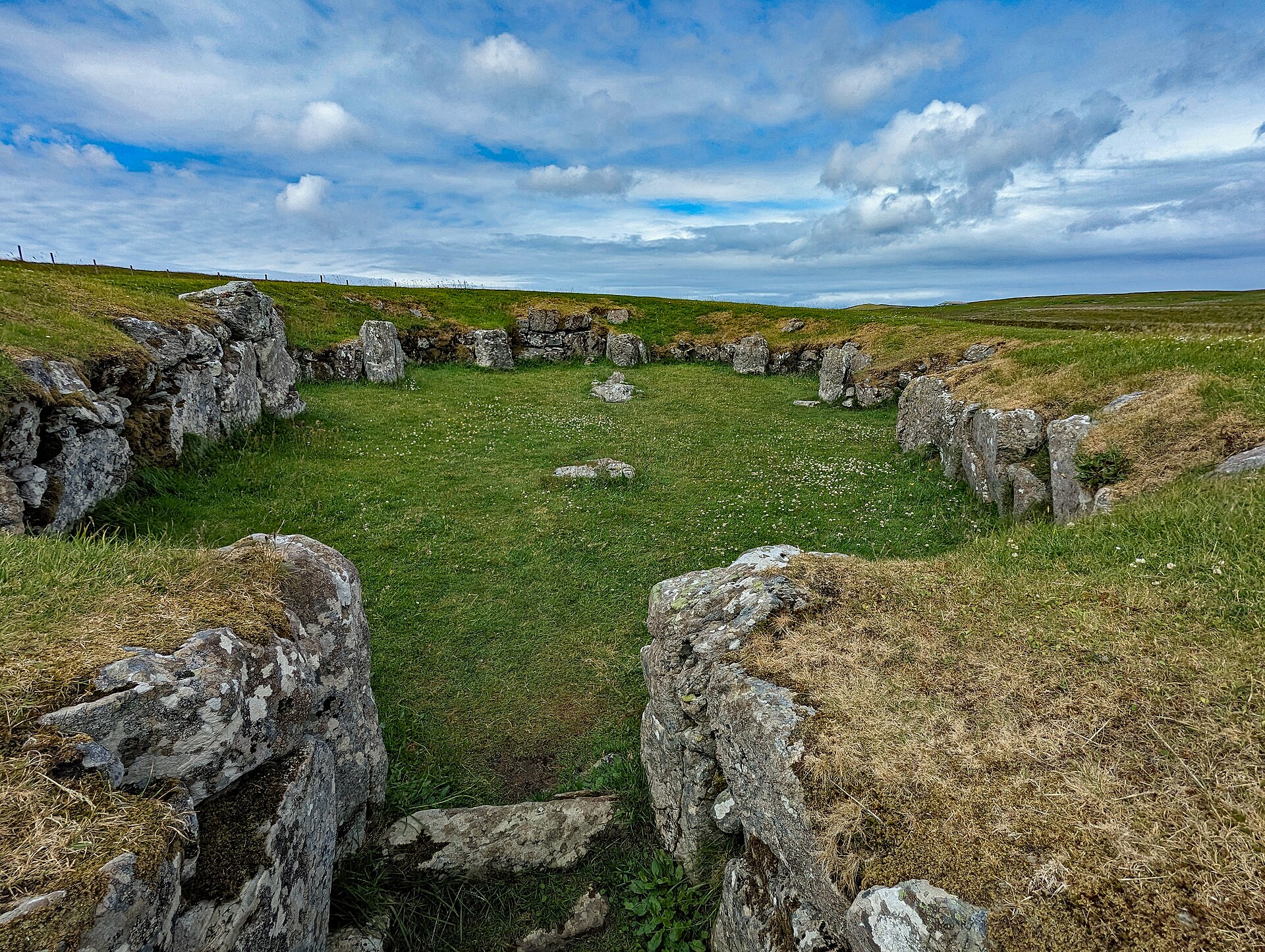
Photo: PaulT (Christine & Gunther Tschuch) / Wikimedia Commons / CC BY-SA 4.0 A Neolithic settlement site some 6 km inland, part of the same west Mainland prehistoric landscape.
Discovery & excavation
Broch of Culswick was recorded and measured by the Royal Commission on the Ancient and Historical Monuments of Scotland in 1931, and the Ordnance Survey revisited it in 1968. It has not been excavated; the visible structure and its outer defence remain the basis for understanding the site.
What to look for
-
The triangular entrance lintel
A single massive triangular stone spans the main entrance, though rubble now partly fills the passage beneath it.
-
The guard cell
A guard cell is visible immediately to the right of the main entrance, a common defensive feature of broch doorways.
-
The upper gallery face
Above the entrance, the inside face of an upper intramural gallery can still be seen, along with a further void or doorway showing in the inner wall face.
-
The rubble-choked interior
The centre of the broch is full of fallen debris, a reminder that the site has never been excavated or cleared.
Plan your visit
- Location
- 60.1870°N · 1.5441°W
- Access
- Open access
- Terrain
- Moderate walking
- Time needed
- About 90 minutes
Nearby places

Settlement · Prehistoric
Stanydale Temple
Shetland Islands
In a field roughly 21 miles by road northwest of Lerwick, on Mainland Shetland, a large walled enclosure is all that survives of a building once ro…
- Easy path
Fortified place · Iron Age
Broch of West Burrafirth
Shetland Islands
The Broch of West Burrafirth stands on a low rocky islet known as the Holm of Hebrista, within West Burra Firth on the west side of Shetland Mainla…
- Some walking

Fortified place · Medieval
Scalloway Castle
Shetland Islands
Built by unpaid workers summoned from the parishes of Shetland, for an earl who was executed for misrule eight years after it was finished.

Carved stone · Pictish & early medieval
Papil Stone
Shetland Islands
Carved on a single face of stone left otherwise plain, the Papil Stone rises to a large, long-stemmed cross shaped like a fan, its shaft crowded be…
- Easy path
Questions people ask
- What is the Broch of Culswick?
- It is an unexcavated coastal broch in the Shetland Islands, standing on a rock platform on top of a steep knoll about a kilometre west of Culswick in the parish of Sandsting.
- Has the Broch of Culswick been excavated?
- No. It remains unexcavated, so the structure visible today is exactly as centuries of collapse and weathering have left it, rather than a cleared archaeological site.
- How big is the broch and how well preserved is it?
- It has an external diameter of around 16 metres, with sections of wall preserved up to 3.5 metres high, though the tallest surviving point is only about 3 metres above the current rubble level.
- What can visitors see at the site today?
- A massive triangular lintel stone over the entrance, a guard cell to the right of the doorway, the inside face of an upper intramural gallery above the entrance, and a rubble-filled interior and entrance passage.
- How do we know the broch was once better preserved?
- Antiquarian drawings survive from 1774 (by George Low) and 1805 (by Skene), and Low's drawing in particular shows three complete intramural galleries and a scarcement ledge that are no longer visible today.
Sources
- Broch of Culswick - Wikipedia
- Historic Environment Scotland, "Broch of Culswick (SM2055)"
- Media related to Broch of Culswick at Wikimedia Commons
Explore more: Fortified places · Iron Age · Shetland Islands
The Ancient Codex, in your pocket
Get the Pocket Codex app
Carry the directory with you — Broch of Culswick and thousands of ancient places across Britain and Ireland, offline, wherever you roam.