
Fortified place · Roman · Scottish Borders
Oakwood Roman Fort and Camp
A cohort fort and the builders' camp that put it up, both found from the air in 1949 — and abandoned because of a war on the Danube.
There are two Roman enclosures at Oakwood and they had entirely different purposes. One is a fort. The other is where the men who built the fort slept.
The evidence for that reading is the position. The temporary camp lies on a north-west facing slope just north of the fort, approximately rectangular at 430 by 300 metres and covering 13 hectares, with a rampart and ditch and traces of two of its four supposed gates. It is close to the fort rather than in the best defensive position available — and a Roman camp that ignores good defensive ground in favour of proximity to a building site is a construction camp. That inference is worth more than it might sound, because the great majority of Roman temporary camps in Scotland are read as campaign camps, marking the movement of an army rather than a works programme.
The fort itself sits on a small flat-topped knoll on the south side of the Ettrick Valley, with good views north and west, about 5.6 kilometres south-west of Selkirk. It was square, occupying 1.4 hectares within turf ramparts and two external ditches, with four timber gates each flanked by square towers. That size suits a cohort — roughly 500 soldiers. The defences were renovated and strengthened during the occupation, so this was a position maintained rather than merely held.
Its dating rests on two kinds of find. Stratified pottery and a worn coin minted in AD 69 or 70 indicate both the likely period of occupation and the phases of construction, and point to a fort held from about AD 81, during the Flavian period, when Gnaeus Julius Agricola was campaigning in Scotland.
The most striking thing about the site is a line of sight. From the knoll the Eildon Hills are visible 14 kilometres to the north-east, close to the Roman fort at Newstead, which means communication between the two by visual signal would have been possible. The fort was placed where it could be seen from, not merely where it could see.
Its end had nothing to do with Scotland. The troops were withdrawn, probably as part of the preparations for Trajan’s Dacian Wars — a garrison on the Ettrick pulled out because of a campaign on the Danube.
Both sites were discovered in 1949 from aerial photographs, excavated in 1951 and 1952, and published by K. A. Steer and R. W. Feachem in 1954. Five years from a mark on a photograph to a report in print is brisk work, and it is why so much can be said about a place with nothing standing on it.
What follows is drawn from published sources, with each claim labelled by how firmly it is established.
History
Oakwood Roman Fort and Camp is an archaeological site about 5.6 kilometres south-west of Selkirk in the Scottish Borders, comprising a Roman fort and a nearby temporary camp. The site is a scheduled monument. Both were discovered in 1949 from aerial photographs. Excavation followed in 1951 and 1952, and a report by K. A. Steer and R. W. Feachem was published in 1954 — a full sequence from discovery to publication in five years.
The fort stands on a small flat-topped knoll on the south side of the Ettrick Valley, with good views to the north and west. The Eildon Hills, 14 kilometres to the north-east, are visible from it, near the site of the Roman fort at Newstead, so communication by visual signal between the two forts would have been possible. Stratified pottery and a worn coin minted in AD 69 or 70 were recovered, and these finds indicate both the likely period of occupation and the phases of construction. The fort was probably held during the Flavian period from about AD 81, when Gnaeus Julius Agricola was campaigning in Scotland.
The troops were withdrawn at some point afterwards, probably in connection with preparations for Trajan's Dacian Wars. A garrison on the Scottish frontier being pulled out because of a war on the Danube is a useful reminder of how far Roman decisions here were made elsewhere. The fort was square and occupied 1.4 hectares within turf ramparts and two external ditches — a size suitable for a cohort of about 500 soldiers. There were four timber gates, each flanked by square towers, and the defences were renovated and strengthened during the occupation.
The temporary camp lies on a north-west facing slope north of the fort. It was approximately rectangular, 430 by 300 metres, covering 13 hectares, with a rampart and ditch and traces of two of its supposed four gates. The camp was placed close to the fort rather than in the best defensive position available, which suggests its purpose was to accommodate the workers building the fort rather than to defend anything. It is a construction camp, not a campaign camp.
People
-
Gnaeus Julius Agricola
Roman governor whose Scottish campaigns provide the likely context for occupation from about AD 81.
-
K. A. Steer
Co-author of the 1954 excavation report.
-
R. W. Feachem
Co-author with K. A. Steer of the 1954 excavation report on Oakwood Roman Fort and Camp.
Cultural influences
-
A Flavian cohort fort with a builders’ camp
Oakwood’s Roman cohort fort and adjacent temporary camp were part of the Flavian advance into Scotland, with the camp likely housing the fort’s construction workforce.
Connections
-
Selkirk
Oakwood Roman Fort and Camp lies about 5.6 kilometres south-west of Selkirk.
-
Ettrick Valley
The fort is on the south side of the Ettrick Valley.
-
Eildon Hills
The Eildon Hills could be seen from Oakwood and may have enabled visual communication with Newstead.
Discovery & excavation
Aerial photographs found the fort and camp in 1949; excavation in 1951–52 revealed their plans and was published in 1954.
What to look for
-
The line of sight to the Eildons
The Eildon Hills are visible 14 kilometres to the north-east, near the Roman fort at Newstead. Signalling between the two forts would have been possible, and the view is why this knoll was chosen.
-
The square plan
The fort occupied 1.4 hectares within turf ramparts and two external ditches, with four timber gates each flanked by square towers — a standard cohort fort for about 500 men.
-
The temporary camp above
Approximately rectangular at 430 by 300 metres and covering 13 hectares, on the slope north of the fort. Its position is poor defensively, which is the evidence that it housed the fort's builders.
-
Evidence of strengthening
The defences were renovated and strengthened during the period of occupation, so the fort was maintained rather than simply held.
Plan your visit
- Location
- 55.5150°N · 2.9126°W
- Access
- Open access
- Terrain
- Rough ground — reasonable boots advised
- Time needed
- About 60 minutes
- What survives
- The fort’s turf ramparts, ditches and gate positions and the camp’s rampart, ditch and gate traces survive as archaeological earthworks.
Opening & admission
- Rural Roman earthworks; use responsible access and expect uneven pasture or hill ground.
Nearby places

Fortified place · Medieval
Elibank Castle
Scottish Borders
A 1511 royal charter tied one family's right to farmland to a promise to build in stone, and the Italianate terraced gardens later raised here rank…
Fortified place · Medieval
Traquair House
Scottish Borders
Its Bear Gates have stood locked since the eighteenth century under a vow never to reopen them: a promise the family has kept for more than two hun…
Fortified place · Iron Age
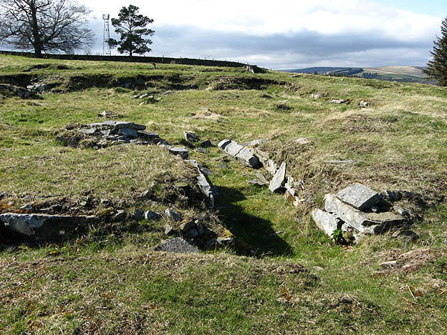
Torwoodlee Broch
Scottish Borders
Roman pottery, glass and a coin found packed inside its walls turn this collapsed tower into rare physical evidence of contact: hostile or looted:…
- Rough ground
Fortified place · Iron Age
Eildon Hill
Scottish Borders
Nearly 300 house platforms cut into a volcanic hilltop make this one of the largest hillforts known in Scotland: later crowned by a Roman signal to…
- Rough ground
The setting
Pasture in the setting of Oakwood Roman Fort and Camp, whose buried remains are not visible above ground.
Photo: Walter Baxter / Wikimedia Commons / CC BY-SA 2.0
Open pasture at the site of a former Roman camp near Oakwood.
Photo: Dr Duncan Pepper / Wikimedia Commons / CC BY-SA 2.0
Fauldshope Farm in the Ettrick Valley near Oakwood Roman Fort and Camp.
Photo: Walter Baxter / Wikimedia Commons / CC BY-SA 2.0
Minor road through farmland near Oakwood Roman Fort and Camp.
Photo: Russel Wills / Wikimedia Commons / CC BY-SA 2.0
Questions people ask
- How was the site found?
- From aerial photographs in 1949. Excavation of both fort and camp followed in 1951 and 1952, and K. A. Steer and R. W. Feachem published their report in 1954.
- When was the fort occupied?
- Probably from about AD 81, during the Flavian period, when Agricola was campaigning in Scotland. Stratified pottery and a worn coin minted in AD 69 or 70 indicate the period and the phases of construction.
- Why was it abandoned?
- The troops were withdrawn, probably in connection with preparations for Trajan's Dacian Wars — a decision taken for reasons on the Danube rather than in Scotland.
- What was the temporary camp for?
- Almost certainly to house the workers building the fort. It sits close to the fort rather than in the best defensive position, which is the argument against reading it as a campaign camp.
Sources
The Ancient Codex, in your pocket
Get the Pocket Codex app
Carry the directory with you — Oakwood Roman Fort and Camp and thousands of ancient places across Britain and Ireland, offline, wherever you roam.