
Nearly 300 house platforms cut into a volcanic hilltop make this one of the largest hillforts known in Scotland — later crowned by a Roman signal tower watching over the legionary fort built in its own shadow.
Cut into the rock of the north summit are close to three hundred flat platforms, each one levelled centuries ago to take the timber or turf-walled house of a family living within the ramparts above Melrose. Seen from the town below, the triple-peaked mass of the hill looks like a single dramatic silhouette, but it is the north top alone that carries this density of settlement, its ring of defences running for more than five kilometres around some sixteen hectares of enclosed ground.
Archaeologists estimate that as many as two thousand people once lived inside those ramparts, making the site one of the largest hillforts anywhere in prehistoric Scotland and, by tradition, the capital of the Selgovae, a people who held the upper Tweed valley before Rome arrived. That arrival changed the hill’s story rather than ending it: legionaries built the great fort of Trimontium at its foot and raised their own signal station on the summit the natives had occupied, reading the same high ground for entirely different purposes.
Long before any of that, the hill seems to have carried a different kind of weight. Holy springs still rise around its base, later rededicated to Christian saints but probably older in origin, and generations of storytellers have gone on treating the hill itself as something more than a hill — a place where a king sleeps, and where a wizard once split a summit in two.
What follows is drawn from published sources, with each claim labelled by how firmly it is established.
The name
The modern name descends from Eldunum, the form used by the twelfth-century chronicler Simeon of Durham. Its second element is Old English dun, "a rounded hill"; the first has been read either as Brittonic eil, referring to a fenced enclosure, or as Old English ǣled ("fire") or ǣlǣte ("empty place") — readings that pull the name's sense in quite different directions.
History
Excavation has shown the hillfort was already occupied by 1000 BC, in the Bronze Age, and its ramparts were built and rebuilt across three distinct phases over the centuries that followed. Within the enclosure some 296 individual hut floors have been identified, implying a resident population of around two thousand people and making it, by that measure, one of the largest settlements known anywhere in prehistoric Scotland.
Long before any of that settlement, the hills appear to have held a sacred meaning for the peoples who lived around them. Scholars have argued the summits may have served as a site of ceremonial gathering, and several holy springs still rise at their base — later rededicated to Christian saints, but probably sacred to earlier Celtic deities before that.
By tradition the hillfort served as the capital of the Selgovae, a people occupying upper Tweeddale before the Roman conquest reached this part of Britain. Their stronghold on the north summit, ringed by more than five kilometres of ramparts enclosing some sixteen hectares, would have stood as the dominant seat of power in the valley below.
In the first century AD the Roman army established the large fort of Trimontium at Newstead, at the foot of the hill on the bank of the River Tweed, naming it after the triple peaks rising above it. Alongside that fort they built a signal tower on the summit of Eildon North Hill, roofed with tiles and set within a fifteen-metre enclosure, converting the same high ground the Selgovae had once held into a Roman lookout.
The timber signal tower raised during the Flavian period was later rebuilt in stone during the reign of the emperor Antoninus Pius, a change that speaks to how long Rome judged the position worth holding. Excavation of the site in 1986 found Roman material lying consistently above native finds, suggesting the hillfort itself had already been abandoned by the time the tower was built.
Even so, occupation of the hill did not end cleanly with the Roman garrison. Coins and pottery recovered from some of the old house platforms date to the second to fourth centuries AD, showing that at least parts of the abandoned settlement were being used again long after the fort's first builders had moved on.
People
-
Antoninus Pius
Roman emperor during whose reign the timber signal tower on the summit was rebuilt in stone.
-
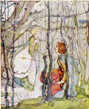
Portrait: Katharine Cameron (1874–1965) / Wikimedia Commons / Public domain Thomas the Rhymer
Borders tradition places Thomas the Rhymer’s encounter with the Fairy Queen at the Eildon Tree Stone near Eildon Hill. The legend makes the hill a setting for one of the region’s best-known prophetic tales.
Cultural influences
-
A strategic summit reused across eras
The enormous Iron Age enclosure on Eildon North and the later Roman signal station at its summit show successive communities using the same commanding high ground for settlement, surveillance and control of the Tweed valley.
Connections
-
Trimontium (Newstead Roman fort)
Built at the foot of Eildon Hill on the bank of the River Tweed, and named after the hill's three peaks; its garrison built and manned the signal tower on the summit.
-
Scott's View
Lies within the same Eildon and Leaderfoot National Scenic Area designated around the hills.
-
Leaderfoot Viaduct
Included within the boundary of the same Eildon and Leaderfoot National Scenic Area.
-
Melrose
The town immediately below the hill, also encompassed within the Eildon and Leaderfoot National Scenic Area.
Discovery & excavation
Excavation of the summit in 1986 examined the Roman signal station and found its archaeological layers lying consistently over native material, evidence used to argue that the hillfort had already fallen out of use by the time Rome built its tower there.
In culture
-
The Lay of the Last Minstrel (1805)
Sir Walter Scott's narrative poem recounts the legend that the wizard Michael Scot cleft the Eildon summit into three, a feat so dangerous the poem's narrator refuses to repeat the words that did it.
-
The Three Perils of Man (1823)
James Hogg's novel retells the hollow-hill legend of Thomas the Rhymer being led into Eildon Hill by the Fairy Queen.
-
"Eiledon", The Seer
The hill is cited in the lyric of this song by the Scottish band Big Country.
What to look for
-
House platforms on the north summit
Close to three hundred level platforms cut into the rock, the levelled bases of Iron Age and earlier timber or turf-walled houses, are still traceable across the north top.
-
The rampart circuit
Over five kilometres of defensive ramparts, built and rebuilt across three phases, still trace the boundary of the enclosed hilltop settlement.
-
The Roman signal station enclosure
A roughly fifteen-metre-diameter enclosure on the summit marks the site of the Roman signal tower, first raised in timber and later rebuilt in stone.
-
The Eildon Tree Stone
A large moss-covered boulder near Melrose traditionally marks the spot associated with Thomas the Rhymer's encounter with the Fairy Queen.
-
The holy springs at the hill's base
Several springs rising around the foot of the hills are now dedicated to Christian saints, having probably carried earlier, pre-Christian significance.
What is said
Folklore and tradition, recorded as what is said — not as established fact.
-
The sleeping king under the hill
Eildon is said to be a "hollow hill", and according to the tale Sir Walter Scott relates, a horse dealer paid in ancient coin was led inside it at night, where a host of armed knights lay sleeping at their horses' feet beside their leader, reputedly King Arthur; shown a horn and sword, he blew the horn instead of seizing the blade, was declared a coward by a great voice, and was ejected by a whirlwind before dying of exhaustion after telling his tale to shepherds outside.
-
Thomas the Rhymer and the Fairy Queen
Local tradition holds that Thomas the Rhymer went under the hill itself, and the Eildon Tree Stone near Melrose is said to mark the spot where the Fairy Queen led him into her realm within the hills.
-
Michael Scot's cleft summit
Tradition credits the three summits to the wizard Michael Scot, who was said to have split a single hill into them. Sir Walter Scott puts the story into verse but withholds the words that were believed to have done it.
Plan your visit
- Location
- 55.5813°N · 2.7186°W
- Access
- Open access
- Terrain
- Rough ground — reasonable boots advised
- Time needed
- About 120 minutes
Opening & admission
- Public responsible access applies; multiple paths cross the hills, with steep and exposed sections.
Nearby places
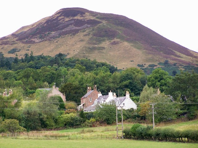
Fortified place · Iron Age
Eildon Hill North Hillfort
Scottish Borders
Excavation has shown the hillfort: a defended settlement on high ground: was occupied by 1000 BC, in the Bronze Age, roughly 2500–800 BC, when meta…
- Near Melrose
- 1.7 km from car park
- Some walking

Minor monument · Medieval
Market Cross, Market Square, Melrose
Scottish Borders
Melrose’s 1645 market cross combines a restored seventeenth-century shaft with a nineteenth-century base and a weathered unicorn finial carrying th…
- Easy path

Building or ruin · Medieval
Melrose Abbey
Scottish Borders
St Mary's Abbey, Melrose was founded in 1136 by Cistercian monks at the request of King David I of Scotland: the first Cistercian abbey in Scotland…
- Near Melrose
- 2 min walk from car park
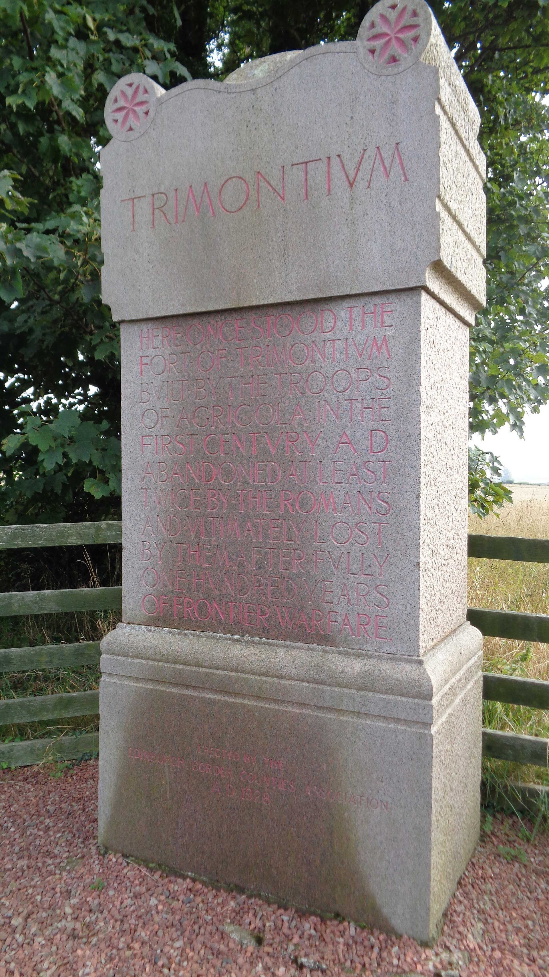
Fortified place · Roman
Trimontium (Newstead)
Scottish Borders
One of the largest caches of Roman military finds in Britain: arms and armour from 117 pits: came from a fort that was, briefly, the empire's most…
- Easy path
Questions people ask
- Why is Eildon Hill unusual among Scottish hillforts?
- Its north summit holds close to 300 house platforms within five kilometres of ramparts, implying a population of around 2,000 — one of the largest hillforts known in prehistoric Scotland.
- Did the Romans occupy Eildon Hill?
- They built a signal tower on the summit linked to their fort of Trimontium below, though excavation suggests the native hillfort had already been abandoned by then.
- What people is the hillfort associated with?
- Tradition holds it was the capital of the Selgovae, who occupied upper Tweeddale before the Roman conquest reached the area.
- What legend is Eildon Hill best known for?
- It is said to be a "hollow hill" where King Arthur and his knights lie sleeping, a tale tied to Thomas the Rhymer and retold by Sir Walter Scott.
- Where does the name Eildon come from?
- It derives from Eldunum, recorded by the 12th-century chronicler Simeon of Durham, combining Old English dun ("rounded hill") with an uncertain first element.
Sources
- Wikipedia: Eildon Hill
- Scotland Before History (Piggott, 1982)
- Scotland's Hidden History (Armit, 1998)
Explore more: Fortified places · Iron Age · Scottish Borders
The Ancient Codex, in your pocket
Get the Pocket Codex app
Carry the directory with you — Eildon Hill and thousands of ancient places across Britain and Ireland, offline, wherever you roam.