
Ten large stone slabs ring a low central mound on the west coast of Lewis, the only part still standing of the stone burial mound known as Steinacleit. The stones sit in an oval arrangement roughly 15 metres (50 feet) across, and some readings of the site suggest the boulders may also trace the outline of a much larger hall that once stood over the mound.
Ten large stone slabs ring a low central mound on the west coast of Lewis, the only part still standing of the stone burial mound known as Steinacleit. The stones sit in an oval arrangement roughly 15 metres (50 feet) across, and some readings of the site suggest the boulders may also trace the outline of a much larger hall that once stood over the mound.
Ten large stone slabs ring a low central mound on the west coast of Lewis, all that survives above ground of a chambered cairn (a mound of piled stones, often covering a burial) known as Steinacleit. The stones sit in an oval arrangement roughly 15 metres (50 feet) across, and some readings of the site suggest the boulders may also trace the outline of a much larger hall that once stood over the cairn (a mound of piled stones, often covering a burial).
Dating the site has proved difficult, and estimates range widely: some sources place its origin as early as 3000 BC, others as late as 1500 BC, with a narrower band of 1800–1500 BC also cited. The spread reflects how little published evidence exists for the monument, leaving its exact chronology and original function open to interpretation.
Local folk tradition in the Outer Hebrides holds that a battle was fought nearby, though no supporting evidence accompanies the claim. To the south-west, the standing stone Clach an Trushal is visible from the site, one of several prehistoric monuments scattered across this stretch of Lewis.
What follows is drawn from published sources, with each claim labelled by how firmly it is established.
History
The chambered cairn at Steinacleit was built at some point between 3000 and 1500 BC, according to differing scholarly estimates; other sources narrow construction to between 1800 and 1500 BC, suggesting the site may date to the transition between the Neolithic and Bronze Age rather than to the Neolithic alone.
Whatever its original date, the monument survives today as an oval ring of ten large stone slabs enclosing a central mound, 15 metres (50 feet) in diameter, all that remains visible of the cairn structure. Some interpretations of the stone arrangement propose that it once marked out the ground plan of a large hall overlying the burial site, rather than functioning solely as a cairn kerb.
Cultural influences
-
Hebridean prehistoric monument landscape
Steinacleit combines an arrangement of standing slabs and a central cairn within the wider prehistoric landscape of western Lewis.
Connections
-

Photo: F Leask / Wikimedia Commons / CC BY-SA 2.0 Standing stone visible to the south-west from Steinacleit, joining the cairn’s wide moorland view to Lewis’s tallest standing stone.
What to look for
-
Ten stone slabs
Ten large stone slabs stand around the central mound, arranged in an oval ring roughly 15 metres (50 feet) in diameter.
-
The central mound
The stones mark what is left of a chambered cairn; some interpretations suggest they may also demarcate the footprint of a large hall that once overlay the site.
-
View to Clach an Trushal
The standing stone Clach an Trushal is visible to the south-west from the site.
What is said
Folklore and tradition, recorded as what is said — not as established fact.
-
A battlefield nearby
Local folk legend of the Outer Hebrides holds that a battlefield probably lay near the site, though no corroborating detail is recorded.
Plan your visit
- Location
- 58.3972°N · 6.4575°W
- Access
- Open access
- Terrain
- Easy going
- Time needed
- About 30 minutes
Nearby places

Sacred place · Prehistoric
Clach an Trushal
Outer Hebrides
On the west side of Lewis, in the village of Ballantrushal, a single grey pillar of stone rises 5.8 metres out of the machair. Clach an Trushal is…
- Easy path
Fortified place · Iron Age
Dùn Èistean
Outer Hebrides
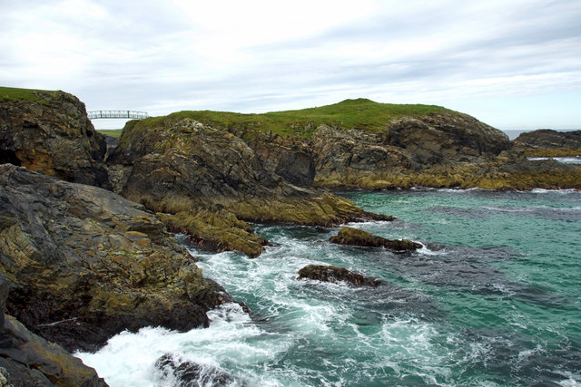
On an inter-tidal sea stack off the north-east coast of the Isle of Lewis, near the village of Knockaird (Cnoc Àrd) in the district of Ness (Nis),…
- Some walking
Fortified place · Medieval
Lews Castle
Outer Hebrides
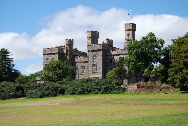
A private retreat built on an opium-trade fortune ended up given whole to the town it once stood apart from: a rare reversal for a Highland laird's…
- Easy path

Fortified place · Iron Age
Dun Carloway
Outer Hebrides
On the south side of Dun Carloway the original wall still stands to 9.2 metres, and on the east side sections of the old wall reach close to nine m…
- Some walking
Questions people ask
- Where is Steinacleit?
- Steinacleit is a prehistoric site on the west coast of Lewis in the Outer Hebrides of Scotland.
- What kind of monument is Steinacleit?
- It is the remains of a chambered cairn, marked by ten large stone slabs in an oval ring around a central mound roughly 15 metres (50 feet) in diameter. Some readings suggest the stones may also trace the outline of a large hall that once overlay the site.
- How old is Steinacleit?
- Its age is debated: sources variously date it to between 1800 and 1500 BC or, more broadly, between 3000 and 1500 BC.
- How many stones make up the site?
- Ten large stone slabs surround the central mound.
- Is there another prehistoric monument nearby?
- Yes. The standing stone Clach an Trushal is visible to the south-west from Steinacleit.
Sources
The Ancient Codex, in your pocket
Get the Pocket Codex app
Carry the directory with you — Steinacleit and thousands of ancient places across Britain and Ireland, offline, wherever you roam.