
On the south side of Dun Carloway the original wall still stands to 9.2 metres, and on the east side sections of the old wall reach close to nine metres as well — heights matched among Scotland's brochs only by Mousa and Dun Telve. Set on a rock outcrop on a steep south-facing slope at 50 metres above Loch Carloway, in the district of Carloway on the west coast of the Isle of Lewis, it is generally reckoned the best preserved broch (a tall circular tower of unmortared stone, found only in Scotland) in the Outer Hebrides, though its original height is unknown since the top courses were lost to stone-robbing over the centuries.
On the south side of Dun Carloway the original wall still stands to 9.2 metres, and on the east side sections of the old wall reach close to nine metres as well — heights matched among Scotland’s brochs only by Mousa and Dun Telve. Set on a rock outcrop on a steep south-facing slope at 50 metres above Loch Carloway, in the district of Carloway on the west coast of the Isle of Lewis, it is generally reckoned the best preserved broch in the Outer Hebrides, though its original height is unknown since the top courses were lost to stone-robbing over the centuries.
The structure is a double-walled roundhouse in the classic broch pattern: an external diameter of 14.3 metres surrounds an internal courtyard just 7.4 metres across, with the intervening walls varying from 2.9 to 3.8 metres thick between south-east and north. Entry is through a low north-west passage only 75 centimetres wide and a metre high, guarded on its south side by a small cell reached through a 61-centimetre-square opening. Inside, three further openings lead off the courtyard: one opposite the entrance gives onto a mural stair that climbs a quarter of the broch’s circumference; another leads to an oval room where traces of at least three peat ovens survive; a third opens onto a chamber beneath the stair itself. Two large voids are visible in the south-eastern wall, and a scarcement — a ledge cut into the wall face two metres above the floor — shows where an upper wooden floor was once supported, though no equivalent ledge survives higher up to confirm a second storey.
Most brochs of this type were raised between 100 BC and 100 AD, and Dun Carloway was probably built in the 1st century AD, remaining in use until the floor level had risen too high on its own accumulated occupation debris. It later served episodically as a stronghold, most famously in 1601, before formal protection arrived in 1882 as one of the first scheduled monuments in Scotland and state management followed in 1887. It is now in the care of Historic Scotland, with its visitor centre run by the community-owned Carlaway Estate Trust.
What follows is drawn from published sources, with each claim labelled by how firmly it is established.
The name
The name Dun Carloway anglicises the Scottish Gaelic Dùn Chàrlabhaigh. The first element, dùn, simply means "fort" and is the standard Gaelic term applied across Scotland to prehistoric and early historic fortified sites, brochs included. The second element, Càrlabhaigh, names the district of Carloway itself, and its origin is generally traced not to Gaelic but to Old Norse, reflecting the centuries of Norse settlement in the Hebrides between the 9th and 13th centuries. The most widely accepted reading joins the Norse personal name Karl to vágr, "bay" or "inlet", giving an original sense close to "Karl's bay" or "the bay of the free man"; this Norse name was in time absorbed into Gaelic phonology as Càrlabhaigh, so that Dùn Chàrlabhaigh reads as "the fort of Carloway", the broch that overlooks both the district and Loch Carloway. The English form Dun Carloway became the standard rendering in antiquarian and archaeological writing during the 19th century as English took over as the language of scholarly publication in Scotland.
History
Most brochs of this design were built between 100 BC and 100 AD, and Dun Carloway probably went up in the 1st century AD. Its later name likely descends from the Norse Karlavagr, "Karl's bay", a linguistic relic of the centuries the site spent within the orbit of the Norse Kingdom of the Isles. The broch stayed in use across this long span until the floor of the interior had risen too high on the build-up of its own occupation layers to remain practical.
By the 16th century the broch was still functioning as a stronghold, and its best-documented episode belongs to 1601, when the Morrisons of Ness took possession of it. According to the story told of the event, the Morrisons had stolen cattle from the MacAulays of Uig; when the MacAulays came looking for their livestock and found the Morrisons holed up inside, one of their number, Donald Cam MacAulay, scaled the outer wall using a pair of daggers driven into the stonework as holds, then smoked the defenders out by throwing heather onto a fire built at the entrance. The MacAulays subsequently destroyed the broch.
The walls were presumably still largely intact in the 16th century, but by the middle of the 19th century a substantial portion of the upper wall had disappeared, its stones carried off and re-used in other buildings nearby. The condition of the ruin in 1861 was recorded in a drawing that Captain Thomas published in 1890, giving a fixed point of reference for how much of the structure had already been lost by that date.
In 1882 Dun Carloway was placed under formal protection as one of the first officially scheduled monuments in Scotland, and in 1887 it was taken into state management, five years after that initial protection. Restoration work has been carried out on the broch in the period since, alongside limited archaeological excavation at the beginning of the 20th century and again in the 1970s.
Excavation of the north-eastern interior room, most substantially in the 1970s campaign, uncovered at least three peat ovens that had been used in succession between AD 400 and 700, along with quantities of pottery, a fragment of a quern-stone, and a collection of snail shells. The absence of animal bone in the ovens argues against their use for cooking meals, while the absence of ironworking tools argues against an industrial function; the room was most probably given over to the manufacture of earthenware pots across those three centuries of use.
People
-
Donald Cam MacAulay
Led the 1601 assault on the Morrisons occupying the broch, scaling the outer wall with two daggers and smoking the defenders out with burning heather.
-
Captain Thomas
Recorded the ruined state of the broch in a drawing made from the 1861 evidence, published in 1890.
Cultural influences
-
The high double walls, guarded entrance and mural cells make Dun Carloway a major surviving example of the Hebridean broch tradition.
Connections
-
Mousa Broch
One of only two other brochs in Scotland with surviving walls taller than Dun Carloway's.
-
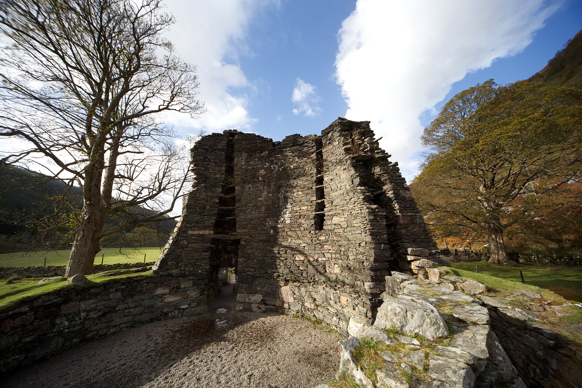
Photo: Tom Parnell from Scottish Borders, Scotland / Wikimedia Commons / CC BY-SA 2.0 The other broch, alongside Mousa, with walls higher than Dun Carloway's.
-
Loch Carloway
The broch stands above and overlooks this loch, from which the surrounding district takes its name.
-
Kingdom of the Isles
The broch's later Norse-derived name is linked to the period when the Hebrides fell within this Norse-Gaelic maritime kingdom.
Discovery & excavation
Archaeological investigation of Dun Carloway has been limited to two episodes, one at the start of the 20th century and a further excavation in the 1970s. Work concentrated on the oval room in the north-eastern part of the interior, where at least three peat ovens dated to AD 400–700 were identified along with pottery remains, a broken quern-stone, and snail shells. The lack of animal bone and ironworking debris among the finds pointed the excavators toward pottery manufacture as the room's most likely function rather than everyday cooking or metalworking.
Finds now held at: North-eastern interior room.
What to look for
-
The tall south wall
The best-preserved stretch of walling rises to 9.2 metres on the south side, among the tallest surviving broch walls anywhere in Scotland.
-
The entrance passage and guard cell
A low north-west entrance, 75 centimetres wide and a metre high, with a small guard cell opening off its south side through a 61-centimetre-square gap.
-
The mural stair
A staircase built within the thickness of the double wall, running for a quarter of the broch's circumference, reached from an opening opposite the entrance.
-
The oval room and peat ovens
A room off the north-eastern opening where traces of at least three successive peat ovens, used between AD 400 and 700, were uncovered during excavation.
-
The wall voids and scarcement
Two large voids visible in the south-eastern wall, and a scarcement ledge two metres above the floor marking where an upper wooden floor was once supported.
-
The protruding bedrock
On the north side of the interior the natural rock on which the broch was built protrudes through the floor.
What is said
Folklore and tradition, recorded as what is said — not as established fact.
-
The 1601 cattle raid
Local tradition holds that the Morrisons of Ness took refuge in the broch after stealing cattle from the MacAulays of Uig, and that Donald Cam MacAulay scaled the wall using two daggers as handholds before smoking the occupants out with burning heather — after which the MacAulays tore the broch down.
Plan your visit
- Location
- 58.2696°N · 6.7940°W
- Access
- Open access
- Terrain
- Moderate walking
- Time needed
- About 90 minutes
- Best time
- Visit during published opening periods and in dry daylight, when the broch and surrounding landscape can be explored safely.
- What survives
- A ruined stone broch with a south wall standing about 9 metres high, preserving an unusually clear cross-section of the double-walled structure.
- Facilities
- Visitor facilities depend on the current heritage-site operation; check the official information before travelling.
Opening & admission
Free entry; open all year round.
- Access is via a rough path across agricultural land; strong footwear is recommended and visitors should not climb the broch walls.
Nearby places
Fortified place · Iron Age
Dun Bharabhat, Great Bernera
Outer Hebrides
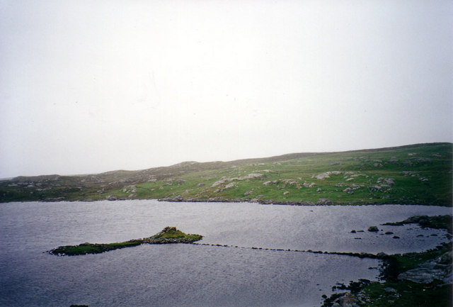
A thirty-metre stone causeway crosses the water of Loch Bharabhat to reach the islet on which Dun Bharabhat stands, its walls rising above the loch…
- Some walking

Sacred place · Prehistoric
Callanish VIII
Outer Hebrides
Four standing stones rise in a semicircle along a cliff edge on the southern side of Great Bernera, looking out over the narrow strait that separat…
- Easy path
Sacred place · Prehistoric
Calanais Standing Stones
Outer Hebrides
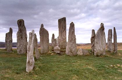
Erected around 2750 BC, before Stonehenge, and laid out so that none of its three stone rows actually points at the centre of its own circle.
- Near Calanais
- 107 metres from car park
- Easy path

Sacred place · Prehistoric
Callanish II
Outer Hebrides
Seven thin standing stones rise from a ridge overlooking Loch Roag, on the western side of Lewis, set out in an ellipse measuring 21.6 by 18.9 metr…
- Easy path
The setting
The setting near Dun Carloway.
Photo: John Allan / Wikimedia Commons / CC BY-SA 2.0
Questions people ask
- How tall are the walls of Dun Carloway?
- The wall rises to 9.2 metres on the south side, with sections on the east side reaching close to nine metres as well. Only Mousa Broch and Dun Telve have taller surviving broch walls in Scotland.
- What does the name Dun Carloway mean?
- Dùn Chàrlabhaigh means "the fort of Carloway" in Gaelic. Dùn is simply "fort", while Càrlabhaigh is thought to derive from Old Norse Karl (a personal name) and vágr ("bay"), giving an original sense of "Karl's bay".
- When was Dun Carloway built?
- It was probably built in the 1st century AD, within the period from 100 BC to 100 AD when most Scottish brochs were constructed.
- What happened at the broch in 1601?
- According to the story told locally, the Morrisons of Ness occupied the broch after stealing cattle from the MacAulays of Uig. Donald Cam MacAulay scaled the outer wall with two daggers and smoked the occupants out with burning heather, after which the MacAulays destroyed the broch.
- Who manages Dun Carloway today?
- It has been under state management since 1887 and is owned by Historic Scotland. Its visitor centre is run by the community-owned Carlaway Estate Trust (Urras Oighreachd Chàrlabhaigh), which fundraises to maintain and develop it.
Sources
- Dun Carloway — Wikipedia
- Dun Carloway — Wikidata (Q1265209)
- Dun Carloway, Historic Scotland
- Ponting, Gerald and Margaret. A Mini-Guide to Dun Carloway Broch, Isle of Lewis. Callanish, Isle of Lewis: G. and M. Ponting, 1980.
- Dun Carloway broch — Megalithic Portal
Explore more: Fortified places · Iron Age · Outer Hebrides
The Ancient Codex, in your pocket
Get the Pocket Codex app
Carry the directory with you — Dun Carloway and thousands of ancient places across Britain and Ireland, offline, wherever you roam.