
Erected around 2750 BC, before Stonehenge, and laid out so that none of its three stone rows actually points at the centre of its own circle.
None of the three stone rows here points at the centre of the circle they join. The east-north-east row aims two metres south of it, the south row a metre west, the west-south-west row a metre south. Three separate near-misses, all small, all in different directions - which is harder to explain as carelessness than as intention.
The circle is not quite a circle either. Thirteen stones enclose 11.4 metres, with the eastern side flattened, so the ring measures 13.4 metres north to south and 12 east to west. The central monolith stands 0.8 metres west of the true centre, 4.8 metres high, shaped like a ship’s rudder, weighing perhaps seven tonnes, with its broad faces set almost exactly north and south. Everything is Lewisian gneiss, quarried from the ground it stands on.
The avenue running north-north-east is the other thing to walk. It is 83.2 metres long with 19 stones left, and its two rows are not parallel - they fan out, six metres apart at one end and 6.7 at the other. The heights fall as the rows approach the middle and rise again beyond it, and the eastern stones are consistently three-quarters the height of the western.
All of this went up around 2750 BC, before Stonehenge. Later, somebody wedged a chambered tomb 6.4 metres long into the gap between the central stone and the eastern arc of the circle - built after the monument and squeezed into it.
Calanais is not one monument but the centre of a landscape of them. Archaeologists number it Calanais I to separate it from Callanish II, III, IV, VIII and X and a scatter of arcs and single stones, many visible from this ridge above Loch Roag. Callanish II and III, just over a kilometre south-east, were each circles of at least eight stones. Together they suggest this ground was a focus for ceremony for something like fifteen hundred years.
What follows is drawn from published sources, with each claim labelled by how firmly it is established.
The name
The Gaelic names Clachan Chalanais and Tursachan Chalanais mean, respectively, the stones or group of stones at Calanais and the standing stones of Calanais.
History
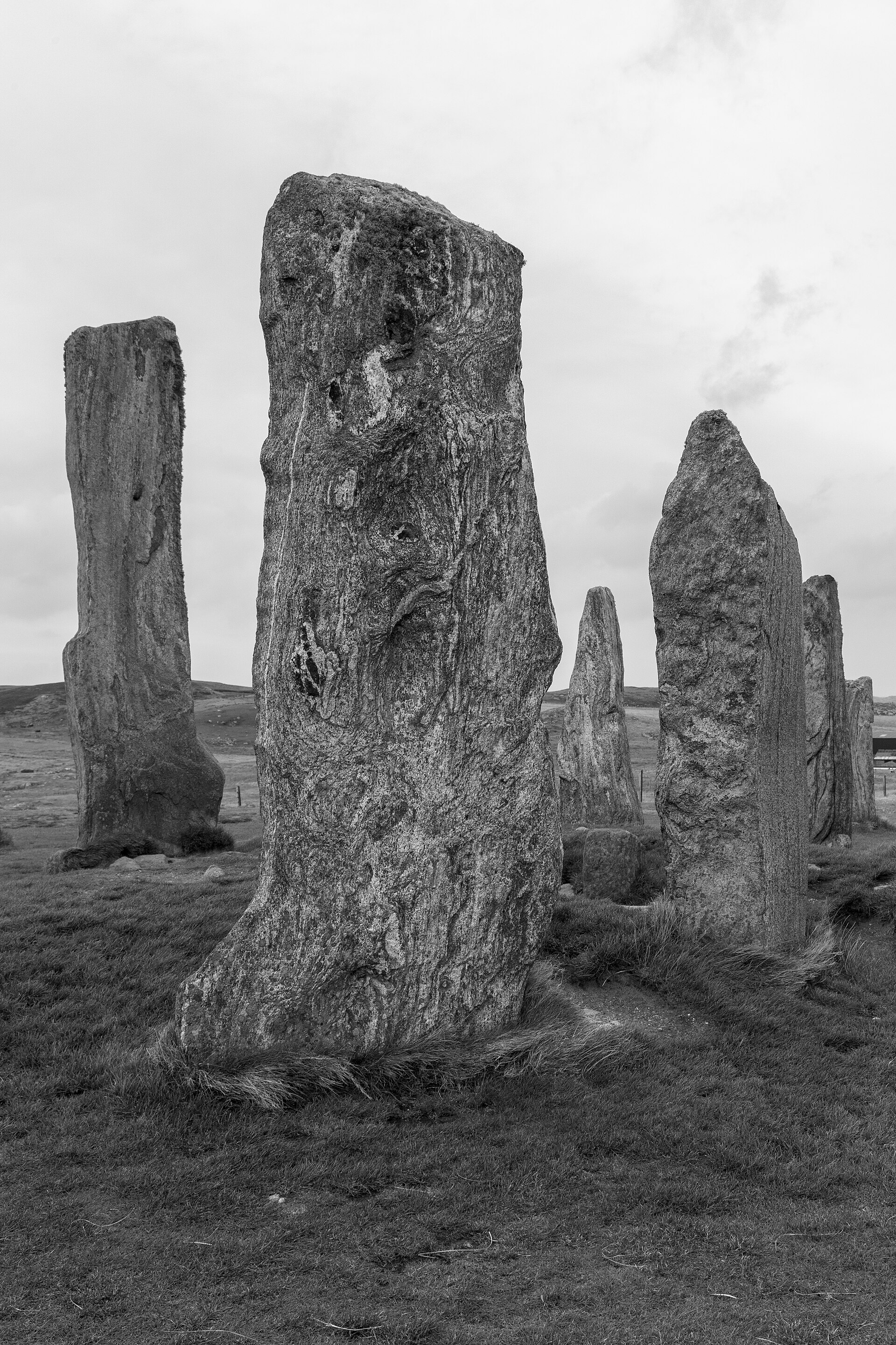
The Calanais Stones, known in Scottish Gaelic as Clachan Chalanais or Tursachan Chalanais, stand on a low ridge above Loch Roag on the west coast of the Isle of Lewis, with the hills of Great Bernera behind them. Historic Environment Scotland dates their erection to around 2750 BC, which puts them before Stonehenge.
The Gaelic names describe what the monument is. Clachan means stones or a group of stones; tursa, plural tursachan, is the standard Gaelic term across Scotland for prehistoric standing stones. Tursachan Chalanais therefore means the standing stones of Calanais, and the local visitor centre trust is named Urras nan Tursachan, the Standing Stones Trust.
Archaeologists call the main monument Calanais I, a numbering that distinguishes it from the many other stone settings around it — Callanish II, III, IV, VIII and X among them — known collectively as the Calanais complex. At least three other circles lie within a few kilometres, along with arcs, alignments and single stones, many of them visible from the main site.
The existence of so many monuments in one landscape implies that Calanais was an active focus for religious activity for at least 1,500 years. The most impressive of the neighbours, Callanish II and III, lie just over a kilometre to the south-east and originally consisted of circles of at least eight stones each.
The circle itself has thirteen stones and a diameter of 11.4 metres, and it is not truly circular — the east side is flattened, giving 13.4 metres north to south against 12 metres east to west. The stones average three metres in height and the ring encloses 124 square metres, which is small by comparison with similar monuments; nearby Callanish II is two and a half times the size.
The central monolith stands 0.8 metres west of the true centre of the circle. It is 4.8 metres high, 1.5 metres wide and 0.3 metres thick, shaped like a ship's rudder, and probably weighs about seven tonnes. Its largest faces are almost perfectly oriented north and south. Every stone on the site is of the same rock, the local Lewisian gneiss.
An avenue runs north-north-east from the circle for 83.2 metres, with 19 stones remaining — nine on the eastern side, ten on the western. The two rows are not parallel but fan out, 6.7 metres apart at the north end and 6 metres at the south. The stones diminish in height from the circle towards the middle of the avenue and then increase again, and those on the eastern side stand only three-quarters as high as those opposite.
Three further rows connect to the circle, from the east-north-east, the south and the west-south-west, of 23.2, 27.2 and 13 metres respectively. None of them is aimed at the centre of the circle. The east-north-east row points to a spot two metres south of the centre, the southern row one metre west of it, and the west-south-west row one metre south. That is a consistent near-miss rather than imprecision, and it is one of the more interesting facts about the layout.
A chambered tomb 6.4 metres long lies between the central monolith and the eastern stone of the circle. It was built later than the circle and is squashed in between them. Another stone cairn on the north-east side has been reduced to ground level, its outline barely traceable, and is not necessarily an original part of the site. Limited excavations between 1980 and 1981 provided some information on how the site developed. The earliest traces of human activity are a broad ditch, no longer visible above ground, which appears to predate the stones.
The stones are among the most important prehistoric monuments in Britain and are protected as a scheduled monument in the care of Historic Environment Scotland.
Cultural influences
-
Long-lived Neolithic ceremonial landscape
The main Calanais circle formed the focus of a wider landscape of stone circles, avenues and alignments used for ritual activity over at least 1,500 years.
Connections
-
Callanish II and III
The most impressive of the neighbouring settings, just over a kilometre south-east, each originally a circle of at least eight stones.
-
Loch Roag
The water the ridge overlooks, with the hills of Great Bernera beyond.
-
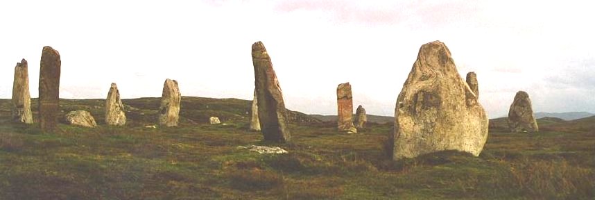
Photo: Tumulus at English Wikipedia / Wikimedia Commons / CC BY-SA 3.0 Callanish III (Cnoc Filibhir Bheag)
Callanish III is one of the smaller stone settings in the wider Calanais ceremonial landscape. Its circle of stones helps show that Calanais I was the focus of a distributed complex rather than an isolated monument.
Discovery & excavation
Limited excavations in 1980–81 identified a broad ditch beneath the monument, suggesting human activity at the site predated the standing stones.
What to look for
-
The central monolith
4.8 metres high, shaped like a ship's rudder, weighing about seven tonnes, standing 0.8 metres west of the circle's true centre with its faces aligned north and south.
-
The avenue
83.2 metres of double row running north-north-east, its two sides fanning apart, the eastern stones standing only three-quarters as high as the western.
-
The three rows that miss
The east-north-east, south and west-south-west rows each point one to two metres off the centre of the circle rather than at it.
-
The chambered tomb
6.4 metres long, built after the circle and wedged between the eastern stones and the central monolith.
Standing there
- The stones stand on a low ridge above the waters of Loch Roag, with the hills of Great Bernera as a backdrop, so the setting is one of wide Hebridean sky, open moorland and water on the exposed west coast of Lewis — wind, distant sea and birdsong are the ambient sound.
- Up close the monoliths are tall slabs of weathered Lewisian gneiss, among the oldest rock in the world: the surfaces are banded grey, silvery and streaked, rough and lichen-crusted to the touch, with the tallest central monolith rising well above head height at the heart of the cross-shaped setting.
- Walking in means passing between rows of standing stones that funnel toward the central circle, so the approach is processional — the avenue and radiating alignments channel movement and sightlines through the monument rather than allowing it to be viewed from outside.
- In the Neolithic, around 2750 BC, gathering here meant the same vast open horizon used as a backdrop for the moon and sun: the site sat within a wider complex of circles and alignments visible across the landscape, and ceremonies would have unfolded under the full sweep of the Hebridean sky against Loch Roag and the hills.
- At its lowest southern rising the moon would have skimmed along the far hills and, seen from the stones, appeared to set into and rise again from the landscape — a rare lunar spectacle the ridge-top siting seems chosen to frame, which would have drawn watchers to the circle at particular times of year.
Plan your visit
- Location
- 58.1976°N · 6.7451°W
- Nearest settlement
- Calanais
- Access
- Reached on a public path
- Terrain
- Easy going
- Parking
- Parking available nearby — see the official getting-here page.
- Start point
- 12m west of Stornoway off the A859, Isle of Lewis.
- Time needed
- About 60 minutes
- Best time
- Visitor Centre (owned and managed by Urras Nan Tursachan): The Calanais Visitor Centre is **closed until 2026** to allow for major redevelopment. Calanais Standing Stones are free to visit and open year-round. The Calanais Visitor Centre is closed until 2026 to allow for major redevelopment.
- What survives
- A well-preserved main stone circle, central monolith and avenue in open moorland above Loch Roag.
- Facilities
- The visitor centre is closed until 2026; plan facilities independently and check current local guidance before travelling.
- Start point
- Calanais Standing Stones car park — HES: 'a small surfaced car park next to the standing stones.' Parking severely restricted and no coach access during the visitor-centre redevelopment (reopening 2026); stay strictly to the paths.
Opening & admission
Free entry
- Visitor Centre (owned and managed by Urras Nan Tursachan): The Calanais Visitor Centre is **closed until 2026** to allow for major redevelopment.
- Calanais Standing Stones are free to visit and open year-round.
- The Calanais Visitor Centre is closed until 2026 to allow for major redevelopment.
Nearby places

Sacred place · Prehistoric
Callanish II
Outer Hebrides
Seven thin standing stones rise from a ridge overlooking Loch Roag, on the western side of Lewis, set out in an ellipse measuring 21.6 by 18.9 metr…
- Easy path
Sacred place · Prehistoric
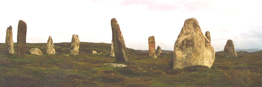
Callanish III
Outer Hebrides
Two concentric ellipses of stone stand on the moor above Loch Roag on the Isle of Lewis, forming Callanish III: Gaelic name Cnoc Fillibhir Bheag. T…
- Easy path

Sacred place · Prehistoric
Callanish IV
Outer Hebrides
Five stones stand today at Callanish IV, arranged in a pronounced oval measuring 13.3 by 9.5 metres on open moorland southeast of the main Callanis…
- Easy path

Sacred place · Prehistoric
Callanish VIII
Outer Hebrides
Four standing stones rise in a semicircle along a cliff edge on the southern side of Great Bernera, looking out over the narrow strait that separat…
- Easy path
Questions people ask
- How old is Calanais?
- Historic Environment Scotland dates the erection of the stones to around 2750 BC, which makes them older than Stonehenge.
- What does the name mean?
- Tursachan Chalanais is Gaelic for the standing stones of Calanais - clachan meaning a group of stones, tursachan the standard Gaelic term for prehistoric standing stones.
- Is it one monument or several?
- Several. This is Calanais I; at least three other circles and numerous arcs, alignments and single stones lie within a few kilometres, together called the Calanais complex.
- Do the stone rows point at the circle's centre?
- No. The east-north-east row points two metres south of centre, the south row one metre west, and the west-south-west row one metre south - a consistent near-miss.
Sources
- Canmore site record 4156 (accessed 2026-06-13)
- Wikipedia: Callanish Stones (accessed 2026-06-13)
- Wikidata Q3242938 (accessed 2026-06-13)
- Calanais or Callanish Standing Stones (SM90054) - Historic Environment Scotland
- Callanish Visitor Centre
Explore more: Sacred places · Prehistoric · Outer Hebrides
The Ancient Codex, in your pocket
Get the Pocket Codex app
Carry the directory with you — Calanais Standing Stones and thousands of ancient places across Britain and Ireland, offline, wherever you roam.