
Its drystone wall still rises over ten metres without a scrap of mortar, making Dun Telve one of the tallest surviving brochs anywhere in Scotland.
A curved wall of drystone rears out of the floor of Gleann Beag, its outer face leaning gently inward as it climbs past ten metres, higher than a three-storey house, built without mortar and still largely standing after two thousand years. Inside the thickness of that wall a narrow stone stair winds upward in darkness, passing openings that once let people step out onto timber floors long since rotted away. Two shallow ledges cut into the inner face mark where those floors were carried, hinting at a tower that held at least two upper storeys above the ground floor.
The broch stands close to a minor road a short walk south of Kirkton, the main settlement of Glenelg, on the bank of a small river. It shares this quiet valley with a twin broch a few hundred metres away and a third, less complete example further along, three drystone towers within a couple of miles of one another, a concentration found nowhere else in Scotland in quite the same way. Local memory and early antiquarian sketches placed visitors here from at least the late 1700s, long before archaeologists had a name for what a broch was.
What survives today is not untouched. Stone was taken from the tower in the early 18th century for a nearby army barracks, and state conservators reshaped parts of the interior in the early 20th century. Yet no archaeological excavation has ever been carried out here, so much of what the broch’s builders intended, and how they actually lived inside it, remains inferred from the standing stone rather than proven by the trowel.
What follows is drawn from published sources, with each claim labelled by how firmly it is established.
The name
The name Dun Telve derives from the Scottish Gaelic Dùn Teilbh, in which "dùn" denotes a fort or fortified place, a term applied across Scotland to defended stone and earthwork sites of many periods.
History
The broch was raised during the Iron Age, roughly two thousand years ago, part of a wave of massive circular drystone towers built across northern and western Scotland in the centuries either side of the turn of the millennium. Gleann Beag came to hold an unusually dense cluster of these structures, with Dun Telve joined by a near neighbour and a further, less complete example within a couple of miles, suggesting the valley held particular importance to the communities who built and used them.
By 1722 the tower had already been robbed of stone, most likely to help build Bernera Barracks, a garrison raised nearby in Glenelg in the aftermath of the Jacobite risings. The loss of masonry from the upper courses at this time likely accounts for the uneven profile of the surviving wall head, which stands noticeably higher on its west and northwest side than elsewhere around the circuit.
Despite that damage, Dun Telve had become a fixture on the tourist circuit by the late 18th century, drawing visitors curious to see so complete a prehistoric tower, and it was first committed to paper in a sketch from that period, one of the earliest visual records of any broch in Scotland. Between 1871 and 1873 the antiquarian Henry Dryden carried out a detailed survey of the structure, producing measured drawings that became an important early record of the tower's form and dimensions before any conservation work reshaped it further.
The site passed into state care between 1882 and 1901, a period during which the boundary markers defining the limits of official guardianship were set out; those markers remain visible on the ground today, a quiet trace of the moment the broch shifted from private ruin to protected monument.
Around 1914 the Office of Works carried out a substantial programme of intervention, clearing out accumulated debris from the interior, inserting concrete into the upper intramural space to stabilise it, and repointing the internal wall face. The broch has never been archaeologically excavated, so this early 20th-century conservation campaign remains the only systematic modern intervention the structure has undergone, and it is now cared for by Historic Environment Scotland.
Connections
-
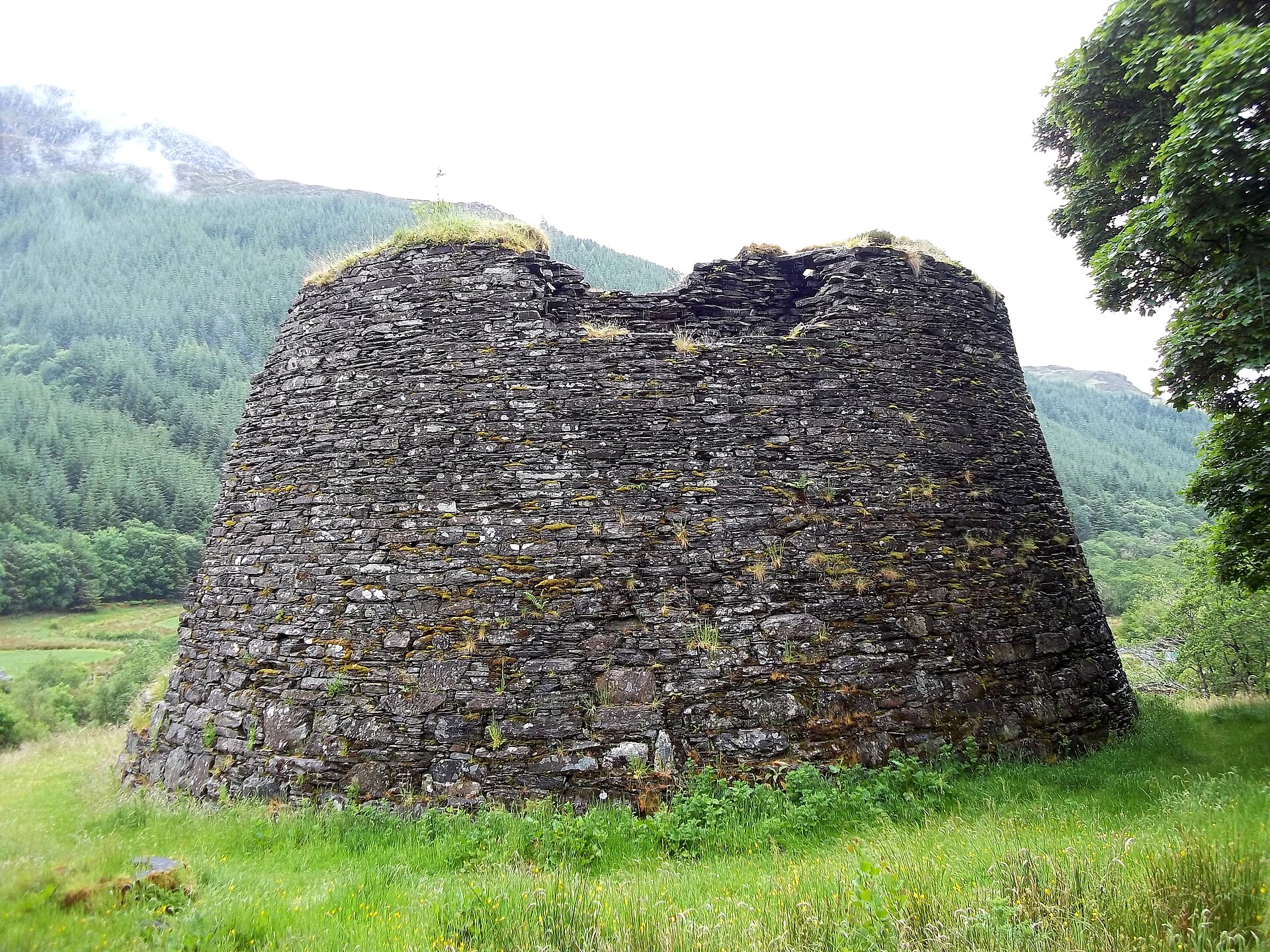
Photo: Pasicles / Wikimedia Commons / CC0 A second broch of the same Iron Age type stands 470 metres to the east along the same valley, forming a closely paired site with Dun Telve.
-
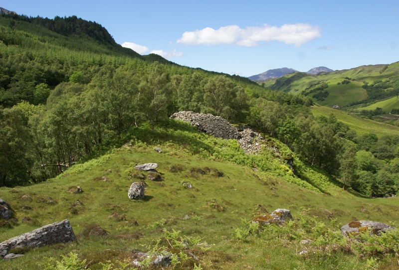
Photo: Otter / Wikimedia Commons / CC BY-SA 3.0 A "semi-broch", a partial form of the same drystone tower tradition, lies around 2.5 kilometres further east along Gleann Beag, extending the valley's cluster of related monuments.
-
Bernera Barracks
Stone is thought to have been robbed from Dun Telve in 1722 to help build this Hanoverian garrison in Glenelg.
Discovery & excavation
Dun Telve has never been archaeologically excavated. What is known of its interior comes instead from a detailed survey carried out by Henry Dryden in 1871–1873 and from the early 20th-century Office of Works conservation programme, which cleared and stabilised the structure without a formal excavation.
What to look for
-
The drystone tower wall
The circular outer wall stands to a maximum height of 10.2 metres on its west and northwest side, 18.3 metres in diameter, and built entirely without mortar.
-
Battered wall profile
The wall is 4.3 metres thick at its base narrowing to 1.2 metres at the surviving top, giving the tower its distinctive tapering silhouette.
-
The entrance and guard cell
The main entrance passage on the west side has been altered, probably in the mid-19th century, and opens on its south side into a small side-chamber known as a guard cell.
-
Intramural stair and scarcements
A doorway on the north side of the interior leads to a cell and then into the intramural space, where a winding stone stair climbs past two horizontal ledges, or scarcements, marking the level of former upper floors, the highest of which stood around nine metres above the ground.
-
Appended outbuilding
Structures added against the west and northwest sides of the broch include at least one rectangular building, evidence of later use of the site around the tower itself.
Plan your visit
- Location
- 57.1946°N · 5.5947°W
- Nearest settlement
- Inverness
- Access
- Open access
- Terrain
- Easy going
- Time needed
- About 45 minutes
- Best time
- Visit in daylight and dry conditions, when the broch remains and surrounding landscape can be viewed safely.
- What survives
- Dun Telve is a substantially preserved drystone broch; Historic Environment Scotland says it still stands more than 10m high in places.
- Facilities
- No dedicated visitor facilities are documented at the broch; plan to use facilities in nearby settlements.
Opening & admission
Historic Environment Scotland lists the Glenelg Brochs as open all year round.
- Historic Environment Scotland cares for the broch beside the minor Glenelg road.
Nearby places
Fortified place · Iron Age
Dun Troddan
Highland
Its stairway still climbs to a first-floor landing inside a wall four and a half metres thick: one of Scotland's most intact broch (a tall circular…
- Near Inverness
- Some walking

Fortified place · Iron Age
Dun Grugaig
Highland
A rare surviving 'semi-broch': the transitional D-shaped form that shows how the great circular broch towers of the Highlands may have evolved.
- Near Glenelg
- Rough ground

Fortified place · Iron Age
Caisteal Grugaig
Highland
A drystone tower still rising over its own five-step internal stair and a triangular lintel massive enough to have never needed a keystone.
- Near Shiel Bridge
- Some walking

Building or ruin · Medieval
Eilean Donan Castle
Highland
The castle photographed on countless shortbread tins is barely a century old: a 1930s recreation of a stronghold the Royal Navy blew apart in 1719.
- Near Inverness
Questions people ask
- How old is Dun Telve?
- The broch dates from the Iron Age, roughly two thousand years ago.
- How tall is Dun Telve?
- The surviving wall reaches a maximum height of 10.2 metres on its west and northwest side, making it one of the tallest standing brochs in Scotland.
- Has Dun Telve been excavated?
- No. It has never been archaeologically excavated; knowledge of it comes from an 1871–1873 survey and early 20th-century conservation work.
- Why is part of the wall missing?
- Stone is thought to have been robbed from the broch in 1722, probably to build the nearby Bernera Barracks.
- Is Dun Telve close to other brochs?
- Yes. Dun Troddan stands 470 metres east, and the partial broch Dun Grugaig lies about 2.5 kilometres further along the same valley.
Sources
- Wikipedia: Dun Telve
- Historic Environment Scotland — Glenelg Brochs: Dun Telve and Dun Troddan
- Wikidata: Dun Telve
Explore more: Fortified places · Iron Age · Highland
The Ancient Codex, in your pocket
Get the Pocket Codex app
Carry the directory with you — Dun Telve and thousands of ancient places across Britain and Ireland, offline, wherever you roam.