
A small hilly island north of Mainland, whose density of remains has earned it a reputation of its own.
Two hundred and thirty-six people live on Rousay, and more than a hundred archaeological sites have been identified on it. That ratio is why the island is nicknamed the Egypt of the north.
It is small — 4,860 hectares, fifth largest in Orkney — hilly, and set about three kilometres north of the Mainland across Eynhallow Sound. Its Old Norse name, Hrólfsey, means Rolf’s Island. One road runs round the whole of it, some fourteen miles, and almost all the arable ground lies in the few hundred yards between that road and the sea. The middle of the island is hill, rising to 249 metres at Blotchnifiold, with Keirfea and Knitchen both over 229.
The archaeology gathers along the western shore, where a cluster of sites is strung together by a single footpath. The best known is Midhowe, where an Iron Age broch and a Neolithic chambered cairn stand a short distance apart above the Sound.
The island is also a Site of Special Scientific Interest for its cliffs and wildflower colonies, with an RSPB reserve and two areas totalling around 630 hectares designated for their birds. Grey seals and European otters live around the coast.
Most people here work in farming, fishing or fish-farming, with craft businesses and seasonal tourism alongside. The ferry MV Eynhallow connects Rousay with Egilsay, Wyre and Tingwall on the Mainland.
What follows is drawn from published sources, with each claim labelled by how firmly it is established.
The name
Rousay was Hrólfsey in Old Norse, meaning Rolf’s Island; the Scots form is Rousee.
History
Rousay is a small hilly island about three kilometres north of Mainland, the largest of the Orkney Islands. Its Old Norse name, Hrólfsey, means Rolf's Island, and in Scots it is Rousee. Names of that kind are the clearest surviving trace of Norse settlement across the whole archipelago. It has been nicknamed the Egypt of the north, on account of its archaeological diversity and importance. More than a hundred sites have been identified on an island of 4,860 hectares, which is a concentration matched almost nowhere else in Britain.
The archaeology clusters near the western shore, where a group of sites is linked by a single footpath — among them the Midhowe complex, where an Iron Age broch and a Neolithic chambered cairn stand together above Eynhallow Sound. Walking that path is the simplest way to see three thousand years of building in an afternoon. One road circles the island, about fourteen miles of it, and most of the arable land lies in the few hundred yards between that road and the coast. The interior is hill, which is why settlement and archaeology alike gather at the edges. That distribution has shaped where people have lived on Rousay in every period.
It is the fifth largest of the Orkney Islands and the hilliest after Hoy. Blotchnifiold reaches 249 metres, with Keirfea and Knitchen both over 229, and from them the neighbouring islands are laid out clearly. Height on a small island buys a view of every neighbour it has. The island is a Site of Special Scientific Interest for its cliff formations and wildflower colonies, and carries an RSPB reserve. Two areas totalling some 630 hectares have been designated for their importance to birds, and grey seals and European otters are resident.
In the 2022 census Rousay had a population of 236. Most employment is in farming, fishing or fish-farming, with craft businesses and seasonal tourism work alongside. The ro-ro ferry MV Eynhallow links it with Egilsay, Wyre and Tingwall on the Mainland. A working island rather than a preserved one, which is part of why the archaeology has survived as well as it has.
Cultural influences
-
The Old Norse place-name preserves the Norse settlement of the island, while its archaeology spans from the Neolithic through later periods.
Connections
-
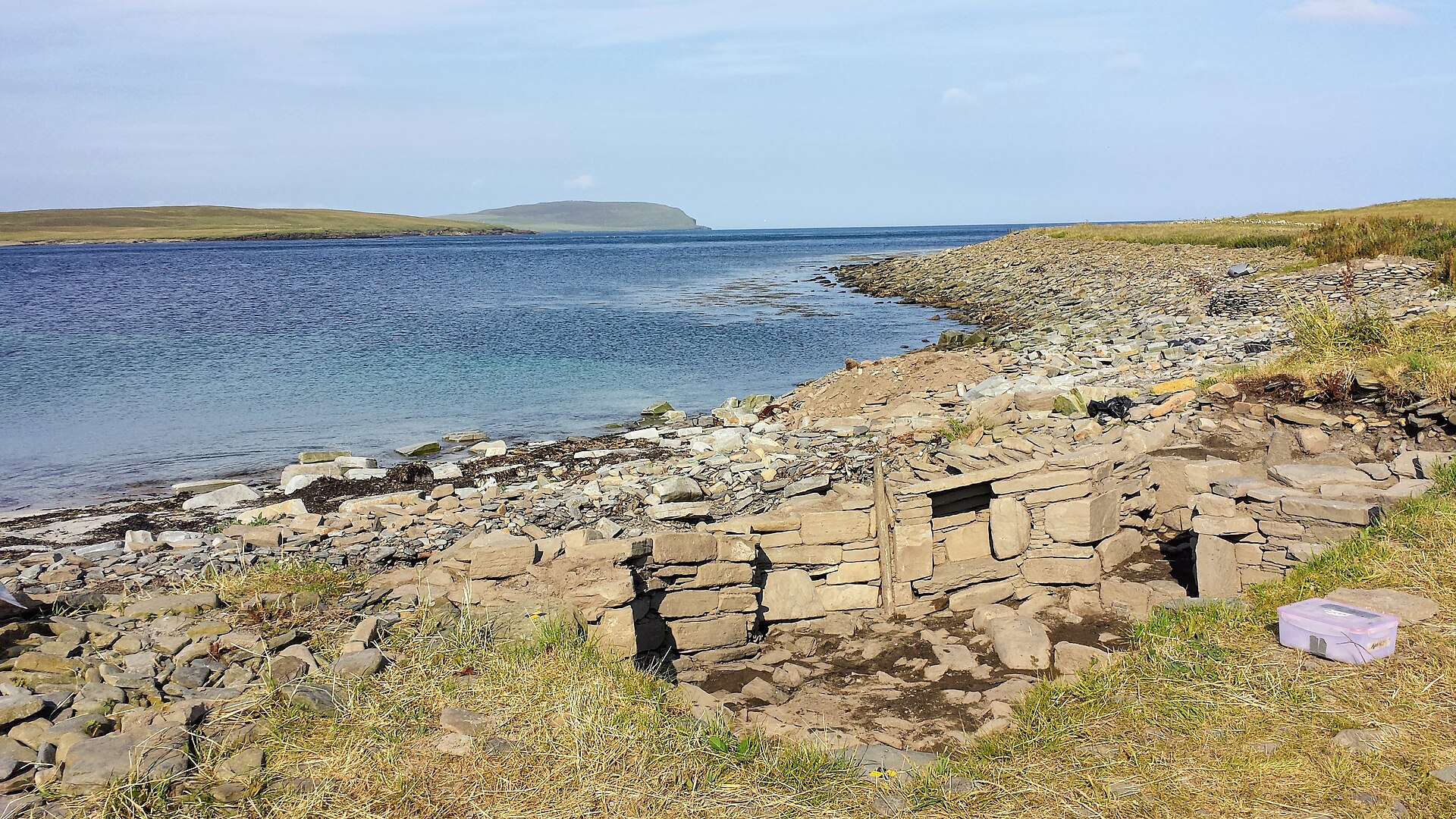
Photo: Bronwyn Chomitz / Wikimedia Commons / CC BY-SA 4.0 Both are archaeological landscapes on Rousay, preserving the island’s long sequence of prehistoric and later settlement.
-
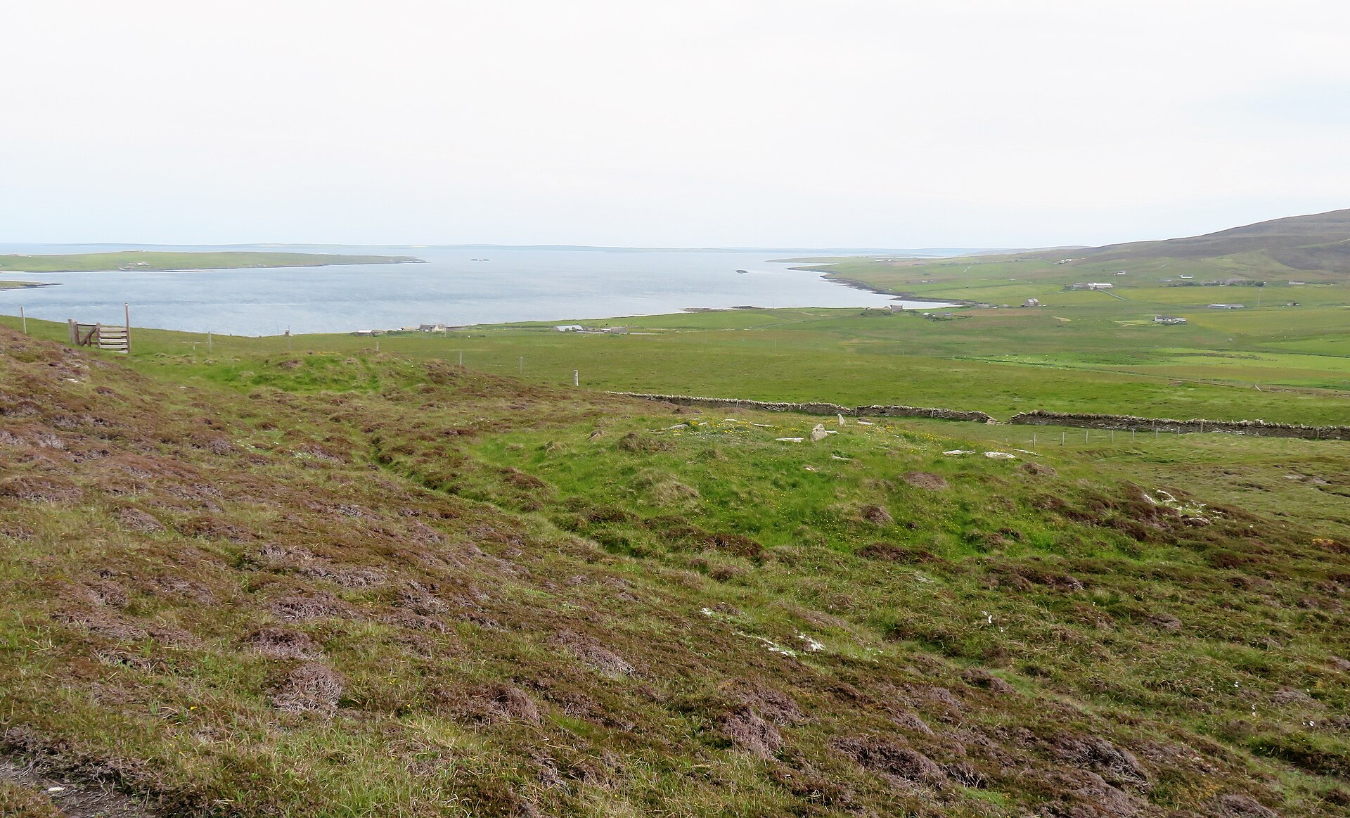
Photo: Gordon Hatton / Wikimedia Commons / CC BY-SA 2.0 Rinyo is part of the dense archaeological landscape of Rousay, complementing the island-wide record represented by the Rousay entry.
-

Photo: MichaelMaggs / Wikimedia Commons / CC BY-SA 4.0 Knowe of Yarso chambered cairn
The cairn and Rousay’s wider archaeological landscape together show the importance of the island for prehistoric settlement and funerary monuments.
What to look for
-
More than a hundred sites on one island
Over a hundred archaeological sites have been identified on Rousay, which is why the island is nicknamed the Egypt of the north.
-
Midhowe broch and cairn
The Midhowe complex — a broch and a chambered cairn together — is the most substantial of the island's monuments.
-
A Norse name
Rousay is Hrólfsey in Old Norse, meaning Rolf's Island, one of the plainest records of who was here after the Neolithic builders.
Plan your visit
- Location
- 59.1667°N · 3.0333°W
- Access
- Open access
- Terrain
- Moderate walking
- Time needed
- About 180 minutes
- Best time
- Daylight hours
- What survives
- Rousay remains a hilly inhabited island with a coastal road and a dense spread of archaeological sites, particularly along the western shore.
Opening & admission
No reliable current admission details are recorded; verify before travelling.
Nearby places
Ancient place · Prehistoric
Rinyo
Orkney Islands
A settlement of the first farming age on Rousay, discovered in the winter of 1937.
- Near Rousay
- Some walking

Tomb or burial place · Prehistoric
Knowe of Yarso chambered cairn
Orkney Islands
Knowe of Yarso preserves a burial mound built around a stone chamber, bringing together material remains and documented history that illuminate Ork…
- Rough ground
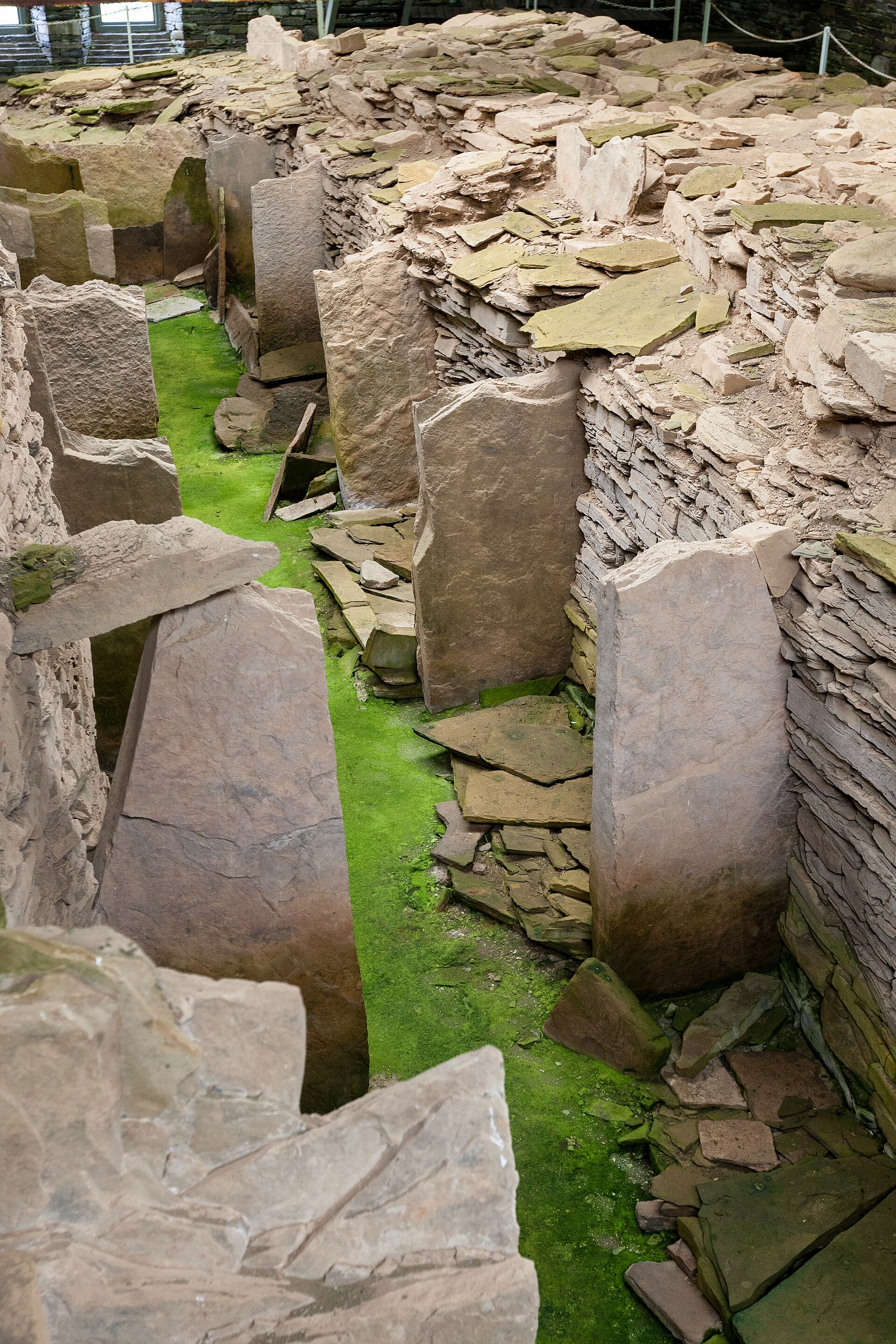
Tomb or burial place · Prehistoric
Midhowe Chambered Cairn
Orkney Islands
A large burial mound with an internal stone chamber on the south shore of Rousay, named after the drystone tower beside it.
- Near Rousay
- 10 min walk from car park
- Easy path

Fortified place · Iron Age
Midhowe Broch
Orkney Islands
An exceptionally well-preserved broch where a spring-fed tank, roasting hearth and converted workshop spaces make everyday life in an Iron Age coas…
- Near Rousay
- Some walking
Questions people ask
- Why is Rousay called the Egypt of the north?
- For its archaeological diversity and importance. More than a hundred sites have been identified on an island of 4,860 hectares with a population of 236.
- Where is the archaeology?
- Mostly near the western shore, where a cluster of sites is connected by a footpath — including Midhowe, where an Iron Age broch and a Neolithic chambered cairn stand together above Eynhallow Sound.
- How do you get there?
- By ro-ro ferry, the MV Eynhallow, from Tingwall. The service links Rousay with Egilsay and Wyre as well as the Orkney Mainland.
- What is the island like?
- Hilly — the hilliest in Orkney after Hoy — with one fourteen-mile road circling it and most arable land in the strip between that road and the coast. It is a Site of Special Scientific Interest with an RSPB reserve.
Sources
The Ancient Codex, in your pocket
Get the Pocket Codex app
Carry the directory with you — Rousay and thousands of ancient places across Britain and Ireland, offline, wherever you roam.