
Knowe of Swandro is a coastal archaeological site on Rousay, where a burial tomb, settlement remains and Viking-age buildings are being eroded by the sea.
The sea is taking Swandro, and the dig is a race. The site lies on a boulder beach on Rousay, partly below the high tide mark, and everything recovered from it has been recovered against a deadline that nobody controls.
What is being lost is unusually rich: a Neolithic chambered tomb around five thousand years old, an Iron Age settlement of roundhouses above it, Pictish buildings above that, and two Viking-age structures on top. Four periods stacked on one spot on a beach.
None of that was known until recently. Only the mound was visible, and it was assumed to be a broch. In 2010 Dr Julie Bond was walking the shore when she noticed worn, half-buried uprights that turned out to belong to a prehistoric building, and the excavation has run every year since apart from the two pandemic seasons.
The boulders that make the site so vulnerable have also protected it. They have sheltered the deposits and the architecture underneath, so the archaeology survives far better than its position would suggest. Against that, sea level rise and heavier storms are speeding the erosion up, and an aquifer beneath the site pushes water seaward through the deposits from the landward side. The sea has cut the whole thing into terraces: the seaward ones stripped back to the earliest layers, the landward ones still holding the latest.
The project won the Current Archaeology Award for Rescue Project of the Year in February 2024.
What follows is drawn from published sources, with each claim labelled by how firmly it is established.
History
Swandro is not one site but four superimposed. A Neolithic chambered tomb some five thousand years old lies beneath the remains of an Iron Age settlement of roundhouses, above which are Pictish buildings, and above those two structures of the Viking age. The whole sequence sits on the Bay of Swandro on Rousay. For a long time only the mound showed, and it was taken for a broch. The structures around it were found in 2010 by Dr Julie Bond, who was walking the beach and noticed worn, part-buried uprights belonging to a prehistoric building.
The site is on a boulder beach, partly below the high tide mark, and the sea is destroying it. Excavation has concentrated on the seaward side because that is what will go first. The boulders have paradoxically helped, sheltering the deposits and architecture beneath them, so the archaeology has survived better than its position suggests.
Erosion is accelerating. Rising sea levels and more frequent, more intense storms are the main drivers, and an aquifer beneath the site adds to the problem as its water works its way seaward through the deposits. The sea has cut the site into terraces — the seaward ones eroded down to the earliest layers, the landward ones still holding the later features.
Work began in 2010 to record as much as possible before it is lost, and has run annually since, pausing only for the pandemic in 2020 and 2021 and resuming in 2022. Beyond the record itself, the excavation is producing an understanding of how tidal and storm damage affect a site like this, which can inform management of others in the same position. In February 2024 the Knowe of Swandro project won the Current Archaeology Award for Rescue Project of the Year.
People
-
Dr Julie Bond
Recognised prehistoric building uprights on the beach in 2010, leading to the excavation.
Cultural influences
-
A Neolithic tomb, Iron Age roundhouses, Pictish buildings and Viking-age structures are stacked in one coastal mound.
-
Tides, storm damage and groundwater are cutting the site into terraces and exposing its earliest layers.
Connections
-
Bay of Swandro
The Bay of Swandro’s tidal boulder beach is actively eroding the mound, making its coastal setting the reason for the continuing rescue excavation.
-
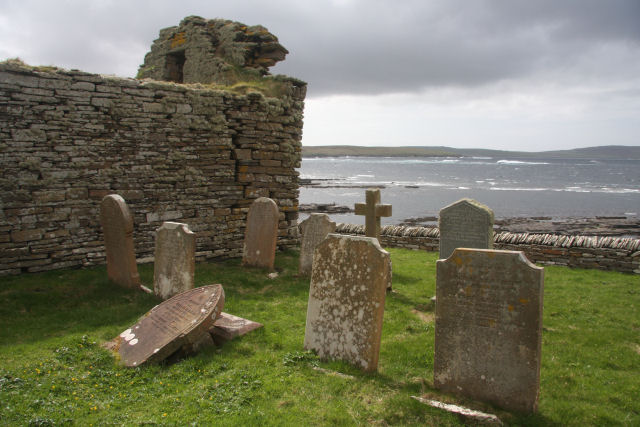
Photo: Bob Jones / Wikimedia Commons / CC BY-SA 2.0 Knowe of Swandro is part of Rousay’s dense prehistoric coastline, where erosion threatens an unusual sequence from Neolithic tomb to Viking-age buildings.
-
Iron Age settlement
Iron Age roundhouses form one layer of the Knowe of Swandro sequence, above the earlier chambered tomb and below Pictish buildings.
Discovery & excavation
Dr Julie Bond noticed worn, partly buried uprights on the beach in 2010. Annual excavation then revealed Neolithic, Iron Age, Pictish and Viking-age buildings within the mound.
What to look for
-
Eroded terraces
The sea has cut the mound into terraces: early deposits are exposed seaward while later archaeology survives on the landward side.
-
Boulder beach
Boulders shelter the buried architecture even as tide and storms erode the outer edge, explaining the site’s precarious survival.
-
Layered structures
A Neolithic tomb lies below Iron Age roundhouses, Pictish buildings and Viking-age structures, five millennia of occupation in one mound.
Plan your visit
- Location
- 59.1491°N · 3.0938°W
- Access
- Open access
- Terrain
- Rough ground — reasonable boots advised
- Time needed
- About 30 minutes
- Best time
- Daylight hours
- What survives
- Coastal erosion is actively removing the layered site from the boulder beach at the Bay of Swandro.
Opening & admission
No reliable current admission details are recorded; verify before travelling.
- The site is directly on a boulder beach, partly below the high-tide mark, and under active rescue excavation.
Nearby places
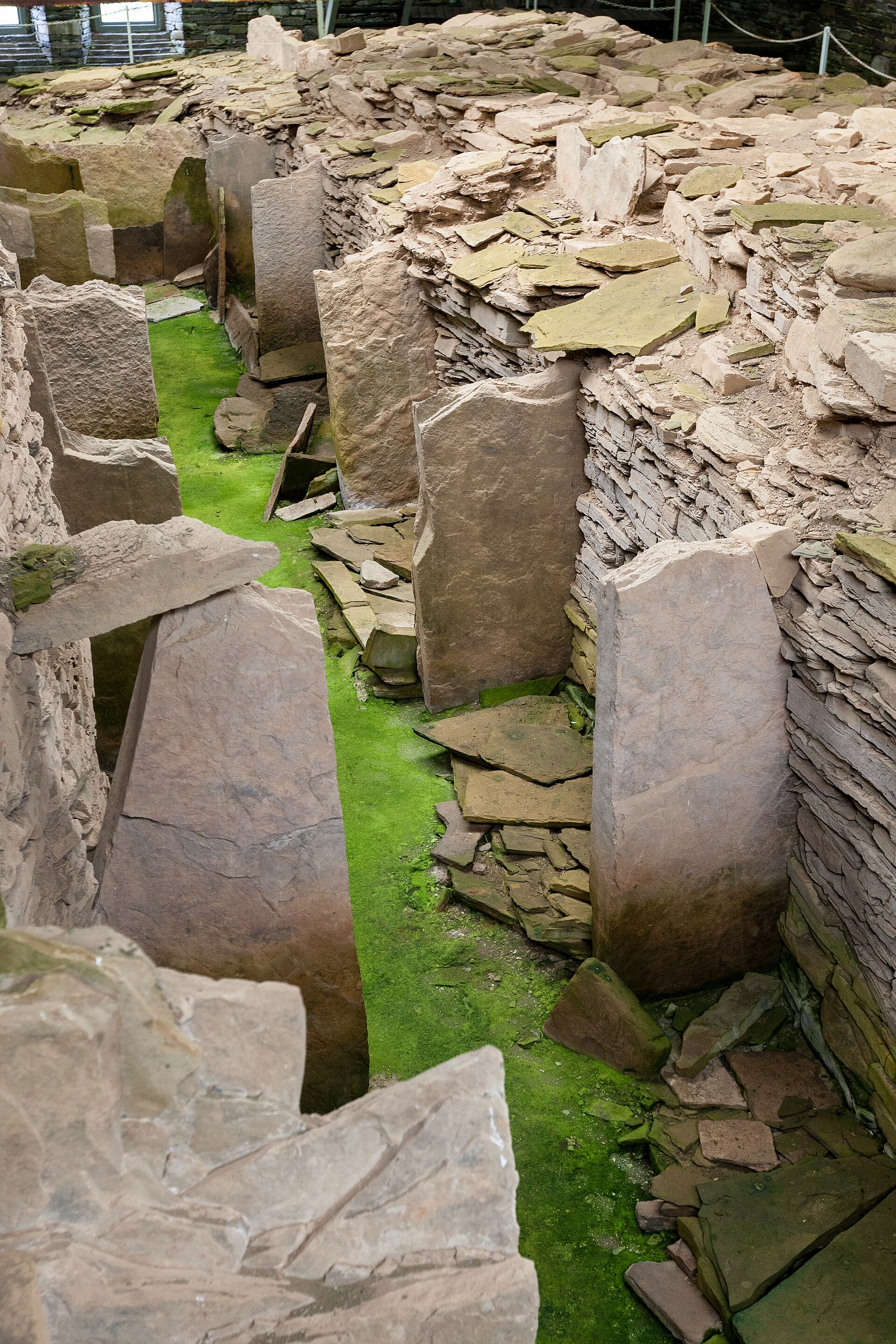
Tomb or burial place · Prehistoric
Midhowe Chambered Cairn
Orkney Islands
A large burial mound with an internal stone chamber on the south shore of Rousay, named after the drystone tower beside it.
- Near Rousay
- 10 min walk from car park
- Easy path

Fortified place · Iron Age
Midhowe Broch
Orkney Islands
An exceptionally well-preserved broch where a spring-fed tank, roasting hearth and converted workshop spaces make everyday life in an Iron Age coas…
- Near Rousay
- Some walking
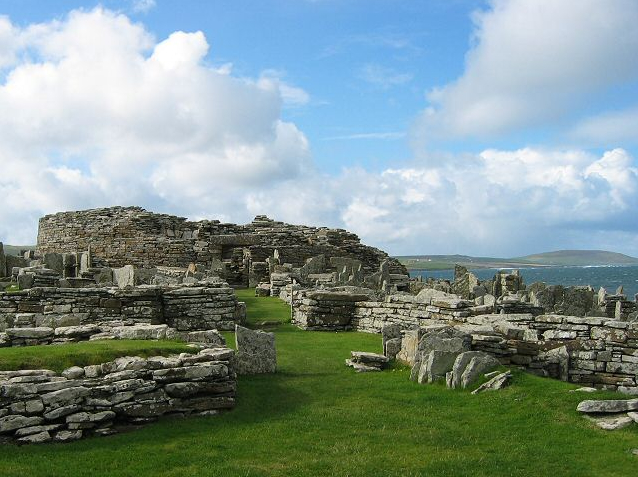
Settlement · Prehistoric
Broch of Gurness
Orkney Islands
The Broch of Gurness is a stone tower and settlement on the north-east coast of Mainland Orkney, overlooking Eynhallow Sound.
- Near Evie
- 141 metres from car park
- Some walking

Tomb or burial place · Prehistoric
Knowe of Yarso chambered cairn
Orkney Islands
Knowe of Yarso preserves a burial mound built around a stone chamber, bringing together material remains and documented history that illuminate Ork…
- Rough ground
The setting
Ploughed ground and the shore beside the Bay of Swandro, looking across to the Mainland of Orkney.
Photo: David Medcalf / Wikimedia Commons / CC BY-SA 2.0
The green shoreline and drystone field wall below Moa Ness, beside the Knowe of Swandro excavation.
Photo: David Medcalf / Wikimedia Commons / CC BY-SA 2.0
Questions people ask
- What is buried at Swandro?
- Four sites superimposed. A Neolithic chambered tomb some five thousand years old lies beneath an Iron Age settlement of roundhouses, above which are Pictish buildings, and above those two structures of the Viking age.
- How was it found?
- For a long time only the mound showed and it was taken for a broch. Dr Julie Bond found the surrounding structures in 2010 while walking the beach, noticing worn, part-buried uprights belonging to a prehistoric building.
- Why is the excavation urgent?
- The site is on a boulder beach, partly below the high tide mark, and the sea is destroying it. Rising sea levels and more frequent, more intense storms are the main drivers, with an aquifer beneath the site adding to the problem. Work has run annually since 2010, pausing only for the pandemic.
Sources
The Ancient Codex, in your pocket
Get the Pocket Codex app
Carry the directory with you — Knowe of Swandro and thousands of ancient places across Britain and Ireland, offline, wherever you roam.