
An isolated three-metre standing stone whose uncarved bulk records the considerable communal labour of quarrying, moving and raising a monument whose purpose is lost.
Nothing was done to this stone except stand it up. Mor Stein is 3.2 metres of unshaped, uncarved rock, set vertical in a field in the south-east of Shapinsay, and the labour that went into it was all in the quarrying, the moving and the raising.
It stands apart from everything else. There is no circle around it, no mound beside it, no other man-made feature nearby, and a single isolated stone gives archaeology very little to work with. Its purpose is not recorded and its date is Neolithic only by association with the class of monument it belongs to.
Shapinsay is one of the two large inner islands of Orkney, about two miles north of the Mainland, with Linton Bay lying a little to the north-east of the stone. A few miles further north is Burroughston Broch, whose earth covering is still intact — an Iron Age tower that visitors can look down into from above, several thousand years younger than the stone and far more legible.
What follows is drawn from published sources, with each claim labelled by how firmly it is established.
History
Mor Stein is a Neolithic standing stone in the south-eastern part of Shapinsay, one of the two large inner islands of Orkney, lying about two miles north of the Orkney Mainland. Linton Bay is a little to the north-east of it. Orkney is full of standing stones, and most of them are as undocumented as this one. The stone is roughly 3.2 metres high and stands vertically. It is unshaped and uncarved — nothing was done to it beyond quarrying it, moving it and setting it upright, which is the whole of the work and by no means a small amount of it. Several tonnes of rock does not walk into a field on its own.
It stands in a field, noticeably separate from any other man-made feature on the island. A single stone with nothing around it gives very little for an archaeologist to work with, and its purpose and precise date are not recorded. A few miles north is Burroughston Broch, whose earth cladding is still intact, so that visitors can look down into the tower from above. The two monuments are several thousand years apart on a small island. Comparing the two shows how much a monument's legibility depends on what happens to it afterwards rather than on what it was.
Cultural influences
-
The stone was quarried, moved and set upright as part of Orkney’s Neolithic monumental landscape.
Connections
-

Photo: Beep boop beep / Wikimedia Commons / CC BY-SA 4.0 Both are major prehistoric standing stones in Orkney, preserving evidence of the islands’ ceremonial landscape.
-

Photo: C Michael Hogan / Wikimedia Commons / CC BY-SA 2.0 Mor Stein and Castle Bloody are prehistoric monuments on Shapinsay, linking a standing stone with a later earthwork feature.
-
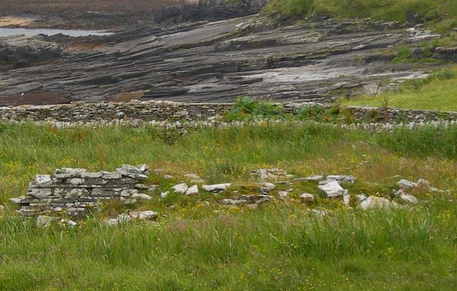
Photo: C Michael Hogan / Wikimedia Commons / CC BY-SA 2.0 The standing stone and chapel form part of Shapinsay’s layered historic landscape, spanning prehistoric monumentality and later Christian use.
Discovery & excavation
Mor Stein has been protected as a scheduled monument since 1953, recognising the standing stone as a prehistoric monument on Shapinsay.
What to look for
-
The standing stone
An uncarved, unshaped stone about 3.2 metres high stands alone in a field, its quarrying, movement and erection the entire visible monument.
Plan your visit
- Location
- 59.0367°N · 2.8297°W
- Nearest settlement
- Shapinsay
- Access
- Open access
- Terrain
- Easy going
- Time needed
- About 20 minutes
- Best time
- Daylight hours
- What survives
- The single 3.2-metre stone remains upright; no associated structures are recorded nearby.
Opening & admission
No reliable current admission details are recorded; verify before travelling.
Nearby places

Tomb or burial place · Prehistoric
Castle Bloody
Orkney Islands
An unresolved Shapinsay structure that may be a burial mound or an underground passage connected with settlement, challenging easy readings of how…
- Easy path
Sacred place · Prehistoric
Linton Chapel
Orkney Islands
An enigmatic small coastal chapel whose proximity to the disputed Castle Bloody offers a rare glimpse of medieval worship beside a much older Shapi…
- Easy path

Fortified place · Iron Age
Burroughston Broch
Orkney Islands
One of Orkney’s best-preserved brochs, its intact guard chamber, wall gallery and internal well make the defensive engineering of a tower from abou…
- Some walking
Fortified place · Iron Age
Loch of Tankerness
Orkney Islands
A shallow loch whose shrinking water exposed a Bronze Age house, while its shores bring together Iron Age, prehistoric and modern water-supply arch…
- Near Kirkwall
- Easy path
Questions people ask
- How big is the stone?
- About 3.2 metres high, standing vertically. It is unshaped and uncarved.
- Where is it?
- In a field in the south-eastern part of Shapinsay, one of the two large inner islands of Orkney, roughly two miles north of the Mainland.
- What is it for?
- Not recorded. The stone stands separate from any other man-made feature on the island, which leaves very little evidence to work from.
Sources
The Ancient Codex, in your pocket
Get the Pocket Codex app
Carry the directory with you — Mor Stein and thousands of ancient places across Britain and Ireland, offline, wherever you roam.