
Castlehill marks an Antonine Wall fort whose surviving plantation masks important Sixth Legion distance slabs and evidence for the frontier’s construction.
A circular beech plantation is now the clearest marker of Castlehill Fort, where the Antonine Wall once crossed a summit with wide views. The fort itself is difficult to read on the ground, but its carved distance slabs preserve the labour claims of Rome’s legions.
Between Bearsden and Duntocher, Castlehill formed part of a tightly spaced military chain. The stones found nearby show how the Wall was measured, built and commemorated long after the timber and turf structures disappeared.
The fort lies in East Dunbartonshire, west of Bearsden and east of Duntocher, south of the A810 Duntocher Road. Its neighbouring forts are Bearsden to the east and Duntocher to the west, with a fortlet at Cleddans between them and Hutcheson Hill nearer still.
A circular enclosed plantation of beech trees is about all a visitor can see today. The summit provides a wide panorama over ground that has produced a great many historical finds. The exact line of the Antonine Wall is sometimes hard to make out here, though there is some signage. Several historians in the 1900s gave their own idiosyncratic descriptions of the site.
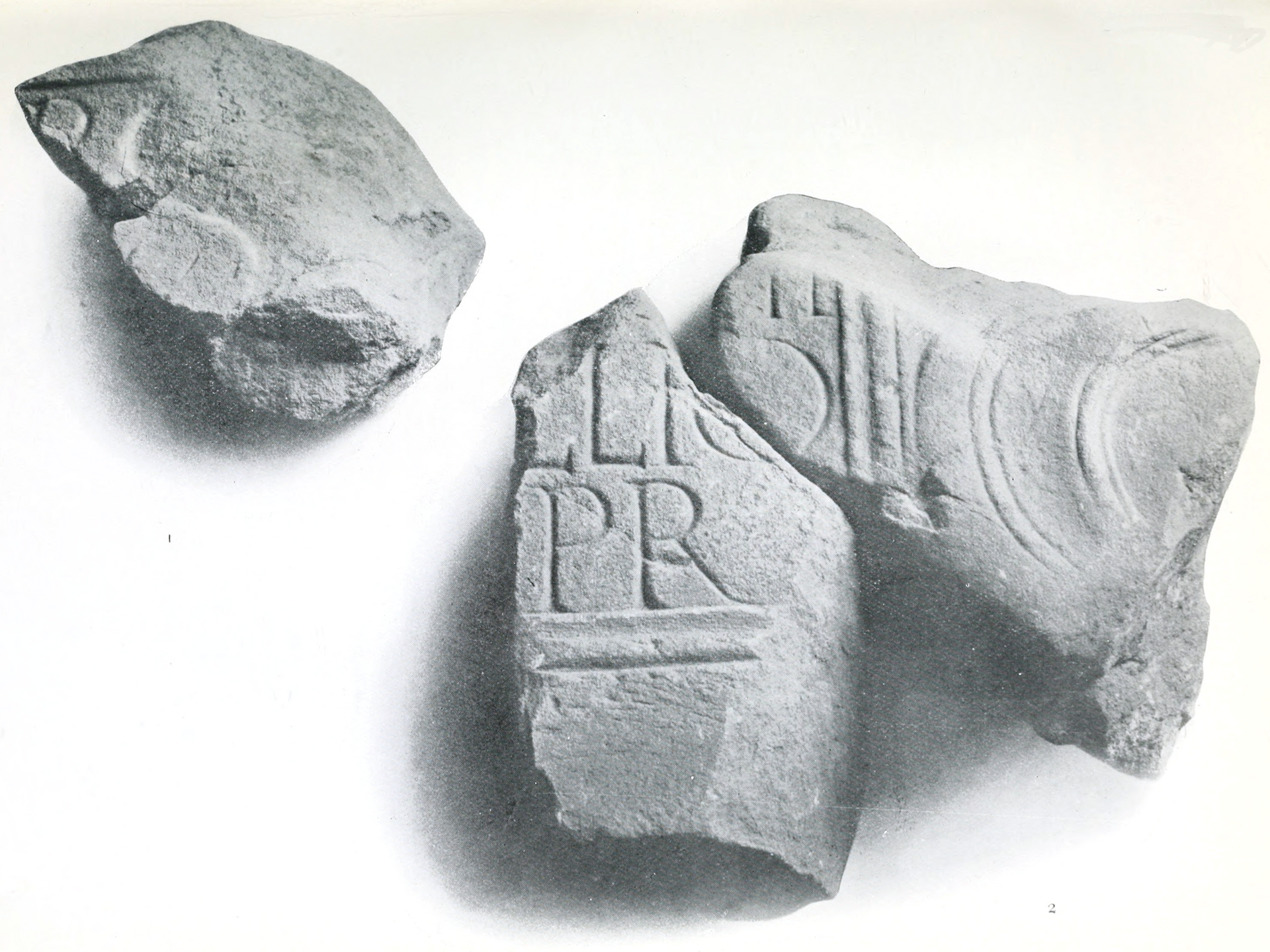
Two Roman distance slabs were found here. One can be compared with another found near Summerston: both, like two more from Duntocher, carry two decorative pelta shields, one on either side of the slab, the horns of each embellished with three rosettes on the Castlehill example, while the Summerston slab ends its horns in two griffins’ heads.
The first slab, badly weathered, has four rosettes between the shields and the inscription. It was found in 1803 on Low Millochan farm — later called East Millichen, near Summerston — where it had been built into a dovecote, and it records the building of 3,666 and a half paces of wall by the Sixth Legion. MacDonald described the work as coarse and noted that some of the abbreviations are unusual, suggesting it stood side by side with another slab at Summerston. On the Castlehill slab he suggested the stone-cutter blundered and cut a P where an F, for Fidelis, was intended on the fourth line. That slab also records 3,666 and a half paces, though the units used remain a matter of ongoing research. A neighbouring farmer found another in 1826.
What follows is drawn from published sources, with each claim labelled by how firmly it is established.
History
Castlehill was a Roman fort on the Antonine Wall in East Dunbartonshire, west of Bearsden and east of Duntocher. A fortlet at Cleddans lies between it and Duntocher, with Hutcheson Hill nearer still. The exact Wall line can be difficult to see, but the summit has wide views and some existing signage. Two Roman distance slabs were found at Castlehill. One was discovered in 1803 at Low Millochan Farm and later built into a dovecote; it records 3,666.5 paces of Wall built by the Sixth Legion. A similar Castlehill slab, RIB 2196, also records 3,666.5 paces, though the units remain a subject of research.
The slabs share decorative pelta shields with related stones from Summerston and Duntocher. The Castlehill carving has rosettes on its shield horns, while another has four rosettes between shields and inscription. A neighbouring farmer found a further slab and a Roman altar in 1826, preserving evidence beyond the now-obscure fort footprint.
Cultural influences
-
Castlehill’s high position gave a commanding view across the Antonine Wall corridor between Bearsden and Duntocher.
Connections
-
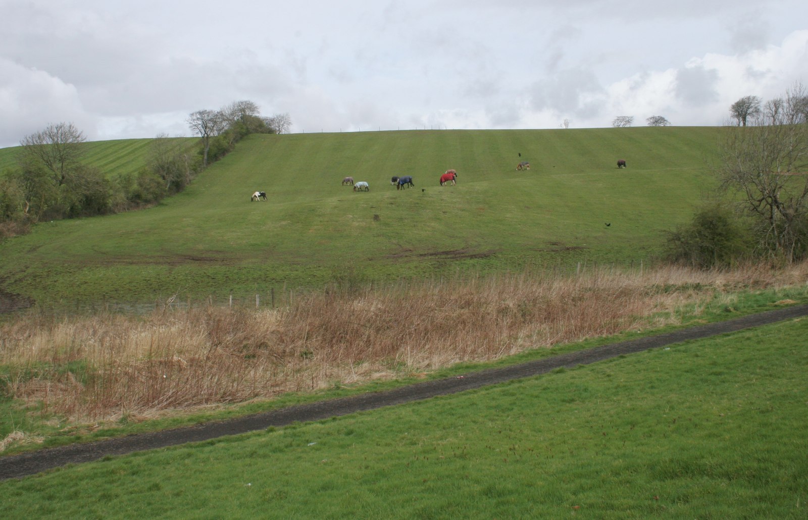
Photo: Richard Sutcliffe / Wikimedia Commons / CC BY-SA 2.0 Another Antonine Wall fort, extending the comparison with Castlehill’s military role along the frontier.
-
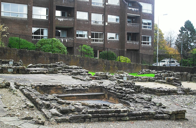
Photo: Lindsay Robertson / Wikimedia Commons / CC BY-SA 2.0 A neighbouring Antonine Wall fort whose remains help explain Castlehill’s place in the connected frontier network.
-
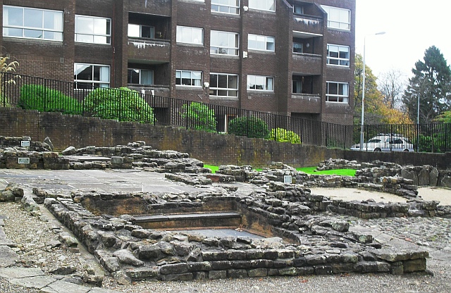
Photo: Lindsay Robertson / Wikimedia Commons / CC BY-SA 2.0 A surviving bath-house associated with the frontier forts, providing context for the domestic and communal life behind Castlehill’s defences.
Discovery & excavation
Distance slabs found at Castlehill record construction by the Sixth Legion, preserving evidence for a fort whose footprint is now difficult to see.
What to look for
-
The beech ring
A circular beech plantation marks the summit of Castle Hill, where grass-covered earthworks and the fort’s position can still be read in the landscape.
-
The summit view
From the Castle Hill summit, look across the broad corridor between Bearsden and Duntocher that the Antonine Wall once controlled.
-
The Wall corridor
Trace the Antonine Wall corridor through the open ground between the neighbouring forts at Bearsden and Duntocher, even where the line itself is obscure.
-
The Sixth Legion slabs
Look for interpretation of the Sixth Legion distance slabs, whose inscriptions record 3,666.5 paces of Wall construction from Castle Hill.
Plan your visit
- Location
- 55.9245°N · 4.3633°W
- Nearest settlement
- Bearsden
- Access
- Open access
- Terrain
- Moderate walking
- Time needed
- About 45 minutes
- What survives
- The fort’s line is faint, but the hilltop, circular beech plantation, Wall corridor and site signage help locate the Roman position.
Opening & admission
The fort site is recorded as open; no admission or ticketing arrangement is published in this record, so confirm current local access conditions before travelling.
- A circular plantation of beech trees is the main visible feature.
- The summit provides wide views.
Nearby places
Fortified place · Roman
Cleddans
East Dunbartonshire
Cleddans confirms the Antonine Wall’s system of small interval fortlets, while its richly carved legionary slabs record the construction and imager…
- Near Duntocher
- Some walking
Fortified place · Roman
Bearsden Roman fort
East Dunbartonshire
Bearsden preserves one of the Antonine Wall’s best-known military bathhouses, discovered beneath twentieth-century housing and now protected close…
- Near Bearsden
- Easy path
Fortified place · Roman
Bearsden Roman Bath House
East Dunbartonshire
The Romans built a stone-and-turf fortification, the Antonine Wall, between the Firth of Clyde and the Firth of Forth between AD 142 and 144 under…
- Near Bearsden
- 3 min walk from car park
Fortified place · Roman
Balmuildy
East Dunbartonshire
Balmuildy is one of only two Antonine Wall forts known to have stone ramparts, with excavated baths, inscriptions and objects now held in Glasgow’s…
- Near Bearsden
- Some walking
The setting
Open grassland on Castle Hill Roman fort.
Photo: Lairich Rig / Wikimedia Commons / CC BY-SA 2.0
Pasture at Castle Hill, the site of the Roman fort.
Photo: Richard Sutcliffe / Wikimedia Commons / CC BY-SA 2.0
Questions people ask
- What can be seen at Castlehill today?
- A circular enclosed beech plantation is the main visible feature, with some Wall signage nearby.
- What did the distance slab record?
- It recorded 3,666.5 paces of Wall construction by the Sixth Legion.
- Where is Castlehill Fort?
- It is in East Dunbartonshire, between Bearsden and Duntocher on the Antonine Wall.
Sources
The Ancient Codex, in your pocket
Get the Pocket Codex app
Carry the directory with you — Castlehill Fort and thousands of ancient places across Britain and Ireland, offline, wherever you roam.