
Bar Hill’s fort, bathhouse and deep well preserve unusually direct evidence of Antonine Wall garrison life, including shoes that may point to women and children at the site.
On Bar Hill’s south-facing slope, the footprint of a Roman headquarters and bathhouse still anchors a fort built into the Antonine Wall line. A 43-foot well produced an especially human collection of discarded objects when the site was excavated.
The finds include footwear for men, women and children, religious material and the equipment of water supply. Together they make Bar Hill more than a defensive point: it was a place where military routines and a wider community overlapped.
Bar Hill Fort was built around AD 142, one of more than a dozen forts raised along the Antonine Wall from about 140. Those forts follow a short route across Scotland’s central belt, a line largely followed again in the eighteenth century when the Forth and Clyde Canal was cut. Older maps and documents sometimes spell the name Barr Hill.
The shoes from the well are why the size and shape of the garrison matter here. Five hundred or so was the usual strength on this line, and a nominal thousand was reserved for a few of the largest posts. Serving soldiers could not legally marry; the footwear indicates who was living at Bar Hill regardless, and settlements of civilians are likely to have gathered outside the bigger forts.
An altar to Silvanus was found on the hill in 1895, thought to have come from a small shrine outside the fort. It is now in the Hunterian Museum in Glasgow, along with others including one from Castlecary. Many further artefacts have been found at Shirva, about a mile away on the other side of Twechar.
A well 43 feet deep was discovered on the site, and several items were recovered from it — possibly dumped there when the fort was abandoned. Shoes belonging to men, women and children were among them, which has been taken to indicate family life. Other finds from the well include an altar, bones, shells and coins, along with structural material such as building columns and wooden beams and part of the well’s own pulley. Videos of reconstructed objects have since been produced, among them a barrel, a window, various columns and a bust of Silenus.
On the south-facing slope of the hill stands the headquarters building, the largest structure visible on the site, and the remains of a Roman bathhouse can also be seen. Sir George Macdonald wrote up the excavation. A computer-generated fly-around has been produced, and lidar scans have been made along the length of the wall, this site included.
What follows is drawn from published sources, with each claim labelled by how firmly it is established.
History
Bar Hill Fort was built on the Antonine Wall around AD 142. It was one of more than a dozen forts along the short central-Scotland frontier route, later broadly followed by the Forth and Clyde Canal. The fort’s south-facing slope contains the headquarters building, the largest visible structure, and the remains of a Roman bathhouse.
A 43-foot-deep well was excavated at the site. Objects recovered from it may have been dumped there when the fort was abandoned, including shoes of men, women and children, bones, shells, coins, structural timbers and columns, and part of the well’s pulley. The footwear has prompted suggestions that family life existed around the garrison. An altar to Silvanus, RIB 2167, was found at Bar Hill in 1895 and is thought to have come from a small shrine outside the fort. It is held in the Hunterian Museum in Glasgow. Further archaeological material has been found at nearby Shirva on the other side of Twechar.
People
-
Sir George Macdonald
He wrote up the excavation that revealed the fort’s deep well and its unusually varied deposits.
Cultural influences
-
Bar Hill formed part of the Antonine Wall’s Roman frontier system, where its garrison, headquarters and bathhouse supported military control and a wider civilian community.
Connections
-
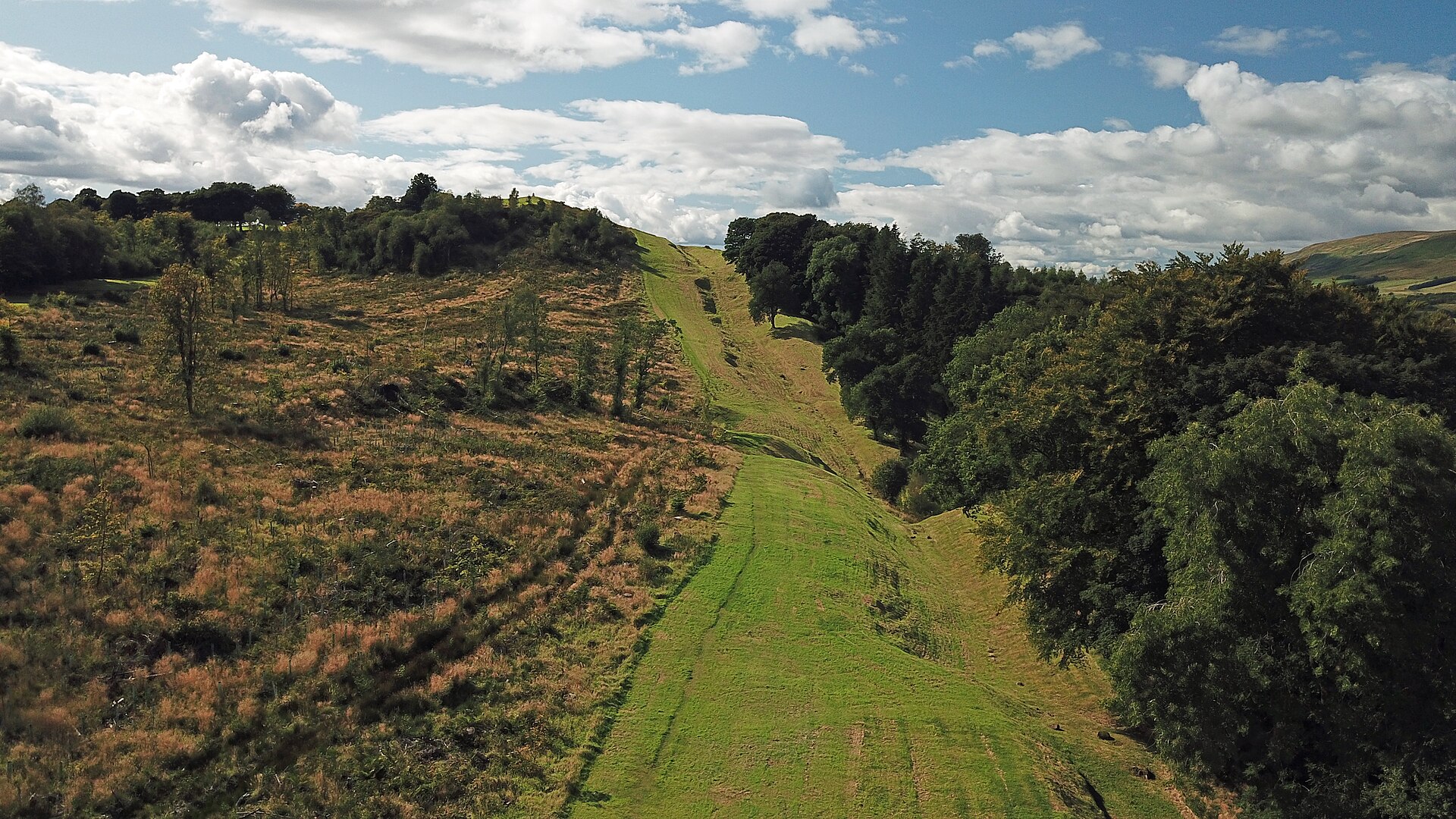
Photo: Gunther Tschuch / Wikimedia Commons / CC BY-SA 4.0 Another Antonine Wall fort, providing a comparison with Bar Hill’s military buildings and position within the frontier system.
-
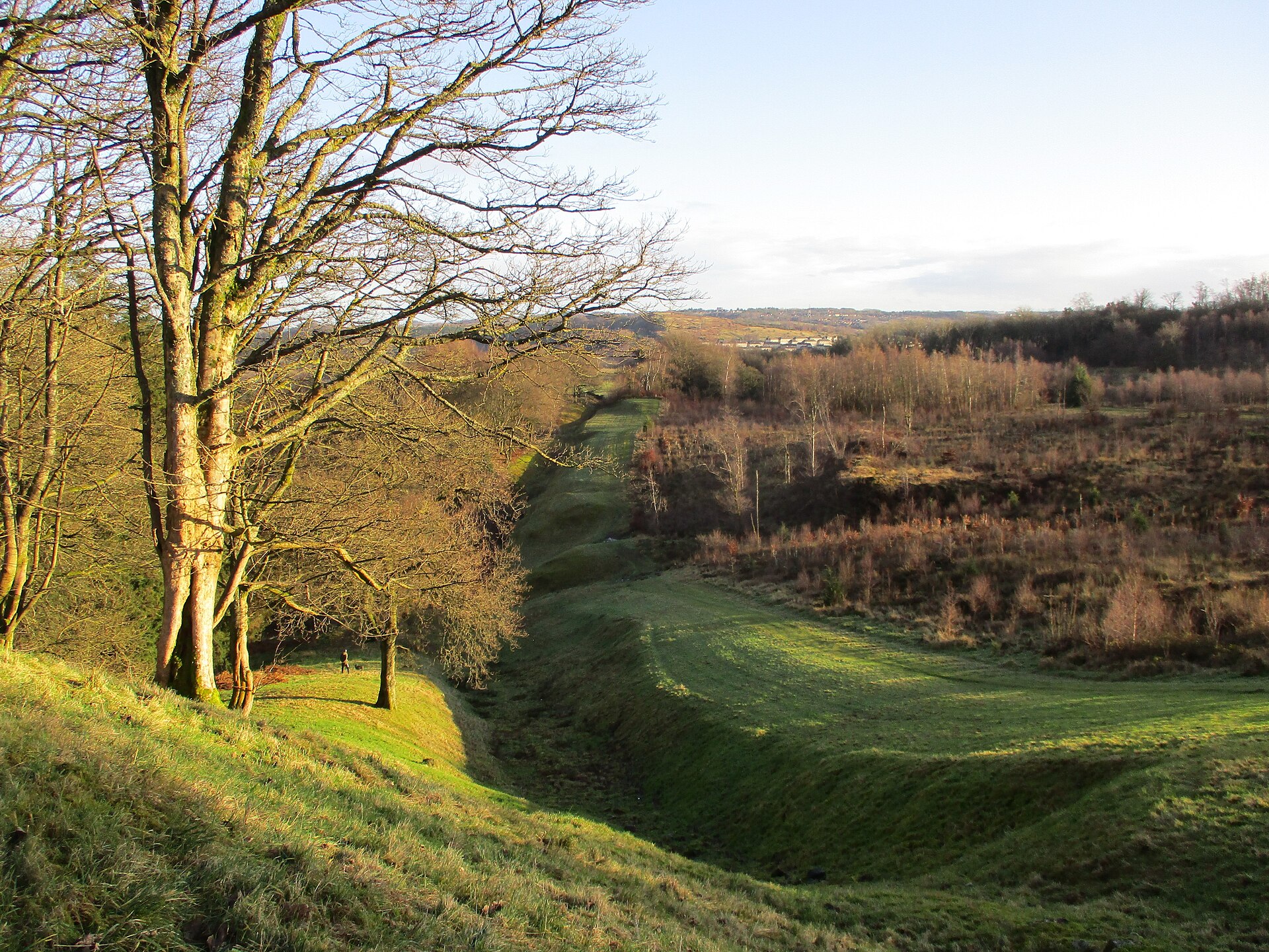
Photo: Alan O'Dowd / Wikimedia Commons / CC BY-SA 2.0 Bar Hill Fort was one of the Wall’s principal installations, making its remains part of the wider Roman barrier landscape.
-

Photo: Chris Wimbush / Wikimedia Commons / CC BY-SA 2.0 A prominent stretch of the Antonine frontier landscape, helping connect Bar Hill’s fort to the earthworks and communications of the Wall.
Discovery & excavation
Excavation revealed a 43-foot well containing shoes, coins, an altar, bones, shells, wooden beams and a pulley, apparently deposited around the fort’s abandonment.
What to look for
-
The headquarters
The south-facing headquarters building is the fort’s largest visible structure, showing the administrative core of a garrison placed on the Antonine Wall.
-
The bathhouse
The Roman bathhouse remains on the south-facing slope beside the headquarters, evidence that the garrison’s routine extended beyond purely defensive works.
-
The deep well
The 43-foot-deep well produced shoes, coins, bones, timbers and a pulley, material apparently discarded when the fort was abandoned.
-
The Wall across the belt
From Bar Hill, the Antonine Wall’s central-Scotland route can be read across the belt later broadly followed by the Forth and Clyde Canal.
Plan your visit
- Location
- 55.9589°N · 4.0721°W
- Time needed
- About 90 minutes
Nearby places
Fortified place · Roman
Antonine Wall
East Dunbartonshire
The Antonine Wall was Rome’s short-lived northern frontier, joining nineteen forts to carved distance slabs whose paint, imagery and military messa…
- Near Kirkintilloch

Fortified place · Roman
Croy Hill
North Lanarkshire
Croy Hill is the Antonine Wall’s exceptional unditched sector, combining difficult geology, frontier forts, a bathhouse and rich religious finds.
Fortified place · Roman
Auchendavy
East Dunbartonshire
Auchendavy was an Antonine Wall fort with an exceptional concentration of inscriptions, altars and military finds, despite severe damage from the F…
- Near Kirkintilloch
- Some walking
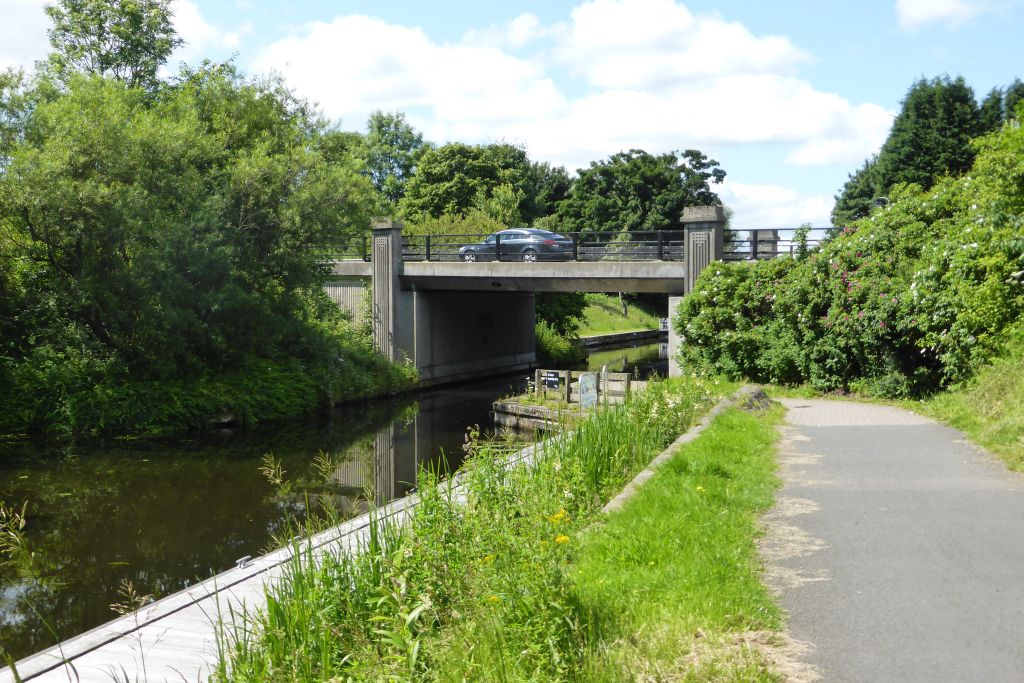
Crossing or structure · Roman
Glasgow Bridge, Kirkintilloch
East Dunbartonshire
Glasgow Bridge marks a largely invisible Antonine Wall fortlet known through aerial evidence, beside a canal crossing that now connects Kirkintillo…
- Near Kirkintilloch
- Easy path
Questions people ask
- When was Bar Hill Fort built?
- It was built on the Antonine Wall around AD 142.
- What was found in the well?
- Finds included footwear, bones, shells, coins, structural material and part of a pulley.
- Where is the Silvanus altar?
- It is held in the Hunterian Museum in Glasgow.
Sources
The Ancient Codex, in your pocket
Get the Pocket Codex app
Carry the directory with you — Bar Hill Fort and thousands of ancient places across Britain and Ireland, offline, wherever you roam.