
The Antonine Wall was Rome’s short-lived northern frontier, joining nineteen forts to carved distance slabs whose paint, imagery and military message still survive.
Twenty carved slabs survive from the frontier the Romans threw across the neck of Scotland, each one set into the rampart, a raised bank of layered turves on a stone footing, to record the length a particular legion had finished. They are sculpture found on no other Roman frontier, and analysis at Glasgow University has shown that they were once brightly painted rather than the bare stone they are now. The wall they came from ran about 63 kilometres, or 39 miles, from Old Kilpatrick on the Firth of Clyde to Carriden near Bo’ness on the Firth of Forth: a bank of layered turves roughly three metres high and five wide on a stone footing, with a deep ditch along its northern side and a service road, the Military Way, behind it to the south. Antoninus Pius ordered it in about AD 142, twenty years after Hadrian’s Wall and to replace it, and for as long as it held a garrison it was the northernmost frontier barrier of the Roman Empire. It was held for barely two decades. Because turf and timber weather away where masonry does not, far less of the second of Rome’s two great walls in Britain shows above ground than of its longer, better-known predecessor to the south.
What follows is drawn from published sources, with each claim labelled by how firmly it is established.
The name
The wall is named for the Roman emperor Antoninus Pius, who ordered its construction around AD 142.
History
Antoninus Pius ordered the barrier about AD 142, some twenty years after Hadrian’s Wall, intending it to supersede the older frontier farther south. Quintus Lollius Urbicus, governor of Roman Britain, directed the work; estimates for its completion range from six to twelve years. The advance probably answered pressure from the Caledonians rather than any personal visit by Antoninus, who never came to Britain.
The finished frontier ran about 63 kilometres from Old Kilpatrick on the Firth of Clyde to Carriden near Bo’ness on the Firth of Forth. A turf-and-earth bank on a stone base, with a northern ditch and the Military Way behind it, linked nineteen forts and smaller fortlets. It was a less monumental structure than Hadrian’s Wall, but while it was garrisoned it marked the northernmost frontier barrier of the Roman Empire.
The legions marked their completed stretches with carved distance slabs, a distinctive frontier sculpture of which twenty survive in Glasgow University’s Hunterian Museum. Scientific analysis has found traces of their original paint, and scans and replicas help make their colour and imagery visible again. The Bridgeness Slab has a replica at Bo’ness, close to the wall’s eastern end.
The frontier was abandoned within two decades, when the legions withdrew to Hadrian’s Wall in 162. Septimius Severus campaigned in Scotland in AD 208–210, but there is no evidence that he restored the Antonine line. Later writers, including Bede, confused the Roman walls and their builders; medieval and early modern names such as Gryme’s Dyke and Graham’s Dyke kept the earthwork alive in local memory.
William Roy’s 1764 survey is now an essential record of stretches lost to later development. Successive Ordnance Survey and archaeological surveys mapped what remained, while modern GIS and lidar model the line in three dimensions and test how forts and fortlets related to one another across the landscape. The Antonine Wall became part of the Frontiers of the Roman Empire World Heritage Site on 7 July 2008. Several accessible points along its route are in the care of Historic Environment Scotland, where the surviving turfwork, fort sites and distance-slab displays turn a largely vanished frontier into a landscape a visitor can still trace.
Writing in 730, Bede misidentified the turf rampart as a work of the Britons, following Gildas and confusing it with Hadrian’s Wall. His account nevertheless shows that the line was still a visible landmark, running from near Kinneil towards Dumbarton. Later writers knew it as Gryme’s Dyke or Graham’s Dyke, names that attached the earthwork to invented kings, clan tradition, the devil or Odin. These changing explanations matter at the surviving sites: the line has never been only a Roman engineering problem, but a landmark whose meaning has been repeatedly remade by the people living beside it.
The wall’s archaeology has had to contend with loss as well as discovery. In the sixteenth century a distance stone was built into Dunnottar Castle, painted and gilded in its later setting; it is now in the Hunterian Museum. Roy’s eighteenth-century plans, nineteenth-century large-scale Ordnance Survey mapping and later dedicated folios recorded sections before urban and agricultural change removed them. Modern World Heritage work has added fresh mapping and interpretation. For a visitor, this explains the discontinuous experience of the Antonine Wall: the route survives as earthwork, museum sculpture, place-name and reconstructed marker rather than as one unbroken monument.
People
-
Antoninus Pius
Roman emperor who ordered the Antonine frontier around AD 142, although he never visited Britain to see its construction.
-
Quintus Lollius Urbicus
Governor of Roman Britain who directed construction of the 63-kilometre frontier, linking forts and fortlets across the Clyde–Forth isthmus.
-
William Roy
Military surveyor whose 1764 plans preserve stretches of the Wall later erased by agricultural and urban development.
Cultural influences
-
The narrow Clyde–Forth isthmus made a practical northern frontier, where a turf rampart, northern ditch, forts and Military Way controlled movement across central Scotland.
Connections
-
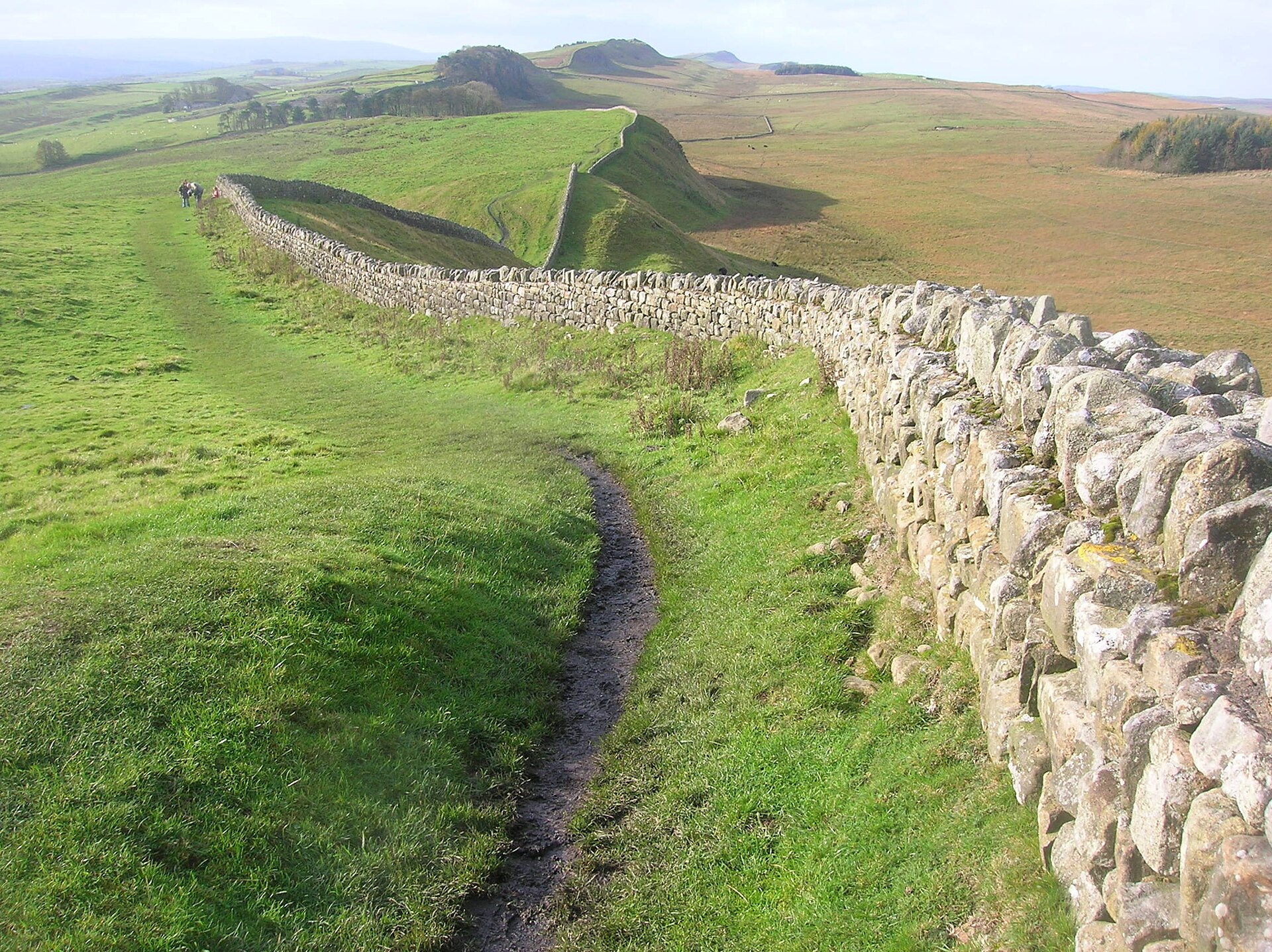
Photo: quisnovus from Gloucester, England / Wikimedia Commons / CC BY 2.0 The Antonine Wall was built some twenty years later and intended to supersede Hadrian's Wall as the frontier of Britannia; the garrisons withdrew back to it in 162.
-
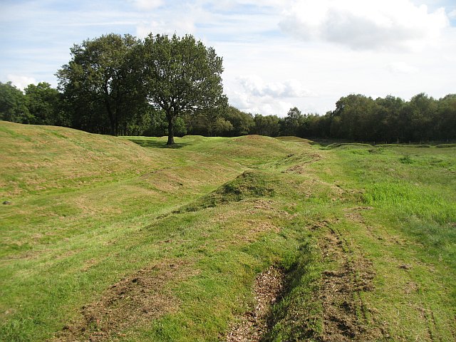
Photo: Richard Webb / Wikimedia Commons / CC BY-SA 2.0 Rough Castle Fort
Rough Castle is the best-preserved of the nineteen forts built along the line of the wall.
-

Photo: No machine-readable author provided. Paul0559 assumed (based on copyright claims). / Wikimedia Commons / Public domain Gask Ridge
Forts on the Gask Ridge, among them Ardoch, Strageath and Bertha, were brought back into service when the Antonine Wall was held.
Discovery & excavation
Visible turfwork, ditch lines, fort foundations and carved distance slabs trace the former frontier; Roy’s 1764 drawings also preserve stretches since lost to development.
In culture
-
The surviving distance slabs were originally brightly painted; pigment research and three-dimensional scans have brought their sculpture back into public view.
What to look for
-
Turf rampart and ditch
Look for the broad turf bank on its stone base and the northern ditch, with the Military Way running behind the frontier defences.
-
Distance slabs
Carved legionary distance slabs, once brightly painted, record completed sections of the Wall; twenty survive in Glasgow’s Hunterian Museum.
-
Rough Castle
Rough Castle is among the best-preserved forts on the line, where earthworks make the Wall’s garrisoned frontier easier to read on the ground.
What is said
Folklore and tradition, recorded as what is said — not as established fact.
-
Graham’s Dyke
Later tradition attached the name Graham’s or Grim’s Dyke to the wall, with Grim also understood as a name for the devil or Odin.
Plan your visit
- Location
- 55.9670°N · 4.0670°W
- Nearest settlement
- Kirkintilloch
- What survives
- The frontier survives in discontinuous stretches of turf rampart, ditch, fort foundations and museum-held sculpture; development has removed other sections.
Nearby places
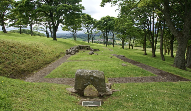
Fortified place · Roman
Bar Hill Fort
East Dunbartonshire
Bar Hill’s fort, bathhouse and deep well preserve unusually direct evidence of Antonine Wall garrison life, including shoes that may point to women…

Fortified place · Roman
Croy Hill
North Lanarkshire
Croy Hill is the Antonine Wall’s exceptional unditched sector, combining difficult geology, frontier forts, a bathhouse and rich religious finds.
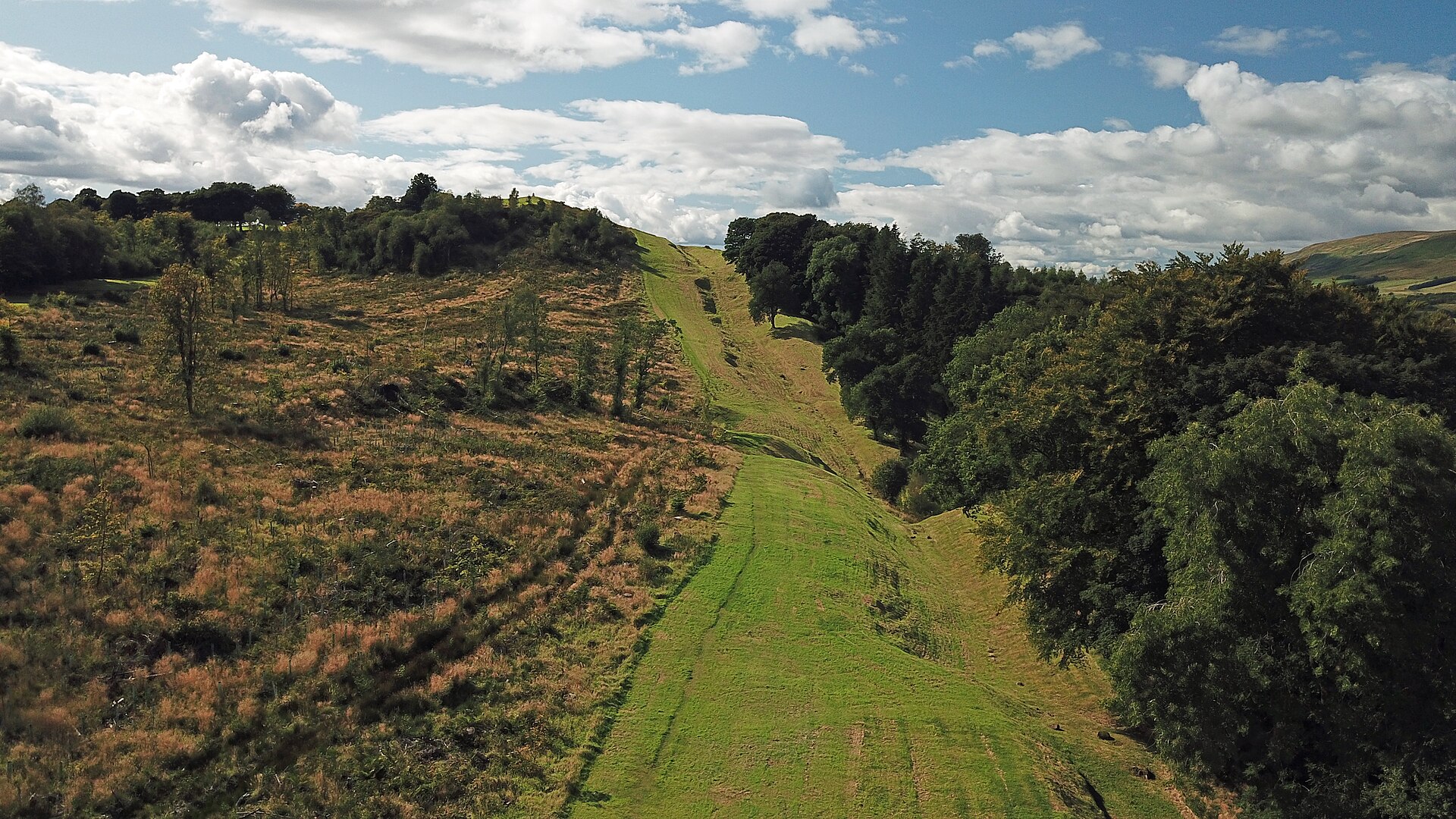
Fortified place · Roman
Auchendavy
East Dunbartonshire
Auchendavy was an Antonine Wall fort with an exceptional concentration of inscriptions, altars and military finds, despite severe damage from the F…
- Near Kirkintilloch
- Some walking
Fortified place · Roman
Castlecary Roman fort
Falkirk
Castlecary Roman Fort anchors an Antonine Wall landscape where archaeological finds: altars, a bathhouse, children’s shoes and military inscription…
- Some walking
Questions people ask
- Why is Antonine Wall significant?
- For roughly two decades this was the northernmost frontier barrier of the Roman Empire, and its distance slabs are described as the best-preserved statuary recovered from any Roman frontier.
- What should a reader focus on?
- The line of bank and ditch between Old Kilpatrick and Carriden, the fort at Rough Castle, the fortlet at Kinneil, and the distance slabs held in Glasgow's Hunterian Museum.
- How certain is the interpretation?
- The building date of about AD 142 is secure; how long the work took is not, with estimates between six and twelve years. Bede and later writers confused this wall with Hadrian's for centuries.
Sources
The Ancient Codex, in your pocket
Get the Pocket Codex app
Carry the directory with you — Antonine Wall and thousands of ancient places across Britain and Ireland, offline, wherever you roam.