
The southernmost cairn (a mound of piled stones, often covering a burial) in Kilmartin Glen's five-mile chain of Bronze Age (roughly 2500–800 BC) burial mounds, later hollowed out and fired as a lime kiln before being restored to something closer to its original form.
A low cairn at the southern end of Kilmartin Glen carries a local tradition that it was a king’s resting place. Its documented history is more grounded: communities raised the mound between 2200 and 1950 BC, choosing the valley floor, within sight of other cairns, for burial.
The mound was later altered into a lime kiln, where limestone was fired into quicklime for use on surrounding farmland. Twentieth-century excavations exposed the prehistoric remains beneath that industrial reuse; the kiln was then stripped away and the site restored to something closer to its earlier form.
Ri Cruin is one of five surviving mounds in the linear cemetery running south-by-southwest from Kilmartin village. Standing stones, rock carvings and a fortress associated with the early kings of Dal Riata surround the wider valley.
What follows is drawn from published sources, with each claim labelled by how firmly it is established.
History
Sometime between 2200 and 1950 BC, builders raised a stone cairn at the southern end of what would become a chain of burial monuments running for several miles across Kilmartin Glen. The mound joined a landscape already thick with ceremonial activity, taking its place as the most southerly of the five cairns that still survive from that original alignment.
Over the generations that followed, the cairn's origins faded from record, and it passed instead into local tradition as the reputed burial place of a king, a story with no documented source but persistent enough to attach itself firmly to the site. No excavation has ever confirmed a royal burial, but the association shows how thoroughly the monument had become woven into the folk memory of the glen long before archaeologists arrived to investigate it properly.
At some point after its construction, and probably many centuries later, the cairn was repurposed as a lime kiln, its stones rearranged to create a structure capable of firing limestone for agricultural use. This industrial reuse altered the visible form of the monument considerably, burying its prehistoric character under the scars of a much more recent farming practice.
In 1870 the Reverend Mapleton carried out the first recorded excavation of the cairn, opening it up for antiquarian study at a time when interest in the prehistoric monuments of Kilmartin Glen was beginning to grow among Victorian clergymen and gentleman scholars working across Argyll. A second excavation followed in 1929 under Craw, part of a wider wave of fieldwork across the linear cemetery in the same decade that also examined the neighbouring Nether Largie cairns, as archaeologists sought to establish a clearer chronology for the string of monuments running through the glen.
The most significant investigation came in 1936, when the pioneering archaeologist V. Gordon Childe examined the site, bringing to it the same rigorous, chronologically minded approach he was applying across Scottish prehistory more broadly. Following this work, and a subsequent reconstruction of the monument, every surviving trace of the lime kiln was deliberately removed, restoring the cairn's profile to something closer to its Bronze Age appearance.
People
-
Reverend Mapleton
Carried out the first recorded excavation of Ri Cruin Cairn in 1870.
-
J. H. Craw
Excavated the cairn in 1929 as part of wider fieldwork across the Kilmartin linear cemetery.
-
V. Gordon Childe
Excavated the cairn in 1936, work that preceded the removal of the later lime-kiln remains and the site's reconstruction.
Cultural influences
-
Kilmartin Glen cemetery
Ri Cruin is the southernmost surviving cairn in the Kilmartin Glen linear cemetery, an extended prehistoric burial landscape.
Connections
-
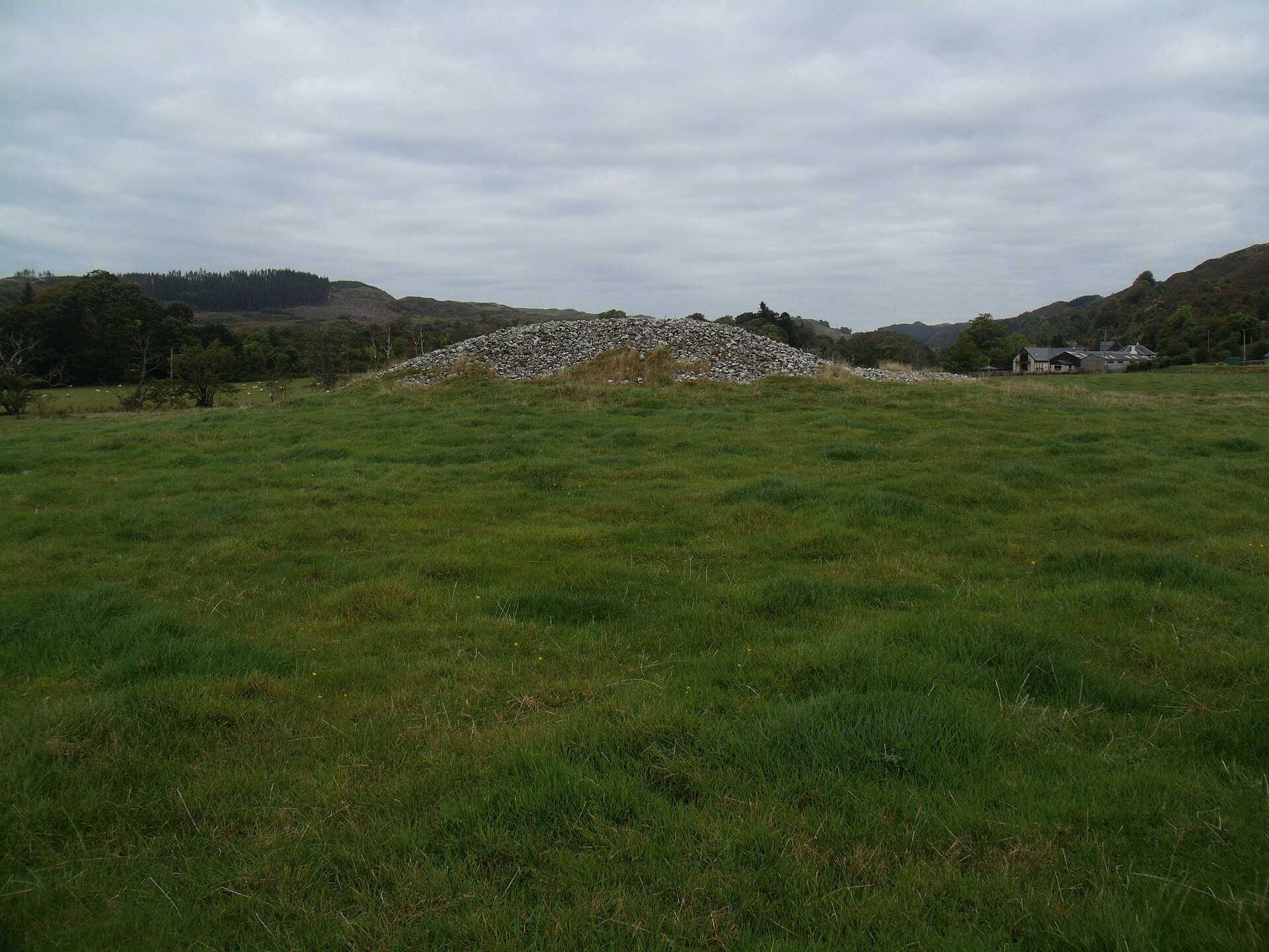
Photo: Euan Nelson / Wikimedia Commons / CC BY-SA 2.0 Glebe Cairn, Nether Largie North, Mid and South Cairns
Together with Ri Cruin Cairn these form the five surviving mounds of Kilmartin Glen's linear cemetery, a chain of Bronze Age burial monuments running south-by-southwest from the village.
-
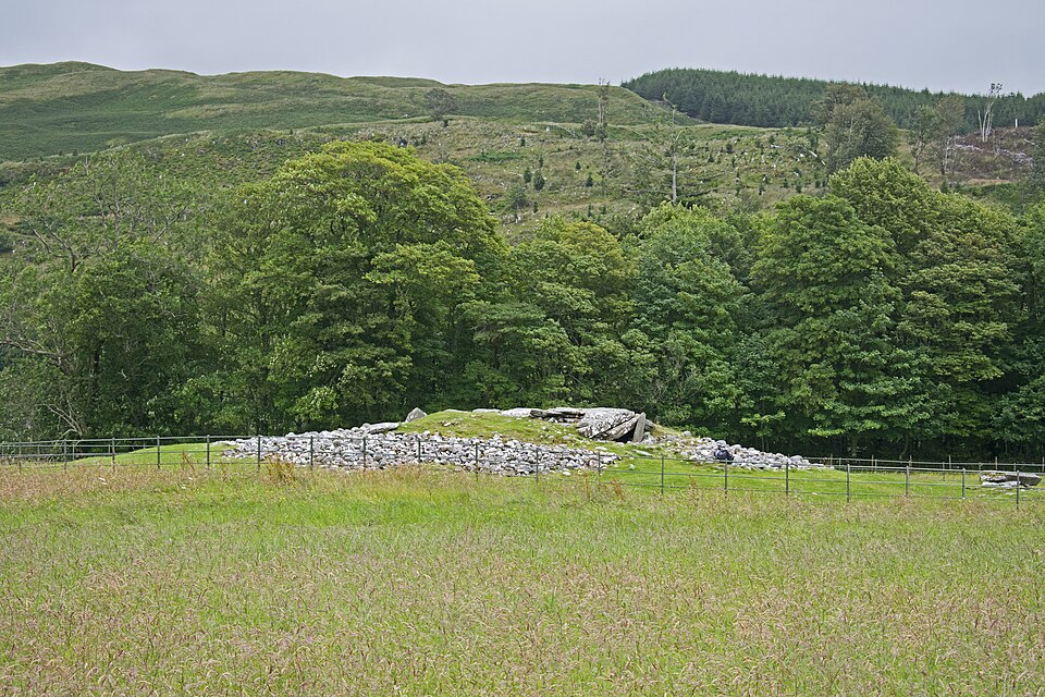
Photo: Ymblanter / Wikimedia Commons / CC BY-SA 4.0 Nether Largie South Cairn
The oldest monument in the same linear cemetery, a Neolithic chambered cairn later rebuilt in the Bronze Age, standing along the same alignment as Ri Cruin Cairn.
-
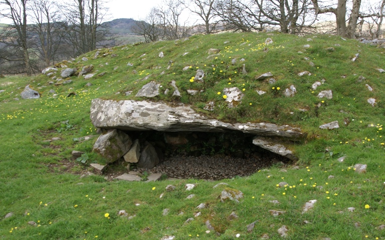
Photo: Otter / Wikimedia Commons / CC BY-SA 3.0 A nearby cairn in Kilmartin Glen where archaeologists announced the discovery of rare prehistoric deer carvings in May 2021, part of the same dense concentration of Bronze Age burial monuments.
-
Kilmartin Museum
The museum in Kilmartin village interprets and conserves the archaeological landscape that includes Ri Cruin Cairn and the wider linear cemetery.
-
Dunadd
The fortress site to the south of the glen, a royal centre of Dal Riata, sits within the same landscape of monuments as the linear cemetery containing Ri Cruin Cairn.
Discovery & excavation
Ri Cruin Cairn was excavated three times: first by the Reverend Mapleton in 1870, then by Craw in 1929, and finally by V. Gordon Childe in 1936. This sequence of investigations gradually clarified the cairn's Bronze Age origins and its later conversion into a lime kiln. Following Childe's excavation, all traces of the kiln were removed as part of a reconstruction of the site, returning the monument to a form closer to its original prehistoric appearance.
What to look for
-
Position in the linear cemetery
Ri Cruin Cairn is the most southerly of the five surviving cairns in Kilmartin Glen's linear cemetery, marking the southern end of a monument chain running for several miles across the valley.
-
Reconstructed cairn form
The visible mound reflects a twentieth-century reconstruction carried out after excavation, following the removal of all traces of the lime kiln that had once altered the site.
What is said
Folklore and tradition, recorded as what is said — not as established fact.
-
The King's Grave
Local tradition calls Ri Cruin Cairn a royal burial, but no excavation has identified a king among the people buried within it.
Plan your visit
- Location
- 56.1171°N · 5.4996°W
- Nearest settlement
- Kilmartin
- Access
- Open access
- Terrain
- Easy going
- Parking
- Parking available nearby — see the official getting-here page.
- Start point
- Ri Cruin Cairn, Kilmartin Glen · Parking can be found at Lady Glassary Wood car park, which is a 550m walk from the Ri Cruin Cairn entrance. The walk is along a single track road with no pavement. · There is no parking at the monument itself. · Please note that the walk to the site includes walking on grass and a stile. · National grid reference - NR 825 971
- Best time
- Open year-round.
- What survives
- The prehistoric cairn survives as an open-air burial monument in Kilmartin Glen.
- Facilities
- Check the official visitor page for current facilities and access arrangements.
- Start point
- Lady Glassary Wood car park — There is no parking at the monument itself. HES states it is a 550m walk from Lady Glassary Wood car park.
Opening & admission
Free entry
- Open year-round.
Nearby places
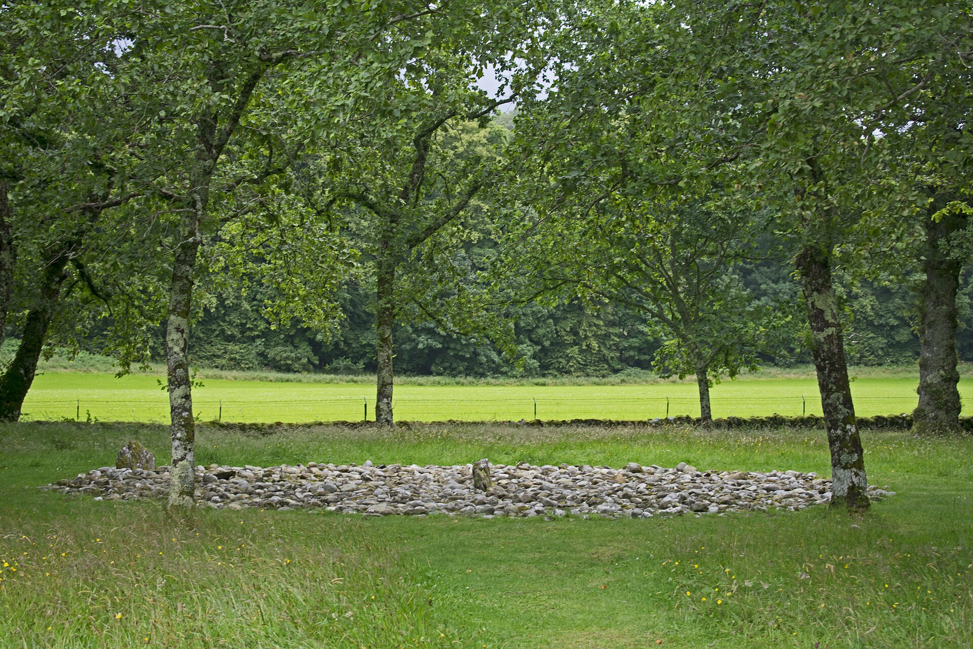
Sacred place · Prehistoric
Temple Wood Stone Circles
Argyll and Bute
At the centre of the southern circle at Temple Wood lies a burial cist (a grave lined and capped with stone slabs), ringed by a smaller circle of s…
- Near Kilmartin
- 8 min walk from car park
- Easy path
Tomb or burial place · Prehistoric
Dunchraigaig Cairn
Argyll and Bute
Dunchraigaig is an Early Bronze Age round cairn, about 30 m across, set a little apart to the south-east of the famous 2 km linear cemetery of cair…
- Near Kilmartin
- 1 min walk from car park
- Easy path
Tomb or burial place · Prehistoric
Nether Largie South Chambered Cairn
Argyll and Bute
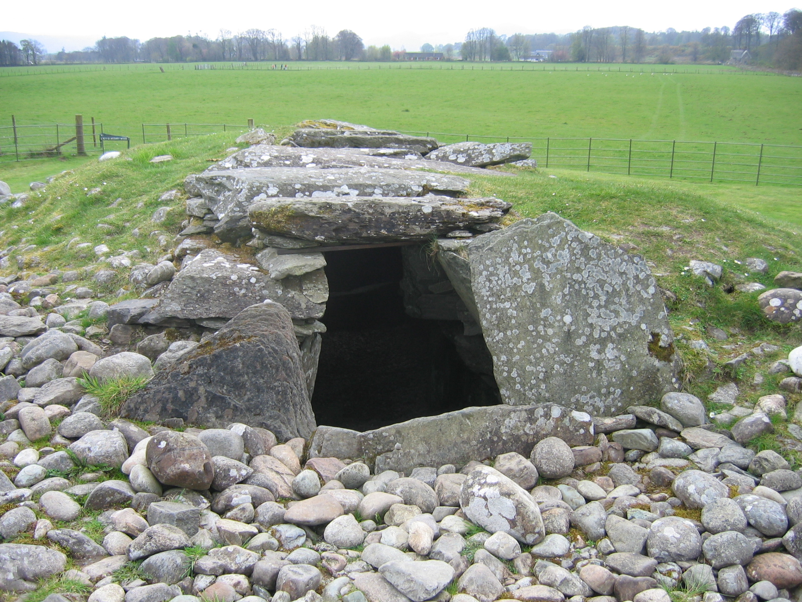
Nether Largie South is a Neolithic Clyde-type chambered cairn, a mound of piled stones often covering a burial, and the earliest monument in the Ki…
- Near Kilmartin
- 7 min walk from car park
- Easy path
Sacred place · Prehistoric
Ballymeanoch Standing Stones and Henge
Argyll and Bute
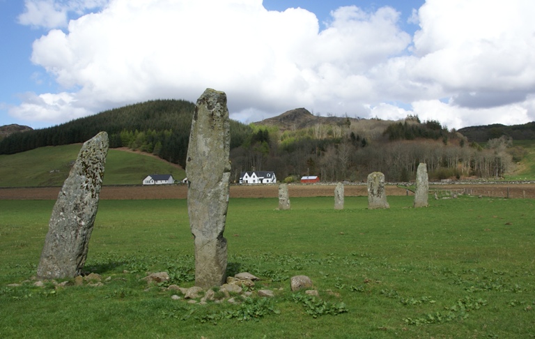
One of the few places in Kilmartin Glen where a stone avenue, a circle and a henge: a circular enclosure from before any written account of Britain…
- Near Kilmartin
- 6 min walk from car park
- Some walking
Questions people ask
- What is Ri Cruin Cairn?
- It is the most southerly cairn in Kilmartin Glen's linear cemetery, a Bronze Age burial mound built between 2200 and 1950 BC.
- Is it really a king's grave?
- Local tradition holds that it may be the burial place of a king, but no excavation has confirmed this claim.
- Was the cairn ever used for anything else?
- Yes, it was later used as a lime kiln, with all traces of that use removed during a modern reconstruction of the site.
- Who has excavated Ri Cruin Cairn?
- Three excavations took place: Reverend Mapleton in 1870, Craw in 1929, and V. Gordon Childe in 1936.
- How does it relate to the other Kilmartin cairns?
- It is one of five surviving cairns in a linear cemetery stretching roughly three miles south-by-southwest from Kilmartin village.
Sources
- Wikipedia: Kilmartin Glen
- Kilmartin Museum
Explore more: Tomb or burial places · Prehistoric · Argyll and Bute
The Ancient Codex, in your pocket
Get the Pocket Codex app
Carry the directory with you — Ri Cruin Cairn and thousands of ancient places across Britain and Ireland, offline, wherever you roam.