
Its broken recumbent stone is the longest known of its kind in Scotland — the sole survivor of what were once three stone circles in this parish.
A single fallen giant dominates what remains of the ring at Kirkton of Bourtie: a recumbent stone (the large flat stone that once lay at the front of the circle, flanked by two uprights) so large it is thought to be the longest of its kind anywhere in Scotland, stretching some 5.2 metres and probably weighing upwards of thirty tons. Broken across the middle, it still rests on a slightly raised mound near the crest of a south-facing hillside above Inverurie, with the Hill of Barra rising prominently to the north.
Only four stones now stand where a ring of six or seven once formed a circle perhaps 22 metres across: the broken recumbent, one flanking upright to the east, and two more uprights to the west. The rest have vanished, and it is thought some may have been broken up and built into a nearby gateway and wall. Fragmentary cairns still lie scattered within the ring, and the surrounding ground appears to have doubled for generations as a dumping place for stones cleared off the surrounding fields.
What survives is as much a record of loss as of construction. A late-18th-century minister could still count three such circles nearby; by the time Ordnance Survey mapmakers arrived in 1867, only the present four stones remained, and no one locally could recall the monument looking any different. Legal protection came in 1925, but the ground within the stones was still being ploughed as late as 1999.
What follows is drawn from published sources, with each claim labelled by how firmly it is established.
History
Writing in the late 18th century, the parish minister Rev Thomas Shepherd recorded that three "Druidical circles" then stood in the area, noting that two of them were still "pretty entire". His brief description is the earliest surviving account of the monument's condition, set down well before a further century of clearance and ploughing reduced the local circles to a single damaged survivor.
Half a century after Shepherd's account, only two of the three circles he had described still stood: Kirkton of Bourtie and the nearby Sheldon stone circle, the latter said at the time to be in "a state of considerable preservation". The disappearance of the third circle in the intervening decades shows how quickly local monuments could be cleared once agricultural pressure on the land intensified.
When the Ordnance Survey mapped the site in 1867, surveyors found the circle already reduced to its present four stones and recorded that "no one in the parish remembers having seen it in any other condition than at present". Their notes also describe a "rude pavement" within the ring, since vanished entirely, which may have formed the base of a cairn that has likewise been destroyed.
In 1925 the Office of Works placed Kirkton of Bourtie stone circle under statutory protection as an ancient monument, formally recognising what survived of a ring that had already lost most of its original stones. Scheduling secured the site's legal status, though it did little to change the working use of the surrounding field. Despite its protected status, the interior of the circle remained under the plough until as late as 1999, with cultivation carried out around the surviving stones for most of the twentieth century. Only at the close of the century did the ground within the ring cease to be worked as arable land.
People
-
Rev Thomas Shepherd
Late-18th-century parish minister whose written account is the earliest surviving description of the local stone circles, recording three still standing in his time.
Cultural influences
-
Recumbent-circle tradition
Kirkton of Bourtie belongs to the Aberdeenshire recumbent stone-circle tradition, centred on a horizontal recumbent and its flanking uprights; its surviving arrangement makes that regional form unusually legible despite later losses.
Connections
-
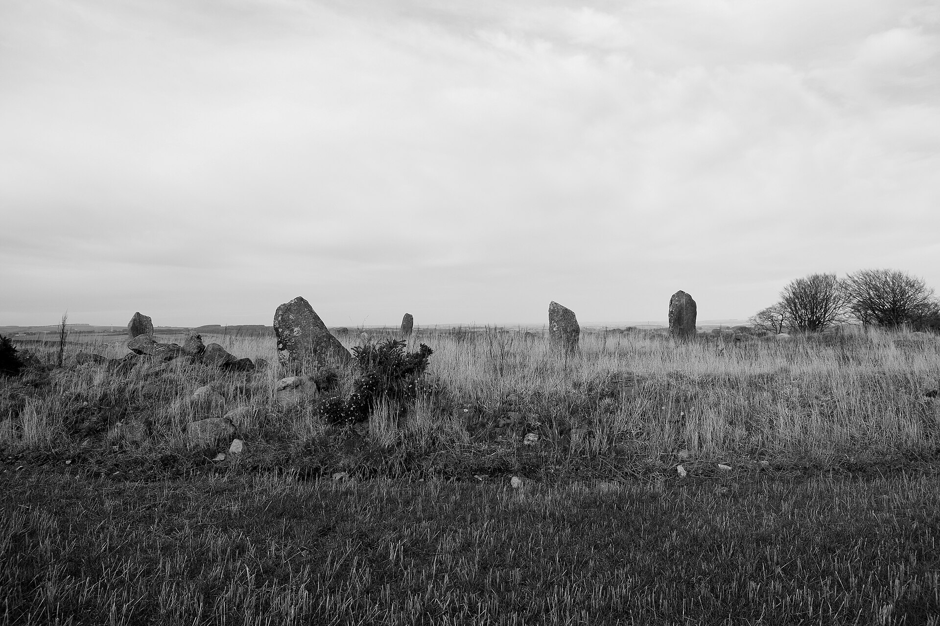
Photo: Bill Harrison / Wikimedia Commons / CC BY-SA 2.0 One of only two of the parish's three recorded stone circles still standing half a century after Rev Thomas Shepherd's account, alongside Kirkton of Bourtie.
-
The lost third Bourtie circle
Shepherd’s account records a third parish circle that disappeared between his late-eighteenth-century survey and the following generation. Its loss gives Kirkton’s four surviving stones added importance as evidence for a once denser local prehistoric landscape.
Discovery & excavation
The monument's decline is documented rather than excavated: an 18th-century minister's account, an 1867 Ordnance Survey visit that recorded the circle already reduced to four stones and a since-vanished "rude pavement", and formal scheduling by the Office of Works in 1925 together trace how the ring was whittled down and then formally protected.
What to look for
-
The broken recumbent stone
The centrepiece of the site: a fallen, fractured stone about 5.2 metres long, 1.02 metres broad and with a girth of 1.93 metres, probably weighing upwards of thirty tons and thought to be the longest recumbent stone recorded in Scotland.
-
The east and west flankers
Three upright stones survive alongside the recumbent: an eastern flanker standing 3 metres high, and two western stones of 1.8 metres and 2.36 metres, all that remain of a ring once thought to hold six or seven stones.
-
Fragmentary cairns within the ring
Scattered remains of cairn material are still visible inside the circle, hinting at burial activity associated with the monument, though much of this material has been disturbed or removed over time.
-
The nearby gateway and wall
A gateway and wall close to the circle incorporate stones that may originally have stood in the ring, physical evidence of how the monument was quarried for building material after it fell out of use.
Plan your visit
- Location
- 57.3141°N · 2.3321°W
- Nearest settlement
- Inverurie
- Access
- Open access
- Terrain
- Easy going
- Time needed
- About 30 minutes
- Best time
- Dry daylight, when the fallen recumbent and surviving flankers can be examined from the minor road.
- What survives
- A broken fallen recumbent and three uprights survive, with fragmentary cairn material within the reduced ring.
- Facilities
- No visitor facilities are recorded; access is informal from the minor road beside arable land.
Opening & admission
No admission fee applies; check current access details before visiting.
- Stands on arable land beside a minor road, reachable without a dedicated path
- Scheduled as an ancient monument; access is informal rather than managed
Nearby places
Sacred place · Prehistoric
Sheldon stone circle
Aberdeenshire
Long classified as a recumbent stone circle despite no recumbent stone ever being found here, Sheldon has recently had that identity questioned by…
- Near Oldmeldrum
- Some walking
Fortified place · Medieval
Caskieben
Aberdeenshire
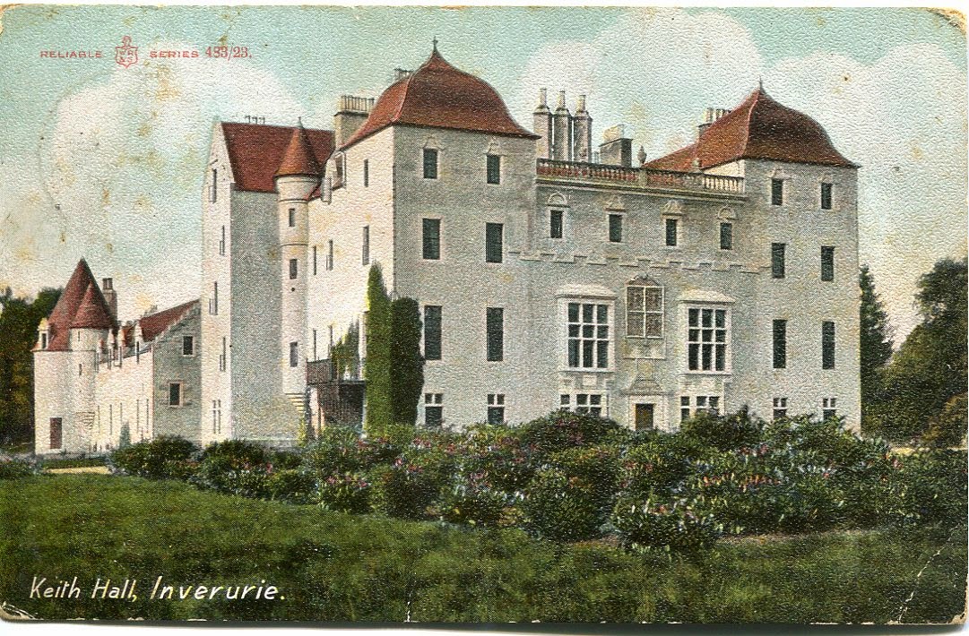
A timber tower's mound and moat still trace the outline beneath Keith Hall, a mansion that grew from Z-plan castle to Georgian seat over seven cent…
- Easy path
Fortified place · Medieval
Bass of Inverurie
Aberdeenshire
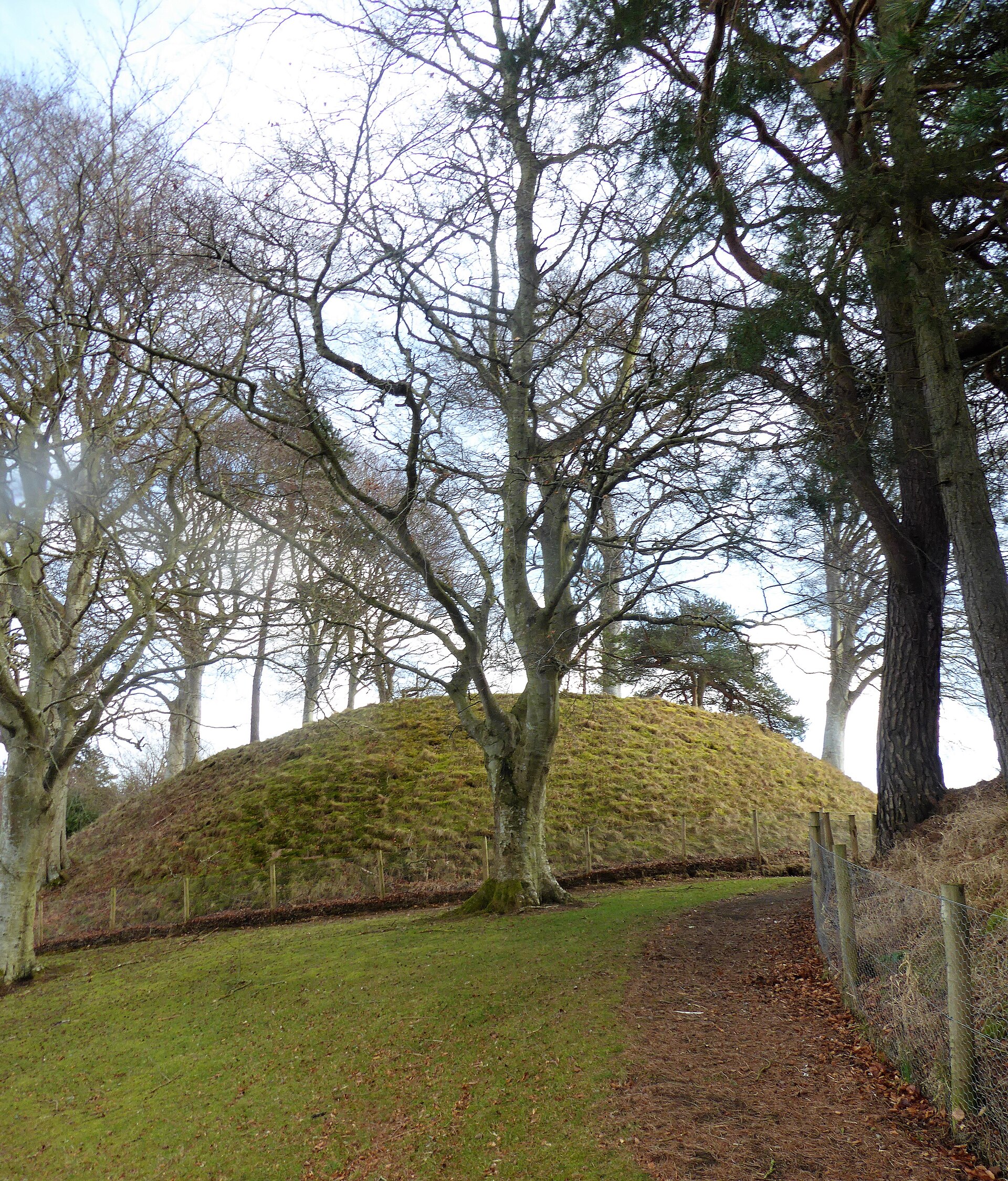
A wooden castle mound that once governed the whole lordship of the Garioch, its earthworks still holding an oak gangway and a 14th-century face-jug…
- Easy path
Carved stone · Pictish & early medieval
Brandsbutt Stone
Aberdeenshire
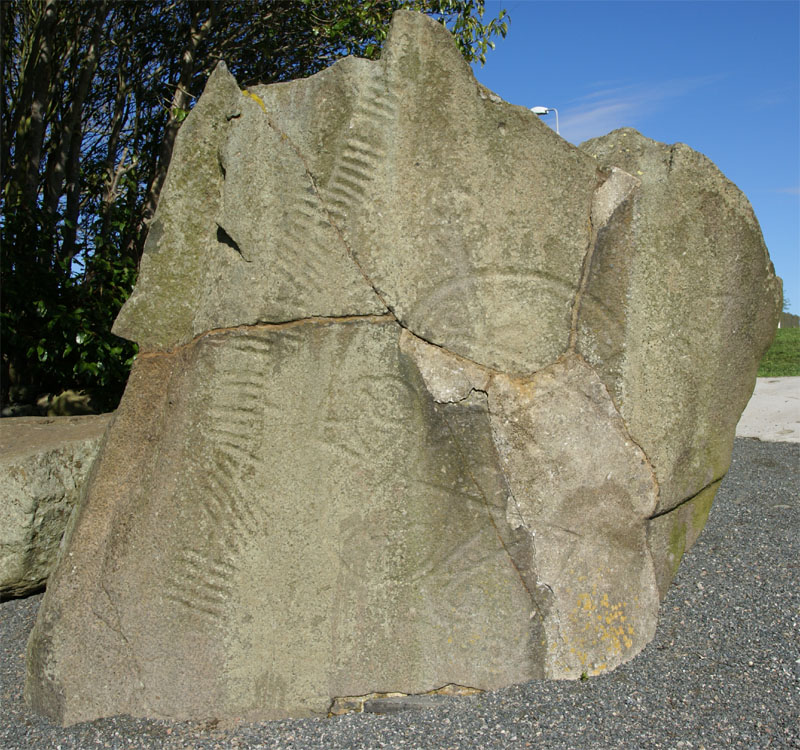
Brandsbutt preserves the symbols of the Picts, people of northern and eastern Scotland from about AD 300 to 900, beside an Ogham inscription still…
- Near Inverurie
- 1 min walk from car park
- Easy path
Questions people ask
- How large is the recumbent stone at Kirkton of Bourtie?
- The broken recumbent stone measures about 5.2 metres long and probably weighs upwards of thirty tons, making it the longest recumbent stone known in any Scottish stone circle.
- How many stones survive at the site today?
- Only four stones remain: the eastern flanker, the broken recumbent, and two western uprights, out of a ring thought originally to have held six or seven stones.
- What is the stone circle aligned with?
- The recumbent stone is aligned with what is known as the major southern moonset, positioning the monument to track a specific point in the lunar cycle.
- When was the circle given legal protection?
- The circle was scheduled as an ancient monument by the Office of Works in 1925, though its interior continued to be ploughed until as late as 1999.
- Why is so little of the circle left standing?
- Centuries of field clearance removed most of the original stones; some may have been reused in a nearby gateway and wall, and the area doubled as a dump for cleared stones.
Sources
The Ancient Codex, in your pocket
Get the Pocket Codex app
Carry the directory with you — Kirkton of Bourtie stone circle and thousands of ancient places across Britain and Ireland, offline, wherever you roam.