
Radiocarbon-dated rampart (the raised bank thrown up around a fortified enclosure) timbers make this eroding sea stack the earliest known Pictish (of the Picts, the people of northern and eastern Scotland from about AD 300 to 900) fort in Scotland, with Roman-world finds far north of where such contact was expected.
A flat-topped pillar of red sandstone rises alone from the sea between Stonehaven and Dunnottar Castle, cut off from the mainland whenever the tide comes in and ringed on every side by cliffs some thirty metres high. Its grassy summit, no larger than a couple of tennis courts today, was once considerably bigger before centuries of erosion narrowed the old headland into the isolated stack seen now.
In 1832 a party of youths climbed the stack and found the remains of a wall crowning its top. Some of the stones they dislodged were later recovered from the sea below carrying incised Pictish symbols, and it took until the twenty-first century for archaeologists to work out what those stones had once belonged to: not a random ruin, but a rampart of stone and oak timber built between the second and fourth centuries AD, making this the earliest known Pictish fort yet found in Scotland.
Reaching the summit means scaling sheer rock with the sea on all sides, which kept the site largely unexamined until a University of Aberdeen team began digging in 2015 and uncovered a hearth, the footings of rooms, and imported Roman-era goods far north of anywhere such material was expected. What they found suggests a fortified household of real status, occupying a position no longer safe to stand on for long.
What follows is drawn from published sources, with each claim labelled by how firmly it is established.
The name
The Scottish Place-Name Society records Dunnicaer, also written Dun-na-caer, as a name combining dun and kair, two elements associated with enclosure and defence. The doubled defensive sense suits the sea stack’s use as a fortified promontory before erosion separated it from the mainland.
History
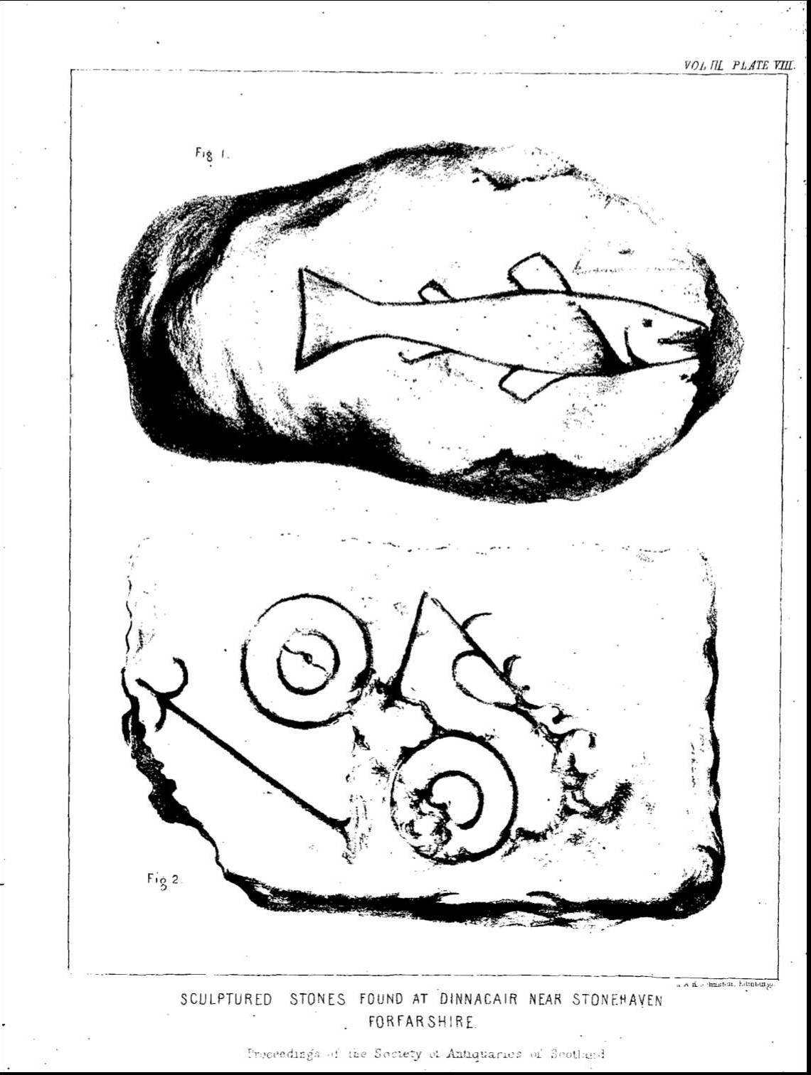
As early as 1819 one of the Pictish symbol stones had already been prised from the stack and carried off to serve as an ordinary hearthstone, its carved symbols exciting little interest at the time. The rock's isolation and the danger of the climb meant that whatever else lay on its grassy summit went largely unexamined for another generation.
In 1832 a group of local youths scaled the stack and found the remains of a wall crowning its summit plateau. They tipped several of the loose stones down into the sea below, and when these were later hauled back out some were found to bear incised Pictish symbols. The discovery marked the first clear evidence that the isolated sea stack had once carried a substantial, deliberately built structure rather than a bare outcrop of rock.
In 1857 the antiquarian Alexander Thomson formally documented the recovered stones for the Society of Antiquaries of Scotland, and they were subsequently illustrated in John Stuart's two volumes of The Sculptured Stones of Scotland, published in 1856 and 1867 by the Spalding Club. These publications fixed Dunnicaer's stones within the wider record of Pictish carving, even though the difficulty of reaching the stack meant no proper excavation followed for well over a century.
Archaeological investigations on the summit in 1977 and again in 1982 found nothing of significance, and for a time it seemed the stack held little more to discover. A thorough scholarly description of the symbols themselves was published in 1992 by Leslie and Elizabeth Alcock, adding detail to the record even as the fate of the structure that had once held them remained unresolved.
That changed in 2015, when a University of Aberdeen team led by Gordon Noble began new excavations that continued over the following two years. They uncovered a stone rampart reinforced with timber framing running southwest towards the mainland, together with a hearth and the footings of internal rooms. Radiocarbon dating of the timbers placed the fort's use between the second and fourth centuries AD, making it the earliest known Pictish fort yet identified in Scotland.
Among the debris the excavators recovered glass, samian ware and black-burnished ware pottery, and a lead weight — an unusual assemblage so far north of the Roman frontier, and evidence that stone and oak timber had been brought in from some distance to raise a high-status stronghold. The fort was eventually abandoned, perhaps when its inhabitants relocated to nearby Dunnottar, perhaps because the sea was already eating away at the stack that supported it.
The symbol stones themselves are now thought to have been set into that same third- to fourth-century rampart, considerably earlier than the fifth- to seventh-century date conventionally assigned to the simplest Class I Pictish symbol stones — a finding that has reopened debate over how early the Pictish symbol tradition actually began.
People
-
Alexander Thomson
Antiquarian who formally documented the recovered symbol stones for the Society of Antiquaries of Scotland in 1857.
-
John Stuart
Scholar who illustrated and published the stones in his two volumes of The Sculptured Stones of Scotland (1856 and 1867).
-
Leslie and Elizabeth Alcock
Archaeologists who published a thorough scholarly description of the symbols in 1992.
-
Gordon Noble
University of Aberdeen archaeologist who led the 2015-2017 excavations that revealed the hill fort.
Cultural influences
-
Possible Roman trade contact
The University of Aberdeen's Archaeological Journal has raised the possibility that Dunnicaer functioned as a Roman trade fortification, comparable to the promontory fort at Drumanagh in Ireland, on the strength of the Roman-era material recovered from the site.
Connections
-
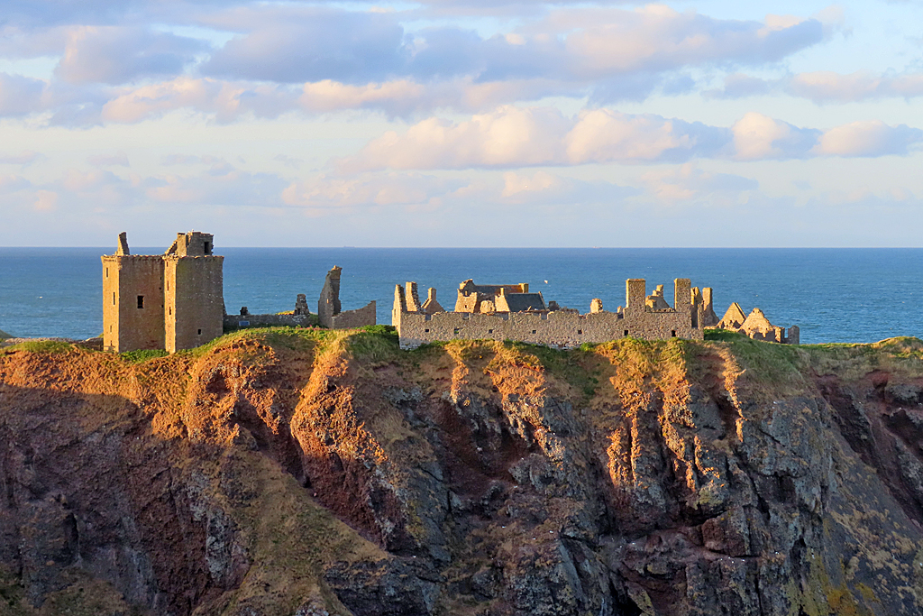
Photo: Anne Burgess / Wikimedia Commons / CC BY-SA 2.0 The nearby castle is considered the likely site the fort's inhabitants moved to after Dunnicaer was abandoned.
-
Drumanagh promontory fort, near Dublin
A much larger multivallate promontory fort with Roman finds, cited for comparison when assessing Dunnicaer's possible Roman-world contact.
-
Marischal Museum, Aberdeen
Holds one of the five Pictish symbol stones recovered from the stack.
-
Banchory House
Holds the remaining Pictish symbol stones recovered from the stack.
Discovery & excavation
Discovery came in stages: a stone was removed for use as a hearthstone as early as 1819, then in 1832 youths climbing the stack found a wall and threw stones from it into the sea, later recovering several bearing Pictish symbols. Excavations in 1977 and 1982 found nothing further, but a University of Aberdeen campaign from 2015 to 2017 finally revealed the stone-and-timber rampart, hearth and room footings that showed the summit had carried a substantial early fort.
Finds now held at: Marischal Museum; Banchory House.
In culture
-
University of Aberdeen reconstruction video (2019)
The University of Aberdeen released a video visualising how the excavated hill fort might have looked when it stood on the more extensive promontory that later eroded into today's isolated stack.
What to look for
-
The stack and its cliffs
Viewed from the coast, the sea stack stands ringed by sandstone cliffs roughly 30-35 metres high, cut off from the mainland at high tide, between Downie Point and Bowdun Head in Strathlethan Bay.
-
The summit plateau
The grassy top now measures only about 20 by 12 metres, far smaller than the promontory that carried the fort in Pictish times, the difference marking centuries of cliff erosion.
-
The excavated rampart line
Archaeologists traced a stone rampart reinforced with timber framing running southwest towards the mainland, the surviving core of the second- to fourth-century fort.
-
Proximity to Dunnottar Castle
The stack sits within sight of Dunnottar Castle and Stonehaven, on the same stretch of coastline the fort's occupants may later have relocated to.
Plan your visit
- Location
- 56.9528°N · 2.1953°W
- Access
- Open access
- Terrain
- Rough ground — reasonable boots advised
- Time needed
- About 90 minutes
Opening & admission
No admission scheme applies; check current access conditions before visiting.
- A precipitous sea stack cut off from the mainland at high tide, surrounded by cliffs some 30-35 metres high, with no safe public route to the summit recorded.
- Best viewed from the coast near Stonehaven, between Dunnottar Castle and Downie Point.
Nearby places
Fortified place · Medieval
Dunnottar Castle
Aberdeenshire
The Annals of Ulster record two sieges of 'Dún Foither' in 681 and 694, possibly the earliest written references to the site; the 681 attack has be…
- Near Stonehaven
- 8 min walk from car park
Minor monument · Medieval
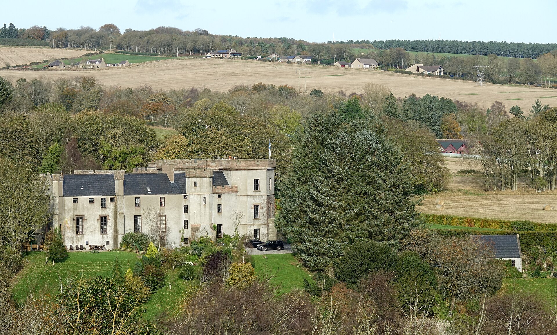
Dovecot, Fetteresso Castle
Aberdeenshire
The sixteenth-century beehive pigeon house outlasts Fetteresso Castle’s dismantling, its three rat lines preserving the working estate landscape be…
- Near Stonehaven
Fortified place · Roman
Raedykes
Aberdeenshire
A computer model of its roughly 93-acre rampart (an encircling bank built for defence) suggests room for three legions -- some 16,000 men -- making…
- Near Stonehaven
- Some walking
Carved stone · Pictish & early medieval
Lang Stane of Auquhollie
Aberdeenshire
Carved in Ogam: an alphabet devised for Irish, not Pictish, speech: the stone has anchored more than a century of scholarly argument over how far I…
- Near Stonehaven
- Some walking
Questions people ask
- Why is Dunnicaer historically significant?
- Radiocarbon dating of its rampart timbers shows the fort was used between the second and fourth centuries AD, making it the earliest known Pictish fort identified in Scotland.
- What are the Dunnicaer symbol stones?
- Five Pictish symbol stones recovered from the stack's summit, mostly in 1832. One is held in the Marischal Museum and the rest at Banchory House.
- Is Dunnicaer easy to reach?
- No. The stack is ringed by cliffs around 30-35 metres high and cut off from the mainland at high tide, making the summit difficult and hazardous to reach.
- Was Dunnicaer in contact with the Roman world?
- Excavated glass, samian ware, black-burnished pottery and a lead weight are unusual finds so far north of the Roman frontier, hinting at contact comparable to Ireland's Drumanagh fort.
- Why was the fort at Dunnicaer abandoned?
- It was likely abandoned when its occupants moved to nearby Dunnottar, or because sea erosion was already undermining the stack it stood on.
Sources
- Wikipedia: Dunnicaer
- Noble, Goldberg & Hamilton, 'The development of the Pictish symbol system: inscribing identity beyond the edges of Empire', Antiquity 92 (2018)
- Alcock & Alcock, 'Reconnaissance excavations on Early Historic fortifications...', Proc Soc Antiq Scot 122 (1992)
- University of Aberdeen — 'Stunning video shows how earliest Pictish fort could have looked' (2019)
Explore more: Carved stones · Pictish & early medieval · Aberdeenshire
The Ancient Codex, in your pocket
Get the Pocket Codex app
Carry the directory with you — Dunnicaer and thousands of ancient places across Britain and Ireland, offline, wherever you roam.