
An Iron Age broch — a drystone tower unique to Iron Age Scotland — that rhododendrons closed off entirely until they were cleared in 2020.
When a researcher from the University of New England went looking for Leckie Broch in July 2018, they found it almost entirely inaccessible. A dense stand of rhododendron had closed the site off, and earlier visitors had reported much the same.
Clearance in 2020 changed that. The approach now runs from the path just east of the saw mill cottage, up the east side of the Leckie Burn to a bridge dated 1878, and on from there.
What the rhododendrons were hiding is an Iron Age broch — a drystone tower of a type built nowhere but Iron Age Scotland — set just above the confluence of two streams with deep gullies, on the southern foothills of the Forth Valley west of Gargunnock. The gullies are the point: they are what made the position worth building on.
What follows is drawn from published sources, with each claim labelled by how firmly it is established.
History
Leckie Broch is an Iron Age broch — a drystone tower of a kind unique to Iron Age Scotland — in Stirlingshire, just above the confluence of two streams with deep gullies on the southern foothills of the Forth Valley, west of Gargunnock.
For years the site was effectively unreachable. Visitors reported it very overgrown with rhododendrons, and in July 2018 B. Wilson of the University of New England found it almost entirely inaccessible behind a dense stand of them. Rhododendron clearance in 2020 made access much easier. The route now runs from the path just east of the saw mill cottage, along the east side of the Leckie Burn, as far as the bridge dated 1878.
It is one of only a handful of brochs found in southern Scotland. The walls have been destroyed to the point where the original height is unknown, but the archaeologists who dug it took it to be a hollow-walled tower with an internal timber structure. The site became known to archaeologists in the 1960s and was excavated between 1970 and 1978. Until the beginning of the nineteenth century the surrounding area was covered in impassable swamps and bogs, which is why it went unexamined for so long.
The sequence recovered has several phases. A hut underlies the broch, and sheep bones from a post hole gave a radiocarbon date of AD 80 give or take seventy years. Roman Samian pottery with stamps places the construction of the tower after AD 79 or 80, and it appears to have been lived in for roughly sixty years. Then it burned. There is evidence of fire and of sudden collapse, after which the site was reoccupied, partly repaired, and a roundhouse built. It was fortified again and then abandoned in the second century AD. A medieval coin was found, but nothing significant is thought to have happened here after the abandonment.
It has been suggested that the second phase was a promontory fort raised on the ruins of the broch, though that reading has been questioned. Eight years of excavation produced brooches and armlets among other finds, and these are held by the Hunterian Museum and Art Gallery at the University of Glasgow.
Cultural influences
-
A southern Scottish broch
Leckie is one of only a handful of brochs in southern Scotland, using gullied ground above two streams for a naturally defensible position.
Connections
-
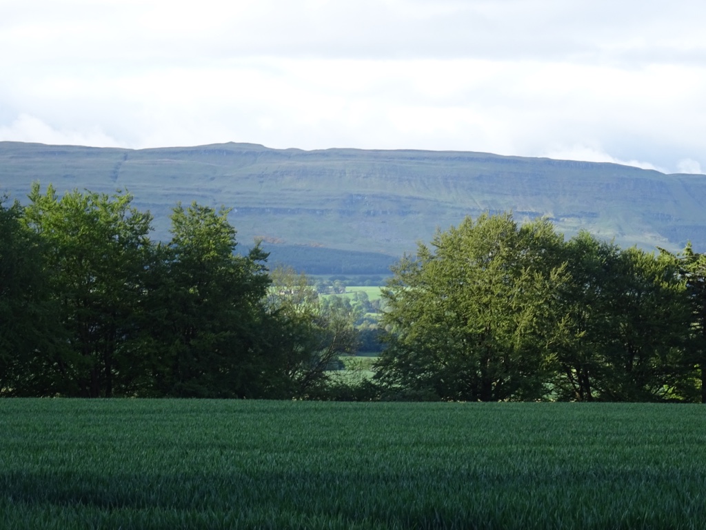
Photo: Richard Webb / Wikimedia Commons / CC BY-SA 2.0 A nearby broch representing the same Iron Age monumental tradition.
-
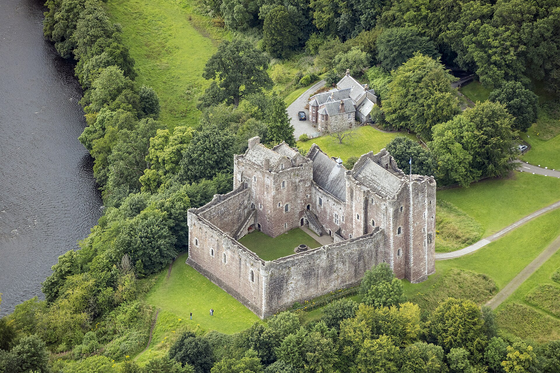
Photo: Godot13 / Wikimedia Commons / CC BY-SA 4.0 A nearby medieval castle in the River Teith landscape.
-
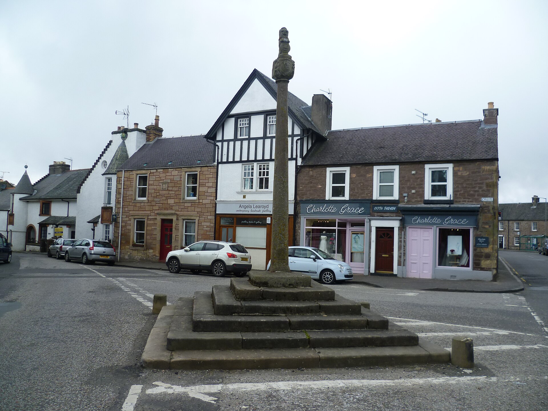
Photo: Kim Traynor / Wikimedia Commons / CC BY-SA 3.0 Market Cross, The Cross, Doune
A nearby historic civic monument in Doune, within the same regional settlement landscape.
Discovery & excavation
Excavation from 1970 to 1978 revealed a hut beneath the broch, a tower phase destroyed by fire and collapse, and later reoccupation with a roundhouse.
What to look for
-
The gullies
The broch sits just above the confluence of two streams with deep gullies — the ground that made the position defensible.
-
The rhododendrons
They closed the site off entirely until clearance in 2020; the difference between the 2018 and 2020 accounts is the difference between inaccessible and walkable.
-
The 1878 bridge
The landmark on the approach along the east side of the Leckie Burn.
-
What the dating rests on
Roman Samian pottery with maker's stamps, a radiocarbon date from sheep bones in a post hole, and Roman glass and coins — an unusually well-dated broch.
-
The burnt layer
Evidence of fire and sudden collapse ends the tower phase, after which the site was reoccupied and a roundhouse built inside the ruin.
Plan your visit
- Location
- 56.1199°N · 4.1055°W
- Access
- Reached on a public path
- Terrain
- Rough ground — reasonable boots advised
- Time needed
- About 45 minutes
- What survives
- The broch walls are heavily reduced, but clearance has reopened the approach along Leckie Burn to the 1878 bridge.
Opening & admission
No admission details are recorded for this site; check current local access arrangements before travelling.
Nearby places
Fortified place · Iron Age
Coldoch Broch
Stirling
Cleared out just before 1870. A plan was drawn, and the excavation report never appeared.
- Near Doune
- Rough ground
Fortified place · Medieval
Doune Castle
Stirling
Only two ranges of the intended courtyard were ever finished, and the stonework is almost all late fourteenth century: repaired, but never replaced.
Minor monument · Medieval
Market Cross, The Cross, Doune
Stirling
The capital carries the arms of Moray and Campbell, two sundials and a lion: a good deal of information packed onto the top of one shaft.
- Easy path
Fortified place · Medieval
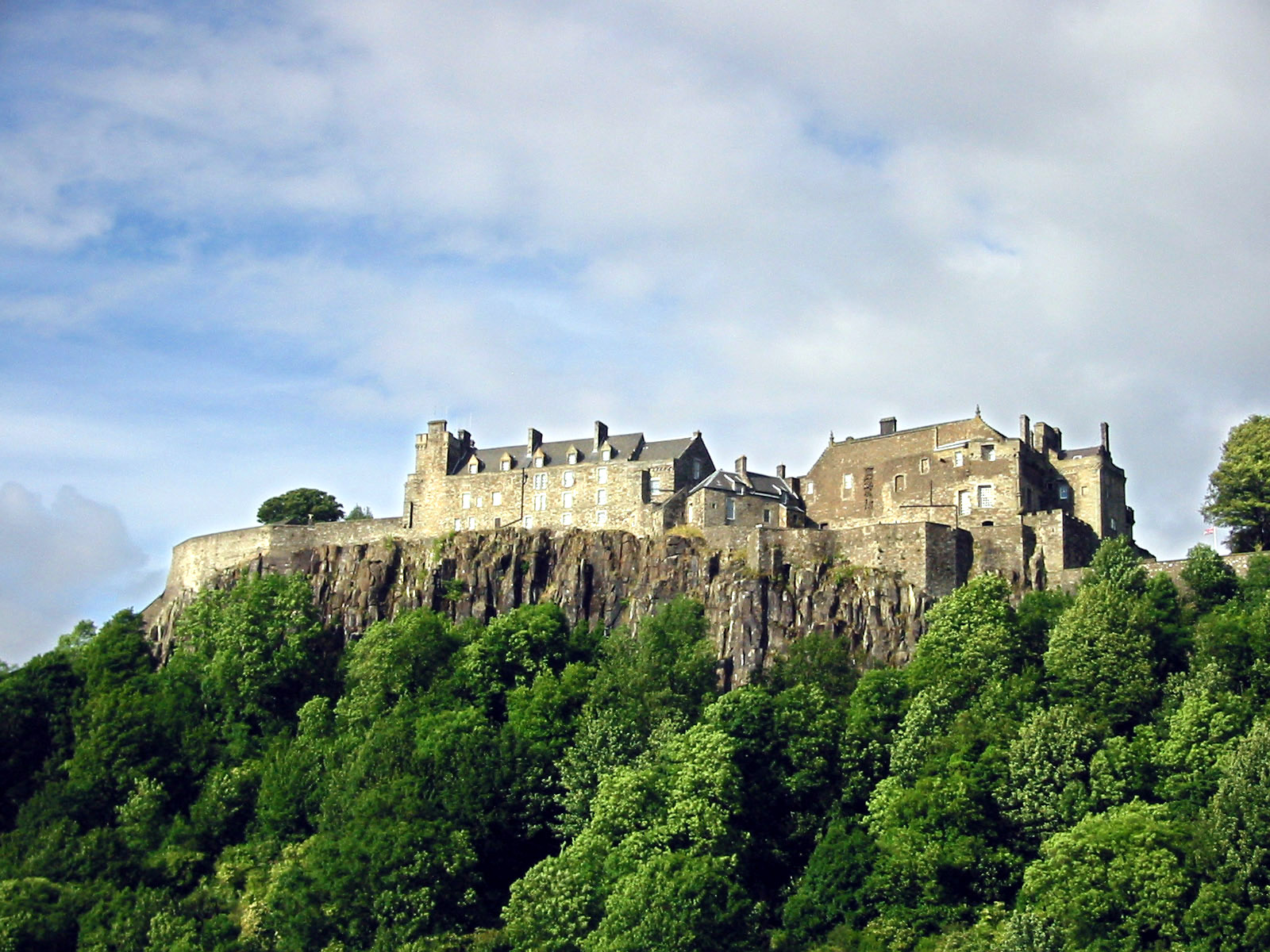
Stirling Castle
Stirling
The castle Edward I kept bombarding after it had already surrendered, because he wanted to try out his new trebuchet.
Questions people ask
- Can it be reached?
- Yes, since rhododendron clearance in 2020. Before that it was almost entirely inaccessible; a visitor in July 2018 found it closed off by a dense stand of them.
- What is a broch?
- A drystone tower of a kind found only in Iron Age Scotland.
- Where is it?
- In Stirlingshire, west of Gargunnock, just above the confluence of two streams on the southern foothills of the Forth Valley.
- When was Leckie Broch built?
- After AD 79 or 80, on the evidence of stamped Roman Samian pottery. A hut beneath it gave a radiocarbon date of AD 80 give or take seventy years, and the tower appears to have been occupied for roughly sixty years before it burned.
- What was found there?
- Brooches, armlets and other objects from eight years of excavation between 1970 and 1978, together with Roman pottery, glass and coins. The finds are held by the Hunterian Museum and Art Gallery at the University of Glasgow.
Sources
- Wikipedia: Leckie Broch
- Wikidata: Q18160986
- Canmore 45379 — LECKIE 1 (broch (iron age)) (accessed 2026-08-03)
Explore more: Fortified places · Iron Age · Stirling
The Ancient Codex, in your pocket
Get the Pocket Codex app
Carry the directory with you — Leckie Broch and thousands of ancient places across Britain and Ireland, offline, wherever you roam.