
Fortified place · Iron Age · Outer Hebrides
Loch na Berie
Loch na Berie sits some 400 yards from the shore of the Isle of Lewis, its broch (a tall circular tower of unmortared stone, found only in Scotland) walls rising from ground that was very probably once an island. To its east the land has slumped into marsh, and the loch itself has largely reverted to the same waterlogged state, leaving the ruin stranded on what now reads as a low, wet promontory rather than the defended islet it was likely built to be.
Loch na Berie sits some 400 yards from the shore of the Isle of Lewis, its broch walls rising from ground that was very probably once an island. To its east the land has slumped into marsh, and the loch itself has largely reverted to the same waterlogged state, leaving the ruin stranded on what now reads as a low, wet promontory rather than the defended islet it was likely built to be.
The broch measures roughly 16.5 metres across, with walls some 3 metres thick, and excavation in the 1980s found that this drystone drum still stands to first-floor level in places, an unusually complete survival for a structure of its age and type. A causeway once carried people out to the entrance, and while the visible causeway today is a later reconstruction, built from stone robbed directly off the broch itself, archaeologists believe it overlies an earlier, ancient crossing on the same line.
Loch na Berie is protected as a Scheduled Monument, and what remains at the site today is essentially the Iron Age broch and its associated causeway, set within a landscape that has changed considerably since the tower was first raised on its islet.
What follows is drawn from published sources, with each claim labelled by how firmly it is established.
History
Loch na Berie was built during the Iron Age as a broch, one of the drystone defensive towers characteristic of northern and western Scotland in this period. It was raised roughly 16.5 metres in diameter with walls about 3 metres thick, and the choice of site was deliberate: the land immediately to the east is marsh, and the broch is thought to have originally stood on an island, its builders trading easy access for the security of water on most sides.
Access to the broch was provided by a causeway leading out across the loch, and although the causeway visible today is a later, modern rebuild, it is thought that an ancient causeway underlies it on the same alignment, suggesting the crossing point itself has been used since the structure's Iron Age origins. In the 1980s the site was excavated, and the investigation established that the broch's walls survive to first-floor level, a level of preservation that sets Loch na Berie apart from many broch sites reduced to little more than their footings.
In more recent times, a modern causeway was built to the west of the broch using stone robbed from the structure itself, a reuse of the ancient fabric that has further altered the setting even as the loch around it has continued to silt up and revert to marshland.
Cultural influences
-
Iron Age island settlement
Loch na Berie represents the use of a loch-side island setting for an Iron Age defensive settlement in the Outer Hebrides.
Discovery & excavation
Excavation of Loch na Berie in the 1980s established that the broch survives to first-floor level, confirming a degree of preservation above what is visible from the exterior alone.
What to look for
-
The broch wall
The drystone wall stands roughly 3 metres thick around a structure some 16.5 metres in diameter, with excavation showing it survives to first-floor level in places.
-
The modern causeway
A causeway of stone robbed from the broch runs out to the site from the west; it is thought to sit directly above an earlier, ancient causeway on the same line.
-
The marshland setting
The ground to the east of the broch has reverted to marsh, and the loch itself has largely done the same, giving a sense of the wetter, more island-like setting the broch originally occupied.
Plan your visit
- Location
- 58.2098°N · 6.9335°W
- Access
- Open access
- Terrain
- Moderate walking
- Time needed
- About 30 minutes
Nearby places
Fortified place · Iron Age
Dun Bharabhat, Great Bernera
Outer Hebrides
A thirty-metre stone causeway crosses the water of Loch Bharabhat to reach the islet on which Dun Bharabhat stands, its walls rising above the loch…
- Some walking

Sacred place · Prehistoric
Callanish VIII
Outer Hebrides
Four standing stones rise in a semicircle along a cliff edge on the southern side of Great Bernera, looking out over the narrow strait that separat…
- Easy path

Fortified place · Iron Age
Dun Carloway
Outer Hebrides
On the south side of Dun Carloway the original wall still stands to 9.2 metres, and on the east side sections of the old wall reach close to nine m…
- Some walking
Sacred place · Prehistoric
Calanais Standing Stones
Outer Hebrides
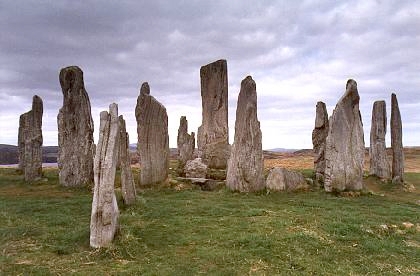
Erected around 2750 BC, before Stonehenge, and laid out so that none of its three stone rows actually points at the centre of its own circle.
- Near Calanais
- 107 metres from car park
- Easy path
The setting
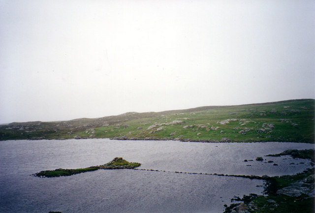
A flooded dun near Cnip, showing a different archaeological site from Loch na Berie.
Photo: PeterJG1970 / Wikimedia Commons / CC BY-SA 2.0
Near Loch na Berie, about 591 metres away.
Photo: Alan Reid / Wikimedia Commons / CC BY-SA 2.0
Near Loch na Berie, about 683 metres away.
Photo: Alan Reid / Wikimedia Commons / CC BY-SA 2.0
Near Loch na Berie, about 720 metres away.
Photo: Alan Reid / Wikimedia Commons / CC BY-SA 2.0
Questions people ask
- What is Loch na Berie?
- Loch na Berie is an Iron Age broch on the Isle of Lewis in the Outer Hebrides, together with its associated causeway. It is designated a Scheduled Monument.
- Where is Loch na Berie located?
- It stands about 400 yards from the shore at Loch na Berie on the Isle of Lewis. The land to the east is marsh, and the broch is thought to have originally been sited on an island.
- How big is the broch?
- The broch is roughly 16.5 metres in diameter, with walls approximately 3 metres thick.
- What did excavation of the site find?
- Excavation in the 1980s established that the broch survives to first-floor level, an unusually well-preserved state for a structure of this type.
- Is there a causeway at Loch na Berie?
- Yes. A modern causeway, built west of the broch from stone robbed off the structure, is thought to overlie an ancient causeway on the same alignment.
Sources
Explore more: Fortified places · Iron Age · Outer Hebrides
The Ancient Codex, in your pocket
Get the Pocket Codex app
Carry the directory with you — Loch na Berie and thousands of ancient places across Britain and Ireland, offline, wherever you roam.