
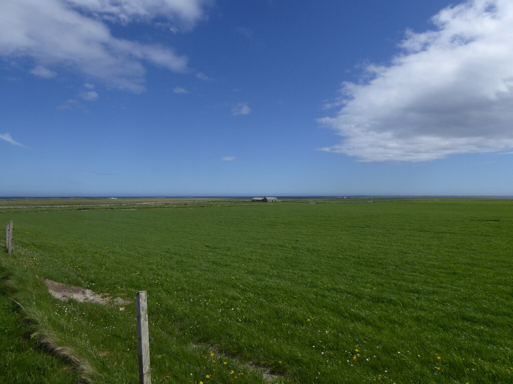
Tofts Ness is a Sanday peninsula with ancient mounds, cairns, enclosures and structural remains, alongside evidence of later shipwrecks.
More than three hundred mounds and cairns lie across this peninsula. That is the first thing to understand about Tofts Ness, at the north-eastern tip of Sanday, and the second is that it was not a cemetery.
Excavation and geophysical survey in the 1980s established that the site was originally a settlement — probably a farm, possibly a kelp-working complex, quite likely both. Many of the mounds are burial monuments and one of the larger ones may be a broch, but the ground between them was worked. A round house was found with a connecting structure beside it, both standing in soil that carries clear evidence of cultivation, and those ancient soils are part of what the scheduling protects.
Occupation came in two phases with a long gap between them. The first ran from the late Neolithic into the early Bronze Age; the second from the late Bronze Age into the early Iron Age. People used this peninsula, left it, and came back to it.
At the shoreline, aerial photography has picked out two unroofed stone buildings and two enclosures, the first building measuring about ten metres by five and divided inside. Tofts Ness is also the site of multiple shipwrecks — which extends the record of human activity here from the Neolithic to the age of sail.
What follows is drawn from published sources, with each claim labelled by how firmly it is established.
History
Tofts Ness is a peninsula at the north-eastern tip of Sanday in Orkney, holding a prehistoric site with evidence of occupation from the late Neolithic through to the Iron Age. The scheduled monument covers mounds, cairns, enclosures, ancient soils and structural remains. Protecting ancient soils as part of a scheduling is unusual and reflects how much of the evidence here is agricultural.
The scale of it is unusual. More than three hundred mounds and cairns spread across the peninsula, many of them probably burial monuments, and one of the larger mounds may be a broch — a drystone tower of the Iron Age. Three hundred monuments on one peninsula is a density matched almost nowhere in Britain. Excavation and geophysical survey in the 1980s established that Tofts Ness was originally a settlement rather than a cemetery. It was probably a farm, a kelp-working complex, or both — a working landscape rather than a ritual one.
There were two main phases of occupation, separated by a long gap. The first ran from the Neolithic into the early Bronze Age; the second from the late Bronze Age into the early Iron Age, so the peninsula was used, left, and taken up again. Gaps of that length in occupation are as informative as the occupation itself.
A round house was uncovered during excavation, with a connecting structure beside it, and both were surrounded by soil showing clear evidence of cultivation. The ancient soils are part of what is protected here, which is unusual in a scheduling. Cultivated soil is fragile evidence and survives only where later ploughing has left it alone. At the shoreline are two unroofed stone buildings and two enclosures, identified from aerial photography. The first of the buildings measures about ten metres by five and is divided internally. Aerial survey remains the most productive method on ground this flat and this exposed.
Tofts Ness is also the location of multiple shipwrecks, so the peninsula's record of human activity runs from the Neolithic to the age of sail without any obvious break in interest.
Cultural influences
-
Cultivated soils, a roundhouse and associated structures show that the peninsula was a working settlement landscape as well as a place of cairns and mounds.
Connections
-
Sanday
Tofts Ness is a peninsula at the north-east tip of Sanday.
-
Sanday settlement
Tofts Ness preserves evidence of prehistoric settlement and later occupation on Sanday.
Discovery & excavation
Excavation and geophysical survey in the 1980s established settlement activity and two broad phases of occupation on the peninsula.
What to look for
-
Over three hundred mounds
The peninsula carries more than 300 mounds and cairns, many of them probably burial monuments. One of the larger mounds may be a broch.
-
A farm, not a cemetery
Excavation and geophysical survey in the 1980s showed the site was originally a settlement — probably a farm, a kelp-working complex, or both.
-
Two phases, two thousand years apart
Occupation ran from the Neolithic to the early Bronze Age, then again from the late Bronze Age to the early Iron Age.
-
Buildings at the shoreline
Two unroofed stone buildings and two enclosures have been identified at the shore, visible on aerial photography; the first measures about 10 metres by 5.
Plan your visit
- Location
- 59.3091°N · 2.4224°W
- Nearest settlement
- Sanday
- Access
- Open access
- Terrain
- Moderate walking
- Time needed
- About 45 minutes
- Best time
- Daylight hours
- What survives
- More than 300 mounds and cairns survive across the peninsula, together with shoreline stone buildings, enclosures and preserved ancient soils.
Opening & admission
No managed admission arrangement is published; confirm access locally before travelling.
- Tofts Ness is a scheduled archaeological landscape on Sanday, where low mounds and shore-side remains are vulnerable to weather and erosion.
Nearby places

Fortified place · Iron Age
Broch of Burrian
Orkney Islands
The Broch of Burrian is a tall circular tower of unmortared stone, a type of building found only in Scotland, on the rocky shore of North Ronaldsay.
- Rough ground
Tomb or burial place · Prehistoric
Scar boat burial
Orkney Islands
A Viking boat burial on Sanday, dating from between 875 and 950.
- Near Sanday
- Some walking

Tomb or burial place · Prehistoric
Quoyness Chambered Cairn
Orkney Islands
A tomb mistaken for a broch until 1867, holding at least ten adults and possibly four children in a stone-lined cist: a box grave built of slabs: w…
- Near Sanday
- 20 min walk from car park
- Easy path

Tomb or burial place · Prehistoric
Huntersquoy chambered cairn
Orkney Islands
An exceptionally rare two-storey tomb, its opposed entrances and flooded lower chamber reveal two burial spaces stacked within one small Eday mound.
- Easy path
Questions people ask
- How many mounds are there?
- More than three hundred mounds and cairns across the peninsula. Many are probably burial monuments, and one of the larger ones may be a broch.
- Was it a cemetery?
- No. Excavation and geophysical survey in the 1980s showed the site was originally a settlement — probably a farm, a kelp-working complex, or both.
- When was it occupied?
- In two phases with a gap between. The first ran from the Neolithic into the early Bronze Age, the second from the late Bronze Age into the early Iron Age.
- What is at the shoreline?
- Two unroofed stone buildings and two enclosures, identified from aerial photography. The first building measures about ten metres by five and is divided internally.
Sources
The Ancient Codex, in your pocket
Get the Pocket Codex app
Carry the directory with you — Tofts Ness and thousands of ancient places across Britain and Ireland, offline, wherever you roam.