
The Grannie Stone is an enduring Irvine river landmark whose uncertain origin—glacial erratic or last stone-circle survivor—reveals how folklore, engineering and civic memory reshape prehistoric (from the era before writing arrived in these islands) claims.
When the River Irvine is low, the Grannie Stone appears below the Rivergate Centre as a large boulder in the water. Its present river setting conceals an unsettled past: it may be a glacial erratic with no archaeological significance, or the lone survivor of a stone group destroyed after the late-nineteenth-century weir raised water levels.
The debate is part of the monument’s significance. Protest saved the stone when nearby boulders were blasted in 1897 and 1899, while stories connect it with a stone circle, the Puddleford stepping stones and the Carters Society’s Marymass procession. Its name has attracted associations with Celtic and Romano-British deities, none conclusive. The Grannie Stone therefore offers a vivid example of how a single natural object can accumulate contested histories.
What follows is drawn from published sources, with each claim labelled by how firmly it is established.
History
The Grannie Stone lies in the River Irvine below the Rivergate Centre and is visible when water is low. Its origin is uncertain: it may be a glacial erratic deposited in the Ice Age, or the sole surviving stone from a circle whose other boulders were removed. It is not recorded by the RCAHMS, not mentioned by Victorian archaeologist John Smith and absent from the first Ordnance Survey map, reasons to treat claims of a prehistoric monument with caution.
Construction of the Irvine weir in 1895 raised the river level and made the stone less prominent. Other stones near the old Irvine Bridge were blasted in 1897 and 1899, but popular protest saved the Grannie Stone. A photograph from the 1890s shows it farther from the river bank than today. These changes show how civil engineering and quarrying altered both the physical visibility of the boulder and the local stories attached to it.
The stone played a role in the Carters Society’s Marymass celebration, whose members twice circled it on their route to Irvine Moor. Tradition linked this act to William Wallace crossing the river in 1297, although the association is later embellishment. Other folklore suggests stones from a lost group were reused for Puddleford stepping stones. Whether or not these claims are historically accurate, they show the boulder’s long civic and imaginative importance.
Cultural influences
-
The 1895 Irvine weir raised water levels around the boulder, while nearby quarrying removed other stones from the old bridge area.
Connections
-
River Irvine
The boulder lies in the river below the Rivergate Centre and is visible at low water.
-
Puddleford
Folklore associates missing stones with the former stepping-stone crossing.
In culture
-
The Carters Society twice circled the boulder on its Marymass route to Irvine Moor.
What to look for
-
The river boulder
The boulder in the River Irvine, visible at low water below the Rivergate Centre.
-
The raised waterline
The altered river setting created after the 1895 weir raised water levels.
-
The Puddleford crossing
The relationship with the former Puddleford stepping-stone crossing.
-
The old bridge setting
Views toward the old Irvine Bridge area where other stones were removed.
-
The uncertain origin
Interpretation distinguishing glacial-erratic and stone-circle theories without treating either as certain.
What is said
Folklore and tradition, recorded as what is said — not as established fact.
-
Wallace at the river
Later tradition linked the Carters Society’s circling of the stone with William Wallace crossing the River Irvine in 1297.
-
Lost circle stones
Folklore says other stones from a lost group were reused at the Puddleford stepping-stone crossing.
Plan your visit
- Location
- 55.6128°N · 4.6697°W
- Nearest settlement
- Irvine
- Access
- Open access
- Terrain
- Easy going
- Time needed
- About 15 minutes
- Best time
- Low water, when the boulder can be seen in the River Irvine below the Rivergate Centre.
- What survives
- A single river boulder whose origin remains uncertain; the raised water level after the 1895 weir makes it less prominent than it was in the nineteenth century.
Opening & admission
The boulder is visible in the River Irvine below the Rivergate Centre when water is low.
- The stone lies in the River Irvine below the Rivergate Centre.
- It is visible only when water conditions allow.
- It may be a glacial erratic or the last survivor of a stone circle.
Nearby places

Fortified place · Medieval
Seagate Castle
North Ayrshire
Seagate’s scheduled ruin preserves Irvine’s former harbour route and the sixteenth-century Montgomerie town house, where defence, aristocratic disp…

Sacred place · Medieval
Kilwinning Abbey
North Ayrshire
Kilwinning’s ruined monastery once held revenues from fourteen parishes, granges and baronial jurisdiction, leaving an unusually wide medieval impr…
Fortified place · Medieval
Dundonald Castle
South Ayrshire
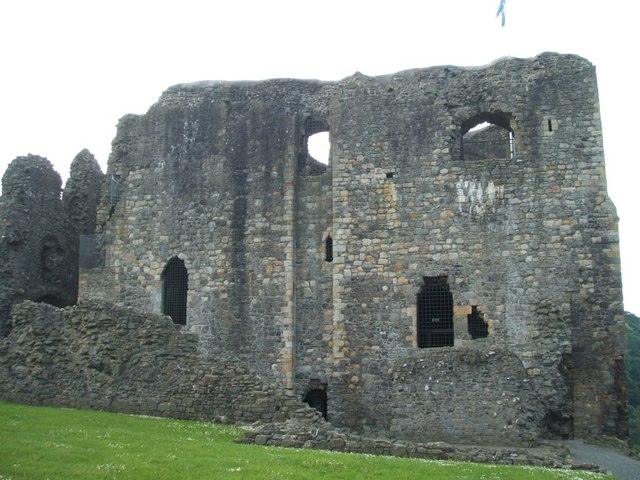
A fourteenth-century royal residence on a hill between Kilmarnock and Troon.
Ancient tree · Medieval
Bickering Bush
East Ayrshire
Bickering Bush preserves the memory of a named hawthorn, its lost site tied to Caprington Castle lands and Wallace tradition.
- Near East Ayrshire
Questions people ask
- Is the Grannie Stone part of a stone circle?
- It is uncertain. Some people consider it the last surviving stone of a circle, but it may simply be a glacial erratic and it is not listed by the RCAHMS.
- Why is the Grannie Stone in the river?
- The stone was already near the River Irvine, but the 1895 weir raised water levels and made it less prominent. It is now visible mainly when the water is low.
- Why was the Grannie Stone saved?
- Other nearby stones were blasted in 1897 and 1899 after the weir was built, but popular protests saved this remaining stone.
Sources
Explore more: Sacred places · Prehistoric · North Ayrshire
The Ancient Codex, in your pocket
Get the Pocket Codex app
Carry the directory with you — Grannie stone and thousands of ancient places across Britain and Ireland, offline, wherever you roam.