
A broch built inside an older promontory fort, fully excavated and then bulldozed into the sea in 1972 — it survives only as a record, not a ruin.
On a low headland above a sea inlet called Chapel Geo, a shallow grassy hollow is almost all that marks where a stone tower once stood inside an older ring of ramparts, with a small village of houses clustered around its base. For two centuries the tower shared its foothold with earlier defences before slipping into a long decline, and then, in 1972, the entire remaining structure was pushed over the cliff by a bulldozer once archaeologists had finished recording it.
The site had been lived on since the very end of the Bronze Age, and its people continued building and rebuilding across more than a thousand years, adapting an existing promontory fort — a defended headland cut off by a wall rather than by natural cliffs alone — into something more ambitious. What they built was, by the standards of later towers elsewhere in northern Scotland, something of a first attempt: thick-walled but poorly founded, unable to bear anywhere near the full height its builders may have intended.
Burials, imported Roman goods, a lost inscribed stone from the age of Norse raiders, and a mediaeval chapel built almost on the doorstep all layered onto the same small headland over the centuries that followed, before coastal erosion forced a final, deliberate act of destruction that this account is really describing.
What follows is drawn from published sources, with each claim labelled by how firmly it is established.
History
People were already settled on the headland by the end of the Bronze Age, and the early Iron Age that followed left behind carinated pottery (vessels with a sharp shoulder or ridge) that appears to have been made locally yet closely resembles wares from the same period in southern and eastern England. Uncorrected radiocarbon dates place some of this pottery, including a few black-burnished sherds, in the sixth and fifth centuries BC.
A discontinuity in the middle Iron Age saw the buildings reconstructed and new types of pottery and other artefacts introduced alongside variants of the older styles, a change that has been read as evidence of an influx of new and influential people. Local pottery-making nonetheless continued in the same tradition through the period when Rome occupied southern Scotland, between roughly 80 and 180 AD, and Roman pottery and glassware reached the site, whether through trade or other contact.
Radiocarbon evidence dates the construction of the broch itself, a large circular stone tower, to around 200 BC, raised inside the earlier promontory fort's rampart so that it would have loomed above the older defensive wall. It included a guard cell, a chamber built within the thickness of the wall, and a stair entrance at ground level, but the wall's core of earth, rubble and boulders made for a weak, experimental design that could never have supported a tower as tall as later examples.
External houses clustered around the tower from about the time it was finished, forming a small village of a kind otherwise found only in northern Scotland, while the broch remained in use into the second century AD despite repairs that never fixed its underlying weakness. A final rebuilding in the second century preceded abandonment, by which point defence seems no longer a concern, and a body was buried sitting upright in one of the round buildings around this time, without grave goods.
Long after the broch had fallen out of use, two cist burials (stone-lined graves) were dug into its debris at some point around 600 AD, showing the mound was still being used as a burial place centuries later. A stone carved with runic lettering once stood at Crosskirk, dating from the age of Norse raiders active around Caithness in the ninth, tenth and eleventh centuries, though the stone itself has since been lost.
St Mary's Chapel was built about 30 yards, roughly 27 metres, south of the broch mound around the 13th century, and the ground to the south of the older site was deliberately levelled to make way for it. In more recent times some of the stones from the broch mound were taken away, likely for building field dykes, gradually reducing what remained visible above ground.
A description recorded in 1871 measured an internal diameter of roughly 30 to 32 feet and a wall 14 to 15 feet thick, noting a probable entrance breach on the south side, while a 1964 survey found the wall reduced to little more than a metre high, already exposed by erosion. Coastal erosion continued to undercut the cliff, and between 1966 and 1972 Fairhurst and Taylor excavated the ruin before it was bulldozed over the edge, the site grassed and a memorial cairn erected in its place.
People
-
Fairhurst and Taylor
Directed the 1966–1972 excavation of the broch that preceded its deliberate destruction.
Cultural influences
-
Long-distance Iron Age contacts
Locally made pottery resembles wares from southern and eastern England, while later Roman pottery and glassware reached the settlement through contact beyond northern Scotland.
Connections
-
Bu Broch
Plant food remains from Crosskirk closely match those found at Bu, suggesting a shared, deliberately varied diet across northern broch settlements.
-
St Mary's Chapel, Crosskirk
Built around the 13th century some 27 metres south of the broch, on ground that was levelled specifically to accommodate it.
Discovery & excavation
The site's instability was already noted by the 19th century, but systematic work only came once coastal erosion made the cliff edge dangerous. Between 1966 and 1972 Fairhurst and Taylor carried out a full excavation of the broch, the surrounding rampart and the outer settlement, recording the sequence of Bronze Age, Iron Age and later activity before the eroding remains were deliberately removed.
What to look for
-
Memorial cairn
A cairn raised in 1972 after excavation marks the spot where the broch and its surrounding settlement once stood, on ground now largely returned to grass.
-
St Mary's Chapel ruins
The roofless walls of a chapel built around the 13th century stand about 27 metres south of the site, on ground levelled at the time of its construction.
-
Chapel Geo cliff edge
The eroding cliff line above Chapel Geo, which undercut the broch and forced its excavation and removal, remains visible immediately beside the site.
Plan your visit
- Location
- 58.6082°N · 3.6799°W
- Nearest settlement
- Reay
- Access
- Visible from a public way
- Terrain
- Rough ground — reasonable boots advised
- Time needed
- About 20 minutes
- Best time
- Daylight, for the memorial cairn, chapel ruins and the eroding coastal setting.
- What survives
- The broch was excavated and removed after coastal erosion; a grassed memorial cairn marks its former position beside the surviving chapel ruins.
Opening & admission
- Broch was destroyed after excavation; memorial cairn marks the grassed-over coastal site.
Nearby places
Tomb or burial place · Prehistoric
Tulach an t-Sionnaich
Highland
Excavation found the earliest known heel-shaped cairn (a mound of piled stones, often covering a burial) on the Scottish mainland folded inside two…
- Near Watten
- Some walking

Sacred place · Prehistoric
Stone Lud
Highland
Its scale rivals the Ring of Brodgar, yet a fallen twin thirty metres off suggests it once anchored a deliberate sightline to the summer solstice s…
- Near Bower
- Easy path

Fortified place · Medieval
Castle of Mey
Highland
The only home Queen Elizabeth the Queen Mother ever owned outright, rescued from near-ruin in 1952 and still kept in family use by King Charles III…
- Near Mey
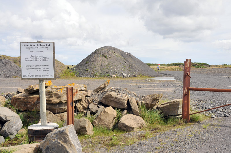
Fortified place · Iron Age
Skitten Broch
Highland
A broch excavated twice within four decades of Highland archaeology before being levelled entirely for a wartime runway: its erasure is now the cle…
- Near Killimster
- Easy path
Questions people ask
- Where was Crosskirk Broch and does it still stand?
- It stood on a headland near the hamlet of Crosskirk, close to Thurso in Caithness. It no longer stands: the ruin was removed in 1972 after excavation, leaving a grassed-over mound and memorial cairn.
- Why was Crosskirk Broch destroyed?
- Coastal erosion had undercut the cliff and made the site unsafe. After a full excavation between 1966 and 1972, the remaining stonework was pushed over the cliff by bulldozer and the site grassed over.
- How old is the broch, and what came before it?
- The broch was built around 200 BC inside an older promontory fort whose rampart and gateway already defended the headland, and it remained in use into the second century AD.
- What did excavation find at Crosskirk?
- Layers spanning the Bronze Age to around 600 AD, including locally made pottery, Roman goods, an unaccompanied seated burial, and later long cist graves dug into the broch's debris.
- What happened to the runic stone once at Crosskirk?
- A stone carved with runic lettering, dating from the era of Norse raiders in the ninth to eleventh centuries, once stood at the site, but it has since been lost.
Sources
- Wikipedia: Crosskirk Broch
- 1871 broch description
- Fairhurst and Taylor excavation report, 1966-1972
Explore more: Fortified places · Iron Age · Highland
The Ancient Codex, in your pocket
Get the Pocket Codex app
Carry the directory with you — Crosskirk Broch and thousands of ancient places across Britain and Ireland, offline, wherever you roam.