
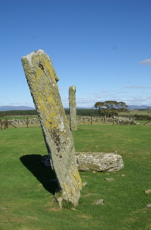
Nineteen granite boulders sit on a slightly raised platform on the land of Torhouse, three miles west of Wigtown. They form a circle roughly 22 metres across, the stones ranging from about 0.6 metres to 1.5 metres in height, with the tallest gathered along the southeast arc. At the centre, three upright boulders stand in a line running northeast to southwest, an arrangement that sets Torhouse apart from a plain ring of stones.
Nineteen granite boulders sit on a slightly raised platform on the land of Torhouse, three miles west of Wigtown. They form a circle roughly 22 metres across, the stones ranging from about 0.6 metres to 1.5 metres in height, with the tallest gathered along the southeast arc. At the centre, three upright boulders stand in a line running northeast to southwest, an arrangement that sets Torhouse apart from a plain ring of stones.
The circle does not stand alone. Two stones, one large and one small, lie 40 metres to the south-southeast, and a row of three stones runs 130 metres to the east. Around them survive the remains of several burial cairns, while records note others long since broken up to build the field dykes. The stone circle has never been archaeologically excavated, and its date is estimated rather than proven: probably Neolithic or Bronze Age.
Torhouse, also recorded as Torhousekie, is held in the care of Historic Environment Scotland as a scheduled monument. Local tradition has attached the site to Galdus, a mythical Scottish king, and to a wayside stone whose cavity travellers were said to fill with a gift in exchange for safe passage.
What follows is drawn from published sources, with each claim labelled by how firmly it is established.
History
The circle probably dates to the Neolithic period or the Bronze Age, though this rests on comparison and setting rather than excavation. The site has never been archaeologically dug, so no artefacts or dating evidence have fixed its age more precisely. The builders raised nineteen granite boulders on a slightly raised platform, arranging them in a ring about 22 metres in diameter and placing the larger stones, those over a metre high, along the southeast side. Near the centre they set three upright boulders in a line running northeast to southwest.
Beyond the ring, further stones were placed as part of the wider monument: two stones, one large and one small, 40 metres to the south-southeast, and a row of three stones 130 metres to the east. Several burial cairns were built nearby, of which some remains survive. In later centuries a number of the surrounding cairns were removed, their stone taken to build the field dykes that now divide the land. History records these losses even where the cairns themselves no longer stand. The Torhouse Stones passed into the care of Historic Environment Scotland, which holds the circle as a scheduled monument with a visitor guide to the site.
People
-
Galdus
A mythical Scottish king whose tomb, by local tradition, was said to lie within the three large central stones of the circle.
Cultural influences
-
The Torhouse Stones form a wider prehistoric landscape with outlying stones, a possible eastern row and nearby burial cairns, despite later stone removal for field dykes.
Connections
-
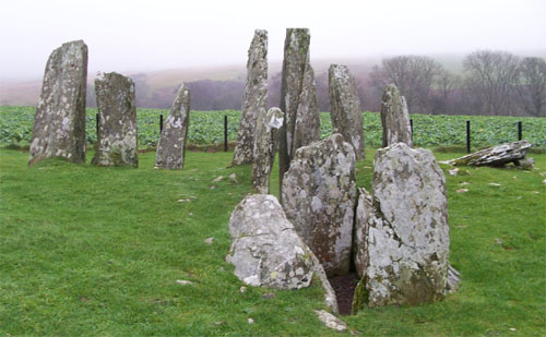
Photo: Original uploader was Otter at nl.wikipedia (Original text : Hopmans) / Wikimedia Commons / CC BY-SA 3.0 Cairnholy
Another prehistoric site in Galloway where a similar tradition places a tomb at one of the cairns, echoing the Galdus legend told at Torhouse.
-

Photo: Jeff Tomlinson / Wikimedia Commons / CC BY-SA 2.0 Wigtown
The nearest town, three miles to the east, which gives the stones their location on the land of Torhouse.
Discovery & excavation
The circle has never been archaeologically excavated; its likely Neolithic or Bronze Age date is therefore based on monument form, setting and comparison rather than recovered finds.
What to look for
-
The ring of nineteen granite boulders
The circle is about 22 metres across, its stones ranging from roughly 0.6 to 1.5 metres high, set on a slightly raised platform.
-
The three central stones
Three upright boulders stand in a line near the centre of the circle, running northeast to southwest.
-
The tallest stones on the southeast
The larger boulders, those over a metre high, are gathered along the southeast side of the ring.
-
Outlying stones and the eastern row
Two stones, one large and one small, stand 40 metres to the south-southeast, and a row of three stones lies 130 metres to the east.
-
Remains of burial cairns
Surviving remains of several burial cairns lie about the site; others were long ago removed to build the field dykes.
What is said
Folklore and tradition, recorded as what is said — not as established fact.
-
The tomb of King Galdus
Local tradition holds that the three large stones at the centre of the circle contained the tomb of Galdus, a mythical Scottish king. A similar story is said of one of the tombs at Cairnholy, also in Galloway.
-
The gift stone in the dyke
In the dyke on the south side of the road stands a stone with a deep cavity into which, tradition holds, "the knowing never pass without depositing therein some pebble or gift to pass in peace".
Plan your visit
- Location
- 54.8775°N · 4.5226°W
- Nearest settlement
- Newton Stewart
- Access
- Open access
- Terrain
- Easy going
- Time needed
- About 45 minutes
Nearby places
Fortified place · Iron Age
Doon of May
Dumfries and Galloway
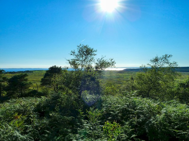
The facing stones of the wall have almost entirely gone, but the heat that once fused the rampart (an encircling bank built for defence) still show…
- Near Newton Stewart
- Some walking
Fortified place · Medieval
Carsluith Castle
Dumfries and Galloway
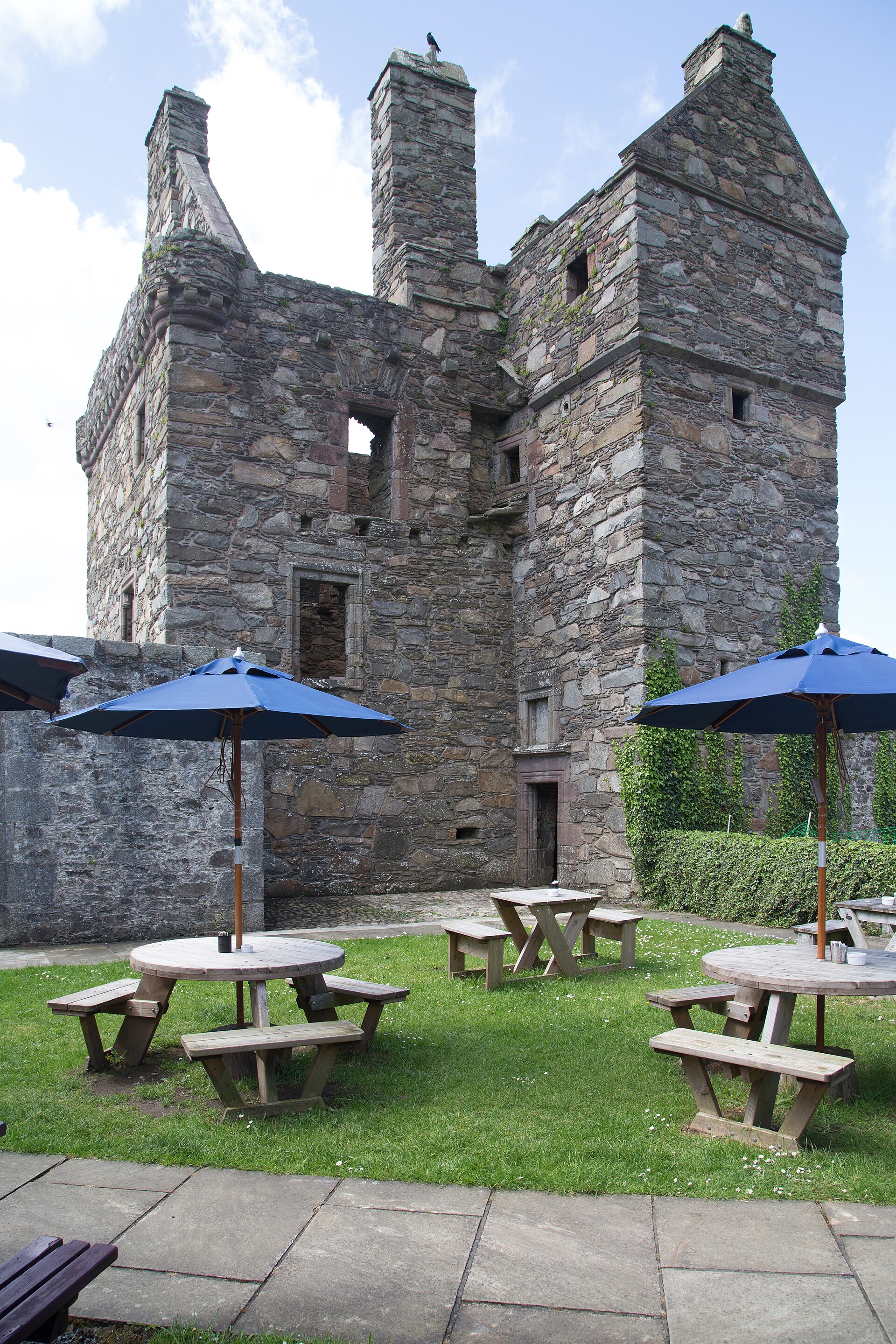
Carsluith Castle is a sixteenth-century Galloway tower house whose Lindsay and Brown history, Catholic recusancy and surviving hall-and-stair archi…
- Near Newton Stewart
Fortified place · Medieval
Sorbie Tower
Dumfries and Galloway
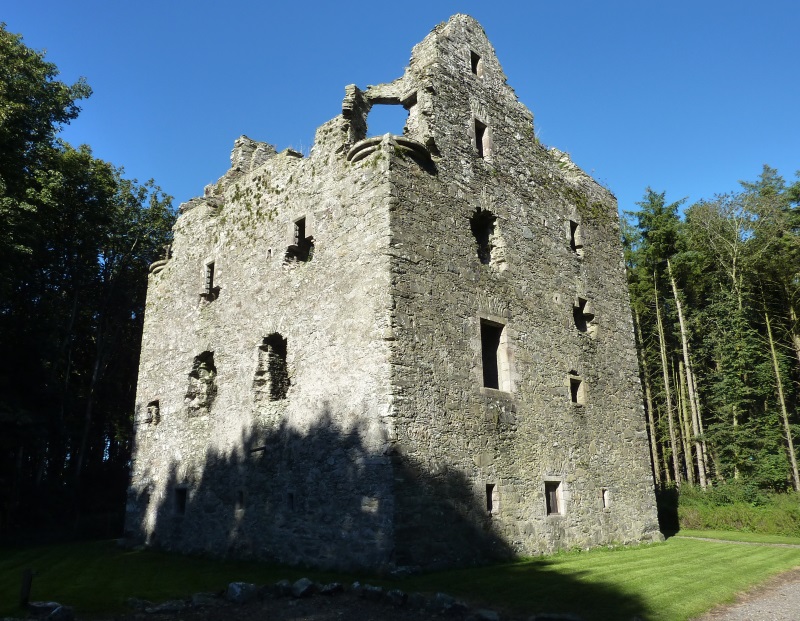
Sorbie Tower is the ancestral stronghold of Clan Hannay, a late-sixteenth-century fortified house whose surviving lower levels preserve a rare Gall…
- Near Sorbie
Sacred place · Prehistoric
Drumtroddan standing stones
Dumfries and Galloway
Of the three stones that once formed the alignment at Drumtroddan, only one still stands. The others lie fallen on the ground, set in a line runnin…
- Easy path
Questions people ask
- How many stones are in the circle at Torhouse?
- The circle is made of nineteen granite boulders, set on a slightly raised platform and arranged in a ring about 22 metres in diameter.
- How old are the Torhouse Stones?
- The circle has never been archaeologically excavated, so its age is estimated rather than proven. It probably dates to the Neolithic period or the Bronze Age.
- Where is Torhouse?
- The stones stand on the land of Torhouse, three miles west of Wigtown in Scotland. The site is also recorded under the name Torhousekie.
- What is the legend of King Galdus?
- Local tradition holds that the three large stones at the centre of the circle contained the tomb of Galdus, a mythical Scottish king. A similar story is told of one of the tombs at Cairnholy, elsewhere in Galloway.
- Who looks after the Torhouse Stones?
- The stones are in the care of Historic Environment Scotland as a scheduled monument, and there is a Historic Environment Scotland visitor guide to the site.
Sources
- Wikipedia: Torhouse
- Wikidata: Q939931
- Historic Environment Scotland: Visitor guide
Explore more: Sacred places · Prehistoric · Dumfries and Galloway
The Ancient Codex, in your pocket
Get the Pocket Codex app
Carry the directory with you — Torhouse and thousands of ancient places across Britain and Ireland, offline, wherever you roam.