
Fifteen locks and two burst reservoirs of history connect Loch Gilp to the Sound of Jura, sparing ships the long, exposed passage around the Mull of Kintyre.
A boat laden with fish tied up at the Broomielaw in Glasgow on a Monday in August 1801, having sailed all the way from the Western Isles without once having to round the exposed headland of the Mull of Kintyre. It was the first vessel to complete the journey through a new nine-mile cut across the neck of the Kintyre peninsula, and the newspapers of the day thought it worth reporting: a shortcut that turned a hazardous sea voyage into a sheltered inland passage.
Getting the water to flow that way had not been easy. The engineer John Rennie designed the route in the 1790s, but rising costs, bad weather, expensive land and a shortage of willing labourers pushed completion two years past schedule, and the young canal then suffered repeated setbacks: a diverted bank, a burst reservoir that wrecked locks and roads, and a second reservoir failure decades later that tore out seven lock gates in a single night. Each time, the company patched, borrowed and rebuilt.
What survives today is a working waterway rather than a ruin. Fifteen locks and seven bridges — six of them swinging open, one rolling back on rails — still carry traffic between Ardrishaig and Crinan, now mostly leisure boats rather than fishing smacks and puffers, with a towpath shared by walkers and cyclists on National Cycle Route 78.
What follows is drawn from published sources, with each claim labelled by how firmly it is established.
History
Parliament authorised the waterway under the Crinan Canal Act of 1793, and the civil engineer John Rennie was engaged to design a route linking Loch Gilp to the Sound of Jura. Work began in 1794, but finance troubles, poor weather, high asking prices from landowners and a shortage of navvies willing to leave better-paid jobs elsewhere delayed completion until 1801, two years behind schedule, at a cost of £127,000.
The canal opened in 1801, and on Saturday 8 August that year the Carlisle Journal reported that a boat laden with fish had arrived at the Broomielaw in Glasgow from one of the Western Isles, the first vessel to have passed through the new waterway. The notice marked, in print, the moment ships could avoid the long and often dangerous passage around the Mull of Kintyre.
Early problems continued after opening: the canal bank near Lochgilphead failed in 1805, forcing the course to be diverted around marshy ground, and although the feeder reservoirs were finished in 1809, a storm two years later burst one of them, sending boulders and mud surging along the canal in both directions and wrecking locks, banks and nearby roads. Repairs cost £8,000, a considerable sum for the young company to find.
The canal company, led by the Duke of Argyll, could not meet the scale of the damage alone and turned to the government, which sent the engineer Thomas Telford to assess the works. Telford recommended improvements to the locks and a redesign of several sections, including new swing bridges cast in iron in 1816. The government paid for the repairs, but in the process the company lost control of the canal, which passed to the Caledonian Canal Commissioners.
Queen Victoria travelled the length of the canal to Crinan in 1847 during a Highland holiday, greeted at Ardrishaig and towed by four horses, two of them ridden by postilions in royal livery, before boarding the royal yacht Victoria and Albert at Crinan. Her visit turned the route into a fashionable tourist attraction: steamer companies out of Glasgow advertised it as the 'Royal Route', and by 1857 more than 44,000 passengers a year were passing through Ardrishaig to connect with steamers for Oban.
Disaster struck again on 2 February 1859, when the Camloch reservoir that fed the canal burst, sending a torrent of water and rock down onto the banks and sweeping away seven of the lock gates. The canal remained closed to through traffic until 1 May 1860, and although Parliament authorised £12,000 for repairs, the company reported spending some £3,500 more than that after large boulders were found lodged in the canal bed.
A steam-powered passenger boat named Linnet replaced the horse-drawn tourist boats in 1866 and remained in service until 1929. New sea locks built between 1930 and 1932 made the canal accessible at any state of tide, and a swing bridge was installed at Ardrishaig at the same time. Ownership passed to British Waterways in 1962, the canal closed for nine weeks of refurbishment in October 1987, and its Scottish operations became Scottish Canals in 2012.
People
-
John Rennie
Civil engineer who designed the canal under the 1793 Act and oversaw its construction from 1794.
-
Thomas Telford
Engineer sent by the government to assess the canal's problems after the 1811 reservoir failure, and whose recommendations reshaped its locks and bridges.
-
Duke of Argyll
Headed the canal company that built and operated the waterway until it lost control of it to the Caledonian Canal Commissioners.
-
Queen Victoria
Travelled the canal to Crinan in 1847, a visit that turned the route into a popular tourist attraction advertised as the 'Royal Route'.
Connections
-
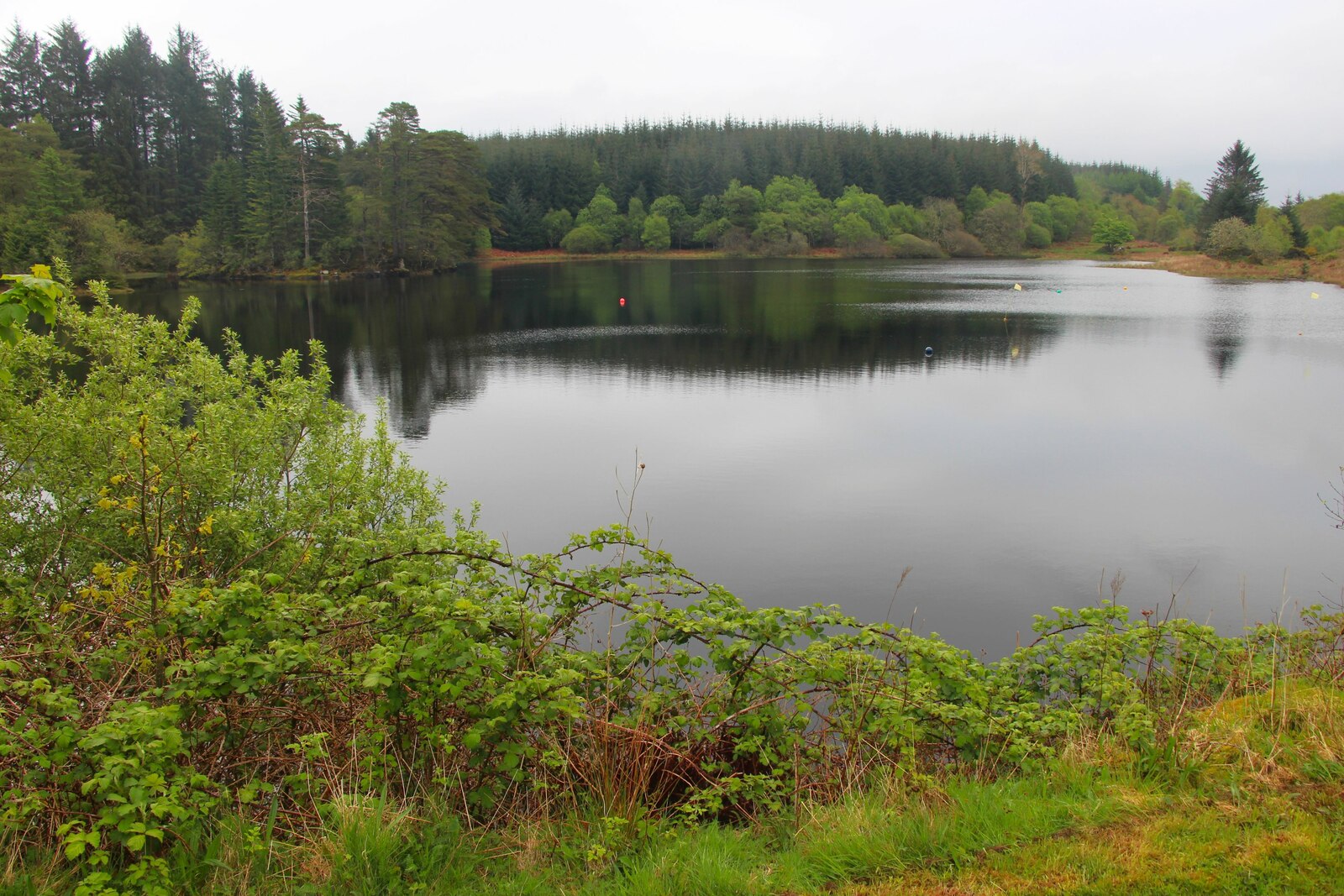
Photo: Alan Reid / Wikimedia Commons / CC BY-SA 2.0 Serves as a feeder reservoir for the canal and is itself a separately scheduled monument.
-
Caledonian Canal Commissioners
Took over control of the Crinan Canal after the government funded repairs following Thomas Telford's assessment.
-
Ardrishaig and Crinan
The canal's two terminal villages, linking Loch Gilp on the Firth of Clyde side with the Sound of Jura on the Hebridean side.
-
Castle of Dunardry (Clan MacTavish)
Ruins associated with Clan MacTavish stand near Dunardry, on the canal's summit reach between Cairnbaan and Crinan.
-
National Cycle Route 78
The canal’s towpath forms part of National Cycle Route 78, providing a level route for walkers and cyclists between Ardrishaig and Crinan.
In culture
-
The Vital Spark
The character Dan MacPhail sings a song about the canal in Neil Munro's Para Handy stories, reflecting the waterway's place in Clyde puffer folklore.
What to look for
-
Fifteen locks in three reaches
From Ardrishaig, three locks raise the four-mile east reach to 32 feet above sea level; the 1,100-yard summit reach between Cairnbaan and Dunardry sits at 64 feet; the west reach down to Crinan is 18 feet above sea level.
-
The retractable bridge at Lock 11
Installed in 1900 to replace an earlier swing bridge, it is worked by a rotating handle and cogged wheel that roll the bridge deck backwards and forwards on rails until it rests across the lock chamber. It is no longer in use.
-
Stone from three sources
The masonry for the fifteen locks was brought in from Mull, the Isle of Arran and Morvern.
-
Towpath and cycle route
A towpath that once let horses tow unpowered craft as late as 1959 now carries walkers and cyclists as part of National Cycle Route 78.
Plan your visit
- Location
- 56.0911°N · 5.5564°W
- Nearest settlement
- Crinan
- Access
- Reached on a public path
- Terrain
- Easy going
- Time needed
- About 120 minutes
- What survives
- A working nineteenth-century canal survives with fifteen locks, towpaths and bridges linking Ardrishaig to Crinan.
Opening & admission
Free to view and walk; check Scottish Canals' site for any current boating or lock-transit charges.
- A towpath runs alongside the canal from Ardrishaig to Crinan, forming part of National Cycle Route 78, giving easy level walking or cycling access.
- The waterway itself has 15 locks and 7 bridges, some no longer in operation, along its nine-mile length.
Nearby places
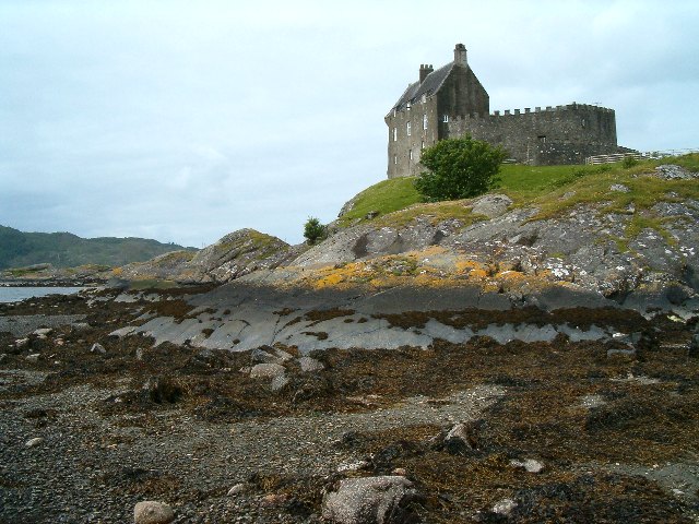
Fortified place · Medieval
Duntrune Castle
Argyll and Bute
A 13th-century curtain wall and 17th-century tower house fused into one lived-in home: held by only three families in eight centuries, still owned…
- Near Crinan
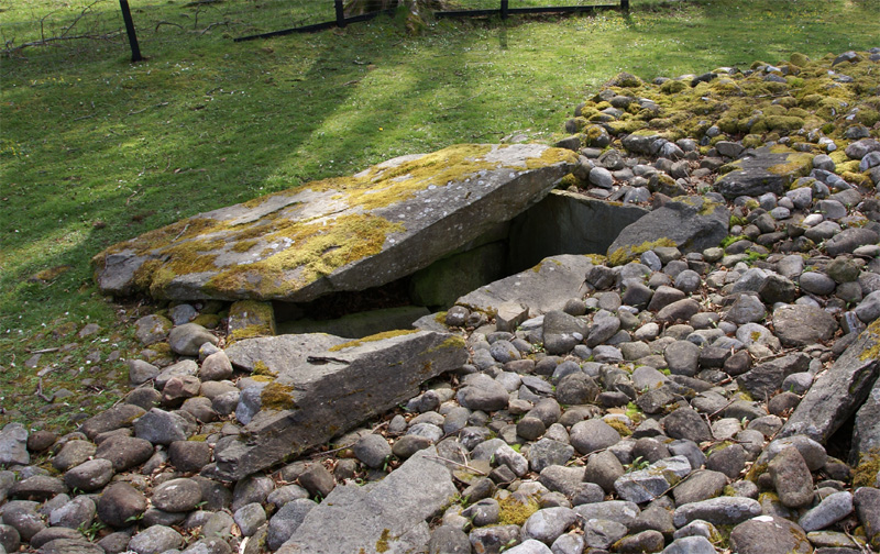
Tomb or burial place · Prehistoric
Ri Cruin Cairn
Argyll and Bute
The southernmost cairn (a mound of piled stones, often covering a burial) in Kilmartin Glen's five-mile chain of Bronze Age (roughly 2500–800 BC) b…
- Near Kilmartin
- 8 min walk from car park
- Easy path
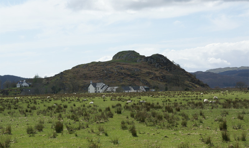
Fortified place · Iron Age
Dunadd Fort
Argyll and Bute
Dunadd is a hillfort in Argyll and Bute, occupied from the Iron Age and into the early medieval period, and believed to have been the capital of th…
- Near Kilmartin
- 237 metres from car park
- Some walking
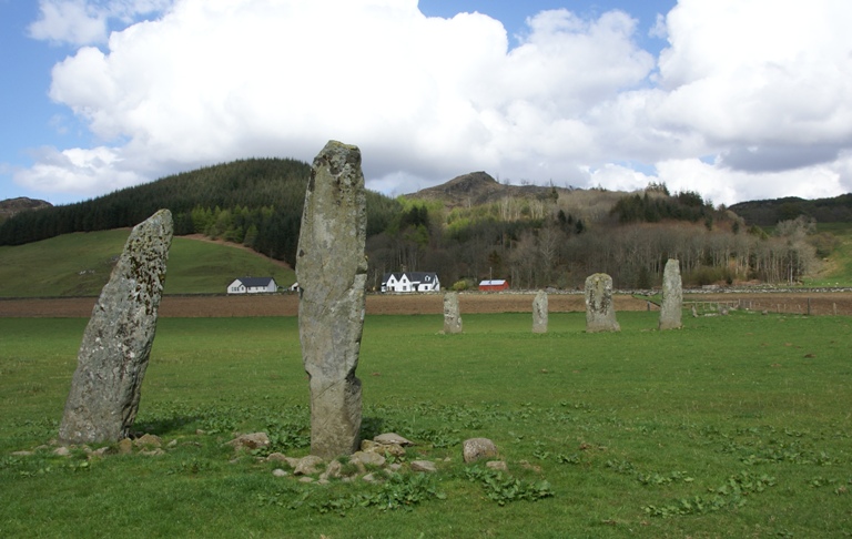
Sacred place · Prehistoric
Ballymeanoch Standing Stones and Henge
Argyll and Bute
One of the few places in Kilmartin Glen where a stone avenue, a circle and a henge: a circular enclosure from before any written account of Britain…
- Near Kilmartin
- 6 min walk from car park
- Some walking
The setting
Crinan Lighthouse at the canal entrance; the canal basin is the subject setting.
Photo: James T M Towill / Wikimedia Commons / CC BY-SA 2.0
Lighthouse at Crinan Basin in the canal setting.
Photo: Colin Park / Wikimedia Commons / CC BY-SA 2.0
Questions people ask
- When did the Crinan Canal open?
- It opened in 1801, two years later than planned, after construction beset by financing problems, poor weather and land costs.
- Who designed the Crinan Canal?
- The civil engineer John Rennie designed it under the Crinan Canal Act of 1793, with work starting in 1794.
- How long is the canal and how many locks does it have?
- The canal is nine miles (14 km) long, with 15 locks and seven bridges between Ardrishaig and Crinan.
- Why did Queen Victoria's 1847 visit matter?
- Her journey to Crinan made the canal a fashionable tourist attraction, advertised afterwards by steamer companies as the 'Royal Route'.
- Is the Crinan Canal still in use today?
- Yes, Scottish Canals operates it for nearly 2,000 leisure boats a year, with its towpath forming part of National Cycle Route 78.
Sources
- Wikipedia: Crinan Canal
- Wikidata: Crinan Canal (Q752064)
- Carlisle Journal, 8 August 1801
- Lindsey, Jean — The Canals of Scotland (David & Charles, 1968)
Explore more: Crossing or structures · Medieval · Argyll and Bute
The Ancient Codex, in your pocket
Get the Pocket Codex app
Carry the directory with you — Crinan Canal and thousands of ancient places across Britain and Ireland, offline, wherever you roam.