
Alexander Thom argued its central stone's flat face was cut to point exactly at sunset over a named Jura peak at the solstices — making Ballochroy one of Scotland's most cited claims for prehistoric (before written records reached Britain) astronomy.
On Kintyre, three mica-schist uprights form a north-east to south-west line across a field. The tallest exceeds eleven feet while the shortest is barely two-thirds that height, and the stones remain conspicuous across the open peninsula.
What draws attention to Ballochroy beyond its size is where the stones seem to look. The flat face of the middle stone sits at right angles to the line of the row, and when a sightline is drawn along it, it points across the water to Cora Bheinn on the island of Jura, some nineteen miles off. The shortest stone, turned the same way, points instead toward Beinn a’ Chaolais, the southernmost of the Paps of Jura. Both peaks sit far enough away, and the geometry lines up closely enough, that the arrangement has been read as deliberate rather than coincidental.
That reading owes much to the engineer and astronomer Alexander Thom, better known for his surveys of Stonehenge, who argued that the long sightlines to these distant summits would have let prehistoric observers fix the midsummer and midwinter sunsets with real precision. The claim has made Ballochroy a fixture in discussions of archaeoastronomy in Scotland, even as the exact purpose of the stones remains disputed.
What follows is drawn from published sources, with each claim labelled by how firmly it is established.
History
The three stones were raised in prehistory by people whose identities and exact dates have not been recorded, part of a wider tradition of standing-stone monuments that clusters across South Argyll. Ballochroy is regarded as the most striking of that group, its unusually tall central stone and long sightlines to Jura setting it apart from smaller, less legible arrangements nearby.
In the twentieth century the engineer Alexander Thom, who had already made his name surveying Stonehenge and other British megalithic sites, turned his attention to Ballochroy. He measured the alignment of the three stones and the bearings to the distant Jura peaks, concluding that the builders had positioned the flat faces of the stones deliberately to mark the setting sun at the summer and winter solstices, turning the row into a working solar calendar.
Thom's interpretation placed Ballochroy at the centre of a broader debate about how much astronomical knowledge prehistoric communities in Britain actually possessed, and how much of the apparent precision in such alignments is real versus a product of hindsight and selective measurement. As with many megalithic sites, the theories remain contested rather than settled.
The monument was later recorded in statutory form by Historic Environment Scotland, whose designation for the site, reference SM175, also notes a cist — a stone-lined burial box — some 400 metres to the north-east of the standing stones, tying the row to a wider funerary landscape even though no excavation details survive in the record.
People
-
Alexander Thom
Scottish engineer and archaeoastronomer, known for his survey work at Stonehenge, who proposed that Ballochroy's stones were aligned to mark the summer and winter solstice sunsets over named peaks on Jura.
Cultural influences
-
Megalithic alignment tradition
Ballochroy’s stone row is part of Kintyre’s prehistoric monument landscape; proposed sightlines toward Jura remain an interpretation rather than a settled explanation.
Connections
-
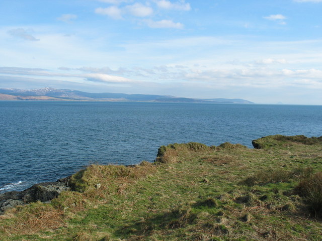
Cora Bheinn, Isle of Jura
The flat face of Ballochroy's central stone is aligned across the row toward this summit, some nineteen miles away, in what Alexander Thom read as a sightline for the midsummer sunset.
-
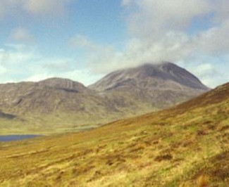
Photo: Mick Garratt Original uploader was Grinner at en.wikipedia / Wikimedia Commons / CC BY-SA 2.0 Beinn a' Chaolais, Isle of Jura
The shortest of the three stones faces this, the southernmost of the Paps of Jura, forming the second long sightline in Thom's proposed solstice alignment.
-
Standing stone monuments of South Argyll
Ballochroy is grouped among a wider cluster of megalithic sites concentrated in South Argyll, and is considered the most spectacular of that group.
Discovery & excavation
Historic Environment Scotland's statutory record for the site (SM175) notes a cist — a stone-lined burial box — roughly 400 metres north-east of the three standing stones. No further excavation details are recorded, but its inclusion in the designation ties Ballochroy to burial activity nearby rather than the standing stones alone.
What to look for
-
Three stones of different heights
The tallest stone stands 11 ft 6 in (3.5 m), the middle stone 9 ft 10 in (3.0 m), and the shortest 6 ft 7 in (2.0 m); the shortest may have had its top broken off at some point.
-
North-east to south-west alignment
The three stones run in a line oriented north-east to south-west, the axis along which their proposed astronomical sightlines were measured.
-
Sightlines toward Jura
The flat face of the central stone points toward Cora Bheinn on Jura, 19 miles away, while the shortest stone faces Beinn a' Chaolais, one of the Paps of Jura, across the water.
Plan your visit
- Location
- 55.7097°N · 5.6190°W
- Nearest settlement
- Campbeltown
- Access
- Open access
- Terrain
- Moderate walking
- Time needed
- About 30 minutes
- Best time
- Clear daylight, when the Jura sightlines can be appreciated.
- What survives
- Three mica-schist standing stones survive in a north-east to south-west row.
- Facilities
- No visitor facilities are recorded.
Opening & admission
Freely accessible standing stones with no admission charge; check Historic Environment Scotland's site for current details.
- Three tall standing stones in a field, aligned toward distant hills on Jura
Nearby places
Fortified place · Medieval
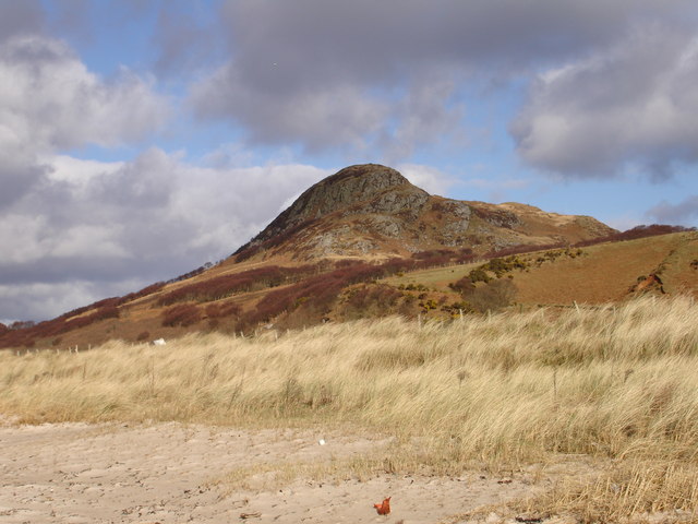
Dun Skeig
Argyll and Bute
Two forts share one summit here: a compact Iron Age (the centuries before Rome arrived, from about 800 BC) dun with a single entrance, and beside i…
- Near Clachan
- Rough ground
Carved stone · Medieval
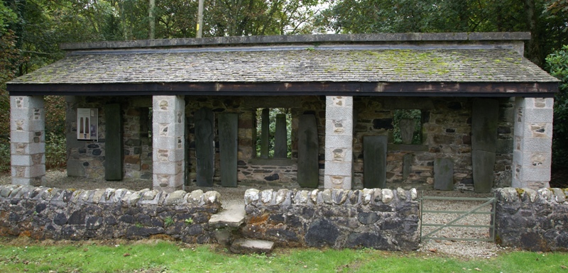
Kilberry Sculptured Stones
Argyll and Bute
The Kilberry Sculptured Stones preserve medieval cross-slabs and grave markers from a parish church destroyed in the 17th century, keeping a disper…
- Near Kilberry
- Easy path
Fortified place · Medieval
Dùn a' Choin Duibh
Argyll and Bute
Its Gaelic name preserves a guardian-dog legend rather than any battle record, and its ridge commands an open sightline across four separate lands.
- Near Tobermory
- Rough ground
Building or ruin · Medieval
Airds Castle
Argyll and Bute
For a century after the Lordship of the Isles fell, this headland castle changed hands between an Ayrshire family and the MacDonalds of Dunnyveg: K…
- Near Carradale
- Rough ground
Questions people ask
- What is Ballochroy?
- Three standing stones in Kintyre, Argyll, set in a line running north-east to south-west and linked by some researchers to solstice sunset alignments on Jura.
- How tall are the stones at Ballochroy?
- They range from about 2 metres to 3.5 metres, cut from mica schist; the shortest may have lost part of its top.
- Who proposed that Ballochroy was an astronomical calendar?
- Alexander Thom, an engineer known for surveying Stonehenge, argued the stones' alignment with distant Jura peaks marked the solstices precisely.
- Is the astronomical interpretation of Ballochroy accepted by all researchers?
- No. As with many megalithic sites, theories about its exact purpose remain contested rather than settled.
- Is there anything else recorded near the standing stones?
- Yes — Historic Environment Scotland's listing for the site also records a cist, a stone-lined burial box, about 400 metres to the north-east.
Sources
- Wikipedia: Ballochroy
- Historic Environment Scotland — Canmore (SM175)
- Wikidata: Ballochroy
Explore more: Sacred places · Prehistoric · Argyll and Bute
The Ancient Codex, in your pocket
Get the Pocket Codex app
Carry the directory with you — Ballochroy and thousands of ancient places across Britain and Ireland, offline, wherever you roam.