
A hillfort of the Maeatae with a thousand-year gap in its occupation — and a Jubilee beacon on the summit now filled with other people's wishes.
The hill is named after the people who fortified it. Dumyat is thought to come from Dun, a hill fort, and the Maeatae — the tribe recorded as living north of the Antonine Wall — and the fort they built is still clearly visible on the summit of Castle Law, the western of the hill’s two tops.
Excavation by Dr Murray Cook and Professor Gordon Noble of Aberdeen University has produced radiocarbon dates, and the dates are the interesting part. There are at least two periods of use: one around 500 BC, and another between the fifth and seventh centuries AD. A thousand years separate them. Somebody built a fort here in the Iron Age, the hill went quiet, and then in the centuries when the Maeatae and their neighbours were dealing with the aftermath of Rome, somebody came back and used it again.
At 418 metres Dumyat is not a large hill, but it is a conspicuous one. Its shape forms an important part of the scenery around Stirling, and it turns up constantly on postcards and calendars, usually paired with the nearby Abbey Craig. It is a popular climb with visitors to the Stirling and Trossachs area, helped by the history of the town and the closeness of the Wallace Monument.
Its geology is written across the southern face. A prominent gully runs almost straight up the scarp and continues down the gentler northern slope, formed by erosion along a fault where soft pyroclastic rock meets harder andesite and basalt. Where the andesite slightly overhangs is the darkest and least exposed part of the climb, which is not particularly difficult. Further gullies, torn out around the main fault as a consequence of the great Ochil Fault, run off to the right into Dumyat and offer shortcuts to the summit. They are not equivalent. Raeburn’s Gulley is dangerous and should be left to experienced and properly equipped rock climbers; Siart Gulley can be managed by anyone of average ability.
The scree on the scarp face rewards looking down as well as up. It is a source of agates, not always of the best quality, and occasionally of smoky quartz and citrine, along with the inevitable quartz, calcite and barytes, and two ores of copper — malachite, and less often azurite.
Farming here has only ever been sheep farming, the ground allowing nothing else, and the hillsides carry several sheep folds and the ruins of a shepherd’s stone house. There was small-scale mining for copper and barytes at one time; those workings are abandoned.
The summit has accumulated its own small collection of monuments. There is a memorial to the Argyll and Sutherland Highlanders, a memorial bench to Michael Simpson, a long-serving and much-loved member of the Open University, a trig point, and a cairn with a beacon on it. The beacon was commissioned for the Queen’s Silver Jubilee in 1977 and carried up and erected by the Menstrie Scout Group, as part of the chain of beacons lit across the country that year. It is currently filled with stones. Each of them is a wish that somebody climbed up here to leave.
What follows is drawn from published sources, with each claim labelled by how firmly it is established.
The name
The name Dumyat (or Dunmyat; Scottish Gaelic 'Dùn Mhèad') is thought to originate from 'Dun' (hill fort) of the Maeatae — the Iron Age people associated with the fort.
History
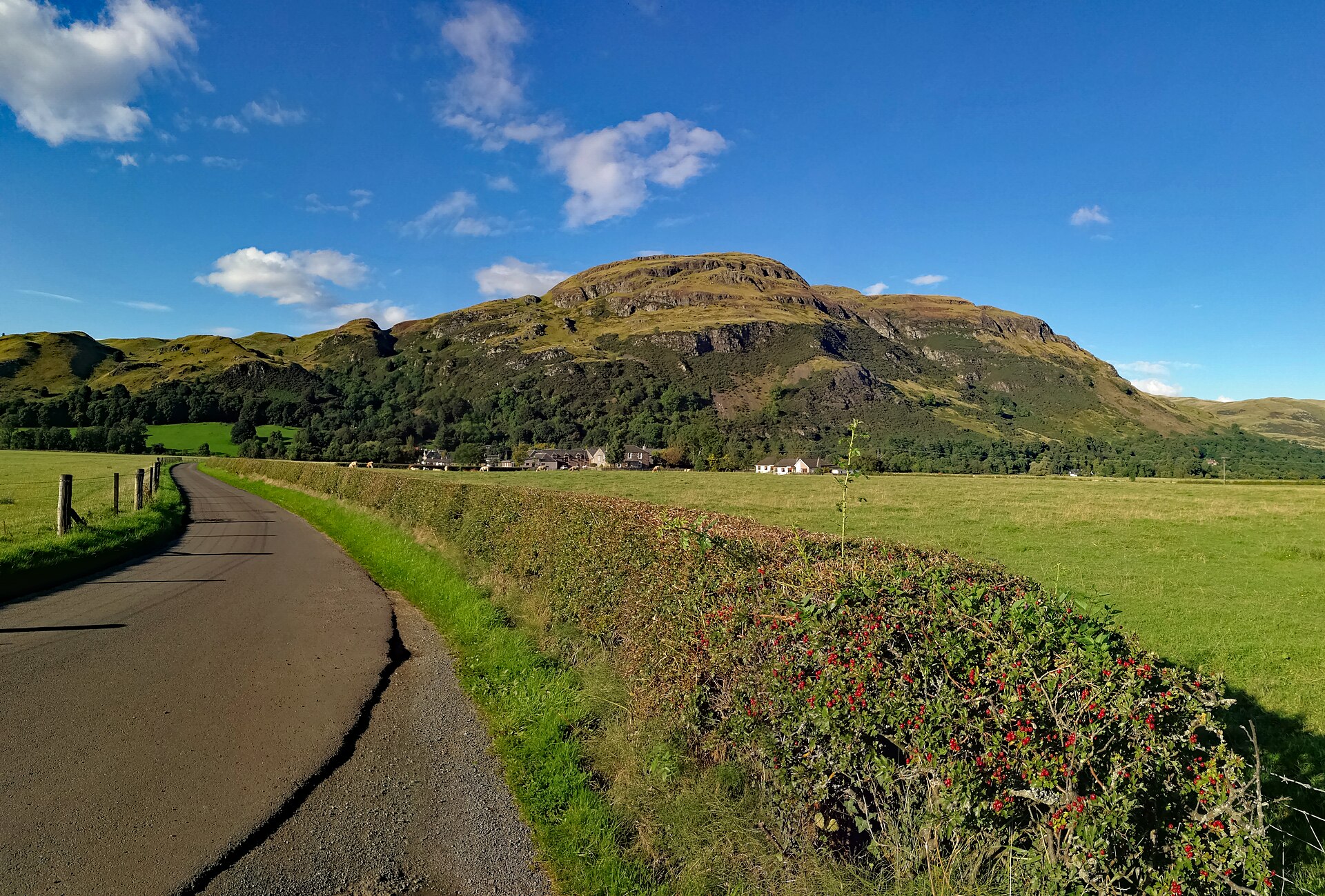
Dumyat is a hill at the western end of the Ochil Hills in central Scotland, with two principal summits — Castle Law on the west and Dumyat proper on the east. Its name is thought to derive from Dun, meaning hill fort, and the Maeatae, the tribe recorded as living north of the Antonine Wall.
The remains of an ancient hillfort, originally occupied by the Maeatae, are still clearly discernible on the summit of Castle Law. The fort is a scheduled monument. Dr Murray Cook and Professor Gordon Noble of Aberdeen University have excavated the site. Radiocarbon dates indicate at least two periods of use — around 500 BC, and again between the fifth and seventh centuries AD, a gap of roughly a thousand years. At 418 metres the hill is relatively small, but its characteristic shape is an important part of the scenery around Stirling and it is often shown, particularly on postcards and calendars, together with the nearby Abbey Craig.
A prominent gully runs almost straight up the southern scarp face and continues down the gentler north face. It was formed by erosion along a fault where soft pyroclastic rocks meet harder andesite and basalt, leaving an area where the andesite slightly overhangs. Further gullies, torn out around the main fault as a consequence of the Ochil Fault, run off to the right into Dumyat. Raeburn's Gulley is particularly dangerous and should be attempted only by experienced and properly equipped rock climbers; Siart Gulley is climbable by anyone of average ability.
The terrain of Dumyat and the surrounding muir suits only sheep farming, and several sheep folds and the ruins of a shepherd's stone house are scattered across the hillsides. There was formerly small-scale mining here for copper and barytes, now abandoned.
People
-
The Maeatae
Iron Age people associated with the hillfort and with the name Dumyat, whose occupation is represented by the defences on Castle Law.
-
Dr Murray Cook
Archaeologist who, with Gordon Noble of Aberdeen University, excavated Castle Law and helped establish its separate Iron Age and early-medieval phases.
-
Professor Gordon Noble
Aberdeen University archaeologist who excavated Castle Law with Murray Cook, contributing to the radiocarbon evidence for its two periods of occupation.
Cultural influences
-
The radiocarbon evidence for two phases of use — c. 500 BC and the 5th-7th century AD — points to occupation spanning the Iron Age and into the early medieval period.
Connections
-

Photo: Janfrie1988 / Wikimedia Commons / Public domain Abbey Craig
The neighbouring crag is often paired with Dumyat in Stirling views, showing the hillfort’s place in the distinctive skyline north-east of the city.
-
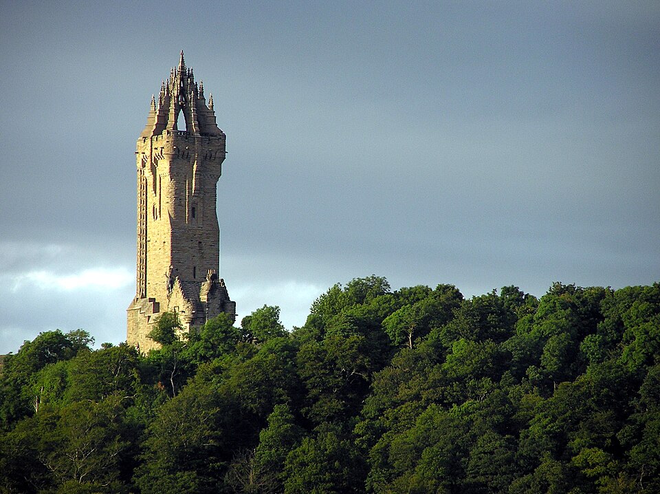
Photo: Finlay McWalter / Wikimedia Commons / CC BY-SA 3.0 The monument on Abbey Craig sits across the Forth valley from Dumyat, making the hillfort part of the familiar walking and viewing landscape around Stirling.
Discovery & excavation
The hill fort on the summit of Castle Law has been subject to excavation by Dr Murray Cook and Professor Gordon Noble of Aberdeen University. Radiocarbon dates obtained from the site indicate at least two periods of use, c. 500 BC and the 5th to 7th century AD.
In culture
-
The hill's characteristic shape is often depicted in postcards and calendars of the Stirling area, frequently shown together with the nearby Abbey Craig.
What to look for
-
The fort on Castle Law
The remains on the western summit are still clearly discernible. Radiocarbon dating puts occupation around 500 BC and again in the fifth to seventh centuries AD, so the hill was fortified, abandoned, and taken up again a thousand years later.
-
The beacon
Commissioned for the Queen's Silver Jubilee in 1977, carried up and erected by the Menstrie Scout Group as part of the UK chain of beacons lit for the celebrations. It is now filled with stones, each one a wish somebody has left.
-
The scree on the scarp face
A source of agates — not always of the finest quality — along with smoky quartz, citrine, quartz, calcite, barytes and two copper ores, malachite and more rarely azurite.
-
The memorials at the top
A memorial to the Argyll and Sutherland Highlanders, a memorial bench to Michael Simpson of the Open University, and a trig point stand on the summit beside the beacon.
What is said
Folklore and tradition, recorded as what is said — not as established fact.
-
The stones placed in the summit beacon are said to be wishes that have been made by people climbing the hill. (local custom)
Plan your visit
- Location
- 56.1577°N · 3.8773°W
- Nearest settlement
- Blairlogie
- Access
- Reached on a public path
- Terrain
- Moderate walking
- Time needed
- About 60 minutes
- What survives
- The hillfort earthworks on Castle Law remain clearly discernible, while the mountain’s steep scarp, gullies and exposed summit terrain require care.
- Start point
- Blairlogie / Dumyat path parking — Roadside parking and information board near Blairlogie at the foot of the usual Dumyat ascent; the hillfort remains are a steep walk up onto the Castle Law summit. No official HES visitor parking exists for this open-hill site.
Nearby places

Fortified place · Iron Age
Dumyat
Clackmannanshire
Dumyat’s Castle Law preserves an excavated hill fort with evidence for occupation from around 500 BC and again in the fifth to seventh centuries AD.
- Near Alloa
- Rough ground
Building or ruin · Medieval
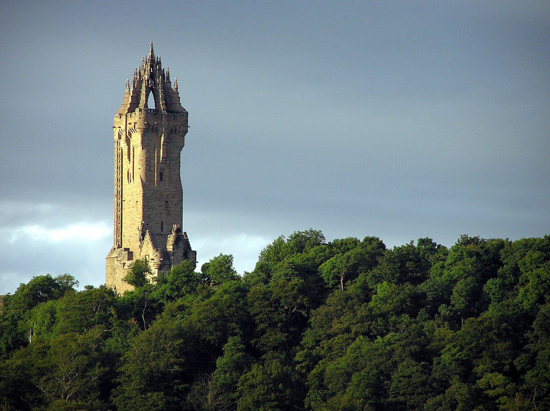
Wallace Monument
Stirling
Garibaldi helped pay for it. A statue of Wallace with Mel Gibson's face stood at the foot of the crag until the public loathing became unmanageable.
Fortified place · Medieval
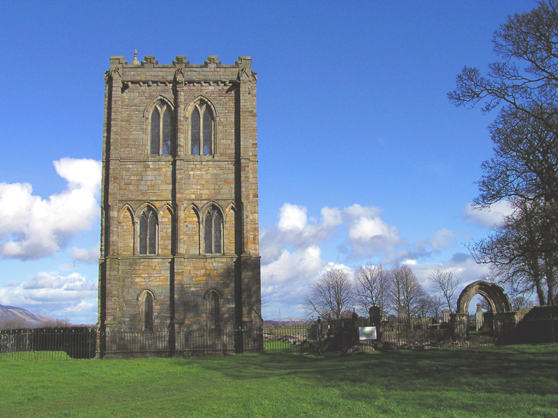
Cambuskenneth Abbey
Stirling
Cambuskenneth Abbey, a provostry of canons regular on land enclosed by a meander of the River Forth near Stirling, was founded by order of King Dav…
- Near Stirling
- 263 metres from car park
Fortified place · Medieval
Stirling Castle
Stirling
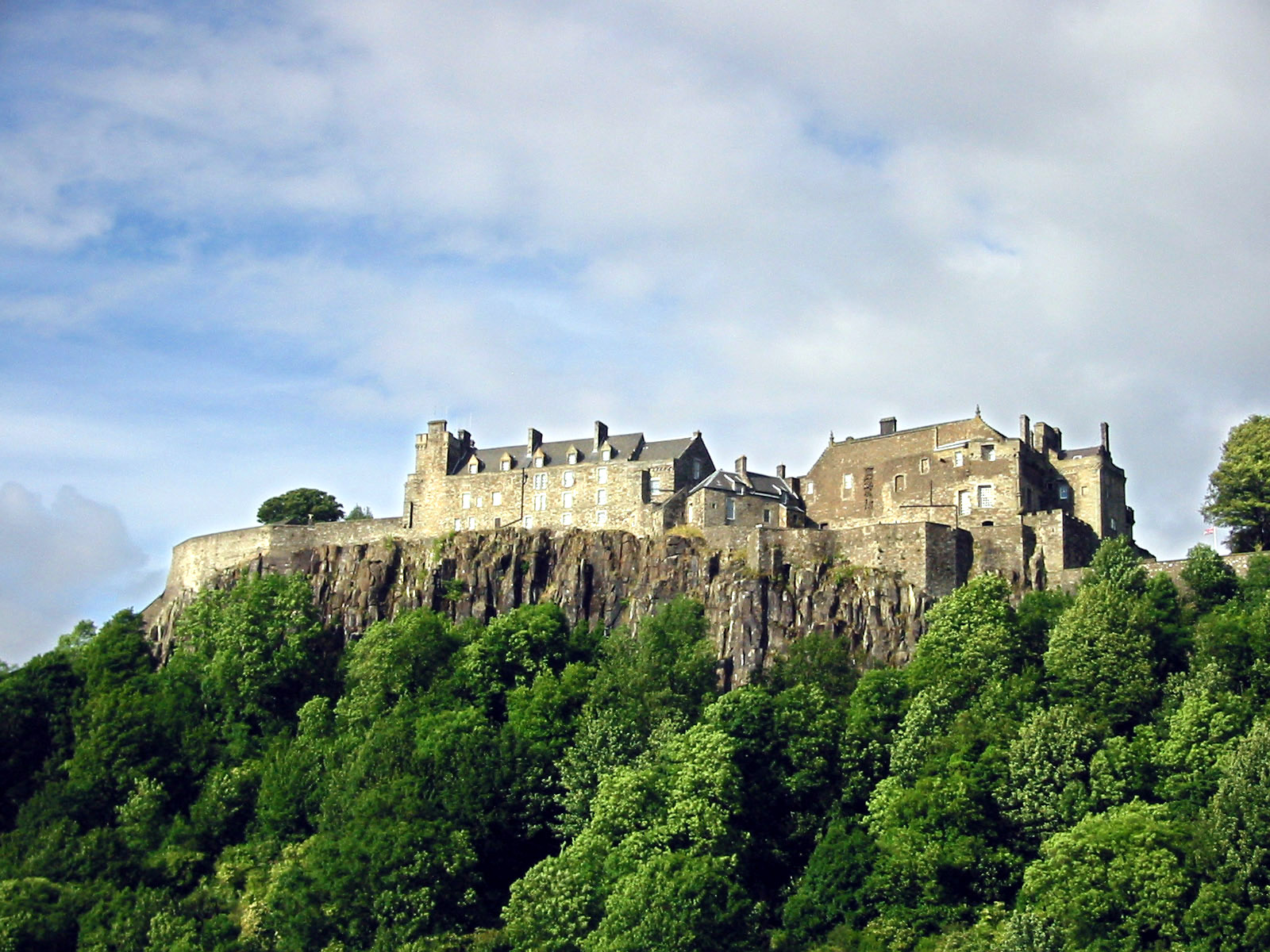
The castle Edward I kept bombarding after it had already surrendered, because he wanted to try out his new trebuchet.
Questions people ask
- What does the name mean?
- It is thought to come from Dun, meaning hill fort, and the Maeatae, the tribe who originally occupied the fort on Castle Law.
- When was the fort in use?
- Radiocarbon dates from excavation by Dr Murray Cook and Professor Gordon Noble of Aberdeen University indicate at least two periods — around 500 BC, and again between the fifth and seventh centuries AD.
- Is it a difficult climb?
- Not by the usual routes. The main gully up the southern scarp is not particularly difficult. Of the secondary gullies, Siart Gulley is climbable by anyone of average ability, but Raeburn's Gulley is dangerous and suitable only for experienced and properly equipped rock climbers.
- What is the beacon on top?
- A cairn with a beacon commissioned for the Queen's Silver Jubilee in 1977, carried up and erected by the Menstrie Scout Group as part of the national chain of beacons. It is now filled with stones left as wishes.
Sources
- Canmore site record 47117 (accessed 2026-06-13)
- Trove (HES) record (accessed 2026-06-13)
- HES designation SM2182 (accessed 2026-06-13)
- Wikipedia: Dumyat (accessed 2026-06-13)
- Wikidata Q1265168 (accessed 2026-06-13)
Explore more: Fortified places · Iron Age · Stirling
The Ancient Codex, in your pocket
Get the Pocket Codex app
Carry the directory with you — Castle Law, Dumyat and thousands of ancient places across Britain and Ireland, offline, wherever you roam.