
Three separate strongholds - an Iron Age (the centuries before Rome arrived, from about 800 BC) hillfort, a Roman signal station and an Early Medieval (roughly AD 400–1100, between the Romans and the Normans) nuclear fort - were raised in succession on the same volcanic summit, with a hoard of Roman bronze vessels turning up in a field far below in 1863.
A cone-shaped hill rises abruptly from the farmland of Teviotdale, its bare rock summit visible for miles around and ringed by cliffs that in places drop twelve to fifteen metres. Fields and strips of conifer plantation climb its lower slopes, giving way near the top to rough grazing and, higher still, to the broken crags that mark the vent of an extinct volcano. Walkers who reach the summit rocks are standing on stone that solidified deep inside that volcano roughly 330 million years ago, long before the hill took its present shape.
The summit’s flat ground and commanding views made it attractive to builders across three very different periods. An Iron Age community walled off the hilltop as a fortified settlement, a Roman garrison later used dressed masonry to raise a signal station, and, after Rome’s withdrawal, a still later community built a fortified residence known to archaeologists as a nuclear fort, reusing the Roman stone in its own walls. Local memory and later tradition then wrapped the hill in further associations, from a persecuted 17th-century preacher sheltering among its rocks to a Borders poet who carried its image into verse.
What follows is drawn from published sources, with each claim labelled by how firmly it is established.
The name
Law, the second part of the hill's name, is the common Scots word for a prominent hill, especially across Lothian and the Borders, and derives from the Anglo-Saxon hlāw, meaning a tumulus or hill. The meaning of the first element, Rubers, has not been established.
History
The earliest structure on the summit was probably an Iron Age hillfort, or oppidum, whose outer wall ran round the hilltop at a single level and enclosed some seven acres (2.8 hectares), with a well-marked entrance on its south side. No Roman masonry was built into this wall, which points either to an early date for the fort or, alternatively, to the wall having served as a cattle enclosure linked to a later post-Roman stronghold on the same hill.
A Roman military presence on the summit is inferred rather than directly recorded: numerous dressed sandstone blocks lie scattered across the hilltop, many carved with a distinctive diamond pattern that also appears on stones at the Roman fort of Castlecary on the Antonine Wall. Given the hill's height and visibility across Teviotdale, the most likely explanation for this Roman masonry is a signal station built to keep watch over the surrounding country.
In 1863 a workman digging field drains some 400 feet (120 metres) below the summit uncovered a hoard of Roman bronze vessels, including a finely decorated ewer handle along with the handles, rims and fragments of around a dozen further vessels. The find, now held in Hawick Museum, is the clearest physical evidence that Roman activity on or near the hill left behind more than just building stone.
After the Roman period, a new fortification known to archaeologists as a nuclear fort was built on the hill, combining an inner citadel on the summit with an annex extending south across the lower rock ridge and plateau. Its builders used loose boulders but also reused masonry from the earlier Roman structure, and the resulting complex - a citadel measuring 235 by 105 feet (72 by 32 metres) attached to a 300-foot (91-metre) annex - is one of the Early Middle Ages' characteristic nuclear forts, a form associated with early post-Roman lordship in this part of Britain.
In 1907 a hut circle within the citadel was excavated, but the dig recovered little beyond small quantities of charcoal and burnt bone, offering scant material evidence of the fort's everyday occupation. Sometime between 1660 and 1688, in the years when ministers ejected from the Church of Scotland preached to their followers in the open air rather than accept an imposed episcopal church government, Alexander Peden may have addressed one such illegal gathering of Covenanters from a chasm among the summit rocks that has since been known as Peden's Pulpit.
On Easter Day in the year 2000, worshippers from the churches of Bedrule, Denholm and Minto gathered on the summit to mark both the two-thousandth anniversary of the birth of Christ and the earlier Christians who had worshipped on the hill, an event now recorded by a metal plate fixed to the summit rocks; Bedrule church has continued to hold a service there each Easter Day since.
People
-
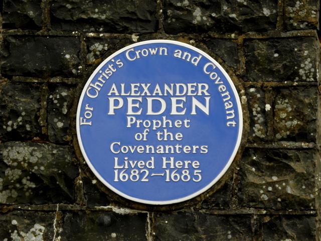
Portrait: Kenneth Allen / Wikimedia Commons / CC BY-SA 2.0 Alexander Peden
A 17th-century Covenanting minister who may have preached to an illegal open-air conventicle from the summit chasm now called Peden's Pulpit.
-
Dr John Leyden
A Scottish romantic poet born in nearby Denholm in 1775, who climbed Rubers Law in his youth and described the hill in his 1803 poem Scenes of Infancy.
Connections
-
Castlecary, Antonine Wall
Dressed sandstone blocks on Rubers Law carry the same diamond carving found on stones at the Roman fort of Castlecary, supporting the case for a Roman signal station on the summit.
-
Hawick Museum
The hoard of Roman bronze vessels dug up below the hill in 1863 is held in Hawick Museum's collections.
-
Bedrule Parish Church
Bedrule church holds an annual Easter Day service of worship on the summit of Rubers Law, continuing a tradition begun in 2000.
Discovery & excavation
In 1863 a workman cutting field drains on the south-east side of the hill, about 400 feet (120 metres) below the summit, unearthed a hoard of Roman bronze vessels: a decorated ewer handle and the handles, rims and fragments of roughly a dozen other vessels, evidence of Roman-period activity in the vicinity of the hill.
Finds now held at: Hawick Museum.
In culture
-
Scenes of Infancy (1803)
Borders poet Dr John Leyden, who grew up in nearby Denholm, recalled climbing 'Ruberslaw' in his youth in this long autobiographical poem, describing its misty summit, shattered crags and a storm sweeping across it while an eagle rode the wind above the cliffs.
What to look for
-
Peden's Pulpit
A chasm splitting the cliff above the summit plateau, traditionally associated with covert Covenanter preaching in the 17th century.
-
The Iron Age outer wall
The remains of a hillfort wall running around the hilltop at a single level, enclosing about seven acres with a clear entrance to the south.
-
Roman dressed stone
Sandstone blocks carved with a diamond pattern, scattered across the summit and matching stonework at the Roman fort of Castlecary.
-
The nuclear fort citadel and annex
The boulder-built walls of the Early Medieval citadel on the summit and its southward annex, incorporating reused Roman masonry.
-
The 2000 memorial plate
A metal plate fixed to the summit rocks recording the Easter Day service held there in 2000.
-
The summit view
A wide panorama taking in the Cheviot Hills, the Eildon Hills, the Lammermuirs and Hawick with the hills of Liddesdale beyond.
What is said
Folklore and tradition, recorded as what is said — not as established fact.
-
Peden's Pulpit
Alexander Peden is said to have preached to an illegal gathering of Covenanters from a chasm in the summit cliffs during the persecution of Presbyterian ministers between 1660 and 1688, a spot still known as Peden's Pulpit.
Plan your visit
- Location
- 55.4322°N · 2.6647°W
- Access
- Open access
- Terrain
- Rough ground — reasonable boots advised
- Time needed
- About 45 minutes
Opening & admission
- Responsible Scottish outdoor access applies; summit routes cross fields, woodland, and rough grazing.
Nearby places

Fortified place · Medieval
Fatlips Castle
Scottish Borders
A reivers' watchtower above the Teviot whose unlikely name is said to record an indecorous greeting for visitors, later reborn as a Lorimer-designe…

Ancient tree · Medieval
Capon Tree
Scottish Borders
Concrete, brick and timber now hold together a sessile oak reckoned at about a thousand years old: one of the last trees of the Jedforest, and the…
- Near Jedburgh
Carved stone · Medieval
Jedburgh Abbey
Scottish Borders
In 1118, before his accession to the Scottish throne, Prince David established a foundation of Augustinian canons at Jedburgh. It rose from priory:…
- Near Jedburgh
- 1 min walk from car park
Fortified place · Iron Age
Peniel Heugh
Scottish Borders
A 237-metre hill near Ancrum carrying both an ancient defended settlement and the Waterloo Monument.
- Some walking
Questions people ask
- What historical structures survive on Rubers Law?
- The summit holds the remains of an Iron Age hillfort, a Roman signal station inferred from dressed masonry, and an Early Medieval nuclear fort that reused Roman stone in its walls.
- Was there really a Roman building on Rubers Law?
- No Roman masonry survives standing, but dressed sandstone blocks carved with a diamond pattern matching stones at Castlecary point strongly to a Roman signal station once occupying the summit.
- What was found below Rubers Law in 1863?
- A workman digging field drains uncovered a hoard of Roman bronze vessels, including a decorated ewer handle, now held in Hawick Museum.
- What is Peden's Pulpit?
- A chasm in the summit cliffs where Covenanting minister Alexander Peden is said to have preached to an illegal open-air gathering in the 17th century.
- How high is Rubers Law?
- The hill rises to 424 metres with a prominence of 196 metres, well above the threshold for classification as a Marilyn.
Sources
- Wikipedia: Rubers Law
- Wikidata
- Canmore 55249 — RUBERS LAW (covenanters meeting place (17th century)) (accessed 2026-08-03)
Explore more: Fortified places · Iron Age · Scottish Borders
The Ancient Codex, in your pocket
Get the Pocket Codex app
Carry the directory with you — Rubers Law and thousands of ancient places across Britain and Ireland, offline, wherever you roam.