
An ancient monument five miles north-east of Stromness that may be the oldest circular enclosure in the British Isles.
These are slabs, not pillars. The Standing Stones of Stenness are thin — about thirty centimetres thick — with sharply angled tops, and the four survivors rise to around five metres. Nothing in southern England looks like them.
They stand on a promontory on the south bank of the stream that joins the sea loch Loch of Stenness to the freshwater Loch of Harray, five miles north-east of Stromness. The name is Old Norse for stone headland, and in Orcadian it is said stane-is. The stream is bridged now; it was once crossed by a causeway of stepping stones, and beyond it, 1.2 kilometres to the north-west, stands the Ring of Brodgar. Maeshowe is about the same distance to the east.
What is missing is the earthwork. Excavation established that this was a henge — possibly the oldest in the British Isles — with an encircling ditch and bank that no longer survives, so a visitor is looking at an incomplete monument and would not guess what shape it originally had.
The density of major Neolithic structures in this small compass is not matched anywhere else in Britain, and it is taken to mean the area held a particular significance. Traditions attached to the stones survived into the modern era. The site is now a scheduled monument in the care of Historic Environment Scotland and part of the Heart of Neolithic Orkney World Heritage Site.
What follows is drawn from published sources, with each claim labelled by how firmly it is established.
History
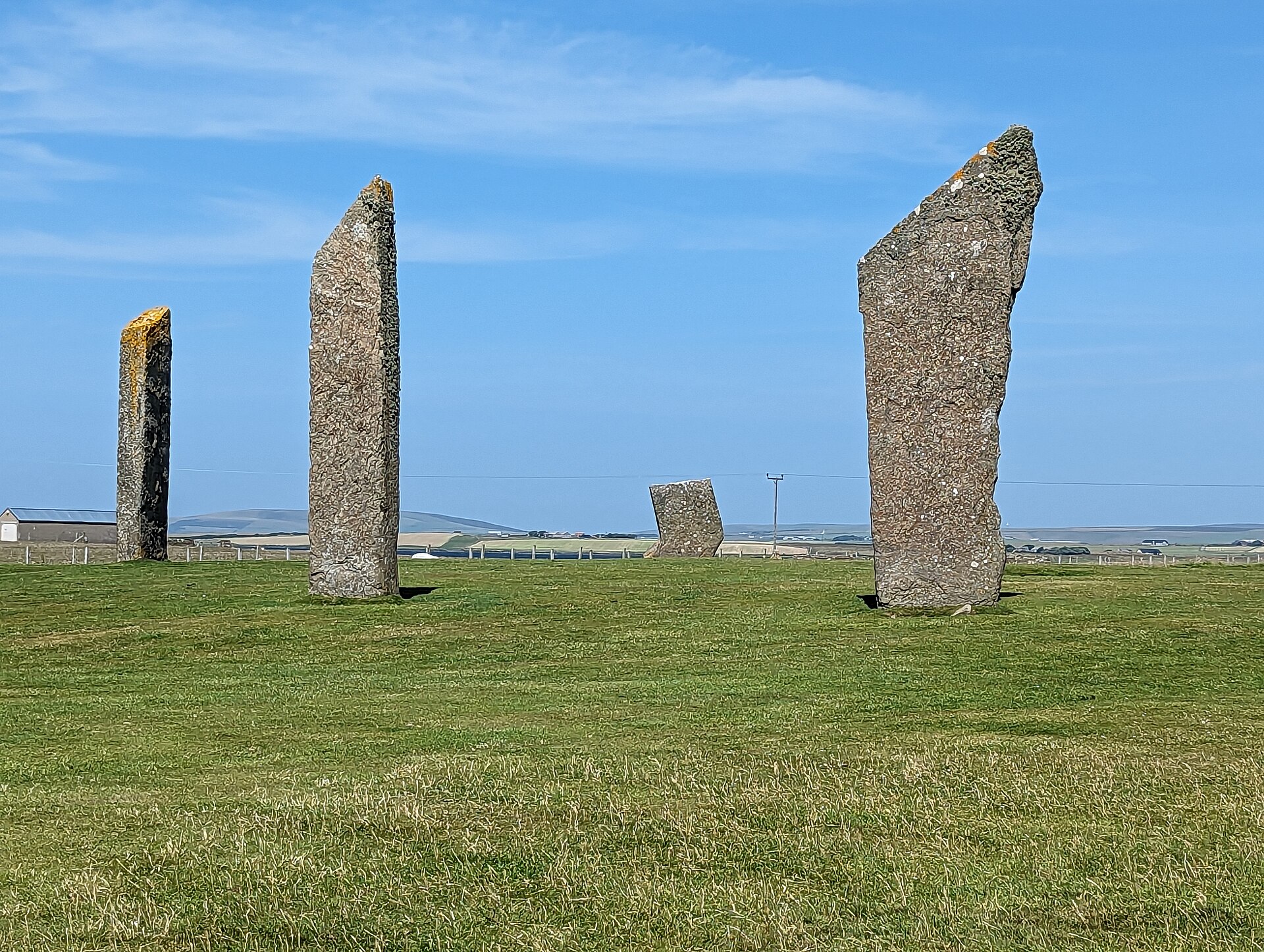
The Standing Stones of Stenness are a Neolithic monument five miles north-east of Stromness on the Orkney Mainland, and this may be the oldest henge site in the British Isles. It forms part of the Heart of Neolithic Orkney World Heritage Site. Being the oldest of anything in the British Isles is a claim that has to be made carefully, and here it is made with the qualifier attached.
The stones stand on a promontory at the south bank of the stream joining the sea loch Loch of Stenness to the freshwater Loch of Harray. The name is pronounced stane-is in Orcadian dialect and comes from Old Norse, meaning stone headland. Norse names sit on top of Neolithic monuments throughout Orkney and record who was farming round them four thousand years later.
That stream is now bridged, but was once crossed by a stepping-stone causeway. The Ring of Brodgar lies about 1.2 kilometres north-west across it, near the tip of the isthmus between the two lochs, and Maeshowe about the same distance east. The three monuments together define the ceremonial core of Neolithic Orkney. Several other Neolithic monuments lie in the immediate vicinity, which is taken to indicate that this area held a particular importance — a concentration of major structures in a very small compass, unmatched anywhere else in Britain.
The site today lacks its encircling ditch and bank, but excavation showed that a henge was here, possibly the oldest in the British Isles. What a visitor sees is therefore an incomplete monument, missing the earthwork that defined it. Missing earthworks are easy to overlook, and they change how a monument should be read. The stones themselves are thin slabs about 30 centimetres thick with sharply angled tops, four of them surviving up to about five metres high. They were originally elements of a stone circle, and the form is quite unlike the blocky uprights of southern English circles.
Various traditions attached to the stones survived into the modern era, and the site is now cared for by Historic Environment Scotland as a scheduled monument. Traditions of that kind are worth recording even when their content cannot be verified.
Cultural influences
-
Neolithic ceremonial landscape
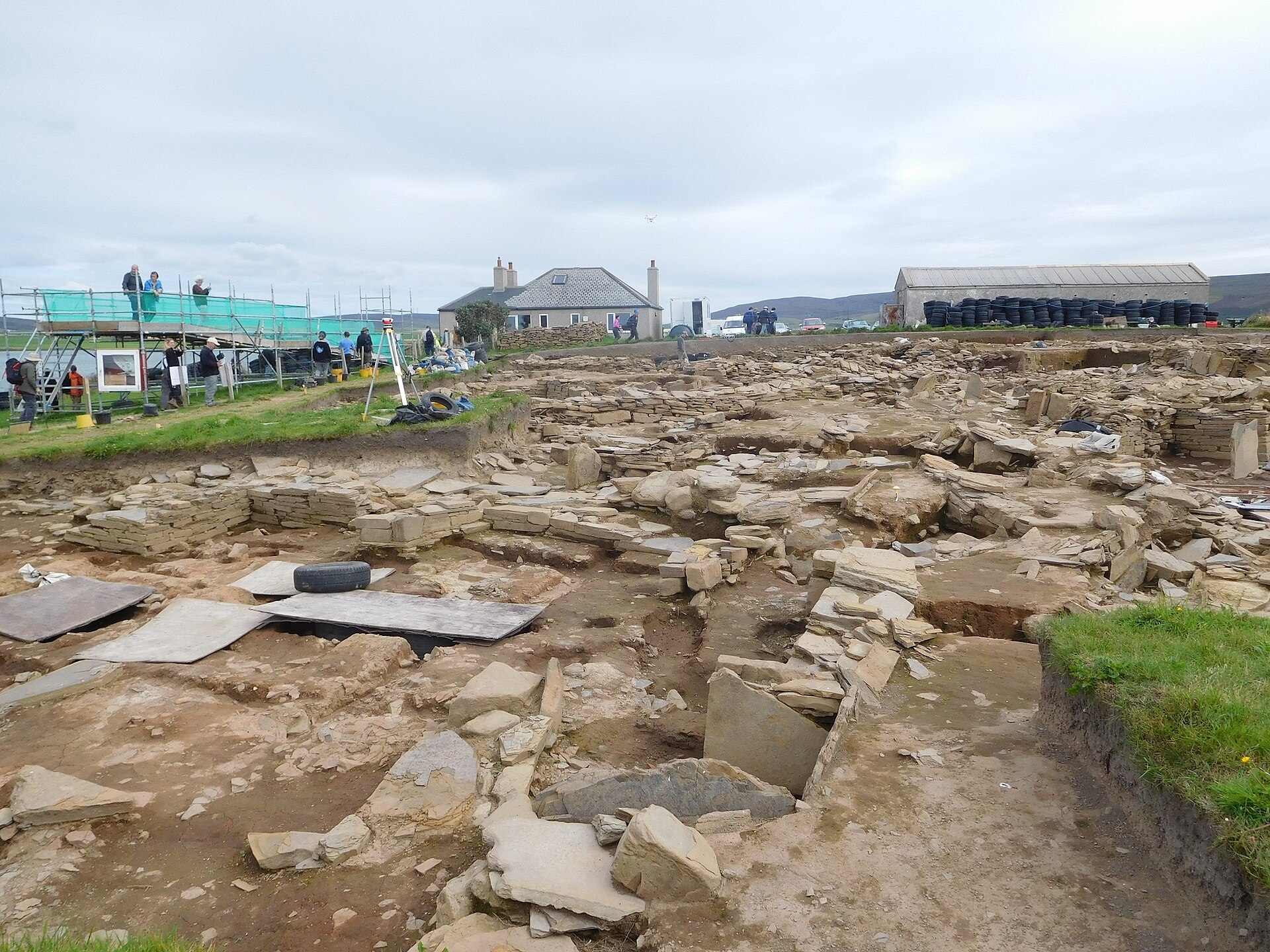
The Stones of Stenness formed part of the ritual landscape of the Ness of Brodgar, alongside the Ring of Brodgar and other monuments between Orkney’s lochs.
Connections
-
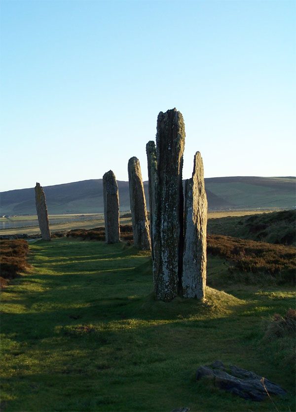
Photo: Original uploader was Otter at nl.wikipedia (Original text : Hopmans) / Wikimedia Commons / CC BY-SA 3.0 The Ring of Brodgar lies about 1.2 kilometres north-west of the Standing Stones of Stenness.
-
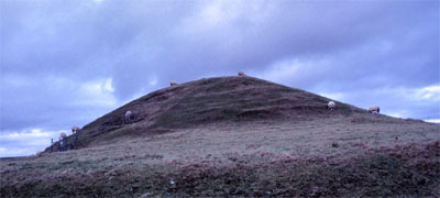
Photo: Otter at Dutch Wikipedia (Original text: Hopmans) / Wikimedia Commons / CC BY-SA 3.0 Maeshowe
Maeshowe chambered cairn lies about 1.2 kilometres east of the Standing Stones of Stenness.
-
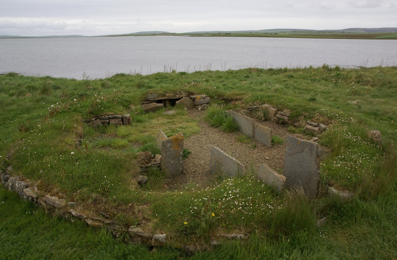
Photo: Otter / Wikimedia Commons / CC BY-SA 3.0 The entrance to the Standing Stones of Stenness faces the Neolithic Barnhouse Settlement.
What to look for
-
The missing ditch and bank
The site today has no encircling earthwork, but excavation showed it was a henge — possibly the oldest in the British Isles.
-
Slabs, not pillars
The stones are thin slabs about 30 centimetres thick with sharply angled tops, four of them up to five metres high — a very different form from the blocky uprights of southern circles.
-
The promontory between two lochs
The stones stand on a spit at the south bank of the stream joining the sea loch Loch of Stenness to the freshwater Loch of Harray. The name is Old Norse for stone headland.
-
The causeway crossing
The stream is now bridged, but was once crossed by a stepping-stone causeway toward the Ring of Brodgar, 1.2 kilometres north-west.
Standing there
- The surviving stones rise on a promontory between the sea loch Loch of Stenness and the freshwater Loch of Harray, where a stream joins the two — so the circle sits on a narrow neck of land almost surrounded by water, under big Orkney sky with the Ring of Brodgar and Maeshowe in view across the lochs.
- Four great stones survive, up to about 5 metres high — thin angled slabs of flagstone only around 30 cm thick with sharply sloping tops — so close up they read as tall, blade-like uprights, much taller than a person, weathered grey and standing stark against loch and sky.
- This may be the oldest henge in the British Isles, with work begun by around 3100 BC, and at its centre archaeologists found a square stone hearth setting with cremated bone, charcoal and pottery — so the heart of the circle was a place of fire, burning and deposited remains.
- In the Neolithic the circle sat inside a deep rock-cut ditch and earth bank entered by a single causeway facing the nearby Barnhouse settlement, so arriving meant crossing the bank and entering an enclosed ritual arena — gatherings here involved feasting and fire, with animal bone left in the ditch and a hearth blazing at the centre.
- Reaching the stones once meant crossing the stream between the lochs on a stepping-stone causeway — so the sounds of moving water and the crossing itself were part of the approach, a threshold of water passed before entering the standing stones.
Plan your visit
- Location
- 58.9939°N · 3.2081°W
- Nearest settlement
- Stenness
- Access
- Open access
- Terrain
- Easy going
- Best time
- Daylight, when the stones and surrounding henge landscape can be read clearly.
- What survives
- A small surviving stone circle within the earthwork setting of a Neolithic henge.
- Start point
- Stones of Stenness car park — Free council-operated (OIC) car park on the B9055 directly beside the stones. Short level walk through the field gate to the circle.
Nearby places

Settlement · Prehistoric
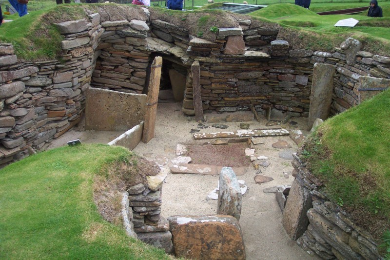
Barnhouse Settlement
Orkney Islands
A settlement of the first farming age on the shore of the Loch of Harray, close to the Standing Stones of Stenness.
- Easy path
Sacred place · Prehistoric
Heart of Neolithic Orkney
Orkney Islands
The Orkney World Heritage group is made up of monuments from the closing Stone Age, roughly 4000–2500 BC, whose remains illuminate the islands’ cha…
- Some walking
Sacred place · Prehistoric
Ness of Brodgar
Orkney Islands
Ness of Brodgar preserves an archaeological site between the Ring of Brodgar and the Stones of Stenness.
- Near Stenness
- Easy path
Tomb or burial place · Prehistoric
Maeshowe Chambered Cairn
Orkney Islands
The burial mound was built around 2800 BC by farming communities of central Orkney and contains a stone chamber associated with the Grooved Ware po…
- Near Stenness
- 1.6 km from car park
- Easy path
Questions people ask
- Is this the oldest henge in Britain?
- Possibly. Excavation showed the site was a henge, and it may be the oldest in the British Isles.
- Why is there no ditch or bank?
- The encircling earthwork no longer survives, so what stands today is an incomplete monument. Its henge form is known from excavation rather than from what is visible.
- What does the name mean?
- Stone headland, from Old Norse. In Orcadian dialect it is pronounced stane-is.
- How large are the stones?
- Thin slabs about thirty centimetres thick with sharply angled tops. Four survive, up to about five metres high.
- What else is nearby?
- The Ring of Brodgar 1.2 kilometres north-west, Maeshowe about the same distance east, and several other Neolithic monuments — a concentration unmatched elsewhere in Britain.
Sources
The Ancient Codex, in your pocket
Get the Pocket Codex app
Carry the directory with you — Stones of Stenness Circle and Henge and thousands of ancient places across Britain and Ireland, offline, wherever you roam.