
Ness of Brodgar preserves an archaeological site between the Ring of Brodgar and the Stones of Stenness.
Twenty-one years of excavation ended in 2024 with the site being filled back in. That was deliberate — the structures uncovered at the Ness of Brodgar are too vulnerable to Orkney weather to be left open — but it means one of the most significant discoveries of the Neolithic — the first farming age, roughly 4000–2500 BC — is now underground again on purpose.
What came out of it first is worth stating. Decorated stone slabs. A stone wall six metres thick, with foundations under it. A building large enough that people reached for the word temple. Activity here dates to around 3500 to 3400 BC, which makes the complex older than the stone circles standing on either side of it, on a peninsula between the Loch of Harray and the Loch of Stenness inside the Heart of Neolithic Orkney World Heritage Site.
The place looked different then. Loch Stenness was less brackish, both lochs stood lower, and the surrounding country carried mixed woodland — birch, hazel, willow, oak and pine — rather than the windswept grass and farmland of today. Because the water was lower, there may well be further Neolithic buildings now lying beneath the lochs, put there by rising sea levels and storm surges rather than by anyone’s intention.
The complex was closed down and partially dismantled by 2200 BC. Deliberate closure of monumental sites recurs across Neolithic Orkney, and it was done here on a very large scale — which is a curious rhyme with what the archaeologists did in 2024.
What follows is drawn from published sources, with each claim labelled by how firmly it is established.
History
The Ness of Brodgar is a peninsula separating the freshwater Loch of Harray from the brackish Loch of Stenness, on the West Mainland of Orkney, and it lies inside the Heart of Neolithic Orkney World Heritage Site. The archaeological site covers about three hectares. Three hectares is a very large footprint for a Neolithic complex anywhere in Britain. Excavation ran from 2003 to 2024, after which the site was deliberately infilled to protect the exposed structures from weather damage. That is an unusual conclusion to a twenty-one-year dig, and it means what has been found is now buried again by design.
The finds have been remarkable. Decorated stone slabs came out of the ground, along with a stone wall six metres thick with foundations beneath it, and a building substantial enough to have been described as a Neolithic temple. Activity on the site can be dated to around 3500 to 3400 BC, which puts it among the earliest of the great Orkney monuments and earlier than the stone circles standing on either side of it. That ordering matters, because it makes the buildings older than the ceremony they were once assumed to serve.
By 2200 BC the complex had been closed down and partially dismantled. Deliberate closure of monumental sites is a recurring pattern in Neolithic Orkney, and here it was carried out on a very large scale. Somebody made a decision to end it, in other words, rather than simply walking away. The landscape was not what it is now. Loch Stenness is thought to have been less brackish, the surrounding country carried mixed woodland of birch, hazel, willow, oak and pine, and both lochs stood at lower levels than today. The country these builders knew would have been unrecognisable to anyone standing there today.
That has a practical consequence. Because the water was lower, there is a real possibility of further Neolithic buildings lying beneath the lochs, put there by rising sea levels, storm surges and centuries of agricultural change rather than by their builders. Excavating under a loch is not a small undertaking, which is why the possibility remains a possibility.
Cultural influences
-
The peninsula formed part of a Neolithic landscape of large buildings, decorated stonework and monumental boundaries between two lochs.
Connections
-
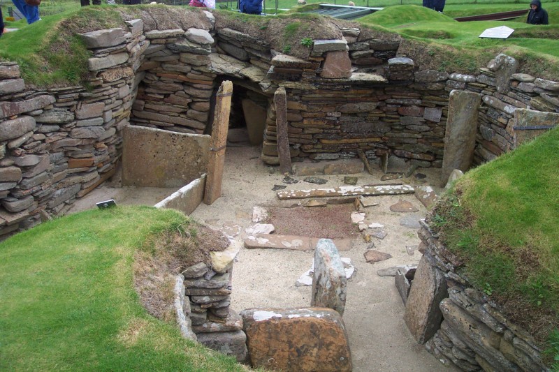
Photo: Dr. John F. Burka / Wikimedia Commons / CC BY-SA 3.0 The Ness forms part of the Heart of Neolithic Orkney landscape: its monumental complex sits among the World Heritage Site’s associated ceremonial and settlement places.
-

Photo: Otter / Wikimedia Commons / CC BY-SA 3.0 Excavations at the Ness found house forms comparable to Barnhouse, helping to link the complex to the neighbouring Neolithic settlement tradition.
-
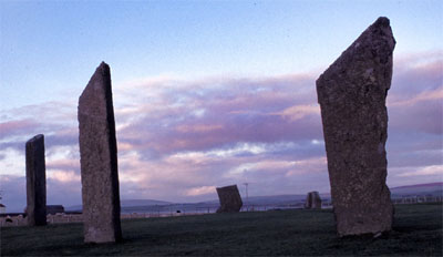
Photo: Otter at Dutch Wikipedia (Original text: Hopmans) / Wikimedia Commons / CC BY-SA 3.0 Stones of Stenness Circle and Henge
The Ness complex lies between the Stones of Stenness and the Ring of Brodgar; its monumental buildings and boundary wall illuminate their shared ceremonial landscape.
Discovery & excavation
Excavation from 2003 to 2024 revealed buildings, decorated stone slabs and a substantial boundary wall before the site was deliberately refilled for protection.
What to look for
-
Boundary wall
Excavation revealed a wall around six metres thick, enclosing major buildings on the narrow peninsula.
-
Decorated stone
Carved and decorated stone slabs were found among the buildings.
Plan your visit
- Location
- 58.9972°N · 3.2156°W
- Nearest settlement
- Stenness
- Access
- Open access
- Terrain
- Easy going
- Time needed
- About 30 minutes
- Best time
- Daylight hours
- What survives
- The excavated structures were deliberately backfilled in 2024 to protect them from weather; the archaeology now survives beneath the restored ground surface.
- Facilities
- Facilities are limited at the excavation area; plan to use facilities in nearby settlements.
Opening & admission
The excavation site is closed to the public.
- Fieldwork ended in August 2024 and the project is now focused on post-excavation analysis and publication.
Nearby places
Sacred place · Prehistoric
Heart of Neolithic Orkney
Orkney Islands
The Orkney World Heritage group is made up of monuments from the closing Stone Age, roughly 4000–2500 BC, whose remains illuminate the islands’ cha…
- Some walking

Settlement · Prehistoric
Barnhouse Settlement
Orkney Islands
A settlement of the first farming age on the shore of the Loch of Harray, close to the Standing Stones of Stenness.
- Easy path
Sacred place · Prehistoric
Stones of Stenness Circle and Henge
Orkney Islands
An ancient monument five miles north-east of Stromness that may be the oldest circular enclosure in the British Isles.
- Near Stenness
- 2 min walk from car park
- Easy path
Sacred place · Prehistoric
Ring of Brodgar
Orkney Islands
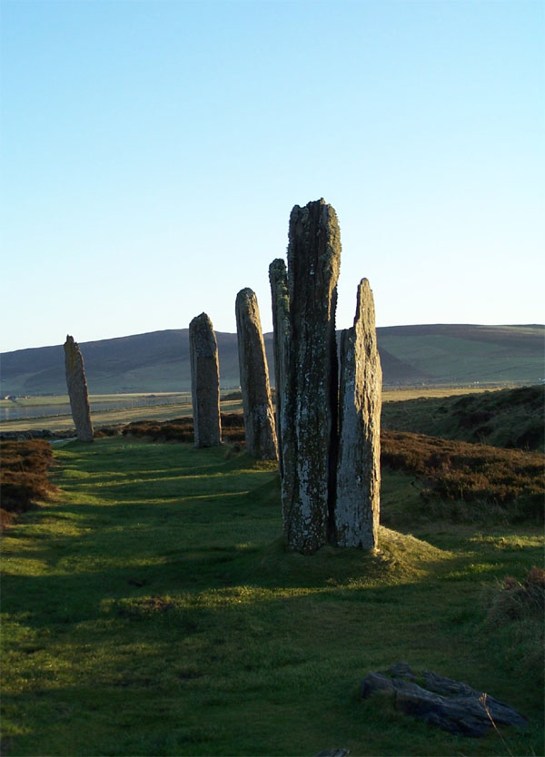
The Ring of Brodgar is a stone circle on the narrow isthmus between the Lochs of Stenness and Harray on Mainland, Orkney.
- Near Stenness
- 5 min walk from car park
- Easy path
Questions people ask
- Why was the site filled in?
- To protect the exposed structures from environmental damage. Excavation ran from 2003 to 2024 and the site was infilled afterwards.
- What was found?
- Decorated stone slabs, a stone wall six metres thick with foundations beneath it, and a building large enough to have been described as a Neolithic temple.
- How old is it?
- Activity dates to around 3500 to 3400 BC — earlier than the stone circles on either side of it. The complex was closed down and partially dismantled by 2200 BC.
- Could there be more buildings?
- Possibly, beneath the lochs. Water levels were lower when the site was built, and rising sea levels, storm surges and agricultural change have altered the landscape since.
Sources
- Wikipedia: Ness of Brodgar
- Wikidata: Q1361836
- Pleiades gazetteer of the ancient world — Ness of Brodgar (accessed 2026-08-03)
- Canmore 269123 — NESS OF BRODGAR (boundary wall (prehistoric)) (accessed 2026-08-03)
- Ness of Brodgar Project — the excavation
- UNESCO — Heart of Neolithic Orkney management plan
Explore more: Sacred places · Prehistoric · Orkney Islands
The Ancient Codex, in your pocket
Get the Pocket Codex app
Carry the directory with you — Ness of Brodgar and thousands of ancient places across Britain and Ireland, offline, wherever you roam.