
A tidal island where Pictish metalworkers — people of northern and eastern Scotland from about AD 300 to 900 — Norse rulers and medieval pilgrims successively made a small sea-girt stronghold a centre of power and worship.
The island is called fort twice over. Its Old Norse name, Byrgisey, means fort island; brough means fort too, from the same root as the word for the drystone towers of the northern isles. Whoever named it in either language was describing what they found.
The Brough of Birsay is tidal, joined to the Orkney Mainland by a largely natural causeway that vanishes under 240 metres of water when the tide comes in. People were here from about the sixth century, possibly Christian missionaries first; by the seventh and eighth it was a substantial Pictish stronghold, and by the ninth the Picts had been displaced by Norsemen.
The Pictish material is what makes the island exceptional. Cecil Curle’s excavations of 1936 and 1937 recovered a small well and a collection of artefacts now split between Kirkwall and Edinburgh, including moulds for fine metalworking — bronze brooches and ornaments were being made here in the eighth century, so this was a workshop as well as a fort. An important carved stone came out of the enclosure round the later church in pieces; the original is in Edinburgh and a replica stands on the site.
Before Kirkwall took over in the twelfth century, Birsay was the seat of the rulers of Orkney. The Orkneyinga saga places Earl Thorfinn the Mighty’s main residence here between 1014 and 1065, though his hall is now thought to have been on the Mainland rather than on the island itself.
What stands is chiefly the church: a small, fine Romanesque building of the twelfth century dedicated to St Peter, with a semi-circular apse, stone benches for the congregation along its walls, and an altar of red sandstone rebuilt in the 1930s. Buildings run round three sides of an open court beside it, which suggests a small monastery, though nothing documents one. It drew pilgrims into the Middle Ages.
The sea is taking part of it. Coastal erosion has already removed some of the Norse settlement, and the cliffs are now held with concrete rip-rap.
What follows is drawn from published sources, with each claim labelled by how firmly it is established.
The name
The Old Norse name Byrgisey means ‘fort island’; Brough likewise means ‘fort’.
History
The Brough of Birsay is an uninhabited tidal island off the north-west coast of the Orkney Mainland, reachable on foot at low tide by a largely natural causeway and cut off at high tide by 240 metres of water — the Sound of Birsay. Its Old Norse name was Byrgisey, meaning fort island, and it gives the parish its name. Brough itself means fort, sharing a root with the word for a drystone tower of the northern isles, so the island is called fort twice over in two languages.
The earliest settlement is thought to date from the sixth century, perhaps established by Christian missionaries. By the seventh and eighth centuries the island was a significant Pictish fortress, and by the ninth the Picts had been displaced by Norsemen arriving from Scandinavia. Cecil Curle first excavated the site in 1936 and 1937. The Pictish settlement is attested by a small well and by an important collection of artefacts, now divided between the Orkney Museum at Kirkwall and the Museum of Scotland in Edinburgh.
Among those finds is a group of moulds for fine metalworking, which shows that bronze brooches and other ornaments were being manufactured here in the eighth century — a workshop, not merely a stronghold. The enclosure around the Norse church overlies a Pictish graveyard, and an important Pictish carved stone was found in pieces within that enclosure during site clearance. The original is in Edinburgh and a replica stands on the island.
Birsay was the seat of the rulers of Orkney before Kirkwall took that role in the twelfth century. The Orkneyinga saga puts the main residence of Earl Thorfinn the Mighty here between 1014 and 1065, though his hall is now thought to have stood on the Mainland rather than on the brough itself. The most significant surviving structure is a small Romanesque church of the twelfth century dedicated to St Peter, with a semi-circular apse, the remains of stone benches for the congregation lining the walls, and a red sandstone altar reconstructed in the 1930s.
Buildings adjoining the church on three sides of an open court suggest it may once have been a small monastery, though no documentation for such a foundation survives. There is also evidence of an earlier, possibly Pictish, church on the same site, and the place was a pilgrimage destination into the Middle Ages. Norse dwellings on the island include some of considerable size, indicating substantial wealth. Part of that settlement has been lost to coastal erosion, and the cliffs are now reinforced with concrete rip-rap to prevent further damage.
People
-
Cecil Curle
Archaeologist who led the first excavations in 1936–37.
-
Thorfinn the Mighty
Earl of Orkney whose principal residence was at Birsay according to the Orkneyinga saga.
Cultural influences
-
The superimposed Pictish and Norse settlement, church and artefacts have made the Brough central to discussion of Pictish–Norse relations in northern Scotland.
Connections
-
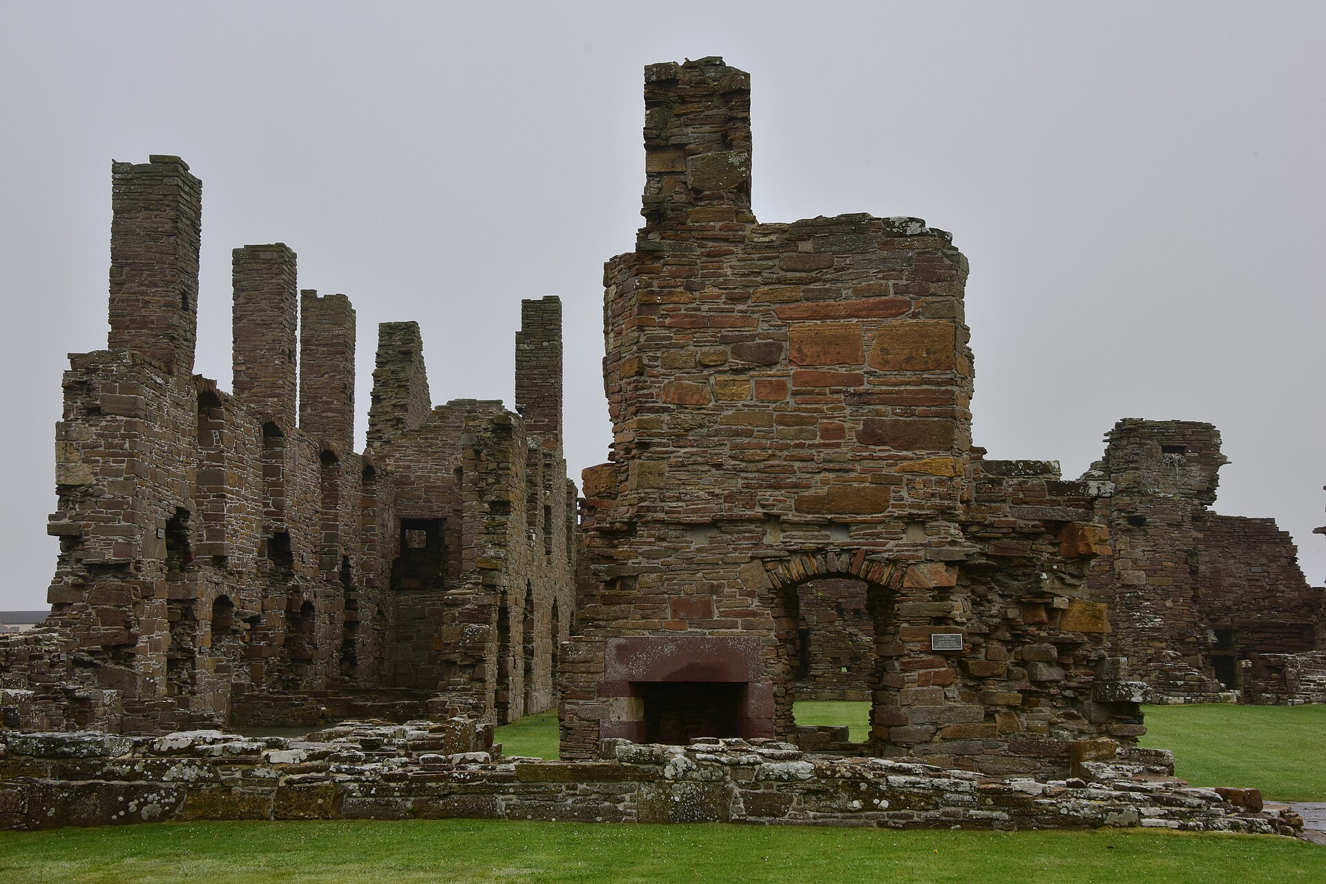
Photo: August Schwerdfeger / Wikimedia Commons / CC BY 4.0 The Norse and Pictish settlement at Brough of Birsay and the later Earl’s Palace together record Birsay’s long role as a political and ecclesiastical centre.
-
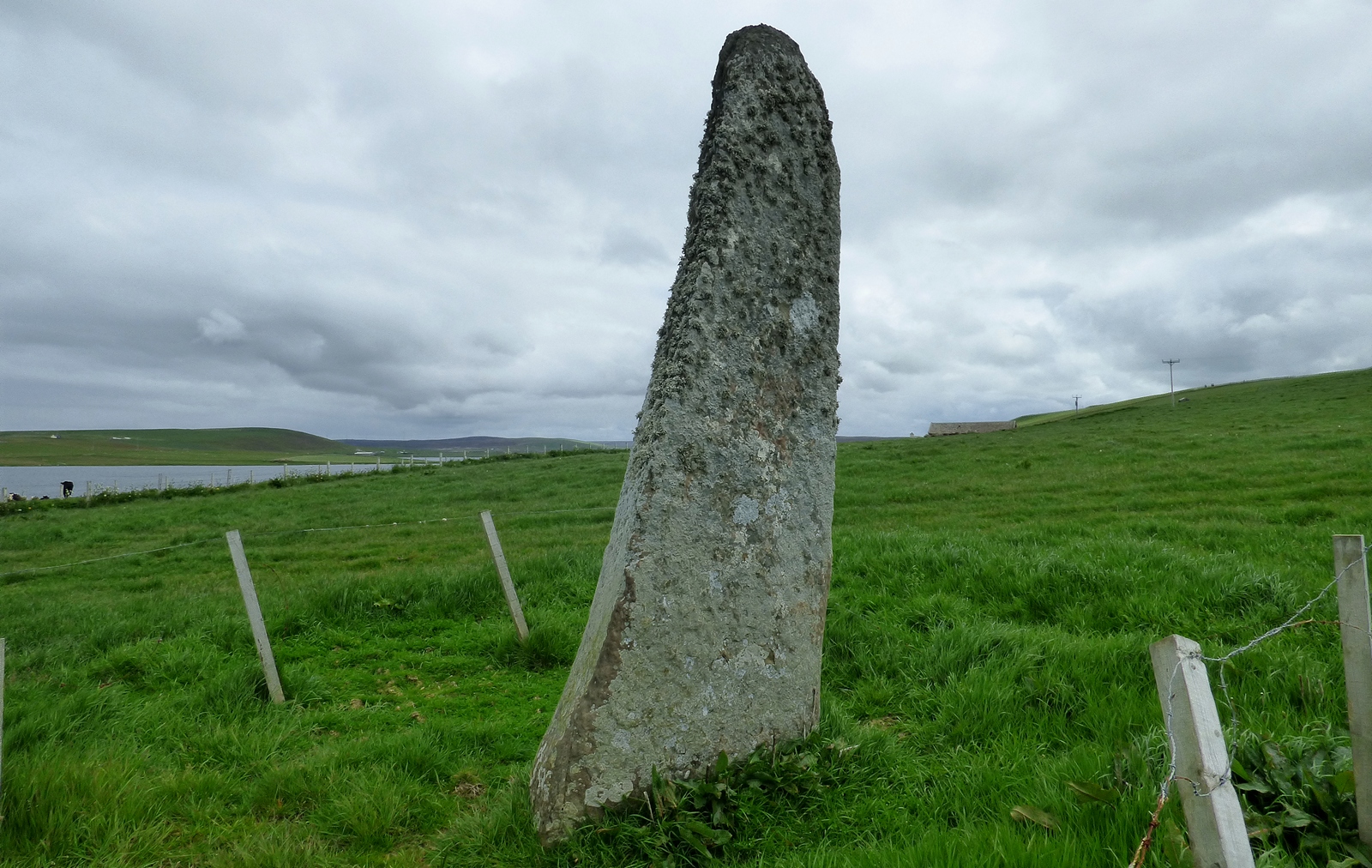
Photo: Sandy Gerrard / Wikimedia Commons / CC BY-SA 2.0 The settlement and standing stone form part of Birsay’s wider prehistoric and early medieval archaeological landscape.
-
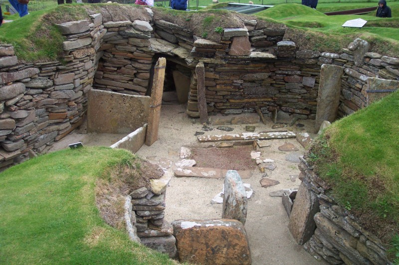
Photo: Dr. John F. Burka / Wikimedia Commons / CC BY-SA 3.0 Both are major Orkney archaeological sites, linking Brough of Birsay’s Pictish and Norse settlement with Skara Brae’s Neolithic village.
Discovery & excavation
Cecil Curle’s 1936–37 excavations uncovered the Pictish and Norse settlement sequence, metalworking moulds, carved stone and church remains.
In culture
-
Orkney Digital Guide
Historic Environment Scotland’s Orkney Digital Guide interprets the Brough within nearly 5,000 years of the islands’ history and prehistory.
What to look for
-
The tidal causeway
The island is reached on foot only at low tide across the natural causeway from the Mainland.
-
St Peter’s Church
The compact 12th-century Romanesque church has a semicircular apse and stone benches around its walls.
-
Pictish settlement evidence
The site’s Pictish occupation is represented by a well, carved stone and evidence for 8th-century fine metalworking.
Plan your visit
- Location
- 59.1369°N · 3.3353°W
- Nearest settlement
- Birsay
- Access
- Permission required
- Start point
- Birsay · Orkney · KW17 2LX · National Grid reference: HY 239 285 · Telephone: 01856 841 815 (Skara Brae)
- Time needed
- About 90 minutes
- Best time
- **Please note, the visitor centre is closed.** Explore more with Orkney Digital Guide Discover nearly 5,000 years of Orkney’s history and prehistory, including Brough of Birsay, with our Orkney Digital Guide. Current unexpected and short term closures Opening times The Brough of Birsay is free to visit and open all year, but only accessible at low tide. Please note, the visitor centre is closed.
- What survives
- The island preserves visible stone outlines of Pictish and Norse settlement, St Peter’s Church and the later lighthouse above the rocky tidal shore.
- Facilities
- The visitor centre is closed; check current access and use facilities in nearby settlements before travelling.
- Start point
- Point of Buckquoy car park (Brough of Birsay) — Car park on the Mainland at the Point of Buckquoy, beside the HES interpretation sign. The island is cut off at high tide — check tide tables before crossing; the on-site visitor centre is currently closed. Postcode KW17 2LX from the HES getting-here page.
- Sat-nav
- KW17 2LX
Opening & admission
Free entry
- **Please note, the visitor centre is closed.** Explore more with Orkney Digital Guide Discover nearly 5,000 years of Orkney’s history and prehistory, including Brough of Birsay, with our Orkney Digital Guide.
- Current unexpected and short term closures Opening times The Brough of Birsay is free to visit and open all year, but only accessible at low tide.
- Please note, the visitor centre is closed.
Nearby places
Building or ruin · Medieval
Earl's Palace, Birsay
Orkney Islands
Robert Stewart’s fortress-palace embodies the political ambition of James V’s illegitimate son, combining ceremonial halls with gun-holed defences…
Sacred place · Prehistoric
Wheebin standing stone
orkney-islands
Livestock have polished the lower half of this stone smooth by rubbing against it; a deep crevice runs from the middle to the top.
Settlement · Prehistoric
Skara Brae
Orkney Islands
Ten roofless stone houses survive at Skara Brae with their built-in furniture still in place: hearths, dressers and box-beds. Occupied for roughly…
- Near Stromness
- 5 min walk from car park
- Some walking

Fortified place · Iron Age
Broch of Borwick
Orkney Islands
The Broch of Borwick is a tall circular tower of unmortared stone, a type of building found only in Scotland, whose remains illuminate changing com…
- Rough ground
The setting
A sea cleft on the Brough of Birsay.
Photo: Giorgio Galeotti / Wikimedia Commons / CC BY-SA 4.0
The Brough of Birsay beyond Earl’s Palace and Birsay village.
Photo: Ymblanter / Wikimedia Commons / CC BY-SA 4.0
Questions people ask
- How do you get to the island?
- On foot at low tide, across a largely natural causeway. At high tide 240 metres of water — the Sound of Birsay — separates it from the Mainland.
- What does the name mean?
- Fort island. The Old Norse Byrgisey means exactly that, and brough also means fort, from the same root as broch.
- Who lived here?
- Christian missionaries may have settled in the sixth century. It was a significant Pictish fortress in the seventh and eighth centuries, and the Picts had been displaced by Norsemen by the ninth.
- What survives above ground?
- Chiefly a small Romanesque church of the twelfth century dedicated to St Peter, with a semi-circular apse, stone benches along the walls and a red sandstone altar reconstructed in the 1930s, along with Norse dwellings and an enclosure wall.
- Was it a monastery?
- Possibly. Buildings adjoin the church on three sides of an open court, which suggests one, but no documentation for such a foundation survives.
Sources
The Ancient Codex, in your pocket
Get the Pocket Codex app
Carry the directory with you — Brough of Birsay and thousands of ancient places across Britain and Ireland, offline, wherever you roam.