
The Broch of Borwick is a tall circular tower of unmortared stone, a type of building found only in Scotland, whose remains illuminate changing communities and island routes.
The sea has taken half of it. The Broch of Borwick stands on a promontory twenty metres above the water, eight kilometres south-west of Dounby, and the cliff that made the site defensible has been eroding out from under it: the western half of the tower is gone, and the eastern half is what remains.
That half is worth the walk. The entrance passage survives complete with its lintels still in place, running 5.6 metres through the thickness of the wall, with door-checks three metres in — a slab set on edge on either side for the door to close against — and a guard cell opening off to the right.
The proportions explain what a broch is. The tower measures 17 metres across the outside and 8 across the inside, which means the drystone walls are between 3.5 and 5 metres thick. More than a third of the building is wall. What stands now reaches 2.6 metres, a fraction of the original height.
What follows is drawn from published sources, with each claim labelled by how firmly it is established.
History
The broch stands on a cliff-top promontory twenty metres above the sea, eight kilometres south-west of Dounby on Mainland Orkney, with a small stream running past immediately to the east. The position uses the cliff for defence on the seaward side. A broch is a drystone tower unique to Iron Age Scotland, built with hollow walls. This one has an external diameter of 17 metres and an internal diameter of 8, so the walls themselves run between 3.5 and 5 metres thick — more than a third of the structure is wall.
The eastern half survives well; the western half has been destroyed by erosion, the sea having taken back the cliff the builders relied on. What stands reaches a maximum height of 2.6 metres. The entrance passage is the best-preserved feature. It is 5.6 metres long and still roofed with its lintels, with door-checks three metres in from the outside — a slab set on edge each side, against which the door closed. A guard cell opens off the right-hand side of the passage, positioned so that whoever occupied it could see anyone coming through before they reached the interior.
Cultural influences
-
The broch used a cliff-top promontory for protection, with the sea defending its western side.
Connections
-
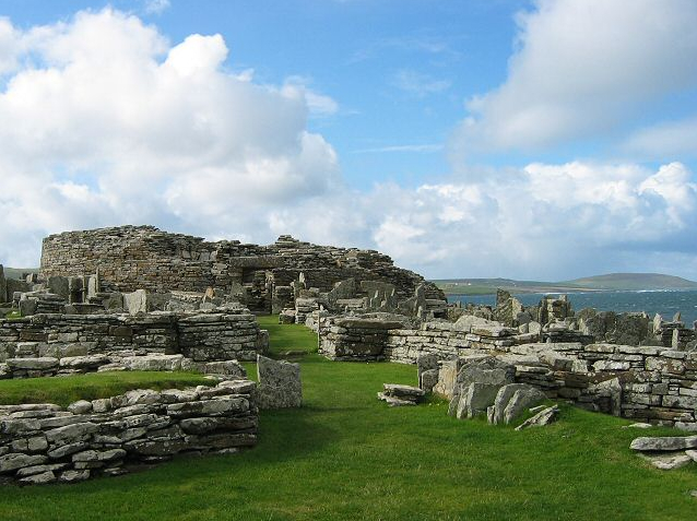
Photo: Rob Burke / Wikimedia Commons / CC BY-SA 2.0 Both are Iron Age brochs in Orkney, preserving the distinctive fortified settlement tradition of the northern islands.
-
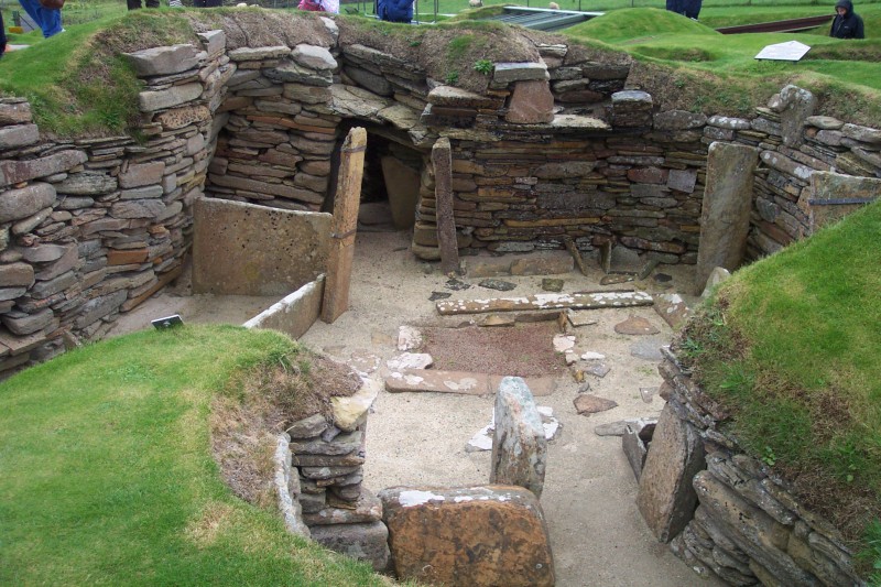
Photo: Dr. John F. Burka / Wikimedia Commons / CC BY-SA 3.0 The broch and Neolithic settlement represent successive phases of occupation around Orkney’s northern coast, from prehistoric village life to Iron Age fortification.
-

Photo: Bruce McAdam from Reykjavik, Iceland / Wikimedia Commons / CC BY-SA 2.0 Both monuments preserve prehistoric occupation and ritual activity in the Orkney landscape, linking an Iron Age broch with an earlier chambered tomb.
Discovery & excavation
W. G. T. Watt excavated the broch in 1881, clearing its interior and uncovering bones, shells, a spindle whorl, querns and other domestic objects beneath the rubble.
What to look for
-
Roofed entrance passage
The 5.6-metre entrance passage retains stone lintels overhead, preserving the protected approach through the broch wall.
-
Door-checks
Stone door-checks stand three metres inside the entrance, where a door could be secured across the passage.
-
Guard cell
A guard cell opens off the entrance’s right-hand side, allowing occupants to watch arrivals before they reached the interior.
-
Eroded west side
Coastal erosion has removed the western half of the tower, exposing the broch’s vulnerable cliff-edge position.
Plan your visit
- Location
- 59.0310°N · 3.3534°W
- Access
- Open access
- Terrain
- Rough ground — reasonable boots advised
- Time needed
- About 30 minutes
- Best time
- Daylight hours
- What survives
- The eastern half of the broch stands to 2.6 metres; cliff erosion has removed the western half.
Opening & admission
No reliable current admission details are recorded; verify before travelling.
- The broch stands on a cliff-top promontory and the western half has been destroyed by erosion.
Nearby places
Settlement · Prehistoric
Skara Brae
Orkney Islands
Ten roofless stone houses survive at Skara Brae with their built-in furniture still in place: hearths, dressers and box-beds. Occupied for roughly…
- Near Stromness
- 5 min walk from car park
- Some walking

Tomb or burial place · Prehistoric
Unstan Chambered Cairn
Orkney Islands
Twenty to thirty bowls were put in here, most of them already broken and already used: one sherd carried the impression of a barley grain.
- Near Stenness
- 2 min walk from car park
- Easy path
Sacred place · Prehistoric
Ring of Brodgar
Orkney Islands
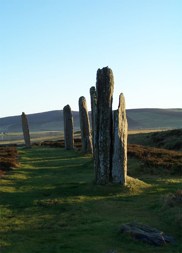
The Ring of Brodgar is a stone circle on the narrow isthmus between the Lochs of Stenness and Harray on Mainland, Orkney.
- Near Stenness
- 5 min walk from car park
- Easy path
Sacred place · Prehistoric
Ness of Brodgar
Orkney Islands
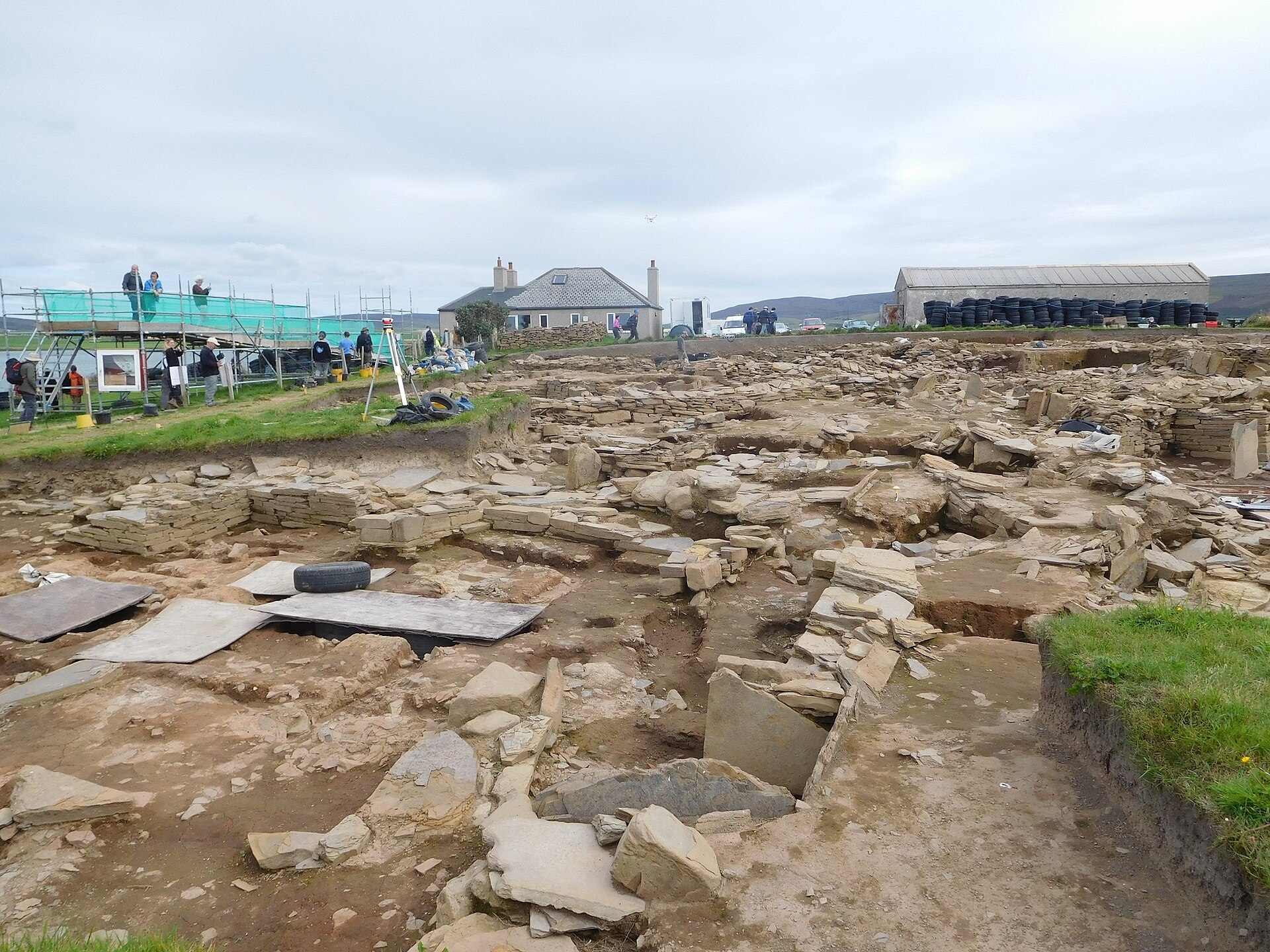
Ness of Brodgar preserves an archaeological site between the Ring of Brodgar and the Stones of Stenness.
- Near Stenness
- Easy path
The setting
Sea cliffs below the Broch of Borwick promontory.
Photo: Aleks Scholz / Wikimedia Commons / CC BY-SA 2.0
Questions people ask
- What is a broch?
- A drystone tower with hollow walls, a building type unique to Iron Age Scotland. This one has an external diameter of 17 metres and an internal diameter of 8, so the walls run between 3.5 and 5 metres thick — more than a third of the structure is wall.
- How much of it survives?
- The eastern half stands well, to a maximum height of 2.6 metres. The western half has been destroyed by erosion, the sea having taken back the cliff the builders relied on for defence.
- What is the best-preserved feature?
- The entrance passage. It runs 5.6 metres and is still roofed with its lintels, with door-checks three metres in from the outside — a slab set on edge each side, against which the door closed — and a guard cell opening off the right-hand side.
Sources
- Canmore site 1660
- Wikipedia: Broch of Borwick
- Wikidata: Q923275
- Historic Environment Scotland scheduled monument SM1418 — Borwick,Brough of,broch (accessed 2026-08-03)
Explore more: Fortified places · Iron Age · Orkney Islands
The Ancient Codex, in your pocket
Get the Pocket Codex app
Carry the directory with you — Broch of Borwick and thousands of ancient places across Britain and Ireland, offline, wherever you roam.