
The chapel above St Margaret's Loch is one of Edinburgh's least explained medieval buildings: no foundation record survives, and the earliest firm date attached to it is a papal grant towards its repair in 1426.
A single wall of rough local stone stands on the crag over St Margaret’s Loch, tall enough to read as a building from halfway across Holyrood Park. It is the north side of St Anthony’s Chapel; that wall, a fragment of the west wall and the footings of a small structure beside it are the whole of what is left.
Nobody has established when the chapel went up, or who paid for it. The first date that can be attached to the building is 1426, and it is a date for repairs rather than for building — the Pope granted money towards putting it right, which means it was standing and already suffering by then. Two connections have been suggested since. One is the Preceptory of St Anthony, a local house of a religious order that kept a skin hospice down at Leith in those years, and whose dedication the chapel shares. The other is Holyrood Abbey, the monastery under an abbot that stood at the foot of the same slope from 1128. The dedication argues for the first, the sheer proximity for the second, and the record settles neither.
Enough of the fabric was measured before it fell for the plan to be reconstructed on paper. The chapel ran about 43 feet by 18, its walls three feet thick, built of stone from the hill it sits on. A tower closed the west end at a little over 39 feet, most likely with a stair turning inside the wall. Richard Lee drew the building on his sketch plan of Edinburgh in 1544, during Lord Hertford’s raid, so it was still worth putting on a soldier’s map in the middle of the sixteenth century.
Two hundred years later it was a ruin, and admired as one. Hugo Arnot, describing it in 1779, thought it suited the rock it stood on and recorded the west tower at roughly forty feet — near enough the measured height to suggest most of the masonry was still up. The collapse that took the rest of it went unrecorded. What the walker sees now is a fragment on a skyline, and a set of questions about it that the documents do not answer.
What follows is drawn from published sources, with each claim labelled by how firmly it is established.
History
No foundation charter survives and no builder is named in any surviving record, so the beginning of the chapel is simply not known. The earliest secure date is 1426, when the Pope granted money towards repairing it — which places the building not merely standing but already worn by the first quarter of the fifteenth century. Two institutional links have been proposed for it. One is the Preceptory of St Anthony, a local house of a religious order which maintained a skin hospice at Leith in the same period, and which the dedication would suit. The other is Holyrood Abbey, the monastery under an abbot that David I founded directly below the crag in 1128. Neither has been demonstrated, and the sources that raise them raise them as possibilities rather than findings.
Enough of the building was recorded before it came down for its plan to be recovered. The chapel was rectangular, about 43 by 18 feet (13.1 by 5.5 m), with walls roughly three feet (0.9 m) thick, built from stone quarried close to the site. A tower stood at the west end, a little over 39 feet (11.9 m) high, and probably carried a spiral stair within the thickness of its own wall. A second and smaller structure stood alongside the chapel and part of it still does; its use is unknown.
The chapel is drawn on Richard Lee's sketch plan of Edinburgh, made when Lord Hertford's forces raided the city in 1544, so it was intact enough then to be worth marking on a military survey. It had become a ruin well before the end of the following century. Hugo Arnot, writing The History of Edinburgh in 1779, called it "a beautiful Gothick building, well suited to the rugged sublimity of the rock", and put the tower at its west end at about forty feet high — close enough to the measured figure to suggest he was looking at masonry still largely in place. What has been lost since went slowly, and without record. The north wall and a fragment of the west wall are what remain.
A tradition recorded by James Grant has the chapel raised to protect a holy spring on the slope beneath it, St Anthony's Well. By that account the spring failed altogether in 1674 and, after some decades, reappeared at a lower point on the hill. It is reported as tradition rather than as evidence, and it is not the only reason offered for the chapel being where it is. The ground directly below the ruin has in any case changed shape since: the sheet of water now called St Margaret's Loch was boggy marshland until 1856, when it was dug out as part of Prince Albert's improvements to the land around the Palace of Holyroodhouse, some 500 m to the west.
The chapel carries no legal designation of its own. In 2013 the whole of Holyrood Park, excepting the occupied buildings and the lodges, was made a scheduled monument — a site protected by law for its archaeological importance — and the ruin is covered by that single designation, alongside the traces of four prehistoric hillforts — Dunsapie Hill, Samson's Ribs, Salisbury Crags and Arthur's Seat itself — together with the cultivation terraces running down the eastern slopes. Historic Environment Scotland manages the park and holds the designation record. Archaeological survey has taken place at various points across the park, but its findings are described as not yet fully understood.
Cultural influences
-
A chapel in the Holyrood landscape
The chapel’s Gothic ruin sits in Holyrood Park above St Margaret’s Loch, where the medieval building, later royal landscaping and the crags make one layered landscape.
Connections
-

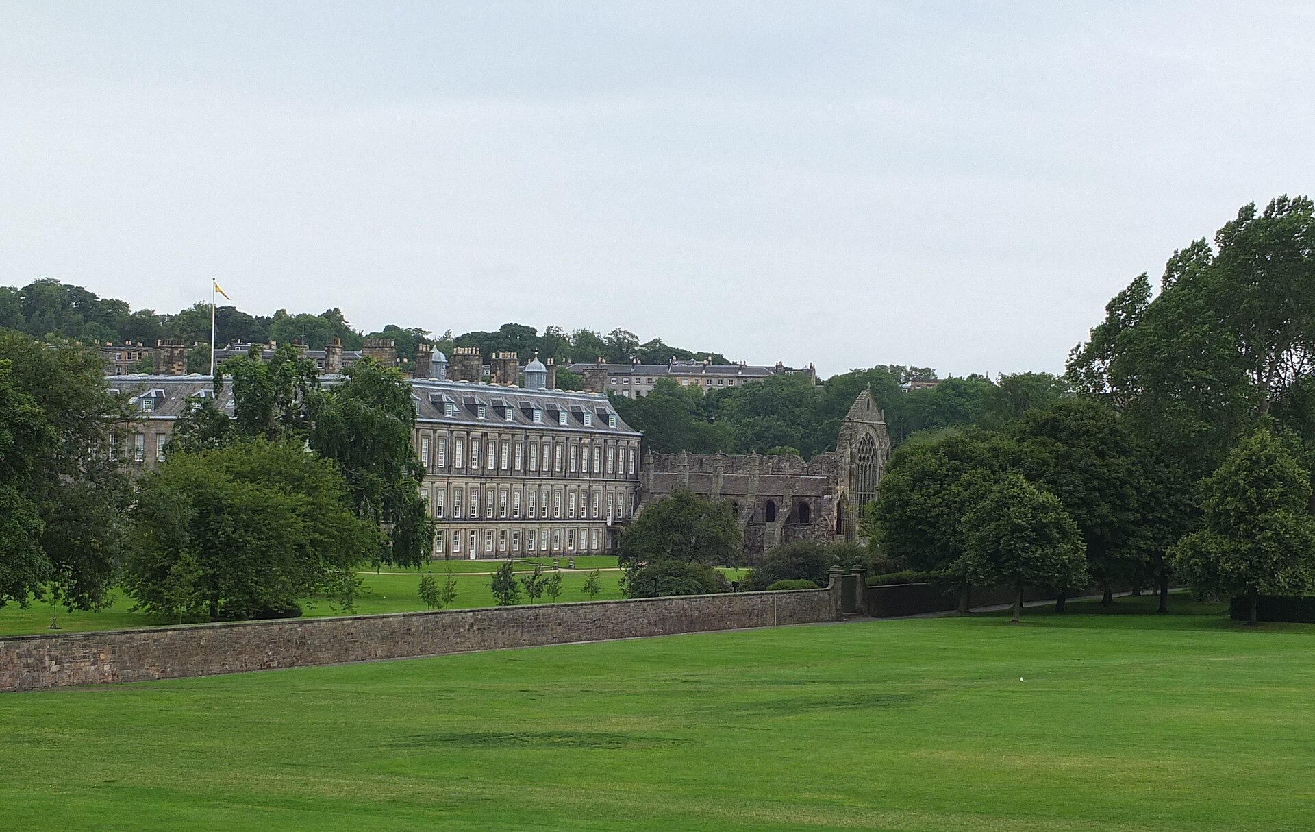
Photo: LASZLO ILYES from Cleveland, Ohio, USA / Wikimedia Commons / CC BY 2.0 Monastery under an abbot founded by David I in 1128 directly below the crag; proposed, but never demonstrated, as the chapel's parent house
-
Preceptory of St Anthony, Leith
Local house of the order that ran a skin hospice at Leith in the early fifteenth century; the shared dedication suggests a link the sources leave unproven
-
St Anthony's Well
Natural spring on the slope below the ruin; a tradition recorded by James Grant makes protecting it the chapel's original purpose
-
St Margaret's Loch
Man-made loch about 100 m below and north of the chapel, dug from marshland in 1856 under Prince Albert's improvement plans
-
Palace of Holyroodhouse
Royal residence some 500 m west; the 1856 landscaping that created the loch beneath the chapel was part of improving its surroundings
-
St Margaret's Well
Late fifteenth-century well house moved into the park from Restalrig in 1860, its design a miniature copy of St Triduana's Aisle there
-
Margaret Hall's Cairn
Memorial cairn at the eastern end of the park; Walter Scott placed the earlier cairn it replaced about a furlong east of the chapel
Discovery & excavation
No foundation charter, builder or excavation record is known. The chapel’s former plan is recovered from drawings and the surviving north wall, west-wall fragment and adjacent smaller building.
What to look for
-
The north wall
The one substantial upstanding piece, and the reason the ruin still reads as a building from the far side of the park. It is the long north side of a rectangle that ran about 43 feet from end to end.
-
The west end and its tower
Only a fragment of the west wall is left. The tower that rose here stood a little over 39 feet high and probably held its stair inside the wall; Arnot still saw it standing to roughly that height in 1779.
-
The building alongside
Part of a second, smaller structure survives next to the chapel. The records call it an ancillary building and stop there — its use is not recorded.
-
The spring below
St Anthony's Well lies on the slope beneath the ruin. It is recorded as having failed in 1674 and returned decades later at a lower point, so where it rises now need not be where it rose when the chapel was built.
What is said
Folklore and tradition, recorded as what is said — not as established fact.
-
St Anthony’s Well
A tradition recorded by James Grant says the chapel was built to protect the spring below it, which was said to have failed in 1674 and later reappeared lower on the slope.
Plan your visit
- Location
- 55.9484°N · 3.1589°W
- Nearest settlement
- Edinburgh
- Terrain
- Moderate walking
- Time needed
- About 60 minutes
- What survives
- A ruin above St Margaret’s Loch: the north wall is the main survival, with only a fragment of the west wall and part of an adjoining smaller building.
Opening & admission
The chapel stands within Holyrood Park; check current Historic Environment Scotland park access and route information before travelling.
- The ruins stand above St Margaret's Loch.
- Only the north wall and a fragment of the west wall remain.
Nearby places

Sacred place · Medieval
Holyrood Abbey
City of Edinburgh
Holyrood Abbey is Edinburgh's ruined royal abbey, founded by David I and central to Scottish parliaments, coronations and palace life before a cata…
- Near Edinburgh
- Easy path

Carved stone · Pictish & early medieval
Bullion Stone
City of Edinburgh
The only Pictish carving to show a man drinking: a bald, bearded rider on a tired horse, lifting a horn that ends in a startled bird's head, cut ju…
- Near Edinburgh
- Easy path

Carved stone · Pictish & early medieval
Woodwrae Stone
City of Edinburgh
The Woodwrae Stone is a richly carved Class II Pictish (of the Picts, the people of northern and eastern Scotland from about AD 300 to 900) cross-s…
- Near Edinburgh
- Easy path
The setting
Path on Whinny Hill near St Anthony’s Chapel.
Photo: Richard Webb / Wikimedia Commons / CC BY-SA 2.0
Woodland on Whinny Hill near St Anthony’s Chapel.
Photo: Richard Webb / Wikimedia Commons / CC BY-SA 2.0
Questions people ask
- When was St Anthony's Chapel built?
- No record of its founding survives. The earliest firm date is 1426, when the Pope gave money towards repairing it, so the chapel was standing and already in need of work by then. Anything earlier is estimate.
- Why is it dedicated to St Anthony?
- The dedication has been read as a link to the Preceptory of St Anthony, whose order ran a skin hospice at Leith around the same period. A separate tradition ties the name to St Anthony's Well below. Neither is settled.
- How much of the chapel is left?
- The north wall, a fragment of the west wall, and part of a smaller building beside it. The tower at the west end was still about forty feet high when Hugo Arnot described the site in 1779.
- Is the chapel protected?
- Not on its own. Scheduled monument status was given to the park as a whole in 2013, its lodges and occupied buildings excepted, and the chapel falls under it. Historic Environment Scotland manages the park.
Sources
The Ancient Codex, in your pocket
Get the Pocket Codex app
Carry the directory with you — St Anthony's Chapel and Hermitage and thousands of ancient places across Britain and Ireland, offline, wherever you roam.