
Tomb or burial place · Prehistoric · Shetland Islands
Ronas Hill
At 450 metres, Ronas Hill is the highest point in the Shetland Islands, and its summit is crowned not just by a trig point but by a Neolithic chambered cairn — an unusual position for a monument of this type. Most surviving Neolithic cairns in Britain were built in prominent places, but rarely on the very top of a taller hill, which makes the siting here distinctive among Shetland's prehistoric (before written records reached Britain) remains.
At 450 metres, Ronas Hill is the highest point in the Shetland Islands, and its summit is crowned not just by a trig point but by a Neolithic chambered cairn — an unusual position for a monument of this type. Most surviving Neolithic cairns in Britain were built in prominent places, but rarely on the very top of a taller hill, which makes the siting here distinctive among Shetland’s prehistoric remains.
The hill sits on the Northmavine peninsula of Mainland, Shetland, at grid reference HU305835, and gives its name to the sea loch of Ronas Voe below it. Its own name comes from the Old Norse rön, meaning stony ground or scree, a description borne out by the bare, boulder-strewn summit plateau. On a clear day the view from the top takes in much of Shetland, Yell Sound, the North Sea, the Atlantic, and even the highest ground of Fair Isle far to the south.
The hill is also a Ramsar-designated wetland site, home to rare Arctic plants, and it forms part of the Ronas Hill – North Roe and Tingon Important Bird Area, recognised by BirdLife International for its moorland-breeding birds. Its granite-topped cairn, meanwhile, carries the marks of a much longer and more disrupted history than its Neolithic origins alone suggest, having been reshaped, raised, and even turned into a military foxhole in the centuries since it was first built.
What follows is drawn from published sources, with each claim labelled by how firmly it is established.
The name
The name Ronas Hill derives from the Old Norse rön, meaning stony ground or scree — a fitting description of the hill's bare, boulder-covered summit. The hill in turn gives its name to Ronas Voe, the sea loch it sits adjacent to.
History
During the Neolithic period, a chambered cairn was built on the summit of Ronas Hill, an unusual choice of site since most surviving Neolithic cairns elsewhere in Britain were placed in prominent but lower-lying locations rather than mounted on top of a hill of this height.
At some point in past centuries, the cairn's upper structure appears to have been substantially rebuilt and its peak of pink granite stones raised in height, possibly to serve as a mede — a navigation or fishing mark visible from the sea and the valley below. Evidence for this later rebuilding survives in the lack of lichen growth on the stones above the entry passage and main cist, in contrast to the older, more weathered stonework beneath. During a military exercise in the 1960s, soldiers altered the cairn further, building a wall around its entrance and converting it into a foxhole.
Until the construction of the Sullom Voe oil terminal in the mid-1970s, local farmers reported that the cairn continued to receive small votive offerings — coins, some apparently very old, and other items left as a form of sacrifice. Before the terminal was built, Ronas Hill lay far off the beaten track, and the practice is understood to have ended as the area became more accessible and developed.
Connections
-
Ronas Voe
The sea loch adjacent to Ronas Hill, which takes its name from the hill.
-
Sullom Voe Terminal
The oil terminal whose construction in the mid-1970s brought Ronas Hill within reach of wider development, reportedly ending the local practice of leaving offerings at the cairn.
-
Fair Isle
Visible from the summit of Ronas Hill on a clear day, along with Yell Sound, the North Sea and the Atlantic Ocean.
-
Ronas Hill – North Roe and Tingon Important Bird Area
The BirdLife International-designated Important Bird Area of which Ronas Hill forms part, recognised for its moorland-breeding birds.
What to look for
-
The summit chambered cairn
A Neolithic chambered cairn sits directly on the summit, unusual among British Neolithic monuments for being placed on the very top of a hill of this height rather than on lower, prominent ground.
-
Pink granite peak
The cairn's current peak is built of pink granite stones, clearly visible from the valley below, and may have been raised in height in past centuries to act as a mede, or navigation and fishing mark.
-
Signs of rebuilding
A difference in lichen growth on the stones above the entry passage and main cist marks out the sections of the cairn that were rebuilt in more recent centuries from the older stonework beneath.
-
The 1960s foxhole wall
A wall built around the cairn's entrance during a 1960s military exercise, when the monument was adapted for use as a foxhole, remains visible at the site.
-
Panoramic views
From the 450-metre summit, the highest in Shetland, views extend over Yell Sound, the North Sea, the Atlantic Ocean and, on a clear day, as far as the highest points of Fair Isle.
-
Arctic plants and moorland birds
The hill is a Ramsar site supporting rare Arctic plants, and forms part of an Important Bird Area recognised for moorland-breeding birds including red-throated loons, great skuas and merlins.
What is said
Folklore and tradition, recorded as what is said — not as established fact.
-
Offerings at the cairn
Local farmers have said that, until the construction of Sullom Voe Terminal in the mid-1970s, the chambered cairn contained a variety of items left as a form of sacrifice, including coins — some described as very old.
Plan your visit
- Location
- 60.5339°N · 1.4461°W
- Access
- Open access
- Terrain
- Easy going
- Time needed
- About 45 minutes
Nearby places
Tomb or burial place · Prehistoric
Punds Water
Shetland Islands
Above the peat near Mangaster, in Northmavine on Shetland's Mainland, a low mound of large boulders rises about 1.5 metres from the surrounding gro…
- Easy path
Tomb or burial place · Prehistoric
Fethaland
shetland-islands
Haaf fishermen lit their böds with oil lamps made from whelk shells. One from here is in the Shetland Museum, collected by a man who argued about w…
Carved stone · Pictish & early medieval
Lunnasting stone
Shetland Islands
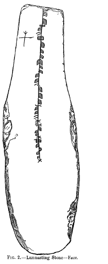
The Lunnasting stone is a slab of slate, 44 inches (1.1 m) long, about 13 inches (0.33 m) wide and just an inch (2.5 cm) thick, carrying an ogham i…
- Easy path
Fortified place · Iron Age
Broch of West Burrafirth
Shetland Islands
The Broch of West Burrafirth stands on a low rocky islet known as the Holm of Hebrista, within West Burra Firth on the west side of Shetland Mainla…
- Some walking
The setting
Ronas Hill above Ronas Voe; the summit cairn is not visible from this coastal view.
Photo: James Allan / Wikimedia Commons / CC BY-SA 2.0
Questions people ask
- How high is Ronas Hill and why is it significant?
- Ronas Hill rises to 450 metres (1,480 feet), making it the highest point in the Shetland Islands. It is classed as a Marilyn and carries a Neolithic chambered cairn on its summit.
- Why is the cairn's position on top of the hill unusual?
- Most surviving Neolithic cairns in Britain were built in prominent but lower-lying places rather than on the very summit of a taller hill, which makes the siting of the Ronas Hill cairn distinctive.
- What does the name Ronas Hill mean?
- The name comes from the Old Norse rön, meaning stony ground or scree, which accurately describes the bare, boulder-covered summit.
- What happened to the cairn in the 1960s?
- During a military exercise, soldiers built a wall around the cairn's entrance and converted it into a foxhole, altering the monument's structure.
- What wildlife is associated with Ronas Hill?
- The hill is a Ramsar site supporting rare Arctic plants and unusual woodland fungi that grow in association with creeping willow rather than deciduous trees. It also forms part of the Ronas Hill – North Roe and Tingon Important Bird Area, home to moorland-breeding birds such as red-throated loons, great skuas and merlins.
Sources
The Ancient Codex, in your pocket
Get the Pocket Codex app
Carry the directory with you — Ronas Hill and thousands of ancient places across Britain and Ireland, offline, wherever you roam.