
Tomb or burial place · Prehistoric · Shetland Islands
Punds Water
Above the peat near Mangaster, in Northmavine on Shetland's Mainland, a low mound of large boulders rises about 1.5 metres from the surrounding ground. This is the heel-shaped cairn (a mound of piled stones, often covering a burial) that takes its name from the freshwater loch beside which it stands, Punds Water. Unlike the tidy round mounds found elsewhere, a heel-shaped cairn is built with a curving, horn-like facade that gives the monument its characteristic outline when seen from above — a shape unique to Shetland's Neolithic (the late Stone Age, roughly 4000–2500 BC in Britain) chambered tombs.
Above the peat near Mangaster, in Northmavine on Shetland’s Mainland, a low mound of large boulders rises about 1.5 metres from the surrounding ground. This is the heel-shaped cairn that takes its name from the freshwater loch beside which it stands, Punds Water. Unlike the tidy round mounds found elsewhere, a heel-shaped cairn is built with a curving, horn-like facade that gives the monument its characteristic outline when seen from above — a shape unique to Shetland’s Neolithic chambered tombs.
At Punds Water that facade faces east by southeast and stretches more than 15 metres across, while the cairn measures 9.8 metres from front to back. Set within the facade is the entrance to a passage that leads into a burial chamber built to a trefoil, or three-lobed, plan. The scale of the boulders used and the survival of the passage and chamber beneath the covering mound have made the site a recurring reference point in surveys of Shetland’s prehistoric tombs.
What follows is drawn from published sources, with each claim labelled by how firmly it is established.
History
The heel-shaped cairn at Punds Water was raised in the Neolithic period by builders working in a tradition distinctive to Shetland, piling large boulders into a mound with a broad, curving facade rather than the simple round cairns more common elsewhere in Scotland. Within that facade they set an entrance leading to a passage and, at its end, a burial chamber laid out on a trefoil plan, a design that recurs at other Shetland tombs of the same period.
In 1940 the antiquary Thomas Hastie Bryce examined Shetland's heel-shaped cairns as a group, publishing his findings, alongside remarks on the chambered tombs of Orkney, in the Proceedings of the Society of Antiquaries of Scotland — placing the Punds Water cairn within a wider study of the type. The Royal Commission on the Ancient and Historical Monuments of Scotland catalogued the cairn in 1946 as part of its twelfth report, an inventory of the ancient monuments of Orkney and Shetland, recording it as monument No. 1367.
Later archaeological surveys kept the site within the published record: Audrey Henshall included it in the first volume of The Chambered Tombs of Scotland in 1963, and Euan MacKie referenced it in his 1975 archaeological guide to Scotland. Anna Ritchie's Exploring Scotland's Heritage volume on Orkney and Shetland covered the cairn in 1985, with a second edition following in 1997, keeping Punds Water in view for visitors and researchers alike.
Connections
-
Punds Water (loch)
The cairn stands beside this freshwater loch in Northmavine and takes its name from it.
-
Heel-shaped cairns of Shetland
Punds Water is one example of this Shetland-specific class of Neolithic chambered tomb, studied as a group by Thomas Hastie Bryce in 1940.
-
Chambered tombs of Orkney
Bryce's 1940 study considered Shetland's heel-shaped cairns alongside the chambered tombs of Orkney as related traditions.
Discovery & excavation
The cairn was recorded in the Royal Commission’s 1946 inventory of Orkney and Shetland monuments as No. 1367, and was subsequently included in major surveys of Scotland’s chambered tombs.
What to look for
-
The curving facade
A broad, horn-shaped facade of large boulders faces east by southeast and measures more than 15 metres across, giving the cairn its distinctive 'heel' outline.
-
The entrance and passage
Set within the facade is an entrance opening onto a passage that leads into the burial chamber at the heart of the cairn.
-
The trefoil burial chamber
At the end of the passage lies a burial chamber built to a three-lobed, trefoil plan, a chamber form shared with other Shetland heel-shaped cairns.
-
The mound itself
The cairn stands about 1.5 metres above the surrounding peat and measures 9.8 metres from front to back, built up from large boulders.
Plan your visit
- Location
- 60.4640°N · 1.4090°W
- Access
- Open access
- Terrain
- Easy going
- Time needed
- About 30 minutes
Nearby places
Tomb or burial place · Prehistoric
Ronas Hill
Shetland Islands
At 450 metres, Ronas Hill is the highest point in the Shetland Islands, and its summit is crowned not just by a trig point but by a Neolithic chamb…
- Easy path
Carved stone · Pictish & early medieval
Lunnasting stone
Shetland Islands
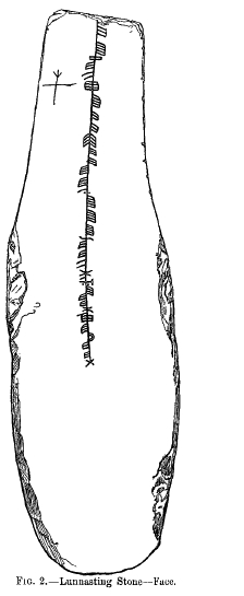
The Lunnasting stone is a slab of slate, 44 inches (1.1 m) long, about 13 inches (0.33 m) wide and just an inch (2.5 cm) thick, carrying an ogham i…
- Easy path
Tomb or burial place · Prehistoric
Fethaland
shetland-islands
Haaf fishermen lit their böds with oil lamps made from whelk shells. One from here is in the Shetland Museum, collected by a man who argued about w…
Fortified place · Iron Age
Broch of West Burrafirth
Shetland Islands
The Broch of West Burrafirth stands on a low rocky islet known as the Holm of Hebrista, within West Burra Firth on the west side of Shetland Mainla…
- Some walking
The setting
Punds Water loch beside the Neolithic heel-shaped cairn.
Photo: David Purchase / Wikimedia Commons / CC BY-SA 2.0
Punds Water and its small islands near the cairn in Northmavine.
Photo: Mike Pennington / Wikimedia Commons / CC BY-SA 2.0
Small islands in Punds Water beside the cairn’s Northmavine setting.
Photo: Mike Pennington / Wikimedia Commons / CC BY-SA 2.0
Questions people ask
- What is Punds Water?
- Punds Water is a freshwater loch near Mangaster in Northmavine, Shetland. It also gives its name to a nearby Neolithic heel-shaped cairn, a chambered tomb built from large boulders.
- What is a heel-shaped cairn?
- A heel-shaped cairn is a type of Neolithic chambered tomb found in Shetland, distinguished by a broad, curving facade that gives the mound a heel-like outline. The Punds Water cairn has a facade over 15 metres across facing east by southeast.
- How big is the cairn at Punds Water?
- The cairn stands about 1.5 metres above the surrounding peat, measures 9.8 metres from front to back, and its facade spans more than 15 metres.
- What lies inside the cairn?
- The facade contains an entrance leading to a passage, which opens into a burial chamber built to a trefoil, or three-lobed, plan.
- Where has the Punds Water cairn been recorded in the archaeological literature?
- It appears in Bryce's 1940 study of Shetland's heel-shaped cairns, the RCAHMS 1946 inventory of Orkney and Shetland monuments, Henshall's 1963 Chambered Tombs of Scotland, MacKie's 1975 archaeological guide, and Ritchie's Exploring Scotland's Heritage volumes of 1985 and 1997.
Sources
- Punds Water — Wikipedia
- Punds Water — Wikidata (Q1652811)
- Bryce, T. H. (1940) 'The so-called heel-shaped cairns of Shetland, with remarks on the chambered tombs of Orkney and Shetland', Proceedings of the Society of Antiquaries of Scotland, 74(2), pp. 25–26
- Henshall, A. S. (1963) The Chambered Tombs of Scotland, vol. 1. Edinburgh, p. 172
- MacKie, E. W. (1975) Scotland: An Archaeological Guide: From the Earliest Times to the Twelfth Century. London, p. 284
- RCAHMS (1946) Twelfth Report with an Inventory of the Ancient Monuments of Orkney and Shetland, vol. 3. Edinburgh, No. 1367
- Ritchie, A. (1985) Exploring Scotland's Heritage: Orkney and Shetland. Edinburgh, No. 103
- Ritchie, A. (1997) Shetland, 2nd edn, Exploring Scotland's Heritage series. Edinburgh, No. 69
Explore more: Tomb or burial places · Prehistoric · Shetland Islands
The Ancient Codex, in your pocket
Get the Pocket Codex app
Carry the directory with you — Punds Water and thousands of ancient places across Britain and Ireland, offline, wherever you roam.