
Benie Hoose lies in Nesting parish, towards the north-east of Whalsay, laid out in the unusual form of a figure of eight rather than the single round or oval chamber typical of most Shetland dwellings. Its curved front elevation opens into a horn-shaped, D-shaped forecourt, and the single main room measures 24.4 by 12.8 metres behind dry-stone walls some 4 metres thick, with a 4-metre passage running in from the entrance. The whole complex lies about 30 metres from the lower slopes of Gamla Vord, roughly 91 metres northwest of the Standing Stones of Yoxie and around 140 metres southeast of the Pettigarths Field Cairns.
Benie Hoose lies in Nesting parish, towards the north-east of Whalsay, laid out in the unusual form of a figure of eight rather than the single round or oval chamber typical of most Shetland dwellings. Its curved front elevation opens into a horn-shaped, D-shaped forecourt, and the single main room measures 24.4 by 12.8 metres behind dry-stone walls some 4 metres thick, with a 4-metre passage running in from the entrance. The whole complex lies about 30 metres from the lower slopes of Gamla Vord, roughly 91 metres northwest of the Standing Stones of Yoxie and around 140 metres southeast of the Pettigarths Field Cairns.
The name itself points toward two competing readings: ‘Benie’ is thought to be either a local term for ‘Bone House’, suggesting a graveyard, or a transliteration of the Old Norse ‘Boenhus’, meaning a house of prayer or chapel. Taken together with its architecture and its proximity to Yoxie, this has led to the conjecture that Benie Hoose served as the residence of priests associated with worship carried out at the nearby Yoxie temple, with the two sites forming what is described as a pairing of ‘paired houses’.
What survives archaeologically is emphatically domestic rather than ceremonial. Excavation recovered 33 trough querns for grinding grain alongside some 1,800 further implements — axes, hammer stones, hammer pounders, picks, pot lids and pot shards, a steatite pot handle and a steatite spindle whorl — and an elaborate drainage system kept the stone-flagged interior dry. No stone furniture was found, from which it has been concluded that any furnishings were made of wood and have not survived.
What follows is drawn from published sources, with each claim labelled by how firmly it is established.
The name
'Benie' (also rendered 'Bunyie', as in the alternative name Bunyie Hoose) is believed to be either a local term for 'Bone House', implying use as a graveyard, or a transliteration of the Old Norse 'Boenhus', meaning 'a house of prayer' or chapel.
History
During the Neolithic, Benie Hoose was built as a single-room complex in the form of a figure of eight, its main block set towards the hill and its curved front elevation opening onto a horn-shaped forecourt. The main block measured 80 feet (24 metres) in length and 40 feet (12 metres) in width, with a 32-foot (9.8-metre) forecourt, dry-stone walls some 4 metres thick, and a 4-metre entrance passage. An elaborate drainage system kept the stone-flagged floor dry, and the absence of any stone furniture suggests wooden fittings that have not survived. Architectural parallels with the nearby Yoxie monument, and the site's position relative to it, have led to the conjecture that Benie Hoose housed priests connected with worship at Yoxie, the two forming a pair of related structures.
In 1936 and 1938, archaeological exploration around 140 metres northwest of Benie Hoose uncovered the two Pettigarths Field Cairns. The first, on the south side, is square in plan and measures 6 metres across with a circular entrance 2 metres wide; the second is a smaller circular cairn 4.5 metres in diameter containing a rectangular cist. Both have been inferred as tombs dating to the Late Stone Age and Early Bronze Age.
Between 1954 and 1955, Charles S. T. Calder excavated Benie Hoose itself, uncovering an unusually large assemblage of tools and domestic material — 33 trough querns and around 1,800 further implements including axes, hammer stones, hammer pounders, picks, pot lids, pot shards, a steatite pot handle and a steatite spindle whorl. The scale and character of the find led Calder to conclude the site had been a dwelling, possibly that of a vicary. The excavated items were handed over to the National Museum of Antiquities of Scotland in 1955–1956.
On 30 May 1968, the Ordnance Survey (recorded under the initials NKB) visited the site, confirming and recording its one-room plan, dimensions of 24.4 by 12.8 metres, and horned forecourt.
People
-
Charles S. T. Calder
Excavated Benie Hoose in 1954–1955 and handed the recovered artefacts to the National Museum of Antiquities of Scotland in 1955–1956.
Cultural influences
-
A paired ceremonial landscape
Benie Hoose shares its unusual plan and position with the nearby Standing Stones of Yoxie. The excavator Charles Calder proposed that the two structures formed a related pair, with Benie Hoose perhaps serving people involved in activity at Yoxie; that interpretation remains a conjecture rather than a settled function.
Connections
-

Photo: John Dally / Wikimedia Commons / CC BY-SA 2.0 Lies approximately 91 metres (100 yards) southeast of Benie Hoose; the two sites share architectural features and are considered 'paired houses', with Benie Hoose conjectured as the residence of priests serving the Yoxie temple.
-

Photo: Vanhercke Christiaan / Wikimedia Commons / CC BY-SA 2.0 Two cairns lying about 140 metres northwest of Benie Hoose, excavated in 1936 and 1938 and inferred as Late Stone Age to Early Bronze Age tombs.
-
Gamla Vord
Hill whose lower slopes lie roughly 30 metres from Benie Hoose, situated southeast of Pettigarths Field.
Discovery & excavation
Charles S. T. Calder's 1954–1955 excavation of Benie Hoose recovered an unusually large quantity of domestic material for a Shetland Neolithic site: 33 trough querns used for grinding, and around 1,800 further implements including axes, hammer stones, hammer pounders, picks, pot lids, pot shards, a steatite pot handle and a steatite spindle whorl. No stone furniture was recovered, implying that any furnishings were made of wood and have not survived. The finds were given to the National Museum of Antiquities of Scotland in 1955–1956, and the site was subsequently visited and recorded by the Ordnance Survey on 30 May 1968.
Finds now held at: National Museum of Antiquities of Scotland.
What to look for
-
Figure-of-eight plan
Benie Hoose's single main room, measuring 24.4 by 12.8 metres, is laid out in the form of a figure of eight — a layout without parallel among other dwelling sites, though it shares features with the neighbouring Yoxie monument.
-
Horned, D-shaped forecourt
The curved front elevation opens onto a horn-shaped forecourt, 32 feet (9.8 metres) wide and D-shaped in plan, thought to have served as an animal pen.
-
Thick dry-stone walls and entrance passage
The walls are built of dry stone some 4 metres (13 feet) thick, with a 4-metre passage leading in from the entrance.
-
Drainage system
An elaborate drainage system runs through the complex, which kept the stone-flagged interior dry.
Plan your visit
- Location
- 60.3667°N · 0.9389°W
- Access
- Open access
- Terrain
- Easy going
- Time needed
- About 60 minutes
Nearby places

Settlement · Prehistoric
Standing Stones of Yoxie
Shetland Islands
Roughly a hundred yards southeast of Benie Hoose, close to the cliff edge at Yoxie Geo on Whalsay's northeastern coast, a partly ruined Neolithic (…
- Easy path

Tomb or burial place · Prehistoric
Pettigarths Field Cairns
Shetland Islands
On a low rise in the parish of Nesting in north-east Whalsay, two burial monuments stand roughly 140 metres north-west of the settlement mound at B…
- Easy path
Carved stone · Pictish & early medieval
Lunnasting stone
Shetland Islands
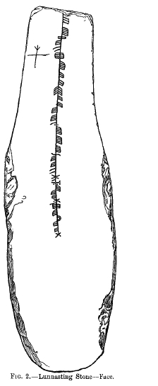
The Lunnasting stone is a slab of slate, 44 inches (1.1 m) long, about 13 inches (0.33 m) wide and just an inch (2.5 cm) thick, carrying an ogham i…
- Easy path

Fortified place · Iron Age
Broch of Cullingsburgh
Shetland Islands
Very little survives above ground of the broch (a tall circular tower of unmortared stone, found only in Scotland) that once stood on a shoulder of…
- Some walking
Questions people ask
- What is Benie Hoose?
- Benie Hoose is a Neolithic site in the parish of Nesting, in the northeast of Whalsay, in the Shetland Islands. Its single main room is laid out in the form of a figure of eight and measures 24.4 by 12.8 metres, with a horned forecourt at the front.
- What does the name 'Benie Hoose' mean?
- 'Benie' is believed to be either a local term for 'Bone House', suggesting use as a graveyard, or a transliteration of the Old Norse 'Boenhus', meaning 'a house of prayer' or chapel. The site is also recorded as Bunyie Hoose.
- How is Benie Hoose connected to the Standing Stones of Yoxie?
- Benie Hoose lies about 91 metres (100 yards) northwest of the Standing Stones of Yoxie. The two share architectural features and are described as 'paired houses'; it has been conjectured that Benie Hoose was the residence of priests associated with worship performed at the Yoxie temple.
- What was found when Benie Hoose was excavated?
- Charles S. T. Calder's 1954–1955 excavation recovered 33 trough querns and around 1,800 implements, including axes, hammer stones, hammer pounders, picks, pot lids, pot shards, a steatite pot handle and a steatite spindle whorl. No stone furniture was found, suggesting wooden furnishings that have not survived. The finds were given to the National Museum of Antiquities of Scotland in 1955–1956.
- What are the Pettigarths Field Cairns near Benie Hoose?
- The Pettigarths Field Cairns are two cairns roughly 140 metres northwest of Benie Hoose, excavated in 1936 and 1938. One is square, measuring 6 metres across with a circular entrance; the other is a smaller circular cairn 4.5 metres in diameter with a rectangular cist. Both are inferred as tombs of the Late Stone Age and Early Bronze Age.
Sources
Explore more: Ancient places · Prehistoric · Shetland Islands
The Ancient Codex, in your pocket
Get the Pocket Codex app
Carry the directory with you — Benie Hoose and thousands of ancient places across Britain and Ireland, offline, wherever you roam.